Maurice Knowles Lane in Cashmere – Named after Maurice William Knowles (1918- 2004). The property had been owned by the Knowles family for over eighty years before being subdivided by James Lloyd Developments Ltd. A member of the family asked that the street be named after her father to recognise his long association with the property. Maurice Knowles lived at 52 Bowenvale Avenue during the 1990s. Named in 2005.
A reasonable amount of information from the library website. The electoral rolls actually show Maurice Knowles living at 52 Bowenvale Ave from the 1960s to early 2000 and not just in the 1990s. It isn’t often that I find a street named after someone that I had met. My older son when he was a teenager did weekend work for Maurice. Most the houses on the street were built in the late 2000s.
Herbs Place in Cashmere – formerly Herbs Lane. Named after Herbert Francis Arnold Anthony (1907-1984). Anthony was a glazier who also owned a market garden there. Des Petherbridge bought the land and sub-divided it, forming the lane. First appears in street directories in 1991 as Herbs Lane and becomes Herbs Place post-1997.
A reasonable of information from the library website and nothing that I can add to this information about the name. The s on the end of a street name is always a good indicator that it was named after a person. Most of the houses here were built in the 1980s and nothing stood out for me.
Fineran Lane in Cashmere and it isn’t on the library website. Only 9 houses here which were built in 1990s and 2000s. The street will have been named after the Fineran family who grew fruit and tomatoes on Bowenvale Ave. There was a father and son on the property and they were both Charles John Fineran. There were several entries on Papers Past as one or possibly both of them were involved with the Fruit Growers Association.
Dalefield Drive in Cashmere and it isn’t on the library website. There were a few mentions on Papers Past and it looks like it was a new street in 1978. By special order that the underwidth road to be known as Dalefield Drive is a summary of the article. Most houses were built in the 1970s and 1990s but there is one house from 1930s. The 1930s house was at the end of the street and impossible to see it from the road. I suspect that the street was named after a person as there were several people with that surname living in Christchurch. I just couldn’t find anyone with that name living on Bowenvale Ave. There was a footpath on only side of the street which is unusual for a street developed in the 1970s but this is probably because it was considered underwidth. Looked like a pleasant street.
Torvill and Dean Lane in Cashmere – Named after Jayne Torvill (1957-) and Christopher Dean (1958-).Torvill and Dean were famed for their ice dancing, winning a gold medal at the 1984 Winter Olympics. Developed on the former site of Ice Rinks Christchurch Ltd., 12 Centaurus Road, Cashmere. First appears in street directories in 1991.
A reasonable amount of information from the library website. Who is old enough to remember the ice skating rink. I have the most dreadful photo of me at the ice skating rink plus I wasn’t very good at ice skating. Most of the houses here were built in the 1980s and mostly seem to be made from brick. Nothing really stood out for me.
Waltham Road in Sydenham – Formerly Gasworks Road. Named because the Gasworks were there. Also Langdown Street. Re-named Waltham Road. Named, as the suburb is named, after Waltham House, a large house on Colombo Road belonging to Charles Prince.Gasworks Road is first mentioned in the Star in 1871 and appears on an 1879 map. Waltham Road is mentioned in street directories of 1878 so the street had alternate names for a time. In 1889 the council proposed re-naming the road Langdown Street to honour a retiring mayor, William Langdown (1827-1903). It appears on an 1890 map as Langdown Street. According to an 1890 newspaper report this name was rejected by residents. However, from 1905 to 1948, the section from Austin Street to the bridge at Wilsons Road was known as Langdown Street. There had once been lime kilns in the street named Langdown & Co.
A reasonable amount of information from the library website. Papers Past had a huge number of entries which included lots of death notices and a few birth notices. Both Gasworks Rd and Waltham Rd were used at the same time and there was also a Gasworks Rd in Lyttelton. Frequent complaints about the state of the road. Because of the huge number of articles I mainly looked at articles pre 1900. Some of the businesses and buildings in the street were Reese’s Store, Innes Brewery, Langdowns, Oddfellows Hall, the old public library and of course the gasworks. I don’t know when Waltham school was opened but I found a mention in 1896.
In 1889 when it was announced that the name was changing to Langdown St there was an outcry about it with a petition against it. In the end only part of the street was named Langdown St and it went from Austin St to Wilsons Rd. This part was still Langdown St on maps until 1950.
A letter to the editor in 1866 amused me as it was headed Mr Prince and the Waltham Hoax. The residents had agreed for the suburb to be called Waltham after Charles Prince’s house Waltham House. Sydenham is supposed to be named after Charles Prince’s shop on Colombo St which was called The Sydenham China Shop. The other theory is that it was named after his teaching academy called Sydenham Academy and this was next door to his shop. He possibly was bankrupt in 1867 and there was a meeting of his creditors. Surprising how many streets in Christchurch are named after men who had financial issues.
One business that I looked at was Urlwin Industries as I remember the business and it was a huge building right on the corner opposite Austin St. I hadn’t realised that it started originally in the central city until it had a fire in 1939. In 1946 the address for the factory was Langdown St. I do remember when it was destroyed by fire in 1965 and apparently many local residents objected to it being rebuilt. In 1968 the company was taken over by PDL and I think that the owner had either retired or died. The reason that this is so clear in my memory is that an uncle worked at the company and Uncle Harry also lived just around the corner from the factory. We would drive past the factory on our way home to Lyttelton and it was over the hills those days.
I also remember the gasworks and I am not sure when it was demolished. It was definitely still there when I used to catch the school train.
I started my walk today near the river and the first big building is the Waltham Swimming Pool. Then it is Waltham Park where there is street art on the toilet buildings. There are houses on the other side of the street and there are many older houses at this end. Where Urlwin’s / PDL factory used to be situated there is a huge number of apartments which were mostly built in 2016 and 2017. The houses then become a mixture of new and old houses plus there is Waltham School. There is also social housing. Between Brougham St and Moorhouse Ave it is mostly businesses. The house from 1880 is looking very sad but the one from 1890 is looking lovely.
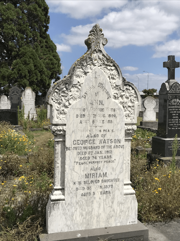
Watsons Rd in Harewood – formerly Watson’s Road. Named after George Watson (1837-1912). Watson, a farmer, is first listed in electoral rolls in the Styx catchment in 1878-1879 and is
described as having a leasehold on Rural Section 57 on the south side of Harewood Road. He later owned land on its north side. He is buried at St James Anglican Church in Harewood Road. Tenders were accepted by the Waimairi County Council for the “forming and shingling” of Watson’s Road in 1911. Formally named in 1917.
A reasonable amount of information from the library website. When looking at Papers Past there was at least three Watsons Roads in the Christchurch area. A few death notices and the earliest entry that I found was dated 1916. In 1957 and 1958 there were several articles about the zoning of the land. It was to be zoned rural because of the airport and any work subdivisions under 5 acres were prohibited. In 1965 a large block of land belonging to the late William Nunweek sold for a very good sum. In 1973 a Professor E R Hudson talked about living on a property on this road. It was apparently once a dairy farm and during World War Two they grew vegetables for the troops on the land.
In the 1970s it was mostly ads for two fruit farms. Coniston was at 51 Watsons Rd and the other one was Honeysuckle Fruit Farm.
George Watson died in 1912 and he lived on Harewood Rd until 5 years before his death. The road would have been formed through his property.
Being a rural road there wasn’t a footpath but the grass verge was fairly wide. There was a cluster of houses at the Waimakariri Rd end of the street and then it was large rural properties. Wai Ora Trust looked like a market gardening business and then there was a B&B. There was a gorgeous looking house on a huge section of land but technically it wasn’t on Watsons Rd as it had a Harewood Rd address. The property was called Omarino Wine Park and it was a wedding venue. There was an entrance on Watsons Rd. I couldn’t find out the age of the building but it looked 1900 to 1920ish but the Wine Park website said that they had a modern new venue built since the earthquakes.
Whitchurch Place in Harewood – Named because it runs behind St James Anglican Church in Harewood Road. Named in 1970. [Boeing Place was another name suggested because of the street’s proximity to Christchurch Airport.]
A small amount of information from the library website. Very little information on Papers Past. Mentioned as a new street in 1970 and in 1972 a new well was mentioned.
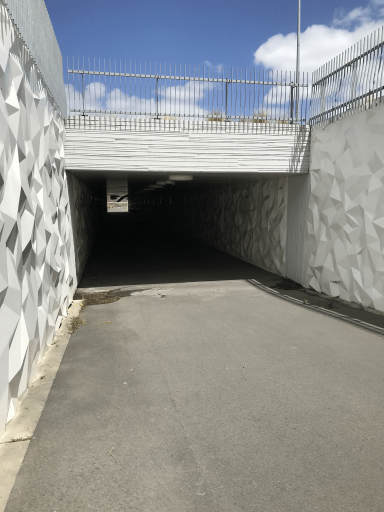
Apart from the church which is technically on Harewood Rd there are only three properties here. I couldn’t see the one from 1916 as it was down a long driveway. The Asian Garden Cooking School took up a large part of the street. The church has a carpark entrance on this street but if you look at old street views this carpark is fairly recent. Google maps show a bit change in the street between 2008 and 2022. At the end of the street there is now a subway that takes you under the extremely busy main road. Lovely wee church and cemetery here. My first thought when I saw the name of the street was that it would have been named after a place in the UK. There are at least three places with that name in the UK.
Waimakariri Rd in Harewood – formerly Part of Johns Road. Named because at one time the whole of Johns Road was known as the Waimak Road. First appears in street directories in 1972. [Kilcroft Road was another name suggested.]
A small amount of information from the library website. I didn’t find the name Kilcroft on Papers Past. The earliest entry that I found for Waimakariri Rd was in 1916 under Roll of Honour. Waimak Rd was mostly only used in the 1920s. The was land for sale in 1926 and described as suitable for market gardening. More land was available in 1956. Lots of ads for selling potatoes. Some entries said Harewood and other entries said Belfast or Styx. I will have to have another look at the older maps as the one from 1974 shows it very clearly as Waimakariri Rd and Johns Rd finishing at Sawyers Arms Rd. Map from 1922 shows it all as one road but modern maps show Johns Rd as extending past Sawyers Arms Rd. There seems to have been a reasonable amount of road changes in the area over the years.
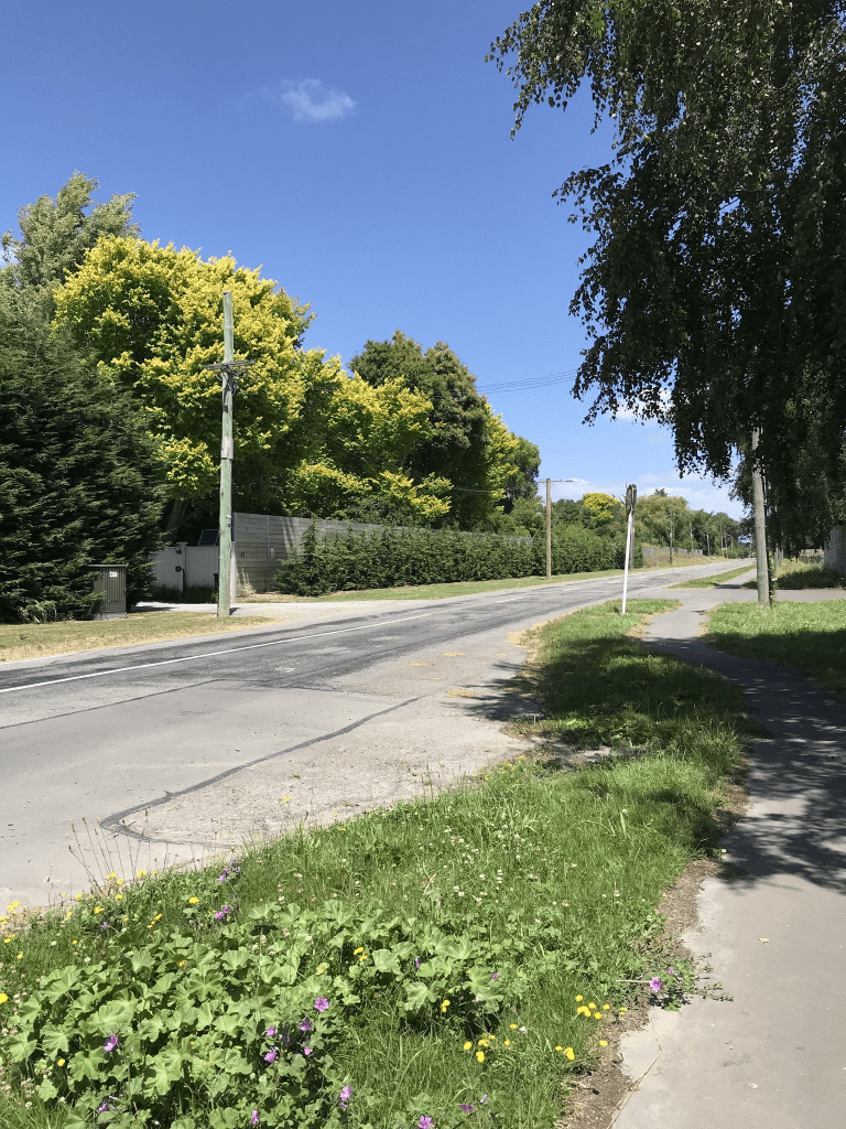
I walked this street today after geocaching in the area and I was surprised to find that I had a footpath to be able to walk on. It was actually a really pleasant walk. Not many houses here and they all sit on large tracts of land. Most seem to have been built in the 1960s but one dates from 1915. There is apparently superior airport parking here but when walking past I actually thought that the property had originally been a domain because that was what it looked. One property looked like it was growing Christmas trees. Another old property I couldn’t see very well because of the vegetation surrounding it but it looked like an old workers cottage. At the Sawyers Arms Rd end the fences surrounding the properties were extremely tall. My best guess for the reason for such fences is for blocking traffic noise. I was surprised to see very little sign of boy racers as I would have thought that it would have been a prime target for such idiots. At one part the map looked there was another road leading off this road but it was just the entrance way to a car distribution business.
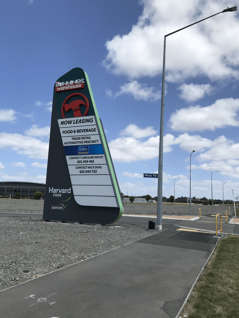
Wasp Road in Harewood – too new to be on library website and too new to be on google maps but weirdly it is on apple maps. It runs between Harewood Rd and Walrus Rd near Orchard Rd. It is in the middle of a big empty section. Couldn’t find any information when googling. It is probably named after the wasp fighter jet.