Be yourself; Everyone else is already taken.
— Oscar Wilde.
This is the first post on my new blog. I’m just getting this new blog going, so stay tuned for more. Subscribe below to get notified when I post new updates.
Lytteltonwitch's Walking the streets of Christchurch Project
I love walking and history and this project covers both interests
Be yourself; Everyone else is already taken.
— Oscar Wilde.
This is the first post on my new blog. I’m just getting this new blog going, so stay tuned for more. Subscribe below to get notified when I post new updates.
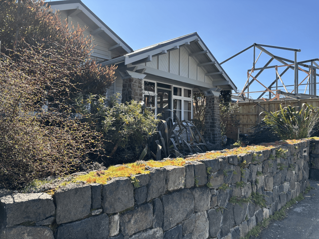
Hardwicke Street in Sumner -Land in Hardwicke Street in the “Township of Wakefield, Sumner Bay” is advertised for sale in the Star in 1880.
A tiny amount of the information from the library website. I couldn’t find anyone with the surname Hardwicke living in Sumner. It was fairly common for many people owning land in Sumner to live elsewhere. There was a family with that surname living in Lyttelton and it is possible that it is named after that family.
Not a huge amount of information on Papers Past. There were sections for sale in 1878 and 1880 with another lot of sections available in 1912. In 1884 the street was to be clayed and when they were doing the work a skeleton was found in a sandhill. In 1901 drainage work and septic tank were mentioned. In 1915 the Sumner Presbyterian Church was erected and in 1927 the Sunday School Hall was built. In 1916 a survivor of the Marquette wrote to his sister who lived on the street.
There was a very sad story in 1926 where a woman killed her baby son. Most headlines said demented mother. The baby was only a few weeks old and it sounds like the mother was struggling after the birth. She tried killing herself by running into the sea. She was acquitted of murder and detained at Sunnyside. Sounds like parents stayed married and they are buried together.
In 1933 the Sumner branch of the WEA was mentioned. After this date there wasn’t many entries on Papers Past. In 1983 there were pensioner cottages to be built on the corner of Hardwicke Street and Wiggins Street and they have a Wiggins Street address. In 1982 the church was called Union Church Hall and it is now the Anglican Church and the address is now Nayland Street. The Anglican Church moved here after the earthquakes. I couldn’t find out when the Presbyterian church moved to Redcliffs.
There were lots of ads for holiday lets for houses on this street. Sumner was a popular holiday destination and frequently featured in the social news.
I walked this street in September last year and was another one where my photos were still on my phone and I hadn’t transferred to my laptop. It is a lovely street and at least half the houses are dated between 1905 and 1920. The school is partly on this street but it has a Colenso Street address.
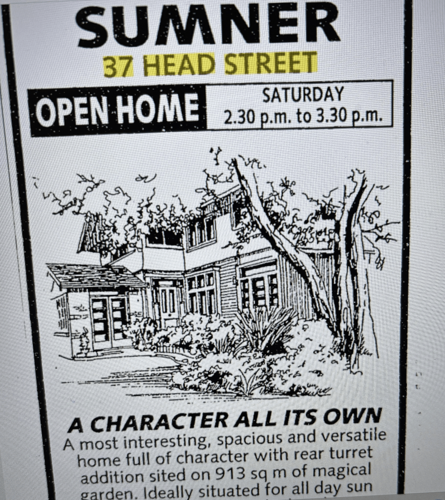
When I was researching Head Street in Sumner I came across several articles about a house at 37 Head Street that was a rest home for nurses. It went under a few names. There was one entry where it was called Adeline Turner Cottage. When it was opened in March 1920 it was called Adeline Rest Cottage. It was described as a rest home for hospital and district nurses. It was run by the Christchurch Hospital Lady Visitors Association. Adeline Turner was an active member of this association. Adeline was a hospital visitor for 36 years and her name Adeline meant noble. There was an obituary for Adeline Turner in 1938. When I was looking for information about Adeline I realised that I had already researched her family. Her sister Kassie was a nurse who had died in 1922 aged 58. There was an article where Adeline said that so many nurses were overworked and exhausted especially during the influenza outbreak that she wanted to have somewhere for them to be able stay and have a break. Adeline came from a well known family and her father was Charles Wesley Turner. The various family trees on the ancestry website are confusing and not helped by the family names being repeated throughout the generations. I have at least one friend on my facebook who is related to this family.
Most of the entries on Papers Past relate to fundraising for the cottage and thank you letters from nurses. In 1969 the cottage was put up for sale as the association said that there was no longer any interest in nurses wanting to use it. After this article there was a letter to the editor from a nurse. The letter said that none of the nurses at the hospital were aware of this cottage and if they had been aware of it they would have used it.
It was still sold and the money from the sale of the cottage went into a fund called Adeline Turner Fund. I couldn’t find a photo of the cottage and street view from google maps was of no help. The house was demolished and I am not sure if it was demolished before or after the earthquakes. I did find an image of the cottage from a real estate ad in the 1990s and it was rather bigger that a cottage.
Head Street in Sumner – First mentioned in the Star in 1880 when land in Head Street in the “Township of Wakefield, Sumner Bay” is advertised for sale.
A tiny amount of information from the library website and I couldn’t find out the reason for the name of the street. There was a reasonable amount of information on Papers Past. In 1880 there were ads for the sale of sections. There were more sections available in 1884 and they were promoted as suitable as winter residences and for invalids. There were a few ads for sections in 1880s and 1890s as the street was gradually extended. From 1888 onwards a creek was mentioned and it seemed to frequently cause issues. In 1915 it was eventually filled in after many years of discussing doing this. Between 1903 and 1905 drainage pipes were laid and in 1907 sewers were connected. The end of the street closest to the beach was occasionally flooded when there was an extra high tide. Heavy seas flooding the street was mentioned in 1914, 1917, 1929, 1951, 1953 and 1954. I was amused by an entry in 1915 when residents were woken up by screaming from the beach. It was an escaped pig being chased by the pig’s owner and owner’s friends. They eventually caught the pig. The tram was frequently mentioned as the tram terminus was at the end of the street. The new tennis courts were opened in 1921. There were the usual birth and death notices. This street featured a lot in the social pages as many of the dwellings in Sumner were holiday homes plus holiday accommodation. Mrs Isaac Wilson who lived at a house called Brantholme did a lot of entertainment at her house. In 1920 a cottage was purchased as a rest home for nurses and it was sometimes called Adeline Rest Cottage and was Adeline Turner Rest Home at other times. Adeline Turner did most of the fundraising for this cottage and her reason for the home was that nurses were so overworked that they needed a place to rest and recover. The influenza epidemic was mentioned as a factor for overworked nurses. Note Adeline Turner had a sister who was a nurse and the sister died in 1922. Baden Norris was mentioned in 1970 as living on this street. In 1985 there were five pensioner cottages to be built and this was the last entry for the street. There is a rest home on this street but none of the entries for the rest home mention that it is at 40 Head Street. In 1960s it was called Powell House In the 1970s and 1980s it was called Cavell House. From about 1991 it was known as Edith Cavell Hospital and was a 20 bed hospital. In 1994 it was extended and became a combined rest home and hospital and it is now known as Edith Cavell Rest Home and Hospital.
This is another street that I walked in September last year and only transferred my photos from my phone to my laptop last week. There are two houses dating from 1905 and one from 1900 but I didn’t managed to get a photo of them. Almost half of the houses on this street are dated between 1900 and 1920. I looked at street view for Adeline Rest Cottage but it doesn’t look like it survived the earthquakes. It is a lovely looking street with the older houses mostly being in good condition. There is a modern house on the street that I personally think is really ugly.
Thorpe Street in Sumner – formerly Sam Street and Harper Street. Named after Archdeacon Richard Joshua Thorpe (1838- 1920) Sam Street is first mentioned in The Press in 1896. First appears in street directories in 1925. Re-named Harper Street in 1933. Re-named Thorpe Street on 1 September 1948 when 120 streets were re-named. Thorpe was the vicar of Sumner 1902-1912.
A small amount of information from the library website. Not much information on Papers Past. The entry in 1896 said that a house was being erected on the corner of Sam Street and Colenso Street and it was being built for a Lyttelton gentleman who was coming to Sumner to live. In 1922 the footpaths and road were formed and in 1930 the road was metalled. In 1924 there was an application for gas and electricity to be installed. In 1931 it was proposed that the street be renamed Harper Street and it was renamed in 1933.
Most entries for Harper Street were for streets of the same name in Sydenham and Timaru. There were a few ads and death notices.
Not many entries under Thorpe Street and apart from a few ads it was mostly death notices.
There are only seven houses on this street and two of them were built in 1910 and another in 1920. The others were 1950 to 1970.
I didn’t manage a photo of the older houses and I actually walked this street in September last year. I hadn’t even transferred the only photo that I had taken from my phone to my laptop. I vaguely recall that I had been checking on a geocache that I have hidden in the Sumner area as someone couldn’t find it.
Smarts Road in Hornby- Named after Samuel Smart (1822-1897). Smart was a roading contractor. First appears in street directories in 1960. Hornby streets are not listed separately until 1960.
A small amount of information from the library website. I wrote about Samuel Smart after walking either Smartlea Street or Milton Street so I won’t repeat myself. Samuel Smart is supposed to have introduced asphalt to New Zealand. When looking at Papers Past I found entries for a Smart’s Road in Sydenham and it sounded like it intersected with Colombo Street. I searched maps but couldn’t find any streets with that name. It would have to be one of the streets running off Bradford Park. This street was mentioned in 1875/ 1876 and one of the maps on the library is from these years. The Smarts Road in North Canterbury is named after a different family.
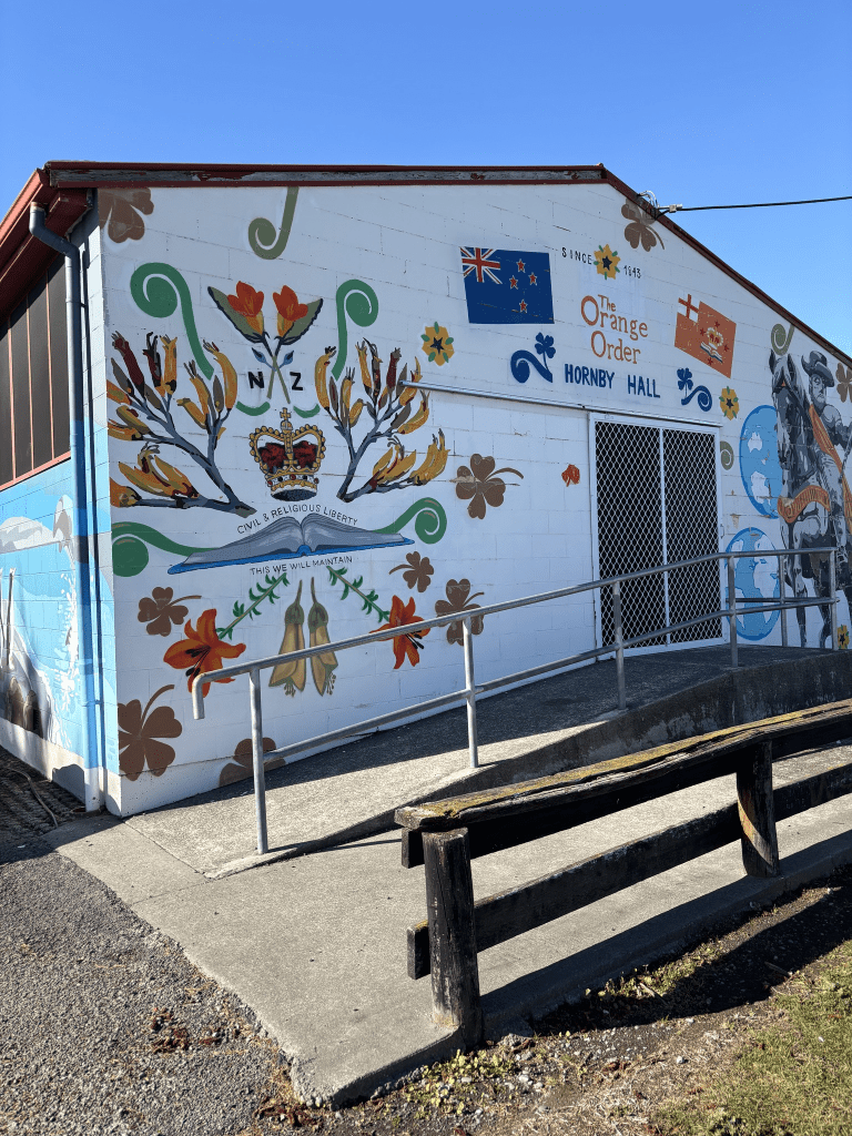
Couldn’t find much information on Papers Past about Smarts Pit and the exact dates that Samuel Smart closed the pit in Sydenham and opened the pit in Hornby. The first mention that I found for Smarts Road in Hornby was in 1929 and it was described as running parallel to the railway line. In was a Smarts Road Reserve mentioned in 1930 but I couldn’t tell if it was in Hornby or in Sydenham. There were obviously houses here in the 1930s as there was a resident hurt in an accident in 1933. There were a few death notices in the 1950s and 1960s. In 1959 the quarry / pit closed and it became a rubbish dump for the council. It was still called Smarts Pit. The rubbish dump closed in 1973 and it became Kyle Park. There is still a Kyle Park but on Smarts Road side of the park there is now the Hornby Library. The new Hornby Library opened in 2024. No wonder I was confused yesterday when walking to the library as I couldn’t remember the library being so far from Hornby Mall. The street was probably fully zoned as industrial land in 1972 and there are no longer any houses here. Most of the businesses seem to relate to the vehicle industry. At the Waterloo Road end there was an interesting small building covered in street art. The building belonged to the Order of the Orange Lodge. I couldn’t find out when the lodge moved to this street. I couldn’t find out the information online but did find a photo of the original lodge building and it wasn’t this building. I looked at street view to see what the library site looked like from before the library was built. It had been a lovely grassy area with trees. The lodge building looked similar but with different street art on it.
I took several photos of the lodge building and the street art on it. I love street art.
Chestnut Avenue in Hornby – First appears in street directories in 1960. Hornby streets are not listed separately .
A tiny amount amount of information from the library website. Surprising that such a small street is called an avenue as I always expect an avenue to be a long wide street lined with trees. I couldn’t find any old maps of Christchurch that showed this area. Papers Past mostly had ads for businesses and it was described as an industrial site in ads for sections. I did find a couple of death notices plus in 1934 Mr and Mrs Robson held a fundraising event at their home on this street. Most entries on Papers Past for Chestnut Avenue were about trees at Hampton Court with a few for a street in Christchurch in the UK. I searched Ancestry website with no luck either.
I walked this street today after visiting the Hornby library and before going to a geocaching event. No photos and there were a few small businesses on the street.
Scarborough Road in Sumner / Scarborough – Named because it runs through the suburb of Scarborough which, in turn, is named after Scarborough, a seaside resort in Yorkshire, England. First mentioned in The Press in 1908 when it is reported that Mr R. M. Morten’s attorney had requested that the Council should accept dedication of the Scarborough Road. Richard May Morten (1827?- 1909) and his family farmed large areas of land at Mount Pleasant, Scarborough, the Port Hills and Tai Tapu and gave generously to the community.
A small amount of information from the library website and in Gordon Ogilvie’s book it is stated that R M Morten gave the area the name Scarborough and named the road Scarborough Road. Richard May Morton was born in Amersham, Buckinghamshire which is a long way from Yorkshire. He did own the land where the road was formed. A letter to the editor in 1980 has someone claiming that Archie Paterson named the road. Archie Paterson was born in Scotland and he did much of the work developing the road. Archie Donald Paterson went on to start the company British Pavements in 1926. He died in a car accident in 1950 and the inquest reports were interesting as the main witness to the accident was a passenger in a light aircraft. The other name that was associated with the development of the road was Colonel Henry Hobday.
Most of the information on Papers Past was about drainage issues, slips on the road, rocks falling from the cliffs, grass fires and the usual death notices. In 1908 the road still belonged to Richard Morten and it was recommended that he get his attorneys to furnish the council with an indemnity against claims for falling rocks until the council take over the road. In 1909 it was described as a recently constructed road. In 1911 there was talk about extending the road to as far as Godley Head. This obviously didn’t happen. From 1911 onwards there were sections for sale.
In 1927 the hairpin bend was mentioned and this was because someone got stuck on the bend in his car. I am not sure which bend they meant as there are two very sharp bends in this road. I suspect that it might have been the lower one as it was mentioned that the driver froze when his car was up against the cliff. In 1933 the council did blasting here to widen the road and they discovered a cave when blasting. The cave was possibly originally a Maori camp as remains of fish bones and shells were discovered.
The road was tar sealed in 1943 and more sections were for sale from 1944 onwards. The owners of these newer houses in the 1950s complained as the milk vendor wouldn’t deliver milk to their houses. In the 1950s and 1960s there were parking issues and the cars parked were blocking the traffic especially in the busy summer months. In 1965 the residents requested that the road be widened in the upper reaches of the road. There wasn’t any further mention of this so I suspect that it didn’t happen. In 1970s there were several accidents on this road with cars going over the bank or hitting the cliff face. A couple of cars managed to end up in the sea.
Yesterday I had a free day with no commitments as my walking companion client was unable to go out walking. I walked to the bus exchange to catch a bus and ended up in Sumner. I am trying to limit my use of my car and I get free bus trips thanks to the gold card.
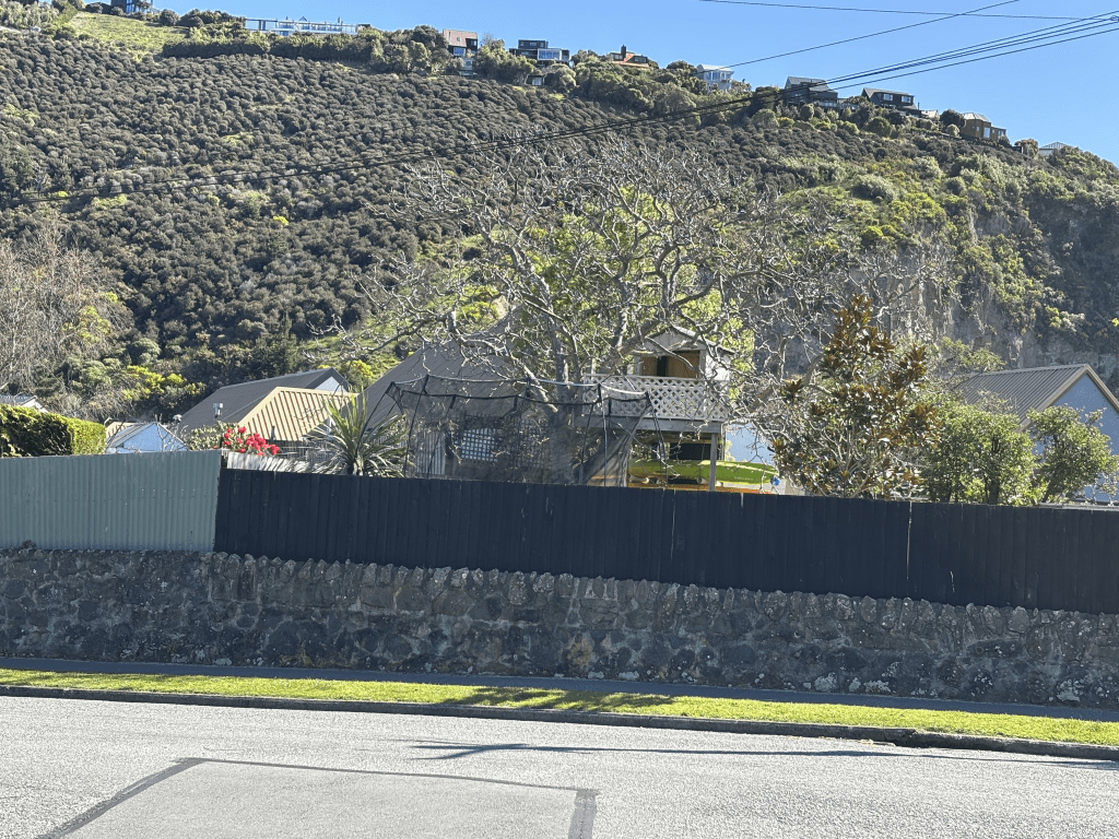
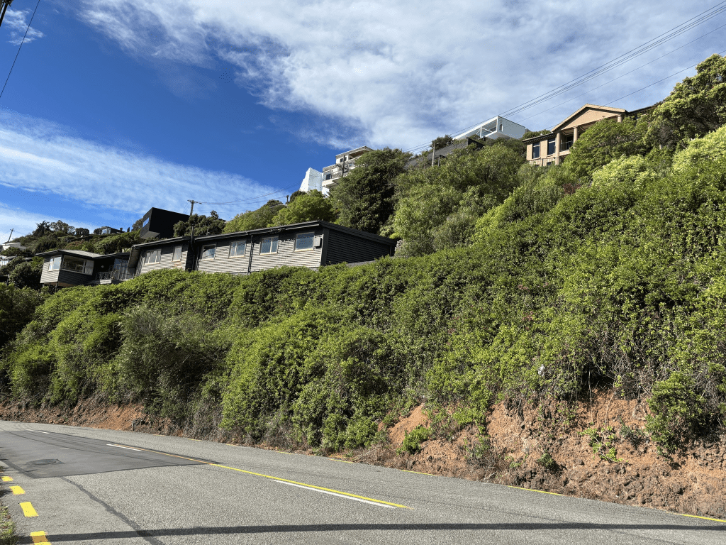
This is an interesting and scary road to walk and will confess that I cheated. I started my walk at the Scarborough Park end and the playground was very busy because of the school holidays. There are the garages under the cliffs and one lot are in good condition but the other group of garages are looking very rundown. The sea and beach is on the other of the road and the sea was busy with surfers. The footpath is narrow and yes I did use bad words at a couple of cyclists. I stood at the bottom of the hill and debated with myself about walking on the road but after watching the cars coming down the hill I decided that it wouldn’t be safe. It is a very narrow road. I went up a track to where there was a sign. Turn left to walk Flowers Track or turn right to walk Scarborough Track. I turned right and followed the narrow walking track. I was walking past the houses as the track was next to the houses. Great views over Sumner from the track. I eventually ran out of track as it had been blocked off yet my map said that it should continue. I was able to walk down to the actual road where I continued walking. It was scary as the road was very narrow and I was walking up the the second sharp bend. It was a bit wider once I got around the bend but I still had to be very careful and several times I stopped and went onto driveways until cars had gone past. I eventually ended up at Nicholson Park where this road ends and becomes Taylors Mistake Road. There are some huge houses here and they would have great views but I wouldn’t like to live here. Besides the houses are well beyond my budget. I walked back down through the park and Flowers Track and ended up chatting with a local. She used to deliver pamphlets and all the people delivering pamphlets refused to do this road because they didn’t feel safe. I don’t blame them.
The houses here cover all decades from 1910 onwards. The older houses start at the bottom of the road and gradually get newer the further up you go. Impossible to get decent photos and I should have taken a photo from The Esplanade. I looked at google maps and took a couple of screenshots from The Esplanade.
Looking at maps is where it gets interesting as Apple Maps and Google maps disagree on where Heberden Ave ends and Scarborough Road starts. For a change I went with Apple Maps and used The Esplanade as the dividing line. One of my paper maps didn’t show Sumner on it and the other one did show Sumner but didn’t have the street names on this part of the streets. One reason that I decided to use The Esplanade as the dividing line was because Scarborough Park is here and the other reason is that the garages under the cliff were mentioned in Papers Past as being on Scarborough Road. The Sumner Coastguard also has a Scarborough Road address and if I went by google maps it shows this building as being on Heberden Ave.
Seaspray Lane in Scarborough and no information on the library website. There are only three houses here built in 2000. The name is probably because the street is in a seaside suburb but I couldn’t find anything on the council website about the naming of this street. There is a reserve called Margaret E Greening Memorial Reserve at the start of the street but I couldn’t find out any information about this reserve. I searched older maps plus looked at a book by Gordon Ogilvie with no luck. From Papers Past I found some information from 1995 that might relate to this street. There was a block of land between Heberden Ave and Scarborough Road that belonged to the council. The council decided that it was surplus to their requirement and one article said that it was for waterworks and drainage. The other article said that it was no longer required for roading purposes.
When I walked the street today it looked like more houses are being built. There are also some steps that look like they go down to a track. I asked a local and he said that it is still a proper track. I will have to come back and check out the track. No photos for this street and nothing on street view. I would love to have taken a photo of this man’s house as half of it was painted bright yellow.
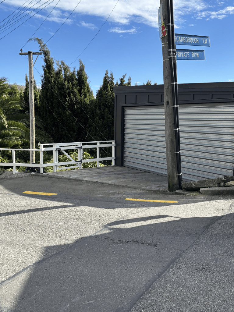
Scarborough Lane in Scarborough. Nothing on library website or various valuation websites including the QV website. A few real estate agents have used this street name and there were a few real estate ads on Papers Past in the 1980s and 1990s using this name. Both google maps and apple maps show the street on their maps. There is a sign post with Scarborough Lane on it but the 8 or 9 houses on this lane all have Scarborough Road addresses.
It just looked like a very narrow driveway to a couple of houses so I was surprised when looking at google maps to realise just how houses were here. Today I watched a huge truck turn in the very narrow Scarborough Road and the driver back the truck into the entrance. I praised him for his excellent driving skills. I obviously didn’t walk this lane which technically doesn’t exist.
Augusta Street in Redcliffs – Formerly Augustus Street. Named after Augustus William Bennetts (1860- 1936). Re-named Augusta Street. Bennetts was an auctioneer and a member of the syndicate that subdivided part of Redcliffs. He is also listed in street directories of 1890 as a cattle dealer of Ferry Road. He is mentioned in the Star in two entries. In 1894 he was declared bankrupt. Augustus Street first appears in street directories in 1901. First appears as Augusta Street in The Press in 1907.
A small amount of information from the old library website. Augustus was born in a place called Pucklechurch near Bristol and he would have been a baby when his parents came out to New Zealand in 1860. In 1881 the partnership that he was in with his brothers was dissolved and his brother Adolphus left the partnership. Augustus continued in business with his brother Albert known as Hugh and the business was called Bennetts Bros. Lots of entries about Augustus in 1894 regarding his bankruptcy. The courts give his address and occupation as sheep farmer of Norwood. He had land all over Canterbury but he had taken out mortgages over most of his properties when he was struggling with his finances. He was also in court in 1882 along with his brother Hugh as they were the trustees of a deceased estate but they didn’t pay out the money to the widow as they were supposed to do. Note Hugh Bennetts was also bankrupt. In 1907 Augustus was charged with neglecting his cattle by not giving them food or water. He was also charged with breaching his prohibition order and the same year he received seven days imprisonment for failing to support his father. In 1909 he was fined for drunkenness and it was his third offence in six months. In 1911 he was in court for not paying his debts. No more information in Papers Past for Augustus after this date so I went looking for details of his death. He is buried in Ashburton so it is highly likely that he ended up at the home for destitute drunks that was in Ashburton. He had a nephew who was frequently jailed for assaulting people with weapons.
In Papers Past there were a few entries right up until 1994 that used the Augustus name for the street but it was mostly a few ads and death notices. In 1908 the Sumner Borough Council were discussing changing some street names as they were considered offensive and this included Augustus Street.
Lots of ads and death notices over the years. Flooding was frequently mentioned especially at the corner by the Main Road. In 1973 there was talk about stormwater drains and there was finally an ad for the tender of installing stormwater drains in 1978. In 1918 a slip damaged two properties and one man lost his greenhouses and orchard. In 1923 and 1924 there was talk about extending the road. In June 1926 there were a few articles about the Redcliffs Methodist Church as they were going to build the church in one day. They managed to get most of the work done except for iron for the roof and the floors. They did this work at Kings Birthday Weekend. On 14th June 1926 the headline said Opening for Church Built in a Day. From 1973 onwards the church was known as the Redcliffs Union Church rather than Redcliffs Methodist Church.
I have to mention that in 1932 the Mayor of Lyttelton F E Sutton and his daughter had a collision with a bakery van on the corner of Augusta Street and the Main Road. This corner seemed to have a few accidents and in 1957 there was a complaint about speeding drivers not stopping for pedestrians on the pedestrian crossing here. Thankfully it now has traffic lights. In the 1930s there were often harrier races starting from this street. The road was tar sealed in 1933. In 1952 there was the opening ceremony for the Beryl McCombs Kindergarten and a plaque was unveiled. Sadly this building didn’t survive the earthquakes and the building was opposite the church. There are now units here that were built in between 2020 and 2023. From 1952 onwards there were lots of ads for a plant nursery and in the 1960s there were two plant nurseries on the street. The owner of the second one was attacked in 1963 and ended up in hospital with head injuries. A neighbour mentioned that a young man was seen running away. The same neighbour said that the victim was in the habit of having strangers visiting him. I did search to see if I could found out more information but nothing. Yes you are all thinking the same as what I was thinking.
In August 1976 a house was destroyed by a slip and I certainly remember this storm. In 1981 an expansion to the supermarket was opposed. Looking at google maps the car park for the supermarket was on the corner of Augusta Street and the Main Road. This supermarket was demolished after the earthquakes and a new one was built. The supermarket closed in 2021 and it was supposed to be turned into apartments but it is still empty.
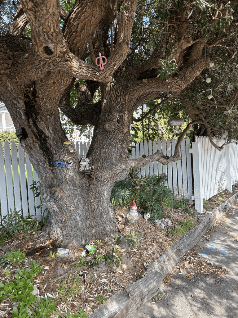
I walked this street yesterday after geocaching in the area. Instead of driving to Redcliffs I caught a bus as I am attempting to reduce my petrol usage because of the current situation. After a coffee at a nearby cafe I started my walk. The empty supermarket is at this end and technically it is on the Main Road. There are some new units at this end and the Redcliffs Uniting Church is opposite. There is a mixture of ages and styles of houses here and many sections have houses built behind older houses. The houses range in age from 1900 to 2024. I was disappointed to see that the house from 1900 has been altered in such a way that the character has been ruined. There was a house from 1905 that I loved and I especially loved the decorated tree on the fenceline. The tree had little toys all over it and I took lots of photos. The street is flat for a while and then it goes uphill. On this part of the street the footpath is only on one side and the street is treelined. Near the top of the hill it looks like the road continues but there is a sign saying private road and property so I didn’t go any further. The footpath also stopped here. This is where you ignore Apple Maps which said that the road connected with other roads and check google maps which says that the road stops here. There was a house near this end of the street that really intrigued me as it looked so unusual. I was surprised to find out that it had been built in the 1970s. I took lots of photos. I liked this street but I do prefer living close to the central city.