Abberley Crescent in the suburb of St Albans, Christchurch

Abberley Crescent in St Albans – formerly Abberley Road. Named after Abberley in Worcestershire, England.Thomas James Maling (1836-1922), an importer and merchant, built his home on this land in 1863, naming it Abberley. He was the only son of Admiral Maling of Abberley, Worcestershire. Abberley Road is referred to as the “new Abberley Road” in an article in the Star in 1876, appears on an 1879 map and first appears in street directories in 1887. Becomes Abberley Crescent in 1941.

A small amount of information from the library website. Papers Past had lots of entries for this street. In 1876 and 1877 the entries were about letters from T J Maling asking about the forming of the street and the shingling of the street. There was land for sale in 1880 and 1881. The 1880s saw many entries about flooding and draining issues. The flood of 1886 affected the entire city and was really bad. A few birth notices but a lot more death notices. In 1938 the residents of the road requested that the street name be changed from Abberley Road to Abberley Crescent because of the shape of the street. A business that was mentioned was the bakehouse belonging to a company called G Money and Sons. They had a fire in the bakehouse in 1942. In 1960 the owner Frank Hawker complained about the land his bakery was on being rezoned as residential. There was a house in front of the bakery so it couldn’t be seen from the road plus any work vehicles entered the premises from a lane behind the business. In 1969 the property was for sale and described as a two story bungalow and bakehouse that used to belong to Money and Son.

The story that amused me the most was from 1957 and about a goat that got stuck in a telephone box. When the police received a phone about the goat they didn’t believe it at first and no the goat didn’t make the phone call. The goat was eventually captured and it had escaped from a property on a nearby street and the owner used the goat as a lawn mower. In 1941 the Women’s Land Army had a large vegetable garden on this street.

In 1939 the council purchased the Abberley old homestead and land that belonged to the late J H Kirk. I actually thought that this property belonged to T J Maling who died in 1922. There was at least one letter to the editor complaining about the council wasting money by buying this property as Christchurch had enough parks. In February 1940 the park was opened and there is a plaque in the park about this event. The original homestead was mostly demolished only leaving the large drawing room standing.

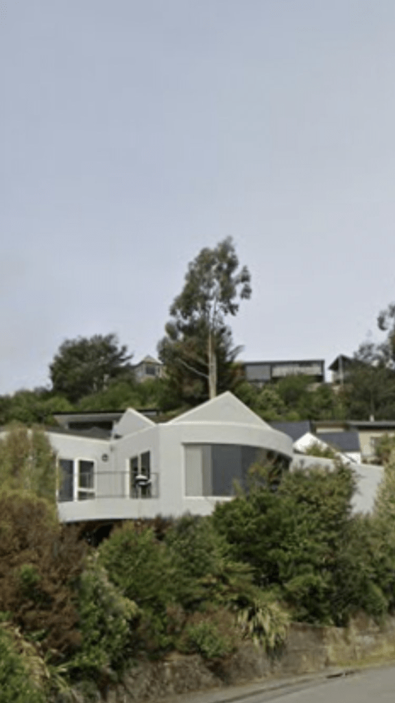
Most of the houses here are from 1970s including pensioner cottages built for Glenora Foundation. Many older houses are still standing dating between 1880 to 1925. Some weren’t obvious as they had been altered and others were behind big fences. For some reason near a group of the older houses there wasn’t a footpath but looked like there should have been a footpath. Abberley Park is still there and I was geocaching in the area today. It is a lovely wee park and so many people walking their dogs here. There is a stream that runs through the park which is likely to have been the source of the flooding and drainage issues in 1880s. I quite liked this street.

Paikea Place in the suburb of Somerfield, Christchurch

Paikea Place in Somerfield – Named in 1966. First appears in street directories in 1970. Information on date of naming in a letter sent to the City Librarian from the Town Clerk dated 13 December 1966.

A small amount of information from the library website and Paikea is the Maori word for the Southern Humpback Whale. Not many entries on Papers Past but several ads for sections in 1967 and it was described as being part of the Palmside subdivision. I searched for a property with that name in the area with no luck. I possibly visited this street in the 1970s as I recognised a name in Papers Past. It looked like a pleasant tree lined street but it didn’t really stand out for me. Most houses were built in the 1970s but one house dates from 1940. This house was down a long driveway so I couldn’t see what it was like. I was geocaching in the area last week when I walked this street.

Grassmere Street in the suburb of Papanui, Christchurch

Grassmere Street in Papanui – Formerly Green’s Road. Named after the Rev. George Rowney Green (1794-1860). Re-named Grassmere Street. Named after Lake Grasmere in the Lakes District, Cumbria, England. [Grasmere has been mis-spelt in the naming of the street.]The Rev. Green, a fellow of Eton and Rector of Everdon in Northamptonshire, selected Rural Section 308, just north of Papanui (North Road) “next to Dunnage”. He was an absentee landowner. His brother, Henry Green of Papanui, advertises for work as a tutor in The Lyttelton Times in 1852. Green’s Road appears in street directories in 1894. Re-named Grassmere Street on 1 September 1948 when 120 streets were re-named

A reasonable of information from the library website. There were several Green Roads or Streets and this subjected was mentioned in 1925. In 1932 Green’s Road kept it’s name and Green’s Lane in Riccarton plus Green’s Way in the city were changed. In 1948 Green’s Road was changed to Grassmere Street. In 1933 there was an obituary for Eleanor Bailey who came out in the shop Fatima in 1851 with her parents and siblings. Her father was Harry ( Henry) Green and he erected the first wooden house in Papanui. They shipped the house in pieces from England and carried it from Lyttelton to Papanui where it was bolted together. The obituary also mentions that Green’s Road was named after her father Harry Green. George Rowney Green’s will in 1860 doesn’t mention him owning any land in New Zealand. The family trees on the ancestry website were full of mistakes and the most common mistake was confusion between Christchurch in New Zealand and Christchurch in Dorset.

Drainage issues and flooding problems were frequently mentioned. William and Annie Aitken were also frequently mentioned as living on this street yet when I researched this family recently for Major Aitken Drive the electoral rolls gave their address as the military hospital in Cashmere. There wasn’t many houses on this street and there was at least two market gardens. Several entries for one of the market gardeners. Frederick Richardson in 1927 collapsed and was taken to hospital and he was described as an elderly man. In 1929 he was charged with attempted murder and his age was 56. He claimed that someone had left a gate open and shot them. He died in 1951 aged 78. In 1969 there was 6 acres of market garden for auction but there weren’t any buyers. In 1977 the Seventh Day Adventist Church wanted to set up a school on this land but the residents on the street objected to this. One reason was that the land frequently flooded. In 1978 there was talk about turning it into a park. For many years there was a sawmill on this street until it was destroyed by a fire in 1968 and the fire was arson.

There are still 4 houses from 1920 on this street but they didn’t stand out or were interesting looking. A few houses from every decade especially 1990s. I was surprised that the valuation website said that there were 152 properties here as the street didn’t seem long enough. The Ngaio Marsh retirement home counted for at least half the properties on the street. Several big empty sections on the street and there is also a cycleway on this street. The history of the street was more interesting than the street and I didn’t even take any photos.

Major Aitken Drive in the suburb of Huntsbury, Christchurch

Major Aitken Drive in Huntsbury – Named after Major (later Doctor) William (known as Peter) Aitken (d. 1959) Aitken was the commanding officer of the Cashmere Military Sanatorium from 1 June 1920-June 1922. This took the form of shelters high on the open hillside above Cashmere Sanatorium. Named in 1993. First appears in street directories in 1996.

A small amount of information from the library website and because of two mistakes in their information it took me longer to research than it should have. Major Aitken was William Aitken and his son and his father were Peter Aitken. He also died in 1958 and found his obituary in December 1958. Major Aitken was born in Dunedin and educated at Otago Boys High School. He graduated from Otago Medical School in 1914 and he served in the NZ Medical Corps. Received Military Cross for Gallantry and reached the rank of lieutenant Colonel. He was superintendent of Military Sanatorium between 1919 and 1925. He then went into private practice specialising in chest complaints. He died at his home on Dyers Pass Rd. He retired in 1949 due to ill health. His wife Annie was assistant matron at Gisborne hospital and did military training at Wellington Hospital. She was amongst the nurses who went to the war on the ship HMHS Marama. She received the British War Medal and the Victoria Medal.

Most houses on this street were built in 1990s and 2000s with one built in 1980 plus a few newer places. This was a long and steep street that I walked on Friday as I was geocaching on this street. So many little streets and lanes run off this street. For a long street there is only 56 houses here but many are fairly large. I liked several of them but there was the usual ugly modern houses here as well. I walked down the street and then walked back to my car via Coronation Reserve and there is an entrance to the reserve from this street. It wasn’t the safest street to walk and the reason was that for much of the street there was a footpath on only one side of the street. You would be walking on the footpath and it would come to an end and the footpath would then be on the other side of the street. The trouble was that this would happen on a very sharp bend and you would then have to cross the street on a blind corner.

Shearer Avenue in the suburb of Papanui, Christchurch

Shearer Ave in Papanui – Named after John “Jack” Shearer (1886-1977). Jack Shearer and his three sons built houses all over Papanui. He moved to Auckland in 1965. First appears in street directories in 1960.

A small amount of information from the library website. I spent far too long on research on Papers Past, Ancestry website and cemetery databases. The best information came from entries for John and Lily’s Diamond Wedding celebration in 1971. John was born in Ashburton and moved to Christchurch in 1922. Went into building business with his two brothers. Retired in 1946. One entry said that their current address was 4 Shearer Ave but the other entry said that they lived in Auckland with their daughter. All family trees on Ancestry website gave John’s death as being in July 1977 in Christchurch but they didn’t provide any proof and I couldn’t find any records for his death. Lily died in NSW in 1985 and going by the gravestone John isn’t buried with her. Their son Kenneth John Shearer was responsible for the building of the houses on this street going by the ads for the sale of sections in 1956. He also lived at 4 Shearer Ave. Most houses were built in 1950s and 1960s but there is four apartment style built this year and going by a sign on a fence another study well built house will be knocked down and replaced with four modern places. It is a property developer whose houses I wouldn’t touch with a barge pole. I had to google the word sullage as in 1961 this was an issue. It is another word for waste water. The saddest story from this street was a young 17 year old who lived on this street died on Caroline Face, Mt Cook and they had trouble retrieving the body because of weather conditions. None of the houses stood out for me and were typical of the 1950s and 1960s era. At the end of the street is a park with a playground and I was geocaching in the area. Do be careful if using the park as there are some dodgy characters who use the area.

Roderick Alleyn Lane in the suburb of Papanui, Christchurch

Roderick Alleyn Lane in Papanui – Named after Detective Chief Inspector Roderick Alleyn, the main series character of the author Ngaio Marsh (1895- 1982). The character made his debut in 1934 in the novel A Man Lay Dead. The street is next to the Ngaio Marsh Retirement Village. Named in 2001.

A small amount of information from the library website and nothing that I can add about the name of the street. I have read all of her books as I like murder mysteries. I have also visited her home in the Cashmere Hills when they had an open day a couple of years ago. Most houses built in 2000 except for one built in 1980. Considering it is a private lane there was a footpath at the beginning of the lane so I was able to walk part of the street. The houses are huge and well above my budget. I would quite like to live here if I could afford it.

Vista Place in the suburb of Huntsbury, Christchurch

Vista Place in Huntsbury – First appears in street directories in 1991. A tiny amount of information from the library website. My best guess about the name of the street is because of the great views from here as one meaning of vista is pleasing view.

Most houses here were built in 1990s but two or three are from 1980. A few are more recent and there is one still being built. There was at least one very ugly house but there was one Mediterranean style house that I quite liked. I ended up walking this street twice as I walked it at the beginning of my walk and then at the end of my walk as I walked through Coronation Reserve to get back to my car.

Edited to say that I forgot to add that this street also has restricted night time access because of idiots who terrorised the street with loud music and doing burnouts plus other anti social behaviour.

Yelverton Place in the suburb of Huntsbury, Christchurch

Yelverton Place in Huntsbury and there wasn’t any information on the library website. The street would have been named after Yelverton in England in keeping with the theme of naming streets in this area after places in England.

Great views from this street and the houses were huge. They were also well beyond my budget. One fairly ordinary house had great artwork. Most houses were built in 2000 with a couple built fairly recently.

Trumble Lane in the suburb of Huntsbury, Christchurch

Trumble Lane in Huntsbury – Named after Louisa Mary Trumble (1874- 1955). Louisa Trumble nursed at the Cashmere Sanatorium. She was matron of the Military Sanatorium 1920- 1929 and matron of the Tuberculosis Institution 1929-1935. Named in 1993

A small amount of information from the library website. Papers Past had several entries for Louisa including an obituary. In 1918 she was awarded the Royal Red Cross medal because of her war record. She is buried in the Karori Cemetery in Wellington in the RSA section of the cemetery. Louisa was from Westport but was at the Christchurch Hospital when she went to the war zone. In 1923 she was appointed matron of the new open air home for children.

I didn’t actually walk this street as it definitely looked like a private driveway but apparently 9 houses on this street mostly built in 1990.

Trecastle Lane in the suburb of Huntsbury, Christchurch

Trecastle Lane in Huntsbury – Formed post-1997. Tiny amount of information from the library website. If this street was named under the theme of naming streets in this area after places in England then they mucked up big time plus insulted the Welsh. Trecastle is a village in the Brecon area of Wales. I have stayed in a YHA nearby and will have driven through this village. It was another tiny street that looked like a driveway to a couple of houses. One house that I thought was on Major Aitken Drive is actually on Trecastle Lane and it was an interesting looking house with an Art Deco look about it. The Google vehicle had obviously gone up the street and google maps showed one house that looked more like a motel rather than a house.