Penwood Street in Russley and it wasn’t on the library website which surprised me as most houses were built in the 1960s. A small amount of information on Papers Past. It was a development by Paramount Homes and they were selling sections in 1961 and 1967. Russley School is behind this street and on the corner with Pinehurst Crescent there is the Pinehurst Playground. The other entries on Papers Past were engagement notices. The name of the street will be from a village in England and this village is near Highclere. I have actually found geocaches in Penwood as I frequently worked nearby at Woolton Hill during my five years in the UK. Parking during the week is limited to 60 minutes so I only stayed long enough to get clues for a multi cache and of course walk this street. None of the houses stood out for me and they were typical 1960s houses and mostly made from brick.
Gray Way Road in the suburb of Russley, Christchurch
Gray Way Road in Russley and the street is too new for library website. Another street in the Karamu subdivision that is a Ngai Tahu development. The street is named after a racehorse called Gray Way. Houses all built between 2019 and 2022 and again I was reminded of the Pete Seeger song Little Boxes.
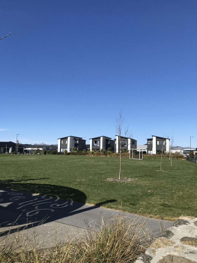
Manakura Street in the suburb of Russley, Christchurch
Manakura Street in Russley and the street is too new for library website. Another street where real estate agents describe as being in Avonhead. Manakura means leader. The street is part of the Karamu subdivision that is a Ngai Tahu development. The houses are all built between 2019 and 2022. There are still houses being built on this street and for most of the street the houses are only on one side of the street as the Riccarton Racecourse is on the other side. There is a reserve on the corner of Manakura St and Gray Way Rd with play equipment. In a couple of places I had to walk on the road because of vehicles blocking the footpath and we all know how much this annoys me.
Horoeka Street in the suburb of Russley, Christchurch
Horoeka Street in Russley and the street is too new for library website. I was amused that real estate agents put the street in Avonhead. The street is in the Karamu subdivision which was a Ngai Tahu development. Horoeka is a type of lancewood. All the houses were built between 2019 and 2022 and I immediately thought of the Pete Seeger song Little Boxes. You can see the houses when you drive down Yaldhurst Rd as Horoeka Street runs parallel to Yaldhurst Rd.
Kinleys Lane in the suburb of St Albans, Christchurch
Kinleys Lane in St Albans – First appears in street directories in 1966. A tiny amount of information from the library website.
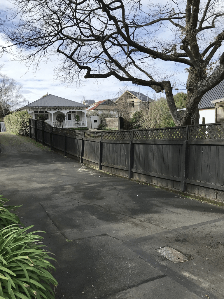
There was only two entries on Papers Past and it was spelt Kinley’s Lane. One entry was for a sale of a property in 1974. The other entry was an ad for Kinley Garage. I searched the ancestry website but couldn’t find anyone with the surname Kinley who owned a garage or was a mechanic. Several with the surname Kinley lived in the area but couldn’t match them to the lane. The lane was probably named after whoever owned the garage. The lane runs from St Albans Street to Abberley Park. Most houses were built in 1990 but one house dates from 1950 which will be the one mentioned in Papers Past. I quite liked the street but it is narrow with very limited parking. I walked this street on Friday when I was geocaching in the area.
Albany Street in the suburb of St Albans, Christchurch
Albany Street in St Albans – Named after the dukedom of Albany The dukedom of Albany is a peerage title occasionally bestowed on the younger sons in the Scottish, and later, British royal family. First mentioned in The Press in 1908 in an advertisement. First appears in street directories in 1909.
A small amount of information from the library website and nothing that I can add about the name of the street. I seriously sidetracked on Papers Past with this street. There were a few birth notices and even more death notices but what dominated the news was a murder in December of 1965. A 73 year old widow was found by her daughter. The widow had been battered around the head by a barometer and then her throat was cut. It created so much interest that it attracted so many Sunday drivers that the cars were bumper to bumper. Note going for a Sunday drive was a big thing those days and yes I am old enough to remember such a thing. Eventually the daughter was arrested for her mother’s murder and found guilty. She appealed the verdict but the appeal failed. Interesting trial as much emphasis was placed on the mother having been married three times and the daughter having been married twice. Three psychiatrists diagnosed the daughter with psycho-neurotic personality disorder. I am not surprised that the mother was a widow as she tended to marry men at least 20 years older than her. The daughter’s marriages were a little bit more interesting. Her first husband died from carbon monoxide poisoning in a fire. The inquest stated that it was a suspicious death and subject to a police investigation. She was divorced from her second husband. He had at least 3 or 4 wives and eventually died from alcohol related illnesses. She married for the third time in 1978 and obviously was out of jail by this date.
Most houses here were built in 1970s and 1980s plus many are from 1905 to 1920s. Some of the older houses are lovely but I was disappointed with the one from 1905 as it has been altered. It was a pleasant street and even the some of the modern houses looked OK.
Harold Denton Place in the suburb of St Albans, Christchurch
Harold Denton Place in St Albans – Named after Harold Ernest Denton (1893?- 1975). Denton was a city councillor 1938-1944, 1956-1959 and 1962- 1968. Formed in 1972 and contains city council housing for pensioners. First appears in street directories in 1974.
A small amount of information from the library website and not a lot that I can add. Not a lot of information on Papers Past with just a couple of death notices and entries in garden competitions. In September 1972 the cottages were opened by the mayor N Pickering. There were 20 council built and owned units for pensioners and they are still council owned. Harold Denton was mentioned and he was 80 years old in 1972.
The street runs off Springfield Rd and it actually had a footpath. The units are typical 1970s units.
Abberley Crescent in the suburb of St Albans, Christchurch
Abberley Crescent in St Albans – formerly Abberley Road. Named after Abberley in Worcestershire, England.Thomas James Maling (1836-1922), an importer and merchant, built his home on this land in 1863, naming it Abberley. He was the only son of Admiral Maling of Abberley, Worcestershire. Abberley Road is referred to as the “new Abberley Road” in an article in the Star in 1876, appears on an 1879 map and first appears in street directories in 1887. Becomes Abberley Crescent in 1941.
A small amount of information from the library website. Papers Past had lots of entries for this street. In 1876 and 1877 the entries were about letters from T J Maling asking about the forming of the street and the shingling of the street. There was land for sale in 1880 and 1881. The 1880s saw many entries about flooding and draining issues. The flood of 1886 affected the entire city and was really bad. A few birth notices but a lot more death notices. In 1938 the residents of the road requested that the street name be changed from Abberley Road to Abberley Crescent because of the shape of the street. A business that was mentioned was the bakehouse belonging to a company called G Money and Sons. They had a fire in the bakehouse in 1942. In 1960 the owner Frank Hawker complained about the land his bakery was on being rezoned as residential. There was a house in front of the bakery so it couldn’t be seen from the road plus any work vehicles entered the premises from a lane behind the business. In 1969 the property was for sale and described as a two story bungalow and bakehouse that used to belong to Money and Son.
The story that amused me the most was from 1957 and about a goat that got stuck in a telephone box. When the police received a phone about the goat they didn’t believe it at first and no the goat didn’t make the phone call. The goat was eventually captured and it had escaped from a property on a nearby street and the owner used the goat as a lawn mower. In 1941 the Women’s Land Army had a large vegetable garden on this street.
In 1939 the council purchased the Abberley old homestead and land that belonged to the late J H Kirk. I actually thought that this property belonged to T J Maling who died in 1922. There was at least one letter to the editor complaining about the council wasting money by buying this property as Christchurch had enough parks. In February 1940 the park was opened and there is a plaque in the park about this event. The original homestead was mostly demolished only leaving the large drawing room standing.
Most of the houses here are from 1970s including pensioner cottages built for Glenora Foundation. Many older houses are still standing dating between 1880 to 1925. Some weren’t obvious as they had been altered and others were behind big fences. For some reason near a group of the older houses there wasn’t a footpath but looked like there should have been a footpath. Abberley Park is still there and I was geocaching in the area today. It is a lovely wee park and so many people walking their dogs here. There is a stream that runs through the park which is likely to have been the source of the flooding and drainage issues in 1880s. I quite liked this street.
Paikea Place in the suburb of Somerfield, Christchurch
Paikea Place in Somerfield – Named in 1966. First appears in street directories in 1970. Information on date of naming in a letter sent to the City Librarian from the Town Clerk dated 13 December 1966.
A small amount of information from the library website and Paikea is the Maori word for the Southern Humpback Whale. Not many entries on Papers Past but several ads for sections in 1967 and it was described as being part of the Palmside subdivision. I searched for a property with that name in the area with no luck. I possibly visited this street in the 1970s as I recognised a name in Papers Past. It looked like a pleasant tree lined street but it didn’t really stand out for me. Most houses were built in the 1970s but one house dates from 1940. This house was down a long driveway so I couldn’t see what it was like. I was geocaching in the area last week when I walked this street.
Grassmere Street in the suburb of Papanui, Christchurch
Grassmere Street in Papanui – Formerly Green’s Road. Named after the Rev. George Rowney Green (1794-1860). Re-named Grassmere Street. Named after Lake Grasmere in the Lakes District, Cumbria, England. [Grasmere has been mis-spelt in the naming of the street.]The Rev. Green, a fellow of Eton and Rector of Everdon in Northamptonshire, selected Rural Section 308, just north of Papanui (North Road) “next to Dunnage”. He was an absentee landowner. His brother, Henry Green of Papanui, advertises for work as a tutor in The Lyttelton Times in 1852. Green’s Road appears in street directories in 1894. Re-named Grassmere Street on 1 September 1948 when 120 streets were re-named
A reasonable of information from the library website. There were several Green Roads or Streets and this subjected was mentioned in 1925. In 1932 Green’s Road kept it’s name and Green’s Lane in Riccarton plus Green’s Way in the city were changed. In 1948 Green’s Road was changed to Grassmere Street. In 1933 there was an obituary for Eleanor Bailey who came out in the shop Fatima in 1851 with her parents and siblings. Her father was Harry ( Henry) Green and he erected the first wooden house in Papanui. They shipped the house in pieces from England and carried it from Lyttelton to Papanui where it was bolted together. The obituary also mentions that Green’s Road was named after her father Harry Green. George Rowney Green’s will in 1860 doesn’t mention him owning any land in New Zealand. The family trees on the ancestry website were full of mistakes and the most common mistake was confusion between Christchurch in New Zealand and Christchurch in Dorset.
Drainage issues and flooding problems were frequently mentioned. William and Annie Aitken were also frequently mentioned as living on this street yet when I researched this family recently for Major Aitken Drive the electoral rolls gave their address as the military hospital in Cashmere. There wasn’t many houses on this street and there was at least two market gardens. Several entries for one of the market gardeners. Frederick Richardson in 1927 collapsed and was taken to hospital and he was described as an elderly man. In 1929 he was charged with attempted murder and his age was 56. He claimed that someone had left a gate open and shot them. He died in 1951 aged 78. In 1969 there was 6 acres of market garden for auction but there weren’t any buyers. In 1977 the Seventh Day Adventist Church wanted to set up a school on this land but the residents on the street objected to this. One reason was that the land frequently flooded. In 1978 there was talk about turning it into a park. For many years there was a sawmill on this street until it was destroyed by a fire in 1968 and the fire was arson.
There are still 4 houses from 1920 on this street but they didn’t stand out or were interesting looking. A few houses from every decade especially 1990s. I was surprised that the valuation website said that there were 152 properties here as the street didn’t seem long enough. The Ngaio Marsh retirement home counted for at least half the properties on the street. Several big empty sections on the street and there is also a cycleway on this street. The history of the street was more interesting than the street and I didn’t even take any photos.
