Molesworth Place in Somerfield – Formerly Tarndale Place. The pastoral runs of Molesworth, Tarndale, Dillon and St. James were formed into Molesworth Station. Re-named Molesworth Place. Named after the Molesworth Station. Tarndale Place first appears in street directories in 1972. Re-named Molesworth Street in 1976. In a subdivision where the streets are named after rivers or properties in North Canterbury.
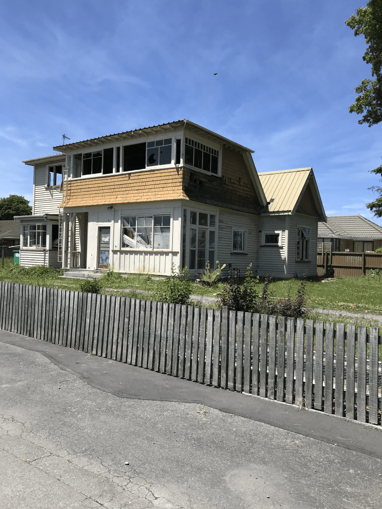
A reasonable of information from the library website. Very little information in Papers Past and there were sections for sale in 1972 in the Tarndale subdivision. A couple of ads in 1976 say Lower Cashmere. Note I get the suburb details from four different official websites. Another street that I walked in August this year and yes I was geocaching in the area. Most houses here were built in the 1970s but none stood out for me. It is really ugly modern houses or lovely older houses that I tend to notice. Part of Ashgrove Reserve is on this street. It looked like a pleasant street. As a side note I would love to do the Molesworth Station trip one day but doubt that my little car would manage it.
Woodbank Street in Somerfield – Information on date of naming in a letter sent to the City Librarian from the Town Clerk dated 13 December 1966.
A small amount of information from the library website. I suspect that this street was named after a high country station as this was the theme for the rest of the streets in the area.
Papers Past had very little information and it was mostly ads for selling sections in 1967. I walked this street back in August this year and none of the houses stood out for me. Most were built in 1960s and 1970s. The Nor’ West Arc Cycleway is on part of this street.
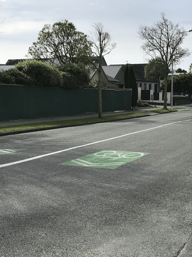
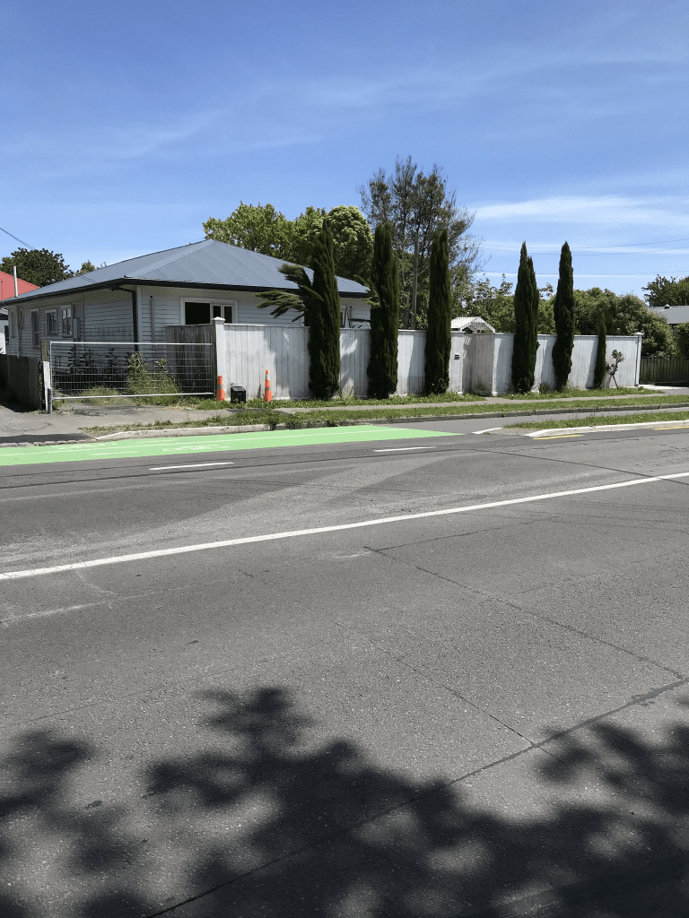
Palmside Street in Somerfield – Named after the Palmside Station. One of a number of streets named after rivers and sheep stations in North Canterbury. First appears in street directories in 1962.
A small amount of information from the library website and I walked this street in August this year.
Not much information on Papers Past. It was named as a new street in 1959 and in 1961 there were sections available. In 1964 when there was a grass fire on the street one of the firemen managed to fall off the fire engine. The saddest story was in 1969 when a young girl died after falling off her horse.
Most houses here were built in 1960s and none of them stood out for me. The street runs from Rose St and then on a slight bend it becomes another street. It is confusing when streets do this. There is a fairly new cycleway here. Edited to say that I have just found out that the cycleway is called Nor’West Arc Cycleway.
Normans Rd in Strowan – Named after William George Norman (1816- 1891). Norman arrived in Canterbury on the Sir George Seymour in 1850. He began working as a carrier and soon earned enough money to import two draught horses. One of these won first prize in the first agricultural show in Christchurch which was held in Market (later Victoria) Square on 6 October 1853. In 1865 he bought a house on Papanui Road near the present Normans Road, calling it Dorset Villa. He developed a beautiful garden there. The property is described in detail in The Press in 1912 when it was advertised for sale. First appears in street directories in 1887.
A reasonable amount of information from the library website and this is another street that I actually walked in October 2021. Papers Past had lots of birth and death notices plus articles about St Andrews School. Best articles about the school were the ones from 1929 where someone managed to set fire to a classroom. This was during the school day. In 1881 building allotments were being offered but there must have already been houses here as in 1879 residents were requesting a footpath. In 1885 there was a petition to rename Norman’s Road to Norman’s Street. It is still Normans Road. Note that over the years the apostrophe is usually dropped from street names where the streets have been named after a person. If you come across a street name that ends in an s then it is frequently named after a person. Between 1914 and 1924 there was talk about widening the road. There were occasionally flooding issues but there is a stream nearby so that is likely to be the reason. Lots of car accidents but I think that is because of Papanui Rd plus the corner by Strowan Rd is tricky. In 1958 a new Elmwood Post Office was opened on Normans Road.
St Andrews College takes up a huge amount of this street at the Papanui Rd end of the street. At Strowan Road end blocks of shops take up both sides of the road. I used to go to Hands Ashfords shop here but sadly that shop has gone. A surprising number of houses built in the 1910s and 1920s are still standing but many are on back sections these days. There are houses from every decade after 1920s and as usual the modern ones are ugly. There is a house from 1890. There have been garages built in front of it so it isn’t easy to see and I hadn’t realised the age of the house. It is a busy road with traffic especially school traffic.
Hawthorne St in Strowan – Formerly Brighton Street for a short time only. Also formerly named Schmidts Road. Named after William (Wilhelm) Schmidt (1832- 1894). Re-named Hawthorn (later Hawthorne) Road and later Hawthorne Street. Named after the Hawthorne Nursery of John Greenaway (1831-1880) situated on 5 acres there.Named Brighton Street by John Bligh (1838- 1896), possibly to publicise the fact he was establishing Blighs Gardens at New Brighton. Brighton Street never appears in street directories but is mentioned in the advertisement in The Press in November 1880 when Bligh subdivided his land and it was auctioned. The land is described as having frontages on “the Papanui Road, Bligh’s Road, Nursery Road (later Watford Street) and Brighton Street”. Also formerly named Schmidt’s Road. Schmidt was the proprietor of Barrett’s Hotel and built the New Zealander Hotel at 76 Madras Street. In retirement, he lived on the corner of Papanui Road and where Schmidt’s Road was developed. He is listed in street directories as living on Papanui Road in 1878. His funeral is mentioned in the Star in 1894. Schmidt’s Road first appears in street directories in 1887 and is also an address in an advertisement in the Star in 1888. Hawthorn Road is first mentioned in the Star in 1880 in a report of a meeting of the Avon Road Board. So the street appears to have alternate names for a time. Hawthorn Road first appears in street directories in 1892. It later becomes Hawthorne Road and was officially named Hawthorne Street on 21 February 1962.
A huge amount of information from the library website and I am not sure that I can add much to it. Papers Past had lots of birth and death notices. Between 1873 and 1894 there were a few large properties for sale. From about 1893 both names are used for the street but eventually the Schmidt name disappears. In 1924 there were complaints about stagnant water. In 1934 various streets in the area including this street were renumbered to conform with city policy. That will confuse anyone researching where their ancestors lived.
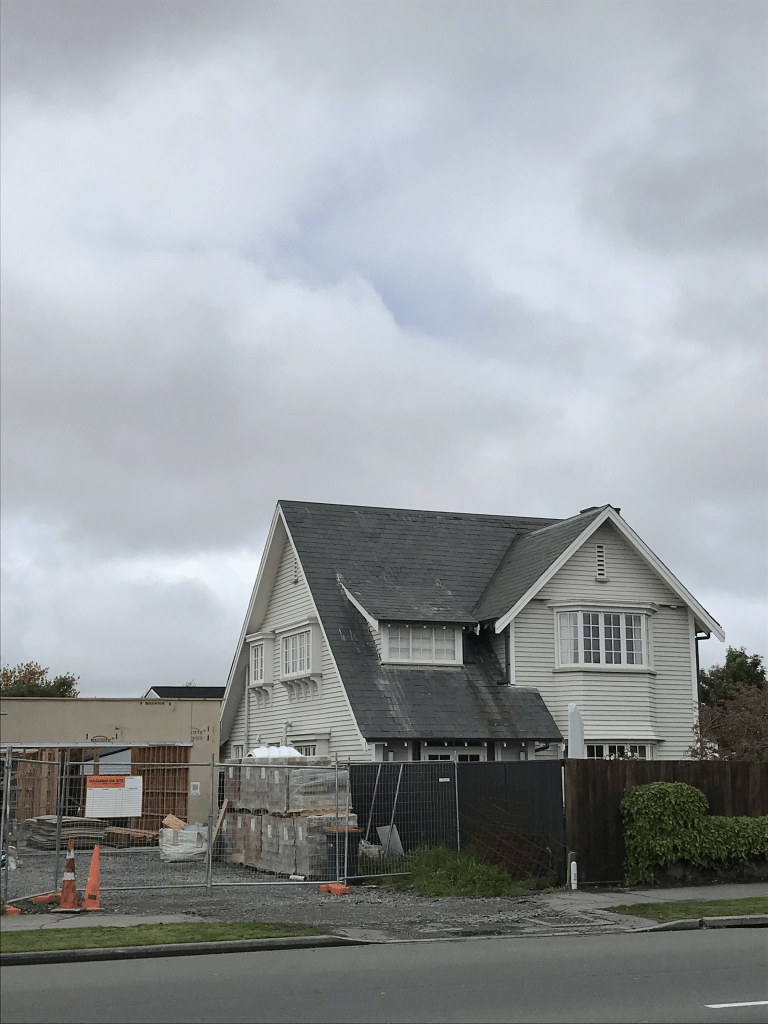
This is another street that I actually walked in October 2021. I am slightly behind in writing up streets. Was too hot for walking today so gives me a chance to catch up. There are at least two houses dating from 1910 here and they look lovely. Also many lovely wooden villas from the 1920s. The rest cover every decade onwards with a large number built in 1970s. Most of the modern houses built after the earthquakes are ugly and one looks like a shipping container. It makes a change from toilet block style. Probably a pleasant street but very close to the railway line. Another street beyond my budget which is a pity as some of those older houses really appealed.
Hartley Ave in Strowan – Formerly St Andrews Terrace. Named because of its proximity to St Andrew’s College. Re-named Hartley Avenue. Named after Leonard Brannon Hart (1874-1960). St Andrews Terrace is first mentioned in The Press in 1924 when land for sale there is advertised. First appears in street directories in 1927. Re-named Hartley Avenue in 1938 because of confusion with St Andrews Square. Hart lived at 2 Hawthorne Street in Papanui and in 1936 he was a branch manager for Abels Ltd. His property was subdivided to form the street plus its extension. A Papanui war memorial street.
A reasonable amount of information from the library website. I actually walked this street back in October 2021 so I am a little bit behind in writing up some of the streets that I have walked. Huge number of entries in Papers Past for garden competitions. The residents were also frequently mentioned in the social pages. Also lots of birth and death notices. In 1924 the street is described as a new street with 14 sections for and that the land is owned by E T Forbes. In 1926 the street name was to be changed to Walnut Ave but that obviously didn’t happen as the name was changed to Hartley Ave. Edited to say that there seem to have been two St Andrew Terraces and I had already walked and written up Walnut Ave and the name change to Walnut Ave refers to the other St Andrews Terrace. Confused yet.
Apparently Mr Hart approved of the name change and that it was his property that was subdivided.
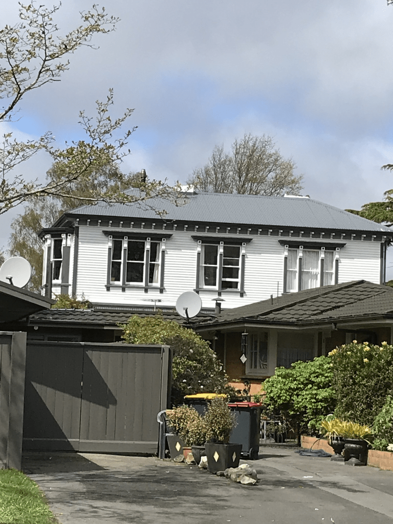
Between 1959 and 1961 the trees that were planted in the street were mentioned. The Cape Tulip trees were planted in 1936 but the residents put forward a petition in 1959 to have the trees removed. Reason for the removal was the damage to the footpaths and residents properties. Most of the houses in this street were built in the 1920s and 1930s and most were really lovely. Some lovely gardens as well. Would love to have managed some photos. The house from 1910 is looking very sad and I wouldn’t be surprised if it is eventually demolished. The modern houses built from 2018 onwards are really ugly and I will use my favourite description of toilet block style for them. It was mostly a lovely street even if spoilt by the modern houses but well beyond my budget.
Middleton Road in Upper Riccarton – Bowens Road was incorporated into Middleton Road. Named after Middleton Grange, Bowen’s home there. Bowens Road was named after Charles Christopher Bowen (1830- 1917). Middleton Road is first mentioned in the Star in1869 when its formation was discussed. First appears in street directories in 1904, running off Bowens Road to McDowells Road (later Wharenui Road). [The road followed a different direction in 1905 as it was then intersected by Hansons Lane.] Bowen was an administrator, politician, poet, magistrate and educationalist. Bowen’s Road is first mentioned in The Press in 1876. Bowen is a resident of the street in 1903, the year it first appears in street directories By 1905 the two streets are amalgamated becoming just Middleton Road.
A reasonable amount of information from the library website. I searched online early maps of Christchurch but none showed this area. Many entries in Papers Past were death notices. Drainage issues were a problem in the 1870s and 1880s but this was the same for most of Christchurch. In 1889 there were complaints about the state of ditches in the street. Between 1896 and 1909 there was frequent talk about road widening. I was amused to see an article in 1915 about there being houses on this street that had electric light installed. In 1918 there was a complaint about a dangerous willow tree on the corner of Middleton Rd and Bowen’s Lane. There were at least two orchards on this street with one belonging to Mr Mullin and the other belonging to Charles Harrow. Sadly in 1913 Charles Harrow accidently drowned on his property. In 1950 the Middleton Grange Homestead that had belonged to Sir Charles Bowen was for sale. The original cob cottage was built in 1858 but had been extended over the years. His land covered an area from Blenheim Rd to Riccarton Rd but had been gradually sold over the years. I believe that it is possible this building is still standing and is now on the grounds of Middleton Grange School. I might need to go back to this area and see if I can sneak a look at it. It was mentioned that William Lovell-Smith owned a big section on the corner of Riccarton Rd and Middleton Road. This would have been opposite the land owned by Sir Charles Bowen. William Lovell-Smith called his house Midway and it is still standing. High fences hide this house. Kate Sheppard lived in this house with William Lovell-Smith and his wife Jennie. After Jennie Lovell-Smith died William went on to marry Kate Sheppard.
Houses on this street cover every decade from 1910 onwards with most built in 1940s, 1950s and 1970s. There are still several older houses on the street but it is impossible to see them from the road as they are now on back sections. There is an entrance to Middleton Park from this street and yes I was geocaching here. Further on towards Blenheim Rd there is Elms Court Village which is a retirement village. There is a cycleway covering much of the street and I believe that this is fairly new.
Field Terrace in Upper Riccarton – Field Street and Spring Street both appear first in street directories in 1921. The two streets were amalgamated and re-named Field Terrace in June 1948.
A small amount of information from the library website. There was possibly a market garden here which possibly explains Field Street and highly likely that there was a spring in Spring Street.
Papers Past had lots of death notices under all the street names. Field St had sections for sale in 1919. In the 1930s and 1940s there were several ads for fruit pickers wanted. I walked this street a few weeks ago and managed to walk it again last night to get back to my car. Most houses here are brick ones from 1980s but there is at least one house from every decade. What surprised me was how many houses from 1920s and 1910s. There are still a couple of lovely 1920s wooden villas but the rest have been altered so that they are no longer recognisable as older houses. One huge house from 1910 is looking very sad and I expect that it will eventually be demolished.
Acacia Avenue in Upper Riccarton and it isn’t on library website yet most houses here were built in 1950s. Most entries on Papers Past were death notices. In 1953 there was a fire on a vacant section and a shed fire in 1955. Sewer connections were done in 1954. In December 1963 there was an open day for the new school Middleton Grange where a memorial stone was laid. In the 1970s all the ads were for a Bible College. Middleton Grange School is still there. There doesn’t seem to be a Bible College any longer but there is something called Redemption Church. Between the church and the school being on this street parking and traffic is horrible. I would hate to live on this street. I thought that I had found an old worker’s cottage on this street but when looking through street view it has only been on this street since about 2012.
Acacia is a tree and if you check out wikipedia the biologists are arguing about which trees belong to this genus. I was also amused when googling Acacia Avenue to find an entry which claims Acacia Avenue is a cliche in British culture to describe an unexceptional middle class suburban street.
Haslett Place in Upper Riccarton and it isn’t on library website which is surprising as most houses were built in the 1950s and 1960s.
In 1958 sections were offered by ballot with preference given to returned servicemen. The sections were offered by Land and Survey Dept. By November 1958 houses were available and being sold by Jones for Homes. The houses were described as brick bungalows and the majority of houses on this street are still brick houses. One person called G Martin who lived on this street had lots of ads for hiring out an angledozer. I did google angledozer and it sounds like it was just a bulldozer. I suspect that the street was named after a person but couldn’t find any information to confirm this. Several people with this surname but most had a Rakaia or Ashburton link.
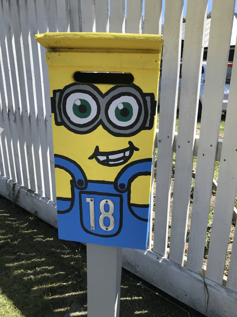
I walked this street a few weeks ago and it was a very ordinary looking street but there was a letterbox that I liked.