Queensbury Street in the Red Zone in the suburb of Burwood, Christchurch

Queensbury St in the red zone of Burwood – formerly Queen Street and Queensberry Street.Queen Street first appears in street directories in 1907. Queen Street and Queensberry Street both appear from 1913. Re-named Queensbury Street by the Waimairi County Council on 8 February 1933 when the problem of duplicate names was addressed with a number of streets.

A small amount of information from the library website.. Found the entry on Papers Past about changing the name from Queens St to Queensbury St but I actually wondered if they were two different streets and Queens St merged with Queenbury St. In 1921 there was a request for Queens St and Queensbury St to be signposted so that people could tell which street was which. Drainage issues are frequently mentioned. 1954 was a busy year as there were sections for sale and then there was more renaming of the street. Queensbury St North remained as Queensbury St. Then Queensbury St South between New Brighton Rd and McBratney’s Rd renamed Fleete St. Queensbury St South between McBratney’s Rd and Birchfield Ave renamed Madge St. I couldn’t find a Madge St and if you look at a map you will see how confusing this is.

In 1955 it was announced that State Housing will be built on Queensbury St. Papers Past show that some of the families who lived on the street were Reaby, Liggins and Goodman. The streets named after these three families run off Queensbury St.

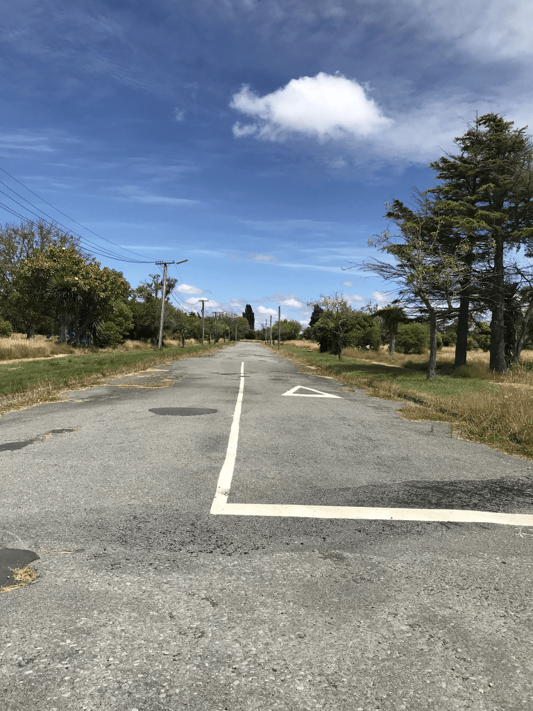
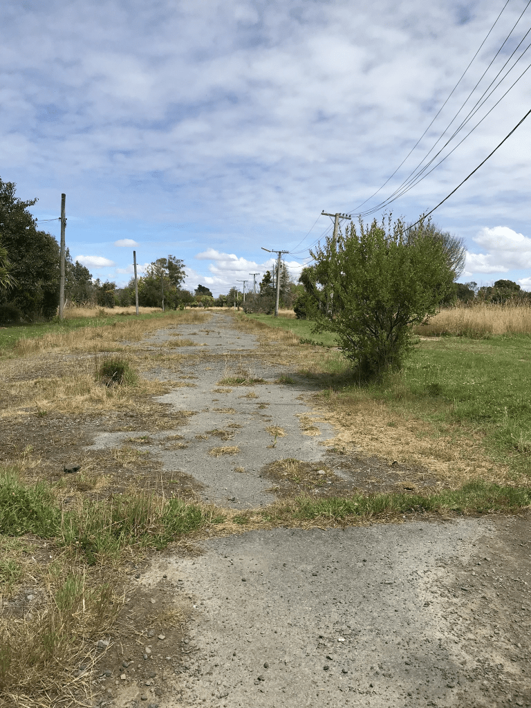
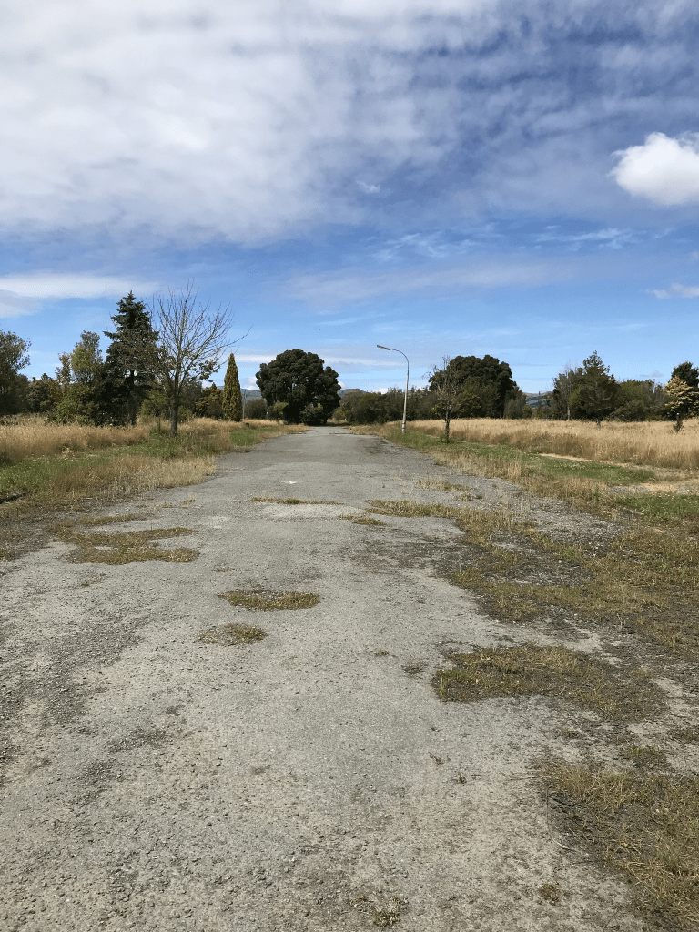
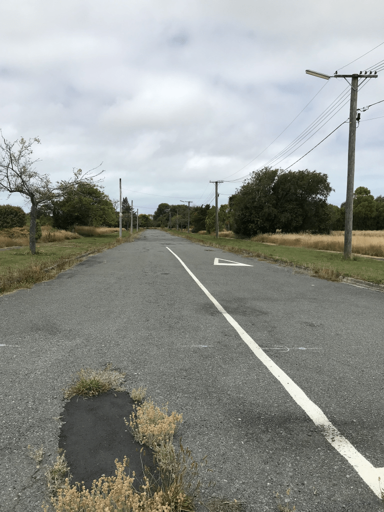
I walked this street in January last year and obviously there are no longer any houses here. When I looked at street view most houses looked like they were 1950s and 1960s houses but a couple looked like 1920s cottages.

Parish Street in the Red Zone in the suburb of Burwood, Christchurch

Parish St in the Red Zone of Burwood – Named after Isaac Parish (1845?-1921). Parish worked with his father, William Parish, on the formation of Ferry Road and was later a farmer. He also served for some years on the Avon Road Board. He lived in a “beautifully situated homestead” on the corner of Lake Terrace Road and New Brighton Road. Name suggested by Councillor Liggins at a meeting of the Waimairi County Council on 26 October 1932. Formally named on 8 February 1933. First mentioned in street directories in 1934. First appears as a separate listing in 1955.

A reasonable amount of information from the library website. Most the entries on Papers Past were for a Parish St off Ferry Rd which is probably named after William Parish. Very few entries for Parish St in Burwood. A few death notices and ads. Isaac Parish was fined several times for not cooling his milk properly before selling it.

I actually walked this street in January last year and there are obviously no longer any houses here. Street view from 2012 shows the mess that the street was after the earthquakes.

Liggins Street in the Red Zone of the suburb of Burwood, Christchurch

Liggins St in Burwood Red Zone – Formerly Alfred Street. Named after HRH Prince Alfred Ernest Albert, Duke of Edinburgh & Saxe-Coburg Gotha (1844-1900). Re-named Liggins Street. Named after and by Joseph Liggins (1888- 1951) Alfred Street first appears in street directories in 1907. One of three streets named after Queen Victoria’s family. Prince Alfred was the second son of Queen Victoria and Prince Albert. Re-named Liggins Street by the Waimairi County Council on 8 February 1933. There is an Alfred Street in the central city. Liggins was a poultry farmer of 205 Queensbury Street, Burwood. He established the Canterbury Egg Farm and bred white leghorns. He was also a chairman of the Waimairi County Council. First appears in street directories in 1934.

A reasonable amount of information from the library website. Papers Past had so many entries for Alfred St as it was a very common street name that it was impossible to search. I narrowed my search to Alfred St Burwood and only found a couple of ads in 1921 for the sale of sections. In 1954 there were houses and sections for sale and that would possibly fit in with Joseph Liggins’s death in 1951. In the 1970s residents were concerned about flooding issues. I did find a name that I knew in an engagement notice in 1972.

I actually walked this street in January last year and there are obviously no longer any houses here. I checked google maps for street view and the street view for 2012 shows what a mess the street was after the earthquakes. Street view from 2007 show a street with houses that mostly looked like 1950s and 1960s styles. There was one interesting art deco house plus a house that looked like an older cottage.

Kingsford Street in the Red Zone in the suburb of Burwood, Christchurch

Kingsford St in Burwood Red Zone – Kingloch Street and King Street were amalgamated to form Kingsford Street. Named after Sir Charles Kingsford Smith (1897-1935). In 1895 the Avon Road Board was asked to metal a further portion of King Street, Windsor. King Street first appears in street directories in 1907, running from New Brighton Road to Mundys Road. Kingloch Street first appears in street directories in 1913, running from New Brighton Road to Alice Street. The two streets were amalgamated and renamed Kingsford Street by the Waimairi County Council on 8 February 1933 when the problem of duplicate names was addressed with a number of streets. Kingsford Smith was Australia’s greatest pioneer aviator. He and his co-pilot, Charles Ulm had made the first trans Tasman flight from Sydney to Christchurch on 10 September 1928. Begins the aviation theme of street names in the area.

A reasonable amount of information from the library website. Under the Kingloch name it was mostly death notices on Papers Past as well as lots of ads for produce including chickens, fruit and vegetables. Under King St it was mostly death notices. The article about the name changes was in 1932 when several streets had the names changed. In 1938 a man was fined for allowing his cattle to graze on the street. In 1951 there was talk about changing the name so that it included Queen rather than King. In 1956 the market gardens in the area were devastated by a big storm. In 1973 residents objected to a building at 34 Kingsford St being used for manufacturing purposes. The residents seemed to be an accident prone lot but this is possibly because they were close to a main road.

I walked this street in January last year and there are obviously no longer any houses here as it is in the red zone. I looked at 2007 on street view and most of the houses looked like brick houses from the 1950s and 1960s. Street view from 2012 showed a few houses still standing and the road was a mess.

Arahura Place in the suburb of Cashmere, Christchurch

Arahura Place in Cashmere and nothing on the library website. Possibly named after the river with the same name. The only information on Papers Past was several ads in 1975 offering sections. Most houses were built in 1970s and 1980s. This runs off Kidson Tce and I actually walked it in August 2020. I finally transferred photos from my old laptop to my new one and I probably need to be more organised with this project. It is a very narrow street with no footpath. Houses would have fairly good views over Christchurch. None really stood out for me and weirdly I only took a photo of letterboxes which were at the beginning of the street.

Oakford Close in the suburb of Riccarton, Christchurch

Oakford Close in Riccarton – Named after Oakford, a large house originally on eight acres of land laid out in garden on the corner of Riccarton Road and Mandeville RoadThe house was built in 1857, on a 20 hectare block on the southern side of Lower Riccarton Road, by Henry Joseph Hall (1837- 1897). Later owners were: Nelson King Cherrill (1845-1916), a photographer, and George Low Beath (1827-1914), a draper and outfitter. The last owner was John Heaton Rhodes (1888- 1960), a lawyer and the chairman of the Christchurch Press Company Ltd. for 24 years. The house was demolished in 1965 to make way for a motel development. Named in 1997.

A reasonable amount of information on the library website. The owner of the house died in 1960 and in 1965 the house was demolished. I don’t know if the motels were ever built but in 1997 approval was granted to a developer to build 55 apartments and townhouses. A reasonable footpath here but parking would be terrible. This street runs off Deans Ave and I couldn’t decide if I would like to live here or not. The street might be called Oakford Close but the complex is called Kirkstyle Estate.

Palazzo Lane in the suburb of Riccarton, Christchurch

Palazzo Lane in Riccarton and nothing on library website. I thought that the reason why it wasn’t on the library website was because the street is too new but most of the houses were built in 1990s. One meaning of palazzo is Italian for palatial. I wasn’t very comfortable walking this street and stopped when I ran out of footpath. The houses here are huge and extremely expensive. Well beyond my budget. The lane runs off Deans Ave.

Orkney Street in the suburb of Strowan, Christchurch

Orkney Street in Strowan – First appears in street directories in 1950.

Not a lot of information on the library website. The street will have been named after the the Orkney Islands. Not much information on Papers Past. Sewage was connected in 1940 and in 1941 it is described as a newly formed street. This included a map. A few death notices and lots of ads with people selling things. I walked this street in June 2022 and yes I was geocaching in the area. Looks like a pleasant street and most houses were built in the 1940s.

Palatine Terrace in the suburb of St Martins or Huntsbury, Christchurch

Palatine Tce in St Martins or possibly Huntsbury – Formerly River Road. Named because it runs alongside the Heathcote River. Re-named Palatine Terrace. A palatine is a high-level official attached to imperial or royal courts in Europe since Roman times. River Road does not appear in street directories. C. W. Jones wrote to the Heathcote County Council in 1934 asking for River Road to be re-named. the council decided to re-name it Palatine Terrace. The request was made by Charles Whittington Jones, a sanitary inspector and a resident of Palatine Terrace in 1936, the first year it appears in street directories.

A reasonable amount of information from the library website. Note that not all of River Rd in this area became Palatine Tce as part of it became Riverlaw Tce. There was a confusing article from 1973 where it states that part of Riverlaw Tce between Burnbrae St and Ensors Rd bridge was renamed as being part Palatine Tce. I forgot to check old maps as Ensors Rd isn’t near Palantine Tce.

The man Charles W Jones who requested the name change lost his house to a fire in 1931. In 1965 there was a letter to the editor suggesting that the old Kowhai nursery on Palantine Tce be turned into sections for houses.

I actually walked this street in August 2021 and was possibly checking a friend’s geocache. The street runs from Centaurus Rd to Burnbrae St. There is an entrance to Farnley Reserve near Centaurus Rd. Weirdly some websites say that Farnley Reserve is on Eastern Tce but I assure you that it isn’t. The houses are on only one side of the street for the rather obvious reason of the Heathcote River is on the other side. There is also a playground at Palantine Reserve. A pleasant street and probably less likely to flood than the other side of the river as it is slightly higher. Most houses were built in the 1970s.

Buxton Terrace in the suburb of St Martins, Christchurch

Buxton Tce in St Martins- formerly part of Rata Street. Named after Alfred William Buxton (1872-1950). Buxton was a landscape gardener and nurseryman. He ran a nursery in St Martins 1902-1925, at first called Premier Nursery and later the Opawa Nursery. It was situated on nearly 18 acres of land to the east of the Heathcote River and to the north and south of what is now known as Buxton Terrace. Named in 1926. First appears in street directories in 1928.

A small amount of information from the library website. A few mentions on Papers Past and in 1926 the Heathcote County Council altered Rata St to Buxton Terrace. This article didn’t mention that it was only part of Rata St in St Martins. I ended up checking several older maps and it isn’t on maps for 1912 or 1922 but is Rata St in 1930 map and Buxton in 1940 map. After checking these maps with a modern map the rest of Rata street in St Martins is now Koromiko St. Alfred Buxton put his business into voluntary liquidation in 1926 and then took up landscaping with his older son. It is likely that this is when sections were sold for housing. I actually walked this street in August 2021 and it looked like a pleasant street. Most houses were built in 1990s and 2000s but there are a couple of houses from 1920 and 1930.