Orkney Street in Strowan – First appears in street directories in 1950.
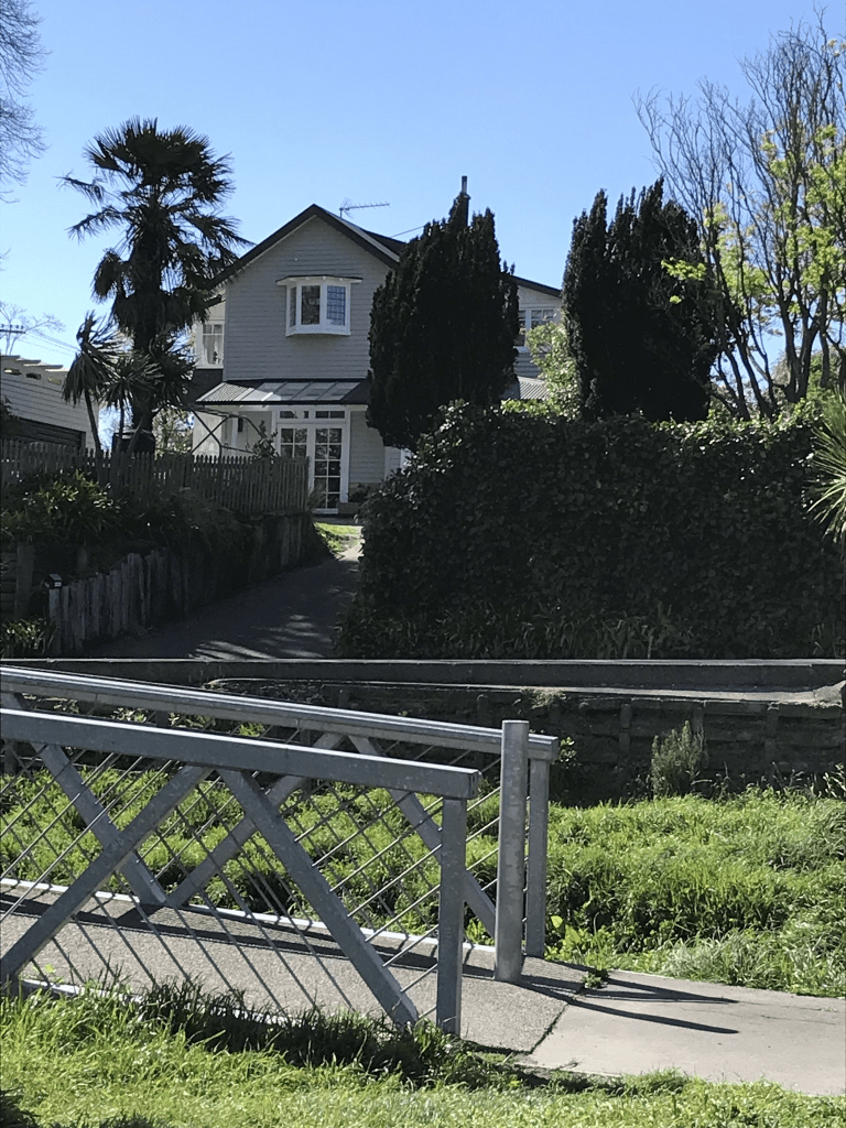
Not a lot of information on the library website. The street will have been named after the the Orkney Islands. Not much information on Papers Past. Sewage was connected in 1940 and in 1941 it is described as a newly formed street. This included a map. A few death notices and lots of ads with people selling things. I walked this street in June 2022 and yes I was geocaching in the area. Looks like a pleasant street and most houses were built in the 1940s.
Palatine Tce in St Martins or possibly Huntsbury – Formerly River Road. Named because it runs alongside the Heathcote River. Re-named Palatine Terrace. A palatine is a high-level official attached to imperial or royal courts in Europe since Roman times. River Road does not appear in street directories. C. W. Jones wrote to the Heathcote County Council in 1934 asking for River Road to be re-named. the council decided to re-name it Palatine Terrace. The request was made by Charles Whittington Jones, a sanitary inspector and a resident of Palatine Terrace in 1936, the first year it appears in street directories.
A reasonable amount of information from the library website. Note that not all of River Rd in this area became Palatine Tce as part of it became Riverlaw Tce. There was a confusing article from 1973 where it states that part of Riverlaw Tce between Burnbrae St and Ensors Rd bridge was renamed as being part Palatine Tce. I forgot to check old maps as Ensors Rd isn’t near Palantine Tce.
The man Charles W Jones who requested the name change lost his house to a fire in 1931. In 1965 there was a letter to the editor suggesting that the old Kowhai nursery on Palantine Tce be turned into sections for houses.
I actually walked this street in August 2021 and was possibly checking a friend’s geocache. The street runs from Centaurus Rd to Burnbrae St. There is an entrance to Farnley Reserve near Centaurus Rd. Weirdly some websites say that Farnley Reserve is on Eastern Tce but I assure you that it isn’t. The houses are on only one side of the street for the rather obvious reason of the Heathcote River is on the other side. There is also a playground at Palantine Reserve. A pleasant street and probably less likely to flood than the other side of the river as it is slightly higher. Most houses were built in the 1970s.
Buxton Tce in St Martins- formerly part of Rata Street. Named after Alfred William Buxton (1872-1950). Buxton was a landscape gardener and nurseryman. He ran a nursery in St Martins 1902-1925, at first called Premier Nursery and later the Opawa Nursery. It was situated on nearly 18 acres of land to the east of the Heathcote River and to the north and south of what is now known as Buxton Terrace. Named in 1926. First appears in street directories in 1928.
A small amount of information from the library website. A few mentions on Papers Past and in 1926 the Heathcote County Council altered Rata St to Buxton Terrace. This article didn’t mention that it was only part of Rata St in St Martins. I ended up checking several older maps and it isn’t on maps for 1912 or 1922 but is Rata St in 1930 map and Buxton in 1940 map. After checking these maps with a modern map the rest of Rata street in St Martins is now Koromiko St. Alfred Buxton put his business into voluntary liquidation in 1926 and then took up landscaping with his older son. It is likely that this is when sections were sold for housing. I actually walked this street in August 2021 and it looked like a pleasant street. Most houses were built in 1990s and 2000s but there are a couple of houses from 1920 and 1930.
Bidwell Place in Hillmorton – Intended to be named Tripp Place. As the name was being used in the Redwood subdivision that was further advanced than the city one, it was named Bidwell Place in 1959. One of the streets in the area formed on land belonging to Christ’s College. First appears in street directories in 1976.
A small amount of information from the library website. I found information on a Christ College newsletter that said this street was named after an old boy. The trouble was that they didn’t give a name for him. The only person in Christchurch that I could find with that surname was Charles Bidwell who was living in Riccarton in 1954. He was living in Redcliffs in 1957 and the surname was spelt Bidwill. I found a second Christ College newsletter with a Charlie Bidwill mentioned. I also found William Edward Bidwill a sheep farmer in the North Island who went to Christ College, William Edward Bidwill received an OBE in 1918 for patriotic work. We have two choices. One choice is that there is a stray Bidwell out there that I can’t find. I searched Papers Past, ancestry websites and cemetery databases. The second choice is that the street name is spelt wrong and it is named after an old boy with the surname Bidwill.
This is a small street of only 26 properties all built in the 1970s and the houses are typical of this era. Being church land the houses would have been built on leasehold land and the freehold has possibly been purchased in recent years. The street didn’t stand out in any way and was an ordinary tidy street. Houses in this suburb are of a fairly standard style with not much variation.
Annex Rd in Middleton – formerly Lincoln & Riccarton Junction Road and Junction Road. In 1914 it was named Lincoln & Riccarton Junction Road. Junction Road first appears in street directories in 1936. Re-named Annex Road in June 1948 when 24 streets in the Waimairi County were re-named.
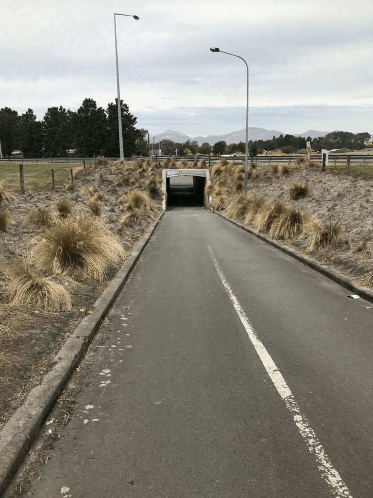
A small amount of from the library website. There was a huge amount of information on Papers Past. Many entries were about Sunnyside now known as Hillmorton Hospital. In 1963 a day hospital was opened at Sunnyside. The rest of the articles were mostly about the condition of the road, complaints about cyclists and there were so many accidents on the road. There was about 10 years of talk about road widening and it took so long because that is how long the negotiations with the railways took as it was railway land that was required. In 1951 because of the unsatisfactory condition of the road the Waimairi County Council was seeking to declare it as a main highway. In 1966 Marylands which had a frontage on Annex Rd was sold to the council and in 1974 the Marylands Industrial block was approved. In 1979 an underpass for cyclists was approved. In the last couple of years the part of the road that goes past Hillmorton Hospital is now part of the Nor’ West Cycleway.
Personally I thought that it was more interesting when the road was Lincoln and Riccarton Junction Rd. In 1866 there were sections of land for sale and in 1875 the owners of the various sections were told to stop water from their artesian wells from draining onto the road because of the damage this was causing. In 1871 Mr Dearsley’s gravel pit is mentioned. Mr G P Williams in 1893 was seeking permission for a water race ford on the road. Mr Barnard had a farm near the the lunatic asylum. In 1893 the property of Sir John Hall was for sale.
When looking atPapers Past there was frequent mention of Middle Lincoln Rd which was a bit confusing so I went looking for maps. Middle Lincoln Rd seems to be now Wigram Rd but Wigram Rd isn’t on the library website. I then managed to find Lincoln and Riccarton Junction Rd on a map dated 1879 and this road went all the way to Riccarton Rd at Church Corner. The portion of the road that went from Blenheim Rd to Riccarton Rd is now Hanson’s Lane but this information isn’t on the library website. There is also no mention in Papers Past. I will have to add this information to my Hanson’s Lane write up. I went back to the 1879 map and compared it to modern maps to confirm this.
I actually walked this street in full in February 2020 and it would have been when I was still doing volunteer work at the University. I used to catch a bus to the University and then walk home via a different route each time. Yes it is a very long from the University to Addington. I remember stopping for coffee and cake at a cafe on Lincoln Rd. From Blenheim Rd to Wigram Rd it is all businesses and too many for me to name them all. Then there is the underpass before you get to Hillmorton Hospital. There is now a few houses plus big area of green space before you get to Lincoln Rd. The area between the underpass and Lincoln Rd I have frequently walked as people keep hiding geocaches in the area.
Six Silvers Ave in Halswell – Named because of the six silver birth trees at the entrance to the subdivision. This is the main accessway into the subdivision off Milns Road/Sparks Road. It is flanked by trees and centre islands giving an ‘avenue’ effect. Developed by Brian Gillman Ltd. and named in 2003.
A small amount of information from the library website and I am not going to correct their spelling mistake as it is amusing.
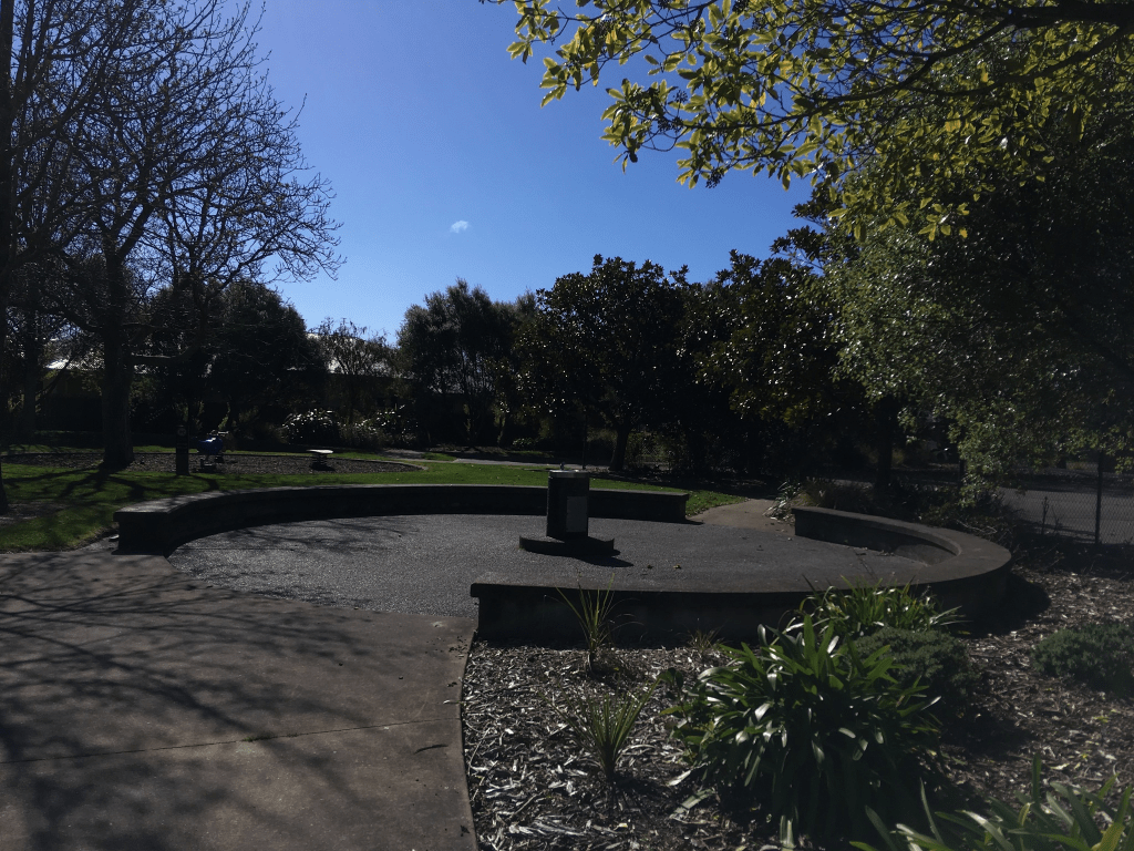
I walked this street today when I was out geocaching and I can’t decide if I like the street or not. Most of the street has a footpath on both sides. There is a nice playground at the Milns Rd end and the trees give it a nice feel. There is also the entrance to a walkway here. The architect with the column fetish was busy on this street. At the other end of the street there is another walkway in Shield Reserve. Most houses were built in 2000 and there was one that I actually quite liked. I was amused by a flag that someone had erected in the middle of the grassy bit in the middle of the road. It had the number 6 on it and pointed towards a driveway.
Shield Place in Halswell – This name continues the theme of English heritage and “Courts and Castles” used for the street names in the subdivision. Developed off Milns Road/Sparks Road by Brian Gillman Ltd. Named in 2003.
A small amount of information from the library website and nothing that I can add to it. I walked this street today when out geocaching. There was a footpath on only one side of the street which I hate. Also where the footpath ended you felt like you were in someone’s driveway. Not many houses here and most were built in 2000. The only one that stood out for me was one I didn’t really like. Weirdly there is a Shield Reserve but it isn’t anywhere near this street but on a neighbouring street.
Armour Place in Halswell – This name continues the theme of English heritage and “Courts and Castles” used for the street names in the subdivision. Developed off Milns Road/Sparks Road by Brian Gillman Ltd. Named in 2003.
A small amount of information from the library website and nothing that I can add to this. I walked this street today when geocaching in the area. What surprised me was that there was a footpath on both sides of the street. This is unusual for the age and style of the street. The houses were fairly large and some had nice gardens but many had such immaculate lawns with no colour or flowers that they were boring. The architect with the column fetishes had designed some of the houses but at least the houses weren’t too ugly but none inspired me to take photos.
Kinloch Street in St Albans – Probably named after Kinloch Rannoch, Perthshire in Scotland. First mentioned in the Star in 1908 when a property is advertised for sale there. First appears in street directories in 1909.
A small amount of information from the library website. Not a huge amount of information on Papers Past apart from death notices. There were sections for sale in 1908 and 1920. The was also a Kinloch St in Burwood. I walked this street in in August 2022 and I refreshed my memory by looking at street view I realised that the google car had been on this street in the same month. Rather disappointed that I missed seeing this car. The oldest house in the street was built in 1905 and it is rather lovely. Many houses built in 1910 but most were built in 1960s and 1970s. Looked like a lovely street.
Pitt Place in St Albans – formerly Pitt Street. Named after George Pitts (1837?-1915). George Pitts ran the Springfield Brewery. The business is mentioned in the Star in 1879 in an advertisement. In street directories of 1890, George Pitts and also Pitts & Co., Springfield Brewery of Springfield Road, are listed. Pitt Street first appears in street directories in 1904. Before this the street is listed as a right-of-way. The street is sited on the land once used for the Springfield Brewery.Re-named Pitt Place on 1 September 1948 when 120 streets were re-named.
A reasonable amount of information from the library website. Very little information on Papers Past apart from a few death notices. Most houses here were built in the 1970s but I quite liked the one older house from 1940s. I walked this street back in August 2022.
Just checked various old maps and there seems to be a stream that runs at the end of the street.