Otakaro Place in Bexley Red Zone and nothing on library website. I couldn’t find out any information about this street. Not even an earthquake story. The street runs off Velsheda St and at the end of the street there was a walkway that led to the walkway that follows the river. I found street view from 2007 and there were some nice houses here. Between the style of houses and the fact there was a footpath on only one side of the street it was possibly developed in the 1990s. I had been geocaching in the area. Obviously there are no longer any houses here.
Wetlands Grove in Bexley Red Zone and nothing on library website. I couldn’t find out much information about this street and the houses that were here possibly had been built in the 1990s. There were a couple of articles online about the earthquakes. The street runs off Anzac Drive and it isn’t blocked off so I was able to drive along it and park up. I parked near the entrance to Harold Henry Park. At the end of the street there was a walkway that led to the walkway that follows the river. All the houses have been demolished here but I couldn’t get over how many campervans were parked up on the street. They were everywhere. I think that the name of the street is a big clue as to why the land was so badly damaged in the earthquakes.
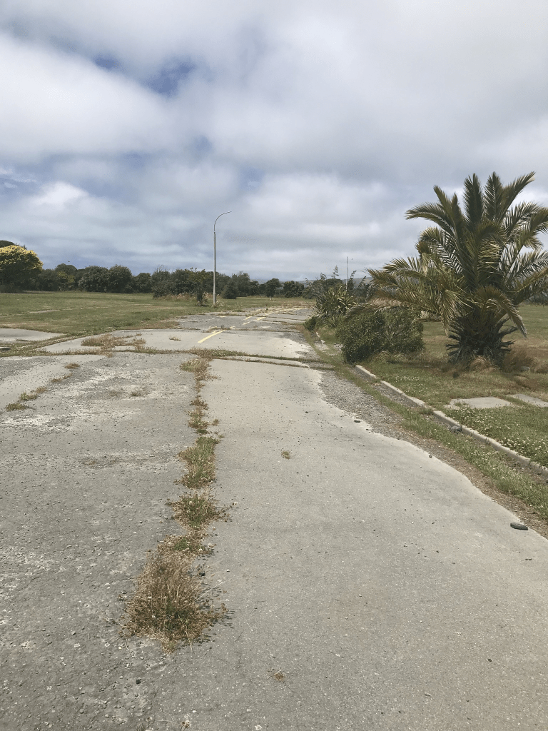
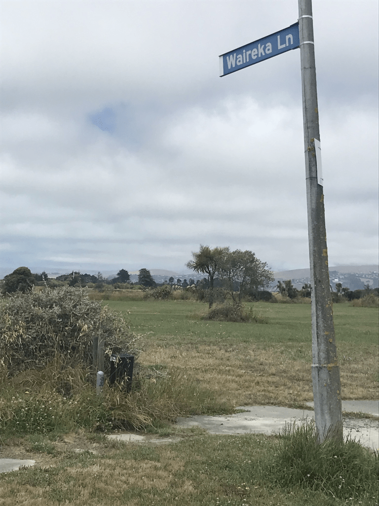
Waireka Lane in Bexley Red Zone and nothing on library website. If I hadn’t taken a photo of the sign post with the street name I wouldn’t have known that this street existed. It doesn’t show up on current maps but I eventually managed to find street view from 2007. It was a tiny lane and the houses looked like 1990s style. The lane ran off Seabreeze Close but I couldn’t find out any information about it.
Onepu Street in Bexley Red Zone and nothing on library website. When I checked street view most of the houses looked like they were built in the 1960s but one was an art deco style house. The earliest entry that I could find on Papers Past was an ad for a section in 1960. Sewage works were done in 1962. A few later entries but there weren’t many entries.
I walked this street on Christmas Day and there are no longer any houses here. The street runs off Pages Rd.
Kia Ora Street in Bexley Red Zone and nothing on library website. When I checked street view I realised that this was an older street as there had been a cute cottage that looked that it dated from 1890s. There were also at least two art deco houses. Papers Past had a few death notes and in 1915 there was a B Keats who owned cows. This area was part of the Heathcote Council but in 1916 they were wanting to be a new borough rather than join the city council. They were still arguing about it in 1917. One of the names that came up frequently was E W Simmons and he seemed to object to everything. He frequently wrote letters to the editor and in 1953 in one of his letters he mentioned that he had lived on the street for 42 years. Ernest William Simmons was a poultry farmer on the street. The street got new kerbs and footpaths in 1957 plus there were sewage works in 1962.
I didn’t actually walk this street as I would have needed gumboots and there are no longer any houses here. The street runs off Pages Road.
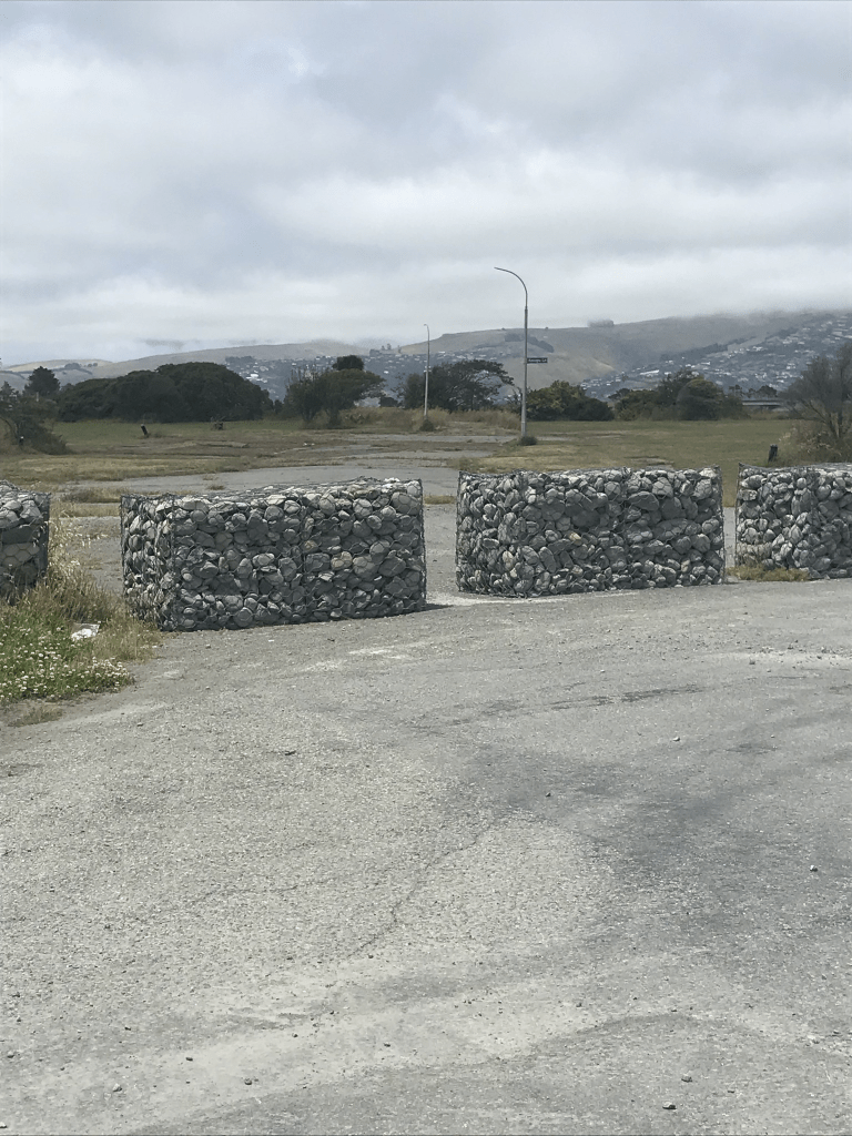
Kokopu Lane in Bexley Red Zone and nothing on library website. The young of Kokopu are what we know as whitebait and they are very delicious. The houses that had been here probably dated from the late 1990s but they have all been demolished. There was an article online from January 2012 about the demolition of the houses. If there hadn’t been a street sign I wouldn’t have known that there had been a street here. The lane ran off a street called Wetlands Grove which should have been a bit of a clue about the land here. My photo includes Wetlands Grove.
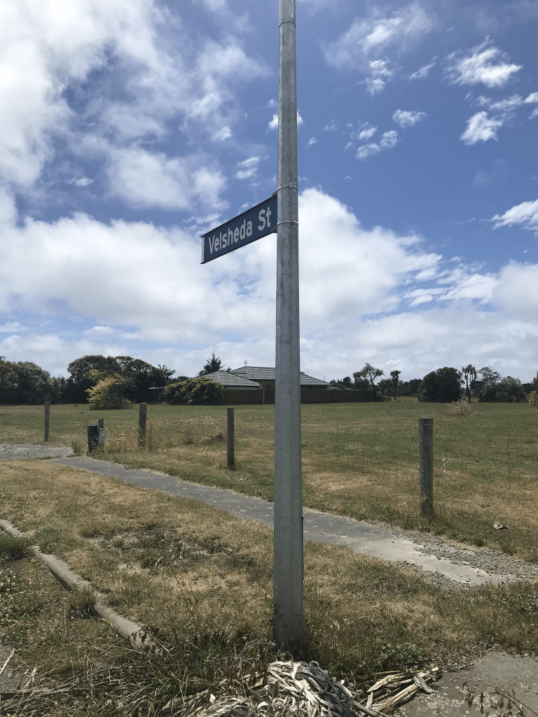
Velsheda Street in the Bexley Red Zone- Named after the Velsheda, a racing yacht. In the Pacific Park subdivision. Named in 1997.
A tiny amount of information from the library website. There is a street called Velsheda Road in a place called Shirley in the UK which confused me briefly. There is a wikipedia page for the yacht and it is named after the designer’s daughters who were Velma, Sheila and Daphne.
I was geocaching in the area today and I was surprised to see that there is still a house on this street. It actually looked like it is in reasonable condition. The rest of the houses have been demolished and after looking at street view for 2007 many of the houses looked quite nice. The houses would have all been built in the late 1990s and there are a couple of articles online about the street after the earthquakes plus a mention in Quake Studies.
York Street – Formerly Balls Road. Named after Robert Ball (1822?-1890).Ball, his wife Jane (1825- 1887) and son Robert (b. 1854?) arrived in Lyttelton on the Mystery in 1859. Ball worked as a blacksmith and later established a coach service and blacksmith’s shop in Balls Road. He ran a coach to Opawa in January 1880, the first American coach imported into Canterbury. Balls Road was developed in 1874 through land formerly owned by Joshua Strange Williams (1837-1915). First mentioned in the Star in 1894 when a property is advertised for sale there. Re-named York Street by 1888. An Edward Ball is listed in street directories as then living in the street. Both street names were used concurrently for a time. Information supplied in 2007 by Gary Dillon of Wanaka, a descendant of Robert Ball, in an interview with Margaret Harper.
A reasonable amount of information from the library website but this information doesn’t match up with early maps. The maps show York St and Balls Road as two separate streets. York St went from the river to Opawa Rd and Ball’s Road sometimes known as Ball’s Lane went from Opawa Rd to Raycroft St. In other words Opawa Rd separated the two streets.
In Papers Past as York St between 1885 and 1890 it was ads for houses and section. From 1910 onwards it was mostly death notices. In the 1880s and1890s Mr Lister of York St was a very busy man as he had a Fruit Garden and Vineries. He also had a Pickle Factory plus a Mineral Water Factory. In 1896 there were obstacles placed in the way of acquiring land to join Upper and Lower York Streets. The council will take the required land under the Land and Public Works Act 1894. This land sounded like it was at the Hassal’s Lane corner. Ball’s Rd possibly was part of York St briefly but it eventually became part of Raycroft St. This was very confusing but Opawa Rd definitely separated the two streets and all the maps from 1912 to 1941 show them as separate streets. The maps for 1950 and 1958 show Ball’s Rd as Raycroft St.
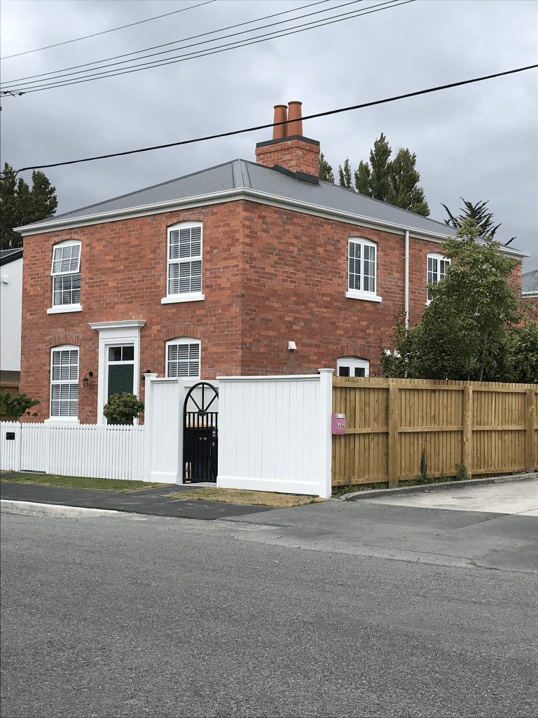
A large number of older houses here dating from 1880 to 1920 and many are in good condition. They had well established gardens and trees and I found it impossible to get photos. A few houses from later decades but many of the older houses are being demolished and several units being built on the sections. Some of the modern units I quite like but the developer here is the only developer who I like. They don’t do toilet block style of housing. Near Hassels Lane there is a big section of land which used to belong to a school and there is possibly a community group here. The school moved to Halswell. I mostly liked this street and I hope that the developer doesn’t ruin it. I have a vague memory of this street from the 1970s and I think that a boy that I went out with briefly lived here. The only reason that I remember is that his surname was York same as the street. He can’t have been that memorable if the only thing that I remember about him is his surname.
Grafton St in Waltham – Formerly William Street. Named after William Barbour Wilson (1819-1897). Re-named Grafton Street. Wilson was a nurseryman, businessman and local politician. In a subdivision of Rural Section 48, land owned by William Wilson (1819-1897). William Street appears on an 1874/75 Deposit Plan. First appears in the Star in an advertisement in 1880. It does not appear in street directories but appears on an 1890 map. Re-named Grafton Street in 1888. Plan of suburban property (Rural Section 48) situated on the Ferry Road near the East Town Belt belonging to William Wilson Esq., Deposit Plan 27 1874/75. Map held by Bob
Pritchard, subdivisions officer, Christchurch City Council. [The land, 200 acres in Ferry Road, had originally been purchased by G. Draper and his son in law, James Edward FitzGerald (1818?-1896).]
A reasonable amount of information from the library website and I am not sure that it being previously named William St is correct. The ad in 1880 actually refers to a street that is where Te Ara is now situated. Other ads say that it is off Lower High Street which again refers to where the William St at Te Ara is situated. I have checked older maps and I can only find the William St at Te Ara. I would have to visit the Archives Office in Wigram to confirm this.
Looking at Papers Past I eventually decided to ignore William St information as it was obvious that none of it related to this street. If anyone has any information showing that this street was originally called William St please let me know. I couldn’t find out how the street got it’s name. In the 1890s there was mostly ads for sections plus one house fire. Between 1900s and 1950s it was mostly birth and death notices. In the early 1900s a Children’s Home was mentioned a few times. They seemed to be an accident prone lot on this street. I was amused by a letter to the editor in 1949 where someone was complaining about there being two streets with the name Grafton. Whoever replied on behalf of the council had a touch of sarcasm in their reply. It was pointed out to the letter writer that Grafton St in Sumner was now Marriner St and had been Marriner St for some time. In 1965 there was a house and land for sale and this property was now zoned industrial.
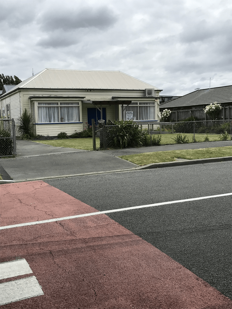
At the dead end of the street it is mostly businesses and the railway line runs behind this end. A huge number of older houses at this end of the street dating from 1905 through to 1920s but sadly many are looking very run down. At least 25% of the houses on this street are dated between 1905 and 1920. The next big lot are from the 1990s and many of these are built from brick. Brick seems to have been the most popular building material in the 1990s and yes I live in a 1990s brick townhouse. There is a house that dates from 1880 and it is now a New Age Christian Centre. There was a block of flats that looked like social housing but couldn’t find out if this was correct. Some of the houses here looked quite nice and well maintained but mostly the street looked very rundown. One of the businesses on the street was a salvage company and another specialised in asbestos. Yes it amused me but then I do have a warped sense of humour. Half way along the street there was a nice playground and I was possibly geocaching here.
Short St in Waltham – Formerly Elizabeth Street. Probably named after Elizabeth Wilson, née Williams (b.1836?). Re-named Short Street. Named because it is a short street leading to Te Wai Pounamu Maori Girls’ College. Elizabeth Wilson was the eldest daughter of John and Isabella Williams and wife of William Barbour Wilson (1819-1897). Wilson was a nurseryman, businessman and local politician who owned Rural Section 48 where this street was formed. Elizabeth Wilson was the first mayoress of Christchurch. Elizabeth Street appears on an 1874/75 Deposit Plan. Re-named Short Street in 1899 by the Linwood Borough Council. Plan of suburban property (Rural Section 48) situated on the Ferry Road near the East Town Belt belonging to William Wilson Esq., Deposit Plan 27 1874/75. Map held by Bob Pritchard, subdivisions officer, Christchurch City Council. [The land, 150 acres in Ferry Road, had originally been purchased by W. Draper, father-in law of J. E. Fitzgerald.]
A reasonable amount of information but there is a mistake about the renaming of the street. The renaming of the street in 1899 is because of duplication of street names as there was also a Elizabeth St in Riccarton. It had nothing to do with the college as the college didn’t open until 1921 and it was built on land belonging to the March family. The original name Elizabeth is probably because of Elizabeth Wilson as many of the streets in the area are named after the members of the Wilson family.
There were thousands of entries for Elizabeth St as it was a popular name for streets. I ended up using Linwood and Opawa when researching so I have possibly missed some information. When the street was Elizabeth St is was mostly birth and death notices plus the information in 1898 and 1899 about the street name being changed because of duplication. In the 1910s and 1920s there were several birth notices mentioning Nurse Barson’s Nursing Home. Her name was also mentioned in an inquest where a young woman had died. The young woman died at Christchurch hospital but had been recovering from an operation at Mrs Barson’s Nursing Home. I suspect that the young woman had had an abortion going by the description of the operation by the doctors concerned. In 1915 a Mr M A Elam of New Brighton was subdividing land in this street. By 1950s there was a business on this street called Industrial Metals Ltd and the street has been a mixture of housing and business ever since.
The oldest house on the street is from 1915 and there is a big empty section where houses have obviously been demolished fairly recently. I checked street view on google maps and one of the demolished houses looked like a lovely well maintained 1920s villa. The other demolished house was also from 1920s but wasn’t in the best of condition. Not many houses here and at the end of the street there are a couple of businesses.