Waitaki Street in Bexley Red Zone – High Street was incorporated into Wai-iti Street and both were incorporated into Waitaki Street. High Street first appears in street directories in 1916. Wai-iti Street first appears in street directories in 1921. High Street was incorporated into Wai-iti Street in February 1933 by the Public Utilities Committee of the Heathcote County Council. It was re-named Waitaki Street the next month as there was an existing Wai-iti Terrace in Fendalton. Waitaki Street first appears in street directories in 1934.
A reasonable amount of information from the library website. A wee bit of information on Papers Past but mostly death notices. I found the same information about the name change for the street. At least one drowning but this was something that this area was a bit prone to being so close to the river. Flooding was another frequently problem. For some reason minor fires was a problem on this street. The corner of Waitaki St and Pages Road had a lot of accidents. There was a big write up in 1974 about a development called Kirklands Estate where 310 houses would be built including on this street. This never happened because of a change in government. The playground in Harold Henry Park gets a few mentions. I also found a more recent article online about the playground equipment in the park. Various organisations for children wanted to take the playground equipment and utilise it elsewhere but the council wouldn’t allow this. After about four years the organisations were told that the equipment wasn’t safe because of the lack of maintenance and it was destroyed. The organisations were a bit vocal about this.
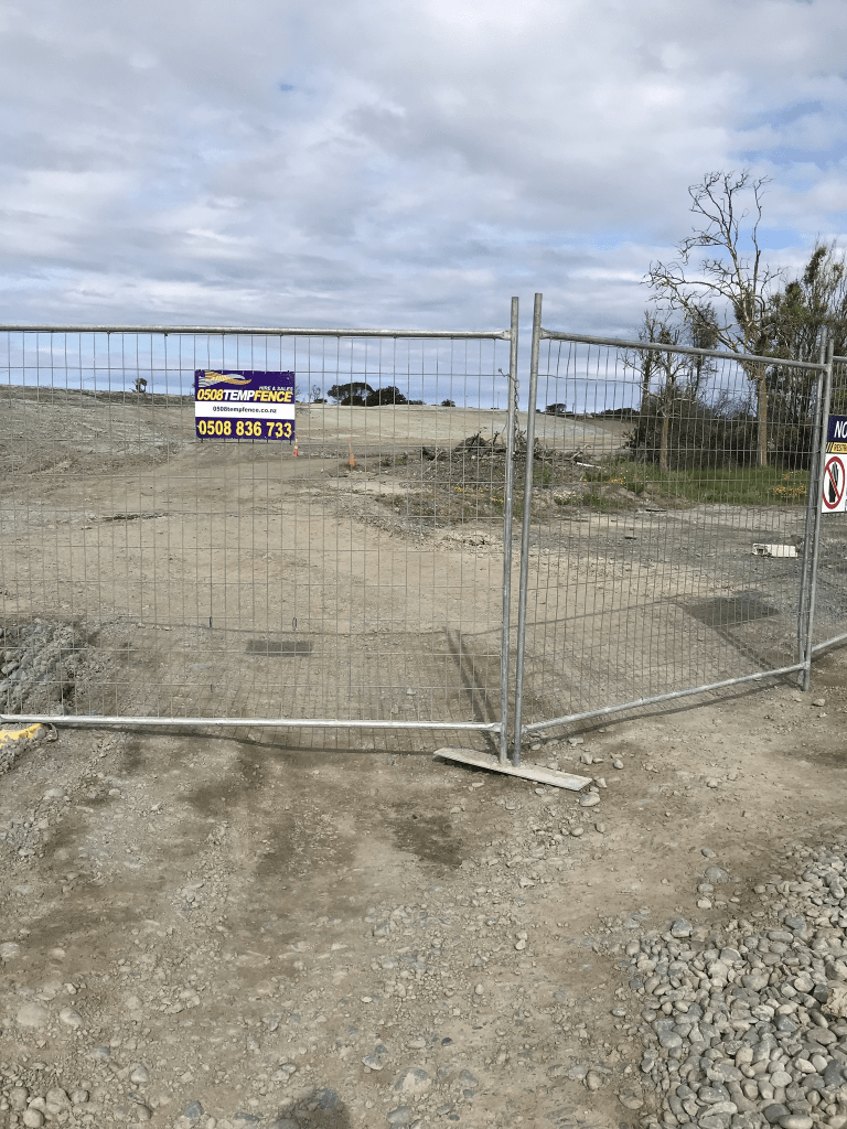
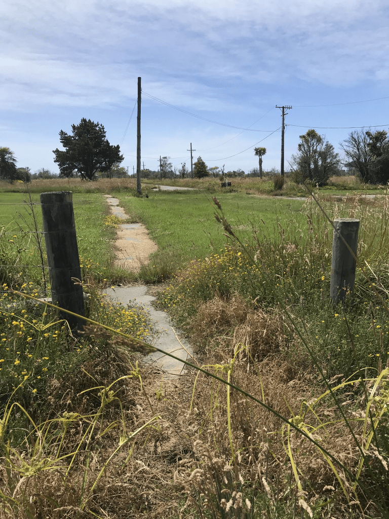
I started my walk at the Wetlands Grove end of Harold Henry Park and the path takes you to Waitaki Street. I finish my walk at Pages Road as I can’t walk the rest of the road. Waitaki Street between Pages Road and Bexley Road it blocked off by high fences. Looking at street view from 2007 the houses here covered most decades especially between 1950s and 1970s. There were about three art deco houses and a couple of 1920s wooden villas. It looked like it had been a pleasant street with some nice gardens.
Wairoa Street in Bexley Red Zone – formerly Wainui Street. Wainui Street appears in the Methodist marriage church register in 1914 when Elsie Mary Hall of Wainui Street, New Brighton married George Ellis. At the time Bexley would have been popularly considered part of New Brighton although it was outside the borough. Wainui Street first appears in street directories in 1948. Re-named Wairoa Street in 1950. Information about Bexley/New Brighton supplied by Richard Greenaway in 2010.
A reasonable amount of information from the library website and I am not going to disagree with Richard Greenaway as he is an excellent researcher.
Papers Past had a reasonable amount of information and under the name Wainui St there were death notices plus information about returning soldiers in 1918. In 1921 the estate of Edward Elliott was for sale and this included heifers, cows, farm machinery, a wagon and a dog cart. The sale also included buildings and land. There was and still is a Wainui St in Riccarton which is the reason for the name change in 1948.
The library website mentioned Elsie Mary Hall who married George Ellis in 1914. Her parents celebrated their Diamond Wedding Anniversary in 1951 and they had lived in the street for over 40 years. They were married in Melbourne. Mr Hall died a couple of years later in 1953.
Flooding was a problem in this street and it is close to the river. In 1973 it was decided that land was needed to create flood protection for the area. Land was acquired from local land owners to create what they called esplanade reserve.
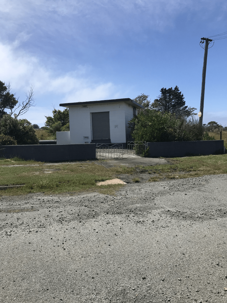
This street starts at Pages Road and looking at street view for 2007 at this end the houses were only on one side of the street and the reserve with a walkway was on the river side of the street. Then I came to the only building on the street and it is probably a pumping station. I vaguely recall that there was a geocache here a few years ago. The road then meets up with Morganwood St and there is the entrance to Bexley Wetlands Reserve. Looking at street view for 2007 the houses here were mostly from the 1950s and 1960s but there were at least three art deco houses. A few houses looked like they were possibly from 1920s or 1930s. There are obviously no houses here any longer as this area was hit badly in the earthquakes.
Orari Street in Bexley Red Zone – Regent Street and Raleigh Street. Regent Street first appears in street directories in 1928 with the alternate name of Raleigh Street. Re-named Orari Street in 1951.
A tiny amount of information from the library website. There wasn’t much information on Papers Past. The usual death notices. Under the Regent Street name there was one death notice and a couple of ads. Under the Raleigh Street name there was one death notice and one ad. In the 1960s there was erosion of the riverbank caused by speedboats going at excessive speeds. Over the years there were various businesses on this street. Tapper Printing Company, Frank and Bryce Ltd and Bradford Dye Works. Trade Aid (NZ) Inc was also here and occasionally the road was closed so that they could have a fair.
I only walked art of this street as there is a section that is impassable unless you have gumboots. It is by the Kia Ora Street intersection and Kia Ora Street is impossible to walk because of the water. You also don’t know what potholes or open drains are hidden under the water.
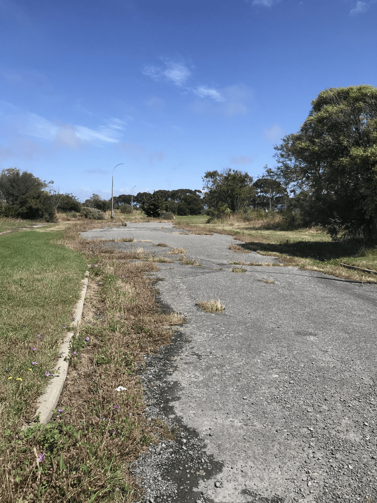
Street view from 2007 show a pleasant looking street and the houses seem to have covered most decades especially the 1950s and 1960s. A couple looked like they might have been from the 1920s. There was also a pumping station on the corner of Orari St and Waitaki St. Further along the street towards Bexley Road there had been a large building that most likely housed the various businesses that had been on the street. There is obviously no longer any buildings on this street because of the earthquakes.
Bexley Road in Bexley Red Zone – formerly Lower Flat Road. Named because it runs through the suburb of Bexley which, in turn, is named after Bexley in England. Lower Flat Road is first mentioned in the Star in 1881 in a report of a meeting of the Drainage Board. It does not appear in street directories. Bexley Road is first mentioned in the Star in 1898. Bexley was named by George Thomas Hawker (1840-1924), a baker of St Albans. He named several places in Christchurch after places in England where he had lived. First appears in street directories in 1911.
A reasonable amount of information from the library website. Papers Past also had a reasonable of information. Lots of death notices plus it was a road that had lots of accidents on it. As Lower Flat Rd it was mentioned in 1881 when there were ads for tenders to clay the road. The road was connected to Dyer’s Rd in 1886. In 1894 there was a section available to buy and then in 1902 there was two acres of land for sale and it was known as Barker’s Clay Pits. Last entry under the name of Lower Flat Rd was in 1916 and it was a complaint about the state of the road.
Bexley Rd was mentioned in 1899 and both names were used until 1916. In 1910 there were 17 sections for sale. The tram is mentioned frequently. Mr Yelland in 1918 was selling his land as he was giving up farming for health reasons. The flooding in 1929 caused a lot of damage to houses and crops. Poultry farms suffered large losses and the cows on a farm were in water at least a foot or more. There must have still been a dairy farm here in the 1930s as residents complained about cows wandering in the street. In 1956 land with frontages to Bexley Rd was purchased by the council for a refuse dump. Also in 1956 the Bexley Rd primary school was to be built. This one confused me for a moment but with further checking plus looking at older maps I worked out that the school was on the corner of Eureka St and Bexley Rd but then Anzac Drive was built and the two streets were no longer connected. The school was demolished after the earthquakes. In 1962 it was suggested that a memorial plaque be put on the corner of Bexley Rd and Eureka St to remember Dr L Cockayne. I don’t know if this actually happened. The proposal for the Woolston – Burwood Expressway was mentioned in connection with Bexley Rd as early as 1969. In the 1970s there was a riding school here and a reserve was to be built at 72 Bexley Rd and it was called John Hinton Reserve. In 1974 the council was considering selling land on both sides of Bexley Rd but it would probably be a few years before this could happen. There was the issue of the future realignment of Bexley Rd and drainage board plan to connect the area to sewage. In the 1980s the Samoan Assembly of God was mentioned a few times usually for funerals. It was decided that the mobile library would stop here. In 1989 several residents were upset to find out that the council were planning on developing a footpath through their backyards. They thought that it was their property but it was apparently a paper road.
Bexley Rd ran all the way from Wainoni Rd to Bridge St but after the Burwood Expressway now known as Anzac Drive was built Bexley Rd was half the length it used to be.
There is still one house standing on this street and I think that it is still occupied. Between Wainoni Rd and Pages Rd much of the land surrounding the road is blocked off by fencing. I hadn’t realised that there was a reserve at the Wainoni St end of the road but did find the John Hinton Memorial. I did need information from the memorial for a geocaching Adventure Lab. Cross Pages Rd and the road goes through open space until it comes to a dead end. I did find a wee footpath to walk on and this followed Anzac Drive.
Looking at Street View from 2007 I started from the Wainoni Rd end where John Hinton Reserve used to be. It looked like it was a lovely reserve. The houses were a mixture of styles and ages. A few looked like they were possibly from the 1910s or 1920s. Some of the houses looked very ordinary and others were a bit more interesting. On the corner of Bexley Rd and Pages Rd there was a large building that was fenced off and looked like it was possibly a power substation. At the dead end art of the road by Anzac Drive there was a huge big building and that would have been the carpet factory.
Between reading Papers Past and comparing old maps with modern maps this took me several hours to research.
Brook Street in Bexley Red Zone – First appears in street directories in 1914. A tiny amount of information from the library website.
I found a reasonable amount of information on Papers Past but probably missed a lot of information. There were a lot of streets with the same name in New Zealand. Lots of death notices and the saddest was a child who drowned in the nearby river. There were photos of the street in 1929 after flooding in the street. Sections were available in the 1950s. There was a carpet factory on the corner of Brook St and Bexley Rd. The factory opposed rezoning of the land to residential and in 1957 the application for extensions to the factory were declined. The factory was called Tattersfield Ltd until it was taken over by Feltex in 1970.
This was another street which had the end of it chopped off when the Burwood Expressway / Anzac Drive was built. When I looked at street view from 2007 I was curious about what the huge building at the Anzac Drive end was and I know know that it was the carpet factory. Most houses in street view looked like they were from the 1960s and 1970s but a couple had a 1920s look about them. Obviously there are no longer any houses here.
Everton Road and Victoria Street. Off Bexley Road. Victoria Street was renamed Everton Road on 22 November 1932. Disappears from street directories in 1987.
Anthony Road formerly Albert Road. Off Bexley Road. Albert Road first appears in street directories in 1952. Re-named Anthony Road in 1955. Stopped when the Pacific Park subdivision was developed in the 1990s although it disappears from street directories in 1987.
These streets no longer exists and I came across these two streets when researching Birch St. Both streets were mentioned in relationship to the Employment Zone / Industrial Park that was planned for this area. I looked at Papers Past but apart from death notices and Employment Zone there wasn’t much information. I did a google search with no luck. Checked old maps of Christchurch and found the streets. Both streets were roughly where Morganwood and Wetlands Grove were developed. There were a couple of council notices that I found regarding the Burwood Express Way being deferred. The notices also mentioned the cost of buying property and that the residents whose houses would be in the path of the Expressway were getting fed up with the delays. They also felt that the council were short changing them and that the value of their properties were dropping because of the delays. They were needing to move and buy elsewhere but the delays were costing them.
There was talk of building the Burwood Expressway in the early 1980s and they were still talking about it in 1998. In the meantime homeowners were in limbo. By 2002 it sounds like they were starting to build the Burwood Expressway which was eventually called Anzac Drive.
Birch Street in Bexley Red Zone – First mentioned in The Press in 1912 when a “cheap building site” is advertised for sale there. First appears in street directories in 1918.
A small amount of information from the library website and I found the same ad from 1912. The owner of the land was leaving the Dominion. Lots of entries on Papers Past and in 1923 the road was metalled. There were sections available in 1956 and in 1959 there was discussion about the zoning of the land in this area. Some wanted it to be zoned residential and others wanted it to be zoned industrial. Being an older street there were several death notices. Between 1975 and 1985 there was a lot of discussion about this area. The residents objected to the plan of a car park being built behind their houses. The car park was to be for an employment zone. The development was also called a Garden Industrial area that would be separated from the houses on this street by a playing field. The original plan for this land was for Housing Corp houses and it was to be called Kirklands after Norman Kirk. A change of government and the discussion is about an employment zone ie industries. Eventually the land behind Birch St was sold to developers and it took several years to get consent and more than one developer before houses were built there. In the 1980s the Burwood / Woolston Express is mentioned and some properties on Birch St were purchased by the government so that the Express Way could be built. Another street was occasionally mentioned in connection with Birch St but Everton St seems to have disappeared and most likely this happened because of the Express Way. The Burwood / Woolston Express Way is probably what we know as Anzac Drive.
Street view from 2007 show a street with houses from various decades especially the 1960s. There was at least one older cottage and an art deco house. When I was walking back to my car along a wee footpath that I had found at the end of Bexley Rd I came across a walkway into Birch St from the walkway beside Anzac Drive. Looking at street view from 2007 there were two little walkways into the street from Anzac Drive and the wee walkway that I had been walking along had been a nice wide walkway / cycleway.
Morganwood Street in Bexley Red Zone and nothing on library website. This was surprising as the library mentioned Morganwood subdivision in connection with two nearby streets.
I couldn’t find out much information about this street apart from it being part of the Morganwood subdivision that was built on reclaimed wetlands.
The street ran from Wetlands Grove to Wairoa St. Looking at street view from 2007 the houses looked like typical 1990s brick houses. About half way along the street it is narrowed and on both sides of the narrowed part of the street is Harold Henry Park and playground. On the curve where Morganwood St met Wairoa St there was an entrance to Bexley Wetlands plus a car park. I managed to find a brochure online for the wetlands. Next to Harold Henry Park there is an area that is fenced off and it is a special dog park called Canine Neuropark.
Brynn Lane in Bexley Red Zone – Named after the Brynn Stream in County Cork in Ireland. Named in 2007.
A tiny amount of information from the library website. This street ran off Almont Gardens and would have been in the Morganwood subdivision. I couldn’t find out any other information about the street but Quake Studies do have photos of this area.
This street wasn’t on google maps and street view of Almont Gardens just shows the entrance to the street. Apple maps on my phone did show the street and it looks like it curled around the back of Almont Gardens.
When I walked here today I couldn’t see where the street used to be and my photos are pure guesswork of where I thought that the street was.
Almont Gardens in the Bexley Red Zone – In the Morganwood subdivision. Named in 1996. A tiny amount of information from the library website.
I couldn’t find out much information about this street or the subdivision apart from the subdivision being built on reclaimed wetlands. That was seriously not a good idea.
Street view from 2007 shows the street as a fairly typical 1990s street with brick houses. Unusual for more modern streets of this type is that it had a footpath on both sides of the street. It ran off Morganwood Street and there are no longer any houses here.