Saunders Place in Redwood – Developed in a subdivision created by the Housing Corporation. Named in 1975. First appears in street directories in 1978.
A tiny amount of information from the library website. The street was probably named after a staff member from Housing Corporation as that was what they frequently did. Papers Past mostly had ads including for the sale of houses. Two articles stood out and one was in 1979 where a man tried to abduct a young girl. The other one was in 1982 where a man tried attacking his wife with an axe.
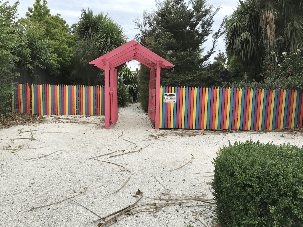
I didn’t particularly like this street and was surprised to find out that the houses are privately owned. There was a walkway through to the Main North Road.
Manse Place – First appears in street directories in 1978.
A tiny amount of information from the library website. A small amount of information from Papers Past and it was mostly about a sculpture by Lew Summers that had been installed in the courtyard of an elderly people’s complex. Many of the residents weren’t happy with the sculpture but they eventually agreed to keep it as long as shrubs were planted to hide the bare backsides. There were a few death notices.
The entire street is social housing and the units were built in 1973 and 1983. There are 42 units and they are owned by the council. It is unlikely that there are any elderly people living here now. I didn’t attempt to walk this street as I didn’t feel that it would have been safe. If I had realised that there was a Lew Summers sculpture here I might have walked it. This is assuming that it is still there.
Because manse is a place where a clergyman or minister lives my best guess is that a manse originally stood here. Manse was derived from the Latin word mansus which means dwelling.
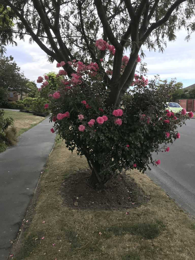
Farnswood Place in Redwood and nothing on library website. I couldn’t find out any information about the naming of this street. All the houses were built in the 1990s and made from brick. The street was so immaculate that it was boring. There is an entrance to Redwood Park from this street. I walked this street last night and it was a lovely evening.
Ashbrook Lane in Somerfield- First appears in street directories in 1976.
A tiny amount of information from the library website. Not much information on Papers Past apart from a few ads and a couple of death notices. I found more information by searching for 7 Ashgrove Terrace and it is very sad. The house and land at 7 Ashgrove Terrace was for sale in 1970 and plans for a proposed subdivision into seven sections was included. The owners of the property both died in 1966 and his occupation was nurseryman. They had a son and a daughter but both died in 1947. Their son Stephen died aged 35 in early 1947. Their daughter Ruth died aged 26 in the Ballantynes fire.
There are 13 houses here and most were built in the 1970s. They looked nice but confess that I only walked a small portion of the street as the footpath is a short one.
Stanbury Ave in Somerfield – Formerly Droitwich Street. Named after the parliamentary electorate in Worcester long held by a member of the Lyttelton family. Re-named Stanbury Avenue. Named after Stanbury Manor, in the west riding of Yorkshire this street. Formerly Droitwich Street for a short time in 1958. Several streets in this area have names associated with the Lyttelton family because they were formed on Rural Section 76, 700 acres on the “Lower Lincoln Road, Heathcote Bridge” purchased by Frederick Spencer, 4th Earl Spencer (1798-1857) and Conway Lucas Rose (1817- 1910). Spencer’s interest in the land was passed on to his nephew, the Hon. George William Spencer Lyttelton (1847- 1913), the 4th son of George William Lyttelton, 4th Baron Lyttelton (1817-1876). Re-named Stanbury Street the same year. The forebears of Lynwood Hollings (1885-1977) had once lived at Stanbury Manor. He claimed to be the prime mover in arranging the subdivision of this street. Local residents disliked the foreign name which was difficult to pronounce.
A reasonable amount of information from the library website. Lynwood Hollings forebears possibly lived on the estate of Stanbury Manor in Yorkshire but they didn’t own it. His family were agricultural labourers on the estate.
There was a reasonable amount of information on Papers Past and all entries for Droitwich St were in 1958. In July of that year the new street in the government subdivision was given the name of Droitwich and the reason for the name was that it was connected to the Lyttelton family. In October one of the members of the group objecting to the street name visited the City Council Offices where he was informed that not only was it an English name but there was the Lyttelton family connection and that many of the streets in the area had a Lyttelton family connection. The man who was representing the residents of Somerfield was apparently taken aback by learning that it was an English name. The residents group were told that unless they could come up with some constructive suggestions that the Droitwich name stays. Note using the name Hollings had already been rejected. A few days later Mr L Hollings came up with the name Stanbury claiming that Stanbury Manor was his ancestral home. He also claimed to have been the prime mover in arranging the subdivision. There was a note that Mr Hollings canvassed the owners of the waste land with the idea of the subdivision. Mr Hollings apparently owned the largest block of land out of the 24 owners of the land. The Ministry of Works developed the land under the title of Hollings and others. Note Lynwood Hollings was very vocal in letters to the editor or representing various groups. He formed his own political party in 1938 calling it the People’s Party. He was a builder at one stage plus owned several houses that he rented out. Sometimes he had disputes with his tenants. In 1952 he was granted a wine sellers licence and had a store on Sparkes Rd in Halswell.
By November of 1958 there were 62 sections available. This was also a state house development and developing state houses here was mentioned as early as 1937. Papers Past mostly had death notices plus entries for the best street and garden competitions. There were several houses for sale in 1968 and 1969 and it looks like the street was developed in stages. There was a hit and run incident in 1971 where the young girl hit eventually died.
This is a pleasant tree lined street with some nice gardens. I couldn’t find out if there were still state houses on the street. There was one house that looked a bit run down and was possibly empty. I had a nice chat with the young woman painting her fence with the help of her young daughter. There is an entrance to the Somerfield Rest Home on this street but the rest home is officially on Barrington St.
The houses here were all built between the 1950s and 1990s and I liked the one with the tree hut.
Cashmere View Street in Somerfield and there wasn’t anything on the library website. This was a surprise as most of the houses on the street were built in the 1920s and 1930s. There are about 5 houses built between 2020 and 2023 but they can’t have been ugly as I didn’t notice them. The name of the street is obvious.
There was a reasonable amount of information on Papers Past and as usual for an older there were a lot of death notices. There was even a surname that I recognised. It wasn’t someone that I knew but I had worked with the person’s grandson when I was at the Hillmorton Post Office / Postbank. This would have been in the late 1980s.
I suspect that this street was created at the same time as Fairview St. There were at least four big properties sold between 1912 and 1920 on Rose St and the streets would have been formed from one of these properties. I didn’t find any ads for sections being sold but there were people living here in the late 1920s going by the death notices. The residents in 1930 suggested that a reserve be formed on the council owned sections that ran between Cashmere St and Fairview St as this would be better than the overgrown and untidy section that it currently was. This land mentioned is probably where the Cashmere View Playground is now situated. Also in the 1930s there was a rabbit breeder living on this street. In 1933 the residents of Somerfield decided to set up the Somerfield Burgesses’ Association and this street was included in the Association. In 1932 sections in the street were being prepared for the planting of pumpkins. In the 1930s in Somerfield there were a lot of vegetables being planted on spare land and they were for the relief depot. Note this was during the big depression.
A letter to the editor in 1934 was complaining about there being constantly deprived of power just as meals were being prepared. The MED reply was that there had been some trouble experienced at the Rose St sub station. I was therefore amused to see another letter to the editor and this time in was in 1936. The person was complaining about a transformer station being erected on Cashmere View St. This substation / transformer station is still there and I now wish that I had taken a photo of it. The rabbit breeder must have still been living here in the 1940s as in 1947 one of the rabbits had escaped. It wasn’t the only thing escaping as someone had lost a mule. The children’s playground was mentioned in the 1940s and they must have used it for outdoor events as marquees were also mentioned. The 1950s saw poultry being offered for sale from a property on the street and there was a milk storage depot. The 1980s it was mostly best street and garden competitions in the news. The one exception was the article in 1987 about the getaway vehicle from a bank robbery being spotted on the street.
I did check old maps and this street wasn’t on maps for 1912 or 1922 but it was on the map for 1930. Going by the map for 1912 there was a large block of land that went between River Road now known as Ashgrove Tce and Rose St. This large section would match up with Cashmere View St and Fairview St being developed.
This is a lovely street with lovely 1920s wooden villas with nice gardens and I hope that it stays this way. I ended up meeting a couple walking a dog here and we had a great chat. She loved the idea of my project and is tempted start doing it herself. There was a nearby painted powerbox and she also loves street art. I should have asked if she also likes cemeteries. The playground / reserve on this street now has a wildflower area and I like that idea. Edited to say that a lawyer Thomas Sydney Dacre possibly owned the land but he didn’t live at the property.
Beechworth Ave in Somerfied – Named after Beechworth, a town in Victoria, Australia.Francis Stanley “Frank” Sullivan (1905-1981) and his son, James Warwick Sullivan (1929-2001), of F. S. Sullivan & Co Ltd, built many of the houses in this street in the 1950s and were permitted to name the street. They named it after Beechworth in Australia because Francis Sullivan’s mother had been born Lavinia Paull in Beechworth in Victoria in 1874. She died in Christchurch in 1932. When she and her husband, James Osborne O’Sullivan (1867-1927), moved to New Zealand they dropped the “O” from their name. Frank Sullivan enjoyed making this family link with the street he and his son helped create. First appears in street directories in 1957. Information supplied in 2015 by Penny Lancaster, granddaughter of Frank Sullivan.
A reasonable amount of information from the library website. The library put this street in the suburb of Spreydon but official websites have it in Somerfield. Real estate agents put it into Lower Cashmere.
Not much information on Papers Past. There were ads for houses in 1958 and 1965. A few death notices. I checked older maps for this street and it was possibly developed on land where there had been a market garden. The map from 1958 show it as a Cul de Sac and Stanbury Ave didn’t exist. The street is a short one that runs from Rose St to Stanbury Ave. The houses are mostly only on one side of the street as there is the Ultimate Care Rose Court on the other side. I couldn’t find out when the care home was built but it looks fairly modern. It actually looked really nice with lovely gardens. Most of the 10 houses on this street were built in the 1950s and they looked pleasant enough. There was one on the corner of Beechworth Ave and Stanbury Ave with a letterbox that looked like an old posting box from the UK. The house also had a very high fence around it. When I checked street view it didn’t have a high fence but did have a lovely garden with plenty of trees. I think that the trees have gone.
Studholme St in Somerfield – Duncan Street was incorporated into Studholme Street. Named after John Studholme (1829- 1903). Duncan Street was named after Thomas Smith Duncan (1821- 1884). Studholme, a lawyer, later became Crown Prosecutor. In 1857 he became the first representative of Timaru in the Provincial Council. He was a member of parliament 1867-1874 and 1879-1881. He married Lucy Ellen Sykes Moorhouse (1838?- 1926), a sister of William Sefton Moorhouse (1825-1881), in 1862. Studholme Street is first mentioned in the Star in 1906. First appears in street directories in 1907. Duncan, a lawyer, was a crown prosecutor. Duncan Street first appears in street directories in 1904 running off Somerfield Street. It was incorporated into and re-named Studhome Street on 1 September 1948.
A reasonable of information from the library website and I have just noticed their spelling mistake. John Studholme has a Wikipedia page about him so I don’t need to research him. Thomas Smith Duncan doesn’t have a Wikipedia page but Discover the Delights of Peeling Back History had the best information for him. Thomas Duncan started the firm Duncan and Cotterill which is still a legal firm. He was described as a bit of a rascal as he ran off with a young woman his employer had guardianship over. They were married at Gretna Green and then came to New Zealand.
I checked maps to doublecheck the streets and Duncan St on the various maps ran from Ashgrove Tce and across Somerfield St to meet Studholme St near the cemetery. Studholme St ran from Barrington St to Duncan St and this street was described as running parallel to the cemetery.
There was a reasonable amount of information on Papers Past but I did limit my searching to Duncan Street Spreydon and Duncan Street Somerfield as there was also a Duncan Street in Sumner and other towns.
In 1904 there was an ad for a missing dog. The dog’s name was Nemo so this appealed to my warped sense of humour. Lots of birth and death notices. There was one ad in 1909 that rather concerned me as the person was wanting to buy swords or bayonets. The street had several market gardens, a landscape garden, nurseries and poultry farms.
A Mr E T Horne owned one of the market gardens and in 1916 he managed to dig up a complete human skeleton in his garden. I don’t which end of Duncan St he lived but if it was the cemetery end of the street the skeleton could have escaped from there. Mr E T Horne had a son William and in 1917 William was called up for military service. William refused and put in for an exemption on the grounds that he was an American citizen. William Horne was born in New Zealand but his father was American. His argument was that he was automatically an American citizen because of his father but this was ruled invalid. He was a no show at the appeal board hearing as he had run off to America.
The rest of the information was a bit boring with a few ads and death notices. In 1948 the street was merged with Studholme St.
Studholme St had cheap sections available in 1905 plus between 1905 and 1910 there were many ads for sections and houses. Pine Farm in 1917 had potatoes for sale. The chickens in this suburb were everywhere as Studholme Farm had chickens. There was a case of polio in 1925. There was an obituary for Fred Cooke in June 1930. Nearby Cooke St was named after Fred Cooke. The obituary made a big thing about Fred using the cemetery as a shortcut even at night. It was noted that many men wouldn’t be brave enough to use the cemetery as a shortcut.
From personal experience it is the living and not the dead that you have to worry about in cemeteries.
There were still chickens for sale in this street in the 1950s plus plants for sale.
I walked this street on Sunday and I did it in a bit of a roundabout way as I walked it between Somerfield St and Ashgrove Tce. I then finished walking Somerfield St and went down Barrington St to rejoin Studholme St. This is too confusing so I will describe my walk as if I started at Barrington St.
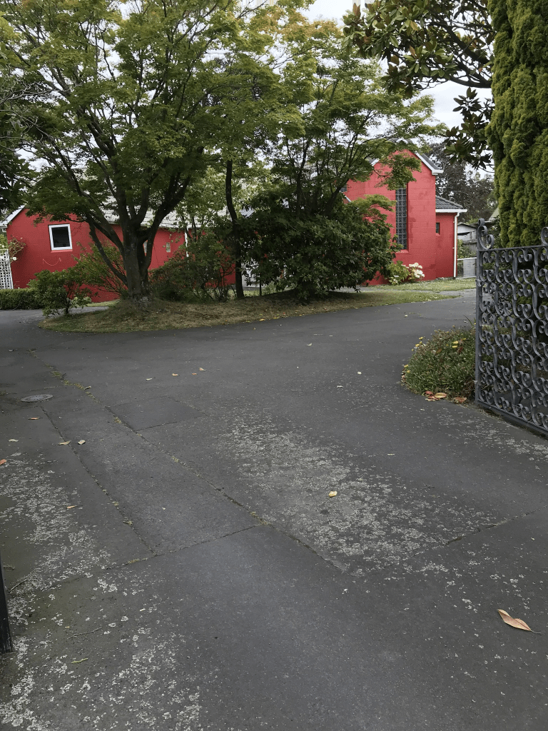
There are still many older houses at this end of Studholme St with a couple of modern ones in the middle of them. The modern houses look so out of place here. Almost opposite Somerfield school is the Somerfield Community Play Centre. The school takes up a fair portion of one side of the street and there is a little bit of street art on a building at the school. Opposite the school as well as the Play Centre there are more houses. On the sharp bend there is Somerfield Park and I took photos of the toilet block. It had street art on it. It is this corner where it would have been two separate streets until 1948. Walking towards Somerfield St I am walking where Duncan St used to be. Still some lovely older houses here with some 1980s houses amongst them. One house had a very overgrown garden and makes my garden look almost tidy in comparison. I cross Somerfield St and there is the same mixture of older houses and ones from the 1980s. There was a bright red house and I thought that it was an old church at first but I was wrong. About half way down there is a big empty section where state houses have been demolished and they will be building new ones. I believe that 6 units will be built where there used to be one house. This is a pleasant tree lined street but it was rather windy when I was walking here on Sunday morning and there was at least one tree branch on the ground. I had a brief chat with a local and she said that the wind had damaged some of her plants.
There were nearly 40 older houses on this street built between 1905 and 1920 and most looked in good condition. The next big lot of houses were all built in the 1980s with only a few built in the other decades.
Woodard Tce in Somerfield – formerly Cemetery Lane and Simpsons Lane. Cemetery Lane was named because of its proximity to Sydenham Cemetery. Also named Simpsons Lane. These are two informal names which do not appear in street directories. Re-named Woodard Terrace. Named after the Woodard family, “a family of very early settlers”. Named Woodard Terrace on 2 August 1939. The source says: “A letter has been received from the Somerfield Burgesses’ Association stating that some time ago the Council requested them to suggest a name for a lane that runs from Somerfield Road to the Sydenham Cemetery at present known as Cemetery Lane and Simpsons Lane, neither of which is considered suitable. The Association therefore suggests that the lane be named Woodard Terrace after a family of very early settlers”. John Woodard (1834-1909) is listed in 1890 street directories as a bootmaker of Ferry Road. First appears in street directories in 1948.
A reasonable amount of information from the library website for a street with only 14 houses. I got a bit confused when looking at Papers Past especially in connection with the Simpson’s Lane part. I had a good look at old maps and mystery solved.
The maps between 1912 and 1930 show a lane here but with no name. The same maps show Simpson’s Lane off Milton St and not anywhere near Sydenham Cemetery. Map for 1941 has it down as Cemetery Rd and Simpson’s Lane is still off Milton St. The map for 1958 has it as Woodard Tce and Simpson’s Lane is now Dominion Ave. Note the library website doesn’t mention that Dominion Ave used to be Simpson’s Lane.
On Papers Past I ignored most entries for Simpson’s Lane as they has nothing to do with this street. There were no entries under Cemetery Lane for this street. The only streets called Cemetery Lane were in Woolston and Lyttelton.
It is a bit strange that the Somerfield Association said that it was informally known as Cemetery Lane and Simpson’s Lane. I can understand Cemetery Lane but not Simpson’s Lane. Most entries in the 1930s referred to it as Cemetery Rd. In 1933 the name of Cemetery Rd was objected to by residents and members of the Association were given the task of coming up with a better name by the next meeting. In 1935 and 1936 there were sections available on the corner of Stenness Ave and Cemetery Rd. The street was still being called Cemetery Rd when the tar sealing was being done. By the 1950s the Woodard Tce name appears in articles and ads. A few death notices. In 1950 pipes were being laid and the residents would have been very pleased about this. In the 1930s there were many complaints about the open drain and the drain was described as a grave menace to the local children. I assume that the writer of grave menace used the word grave as a bit of a pun because of the nearby cemetery. In 1979 there still seem to be drainage issues and in 1980 the strip of land on this street which had been piped was to be turned into a reserve.
I often mention that streets in Christchurch are named after men who went bankrupt. This street is no exception as John Woodard was bankrupt in 1881. This was when his shop was on High St. I got a bit confused when it looked like he went bankrupt again in 1907 in Doyleston but that was his son. John Woodard move around a bit with his shop as he started out on what is now Papanui Rd and I found a photo of his shop dated 1875. He was then in High St and then on Ferry Rd. He was living on Somerfield St when he died in 1909. I found an article from 1950 written by a daughter who said that her parents had only been married 4 days in 1858 when they left on the ship Zealandia to come to New Zealand. Note the passenger list has them as a married couple with a child.
I walked this street on Sunday and I had parked on this street as this is plenty of parking because of Somerfield Park. The houses are only on one side of the street and on the other side there is the reserve and Somerfield Park. A few houses date from 1940s and a few from 2000s and what stood out for me the most was someone’s gate and fence.
Somerfield St in Somerfield – Named because it runs through the suburb of Somerfield which, in turn, is named after Somerfield House near Maidstone, Kent, England. Somerfield House was the birthplace of Edward Brenchley Bishop (1811-1887), chairman of the Town Council in 1866 and mayor of Christchurch 1872- 1873. He and his younger brother Frederick Augustus Bishop (1818-1894) owned 100 acres (40 hectares) on the Heathcote River. They appear on the electoral roll for the district of Christchurch in 1853 as the owners of Somerfield Farm. First mentioned in The Press in 1901. First appears in street directories in 1902.
A reasonable amount of information from the library website. Note a James Freeman owned the property Somerfield when it was sold off in 1900. James Freeman owned tearooms on High St and he also owned animals including chickens. His house was destroyed by fire in 1900 and apparently he was so disheartened that he decided to sell the property and the land. The land was subdivided and in 1903 there were lots of ads for sections. James Freeman can’t have sold all the land as in 1924 he was selling the shops and hall that he owned on the Somerfield St and Colombo St corner. The Barrington St end of Somerfield St was owned by a Mr Clark and I don’t know if he sold it as one big block of land in 1898 or if he was the one who subdivided the land and was selling off sections in a subdivision called Beckenham Estate. Lots of information on Papers Past and apart from the usual birth and death notices it was a busy street. Between 1903 when the sections were being sold and 1920 there were several entries regarding the tramline. Mr Cummings had a poultry farm which was interesting as James Freeman also had poultry before he sold up. In 1908 the Education Dept were looking at 3 sites for the South Spreydon School. Choices were between the site where it ended up being built, a section opposite Baretta St or on Heathcote Stream. I checked old maps and couldn’t find a street with the name Heathcote Stream. The school had it’s official opening in October 1911 and by this time they were calling it Somerfield Street School. I was amused by a letter to the editor in January 1912 where someone was complaining that the doors opened the wrong way. She thought that they should open outwards rather than inwards.
In April 1913 the new Beckenham Hall that was owned by James Freeman was opened by the mayor of Spreydon. It was mostly known as Beckenham Hall but occasionally was referred to as Somerfield St Hall. The writers to the editor were fairly active about the hall as at least one writer objected to it being called Beckenham Hall as it wasn’t in Beckenham. The hall was close to the Strickland St / Colombo St end of Somerfield St and these days the shops in this area are called the Beckenham shops. There was one mention in 1911 of the plans for the Somerfield Street Coronation Bath being approved on the condition that when emptying the water from the bath into the Somerfield St Channel that it should cause no nuisance. I don’t know if they ever got built but the pool at the school was mentioned a few times.
Note there were lots of entries about the hall as it was used for so many events plus the scouts used it.
The year 1920 had several entries as Mr H Williams moved into the street with his new poultry farm. There was a meeting at the hall to discuss the advantages of joining Greater Christchurch. At this stage they were still Spreydon Borough. There was also a request for a footpath to go from Somerfield St to the cemetery. This subject will be covered under another street but they did eventually get their lane. In 1925 there was an outbreak of polio in the street mostly in children. There were the usual complaints about drainage issues and the condition of the street.
We get to the 1930s and in 1932 the new Methodist Sunday School Rooms were opened. In 1938 there was a fire in a hedge of the government property on the corner of Somerfield St and Duncan St ( Studholme St). I didn’t find out what sort of government property was on the street. There must have been high winds in 1949 as a nor west gale caused a lot of damage in Christchurch and Mr Williams had his chicken coops destroyed by the winds. The chickens weren’t very happy about this and many of them ended up being stuck high up in trees and needed to be rescued.
There didn’t seem to be too much drama from 1950 onwards, the usual birth and death notices plus engagement notices. Lots of ads.
When I walked this street I started at the Strickland St end where there are shops plus a big building which has a business in it. This is where the Beckenham Hall would have been but that is long gone. Apparently Beckenham Hall was a handsome brick building. Then it is lots of houses and there are still many houses dating from 1905 to 1925 on this street. Many of them are still lovely and well looked after. Just past Selwyn St there is a house that you need sunglasses to look at. The house is bright orange and it now has a bright green fence in front of it. I frequently drive past as I have friends on Somerfield St and I blink every time. There is Somerfield School plus a childcare business. At the Barrington St end there are more shops including a hairdresser where my neighbour Ai works. There is still a church hall at this end as well. The houses here cover every decade with many from the 1990s.The ones from the 1990s are mostly behind the older houses as it was a big thing in the 1990s to subdivide and built at the back of your property. I hope that the older houses will stay as they are too nice to be demolished.