Thornwood Place in Redwood and nothing on library website.
This street runs off Farnswood Place which is also not mentioned on the library website. There are 23 houses here all built in 1990. Most of the houses looked quite nice but the street had no character. There were mostly no gardens but just immaculate lawns plus there was a footpath on only one side of the street.
Thicket Close in Redwood and there was nothing on library website.
This street runs off Farnswood Place and the library didn’t have any information about that street either.
This was a tiny street with only 8 houses that were built in the 1990s. The footpath was only a few metres long and most of the street didn’t have a footpath. The houses were typical 1990s brick houses and none of them stood out for me. No photos
Scarlet Lane in Redwood – Named after scarlet, a variety of apple. Developed at 45 Tuckers Road on the site of an orchard and named after an old variety of apple once grown there. Originally to be named Robbies Lane after Robbie Deans, a Canterbury rugby player and coach, but the developer changed his mind. Named in 1999.
A reasonable amount of information from the library website and nothing that I can add about the name. The property at 45 Tuckers Rd was owned by W G Freeman and he inherited it from his father E Freeman. The property also grew vegetables and there were lots of ads on Papers Past. W G Freeman when he was younger had a lot of traffic offences. He died in July 1995 and it was after his death that the street was developed.
The 16 houses here were built in 2000 and there wasn’t a footpath on the street.
Saunders Place in Redwood – Developed in a subdivision created by the Housing Corporation. Named in 1975. First appears in street directories in 1978.
A tiny amount of information from the library website. The street was probably named after a staff member from Housing Corporation as that was what they frequently did. Papers Past mostly had ads including for the sale of houses. Two articles stood out and one was in 1979 where a man tried to abduct a young girl. The other one was in 1982 where a man tried attacking his wife with an axe.
I didn’t particularly like this street and was surprised to find out that the houses are privately owned. There was a walkway through to the Main North Road.
Manse Place – First appears in street directories in 1978.
A tiny amount of information from the library website. A small amount of information from Papers Past and it was mostly about a sculpture by Lew Summers that had been installed in the courtyard of an elderly people’s complex. Many of the residents weren’t happy with the sculpture but they eventually agreed to keep it as long as shrubs were planted to hide the bare backsides. There were a few death notices.
The entire street is social housing and the units were built in 1973 and 1983. There are 42 units and they are owned by the council. It is unlikely that there are any elderly people living here now. I didn’t attempt to walk this street as I didn’t feel that it would have been safe. If I had realised that there was a Lew Summers sculpture here I might have walked it. This is assuming that it is still there.
Because manse is a place where a clergyman or minister lives my best guess is that a manse originally stood here. Manse was derived from the Latin word mansus which means dwelling.
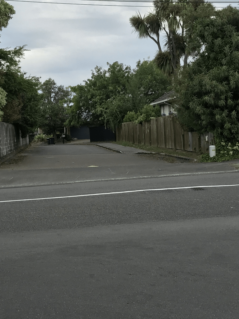
Farnswood Place in Redwood and nothing on library website. I couldn’t find out any information about the naming of this street. All the houses were built in the 1990s and made from brick. The street was so immaculate that it was boring. There is an entrance to Redwood Park from this street. I walked this street last night and it was a lovely evening.
Ashbrook Lane in Somerfield- First appears in street directories in 1976.
A tiny amount of information from the library website. Not much information on Papers Past apart from a few ads and a couple of death notices. I found more information by searching for 7 Ashgrove Terrace and it is very sad. The house and land at 7 Ashgrove Terrace was for sale in 1970 and plans for a proposed subdivision into seven sections was included. The owners of the property both died in 1966 and his occupation was nurseryman. They had a son and a daughter but both died in 1947. Their son Stephen died aged 35 in early 1947. Their daughter Ruth died aged 26 in the Ballantynes fire.
There are 13 houses here and most were built in the 1970s. They looked nice but confess that I only walked a small portion of the street as the footpath is a short one.
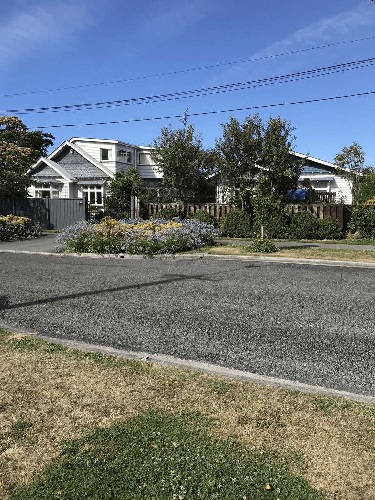
Stanbury Ave in Somerfield – Formerly Droitwich Street. Named after the parliamentary electorate in Worcester long held by a member of the Lyttelton family. Re-named Stanbury Avenue. Named after Stanbury Manor, in the west riding of Yorkshire this street. Formerly Droitwich Street for a short time in 1958. Several streets in this area have names associated with the Lyttelton family because they were formed on Rural Section 76, 700 acres on the “Lower Lincoln Road, Heathcote Bridge” purchased by Frederick Spencer, 4th Earl Spencer (1798-1857) and Conway Lucas Rose (1817- 1910). Spencer’s interest in the land was passed on to his nephew, the Hon. George William Spencer Lyttelton (1847- 1913), the 4th son of George William Lyttelton, 4th Baron Lyttelton (1817-1876). Re-named Stanbury Street the same year. The forebears of Lynwood Hollings (1885-1977) had once lived at Stanbury Manor. He claimed to be the prime mover in arranging the subdivision of this street. Local residents disliked the foreign name which was difficult to pronounce.
A reasonable amount of information from the library website. Lynwood Hollings forebears possibly lived on the estate of Stanbury Manor in Yorkshire but they didn’t own it. His family were agricultural labourers on the estate.
There was a reasonable amount of information on Papers Past and all entries for Droitwich St were in 1958. In July of that year the new street in the government subdivision was given the name of Droitwich and the reason for the name was that it was connected to the Lyttelton family. In October one of the members of the group objecting to the street name visited the City Council Offices where he was informed that not only was it an English name but there was the Lyttelton family connection and that many of the streets in the area had a Lyttelton family connection. The man who was representing the residents of Somerfield was apparently taken aback by learning that it was an English name. The residents group were told that unless they could come up with some constructive suggestions that the Droitwich name stays. Note using the name Hollings had already been rejected. A few days later Mr L Hollings came up with the name Stanbury claiming that Stanbury Manor was his ancestral home. He also claimed to have been the prime mover in arranging the subdivision. There was a note that Mr Hollings canvassed the owners of the waste land with the idea of the subdivision. Mr Hollings apparently owned the largest block of land out of the 24 owners of the land. The Ministry of Works developed the land under the title of Hollings and others. Note Lynwood Hollings was very vocal in letters to the editor or representing various groups. He formed his own political party in 1938 calling it the People’s Party. He was a builder at one stage plus owned several houses that he rented out. Sometimes he had disputes with his tenants. In 1952 he was granted a wine sellers licence and had a store on Sparkes Rd in Halswell.
By November of 1958 there were 62 sections available. This was also a state house development and developing state houses here was mentioned as early as 1937. Papers Past mostly had death notices plus entries for the best street and garden competitions. There were several houses for sale in 1968 and 1969 and it looks like the street was developed in stages. There was a hit and run incident in 1971 where the young girl hit eventually died.
This is a pleasant tree lined street with some nice gardens. I couldn’t find out if there were still state houses on the street. There was one house that looked a bit run down and was possibly empty. I had a nice chat with the young woman painting her fence with the help of her young daughter. There is an entrance to the Somerfield Rest Home on this street but the rest home is officially on Barrington St.
The houses here were all built between the 1950s and 1990s and I liked the one with the tree hut.
Cashmere View Street in Somerfield and there wasn’t anything on the library website. This was a surprise as most of the houses on the street were built in the 1920s and 1930s. There are about 5 houses built between 2020 and 2023 but they can’t have been ugly as I didn’t notice them. The name of the street is obvious.
There was a reasonable amount of information on Papers Past and as usual for an older there were a lot of death notices. There was even a surname that I recognised. It wasn’t someone that I knew but I had worked with the person’s grandson when I was at the Hillmorton Post Office / Postbank. This would have been in the late 1980s.
I suspect that this street was created at the same time as Fairview St. There were at least four big properties sold between 1912 and 1920 on Rose St and the streets would have been formed from one of these properties. I didn’t find any ads for sections being sold but there were people living here in the late 1920s going by the death notices. The residents in 1930 suggested that a reserve be formed on the council owned sections that ran between Cashmere St and Fairview St as this would be better than the overgrown and untidy section that it currently was. This land mentioned is probably where the Cashmere View Playground is now situated. Also in the 1930s there was a rabbit breeder living on this street. In 1933 the residents of Somerfield decided to set up the Somerfield Burgesses’ Association and this street was included in the Association. In 1932 sections in the street were being prepared for the planting of pumpkins. In the 1930s in Somerfield there were a lot of vegetables being planted on spare land and they were for the relief depot. Note this was during the big depression.
A letter to the editor in 1934 was complaining about there being constantly deprived of power just as meals were being prepared. The MED reply was that there had been some trouble experienced at the Rose St sub station. I was therefore amused to see another letter to the editor and this time in was in 1936. The person was complaining about a transformer station being erected on Cashmere View St. This substation / transformer station is still there and I now wish that I had taken a photo of it. The rabbit breeder must have still been living here in the 1940s as in 1947 one of the rabbits had escaped. It wasn’t the only thing escaping as someone had lost a mule. The children’s playground was mentioned in the 1940s and they must have used it for outdoor events as marquees were also mentioned. The 1950s saw poultry being offered for sale from a property on the street and there was a milk storage depot. The 1980s it was mostly best street and garden competitions in the news. The one exception was the article in 1987 about the getaway vehicle from a bank robbery being spotted on the street.
I did check old maps and this street wasn’t on maps for 1912 or 1922 but it was on the map for 1930. Going by the map for 1912 there was a large block of land that went between River Road now known as Ashgrove Tce and Rose St. This large section would match up with Cashmere View St and Fairview St being developed.
This is a lovely street with lovely 1920s wooden villas with nice gardens and I hope that it stays this way. I ended up meeting a couple walking a dog here and we had a great chat. She loved the idea of my project and is tempted start doing it herself. There was a nearby painted powerbox and she also loves street art. I should have asked if she also likes cemeteries. The playground / reserve on this street now has a wildflower area and I like that idea. Edited to say that a lawyer Thomas Sydney Dacre possibly owned the land but he didn’t live at the property.
Beechworth Ave in Somerfied – Named after Beechworth, a town in Victoria, Australia.Francis Stanley “Frank” Sullivan (1905-1981) and his son, James Warwick Sullivan (1929-2001), of F. S. Sullivan & Co Ltd, built many of the houses in this street in the 1950s and were permitted to name the street. They named it after Beechworth in Australia because Francis Sullivan’s mother had been born Lavinia Paull in Beechworth in Victoria in 1874. She died in Christchurch in 1932. When she and her husband, James Osborne O’Sullivan (1867-1927), moved to New Zealand they dropped the “O” from their name. Frank Sullivan enjoyed making this family link with the street he and his son helped create. First appears in street directories in 1957. Information supplied in 2015 by Penny Lancaster, granddaughter of Frank Sullivan.
A reasonable amount of information from the library website. The library put this street in the suburb of Spreydon but official websites have it in Somerfield. Real estate agents put it into Lower Cashmere.
Not much information on Papers Past. There were ads for houses in 1958 and 1965. A few death notices. I checked older maps for this street and it was possibly developed on land where there had been a market garden. The map from 1958 show it as a Cul de Sac and Stanbury Ave didn’t exist. The street is a short one that runs from Rose St to Stanbury Ave. The houses are mostly only on one side of the street as there is the Ultimate Care Rose Court on the other side. I couldn’t find out when the care home was built but it looks fairly modern. It actually looked really nice with lovely gardens. Most of the 10 houses on this street were built in the 1950s and they looked pleasant enough. There was one on the corner of Beechworth Ave and Stanbury Ave with a letterbox that looked like an old posting box from the UK. The house also had a very high fence around it. When I checked street view it didn’t have a high fence but did have a lovely garden with plenty of trees. I think that the trees have gone.