Taunton Green in the suburb of Papanui, Christchurch

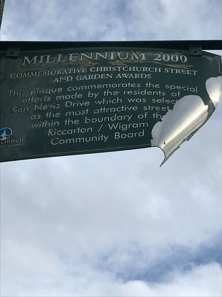
Taunton Green in Papanui – Named after Taunton, which is located in the New Forest near Christchurch in England. Ponies roam freely in the protected woodlands in the area. The property at 94 Grants Road had been used to graze horses, and the applicants wanted to retain the open, rural appeal of the property. Named in 2000 by developers Linda and Phil Mauger (Ben Nevis Holdings). Information supplied in 2003 by Linda Mauger in an interview with Margaret Harper.

A small amount of information from the library website and it had me rolling my eyes. Taunton isn’t in the New Forest and it isn’t near Christchurch in the UK. The New Forest is an area in the UK that I know really well and it can be amusing plus scary when geocaching and a horse suddenly comes up behind you wanting to know you are doing.

I was geocaching today without any success and gave up because of the weather change. Footpath on only one side of the street which is common for modern streets and I dislike this. Most houses built in 2000 and they are huge. There was one that I quite liked but the rest were just OK or just plain ugly. There is a walkway at the end of the street and the path was still muddy from recent flooding. It was a pleasant street but the houses well beyond my budget.

Courtenay Street in the suburb of St Albans, Christchurch

Courtenay Street in St Albans – Codlings Lane and Grafton Street. Formerly Codlings Lane. Named after Thomas Codling (1810?-1892). Re-named Grafton Street and then Courtenay Street. Probably named after William Reginald Courtenay, the 11th Earl of Devon (1807- 1888). Codlings Lane never appears in street directories. First appears in the Star in 1873 as “Codling’s”. Codling, a civil engineer, was living in Church Road (later Rutland Street) in 1890. Grafton Street is first mentioned in The Press in 1887 when a petition signed by 220 residents asked for a bridge over the creek at the north-east end of Grafton Street. First appears in street directories in 1892. Re-named Courtenay Street on 7 March 1904. Courtenay was a director of the New Zealand Company and on the management committee of the Canterbury Association from 1848.

A reasonable amount of information from the library website. Papers Past only had one mention of Codlings which was in 1873. Sounds like Thomas Codling was involved in building some of Christchurch’s early bridges. He died in 1892 aged 82 after a long and painful illness. There were several Grafton Streets including one in Sumner and another off Ferry Rd. When the street was renamed in 1904 along with many other streets it was said that the committee selected names of counties and towns in the old country. There wasn’t a town in the UK called Courtenay but three towns included the name. In 1946 part of the street was renamed Roosevelt Ave. I checked the map from 1912 and Courtenay was a much longer street. The street back then had a big kink in it and looked like the shape of the letter L. Courtenay St runs off St Albans St and only a slight narrowing of the street where they meet shows that it is a different street. The oldest house is from 1915 plus several were built in 1920. The rest cover most decades from then to now. A pleasant street but thought that the modern houses looked out of place amongst the wooden villas. But we all know that I dislike most modern houses.

Massey Crescent in the suburb of St Albans, Christchurch

Massey Crescent in St Albans – Formerly Massey Street. Spooner’s Lane, later Eden Street, was incorporated into Massey Street. Named after William Ferguson Massey (1856- 1925). Spooner’s Lane was named after George Frederick Spooner (1843?- 1918). Re-named Eden Street. Originally part of George Dickinson’s dairy farm. Massey was the Prime Minister of New Zealand 1912-1925. Massey Street is first mentioned in The Press in 1922, described as running from St Albans Street east to Trafalgar Street. Spooner, a coachbuilder, lived where Spooner’s Lane was formed off Crescent Road (later Trafalgar Street). Spooner’s Lane first appears in street directories in 1894. Re-named Eden Street which is first mentioned in The Press in 1905. Massey Street first appears in street directories in 1925. Eden Street was connected to Massey Street in 1927. Massey Street was renamed Massey Crescent in 1950. [In 1925 residents asked for an avenue of mountain ash trees to be planted in the street.]

A reasonable amount of information from the library website. The name Massey is fairly obvious as William Massey died in 1925. There was a letter to the editor in 1925 where someone wanted Colombo St to be renamed Massey St as a memorial to William Massey. This obviously didn’t happen. Not a lot of information on Papers Past and there were so many Massey Streets in New Zealand that I possibly missed a few articles. In 1960s and 1970s the street was mentioned in best street competitions. Several death notices. There was only one mention of Spooner’s Lane in Papers Past and that was when in 1904 the residents requested the street name to be changed to Eden St. George Spooner left the district in 1890 and Spooner’s Lane was developed here he had lived. Eden St was a tiny dead end street leading off Trafalgar St. I ended up checking old maps and the maps for 1912 and 1922 only show Eden St. Massey St doesn’t show up on maps until 1930 and it was a dead end street leading off from St Albans St. The maps for 1941 only shows Massey St and Eden St had disappeared. The streets had joined up and had become one street. The residents in 1927 requested that the street name be changed from Massey St to Massey Crescent but this didn’t happen until 1948.

It was a pleasant tree lined street and most of the houses were built in the 1920s. They were lovely wooden villas.

Sheppard Place in the suburb of St Albans, Christchurch

Sheppard Place in St Albans – formerly School Road and School Place. Named because it leads to St Albans School. Re-named Sheppard Place. Named after Katherine “Kate” Wilson Sheppard (1847-1934)School Road first appears in street directories in 1894. Becomes School Place. Re-named Sheppard Place on 1 September 1948 when 120 streets were re-named. Kate Sheppard was a suffragist, social reformer and writer.

A small amount of information from the library website and nothing that I can add about the name of the street. I was in the area geocaching and this tiny street runs from English Park to Trafalgar St. St Albans School and English Park take up most of the street. Most entries on Papers Past are for games at English Park or for the school. In 1925 there was a complaint about people attending games at English Park damaging the school grounds. There was also a School lane in Riccarton which will explain the name change in 1948. The earliest mention that I could find for the school was in 1866 but the school at that stage was on a different site. The best information about the school was from the centenary in 1973. The school was actually established in 1859 but was a private school called St Albans Wesleyan School. It became a public school in 1873 and moved to the current site in 1874. A few entries in 1956 about building a school hall.

Only 4 houses on the street and the oldest is from 1905 and another is from 1910. The other two are from1985 and 2000. Personally I wouldn’t like to live here because of the park and the school. I suspect that when there are games on at English Park that traffic would be a nightmare even with the yellow no parking lines.

Merlewood Avenue in the suburb of Cashmere, Christchurch

Merlewood Ave in Cashmere – Named after Merlewood, the home built on Cracroft Terrace in 1903 belonging to Dr. John Christopher Bradshaw (1876- 1950).Dr Bradshaw was the first professor of music at Canterbury College 1937-1941. He was organist and choirmaster at Christchurch Cathedral for 35 years. He formed Merlewood Avenue to give better access to his property and it was a private road until Dyers Pass Road was formed. First mentioned in The Press in 1912 when tenders were invited by the England Bros. for the erection of a house there. First appears in street directories in 1914.

A reasonable of information from the library website. It was probably named after a place in England. Electoral rolls give Dr John Bradshaw’s address as 21A Dyers Pass Rd. It is a puzzle that this street is called an Avenue as I always imagine an avenue to be a wide street but this street is very narrow and steep. In 1922 it was described as a narrow badly formed track. It was also described as a private right of way. Between 1920s and 1960s there were many complaints about the road being used as a racetrack by young men. Obviously boy racers isn’t a new problem. The usual birth and death notices but most entries were ads in the 1960s when there were sections for sale. The oldest house on the street was built in 1905 and a few from 1910s and 1920s. A couple of more modern houses and they look so out of place amongst the gorgeous wooden villas. I parked my car on Cracroft Terrace and walked down the street to visit my friend who lives in a lovely 1920s villa. Street was far too narrow for me to even attempt to park on the street. I had to walk on the road as there was only a few metres of a footpath and there were vehicles parked on the footpath. Great views of the city from this street.

Steadman Road in the suburb of Broomfield, Christchurch

Steadman Rd in Broomfield – Named after Steadman Sarah Chisnall, née Wilson, (1823?- 1876)Steadman Chisnall was the wife of William Chisnall (1827-1876) who owned Russley Farm. Named in 1983 after residents objected to the proposed name of North Carmen Road for the section of Carmen Road between Yaldhurst Road and Masham Road. The name change was wanted because realignment meant there was little connection between northern and southern sections of the road.

A reasonable amount of information from library website and there are a couple of mistakes. The name of the farm when William Chisnall owned the farm was Hadleigh Farm after the town they came from in England. His wife’s name was Sarah Steadman Chisnall nee Wilson. I am not even sure that his farm was here as when it was for sale in 1867 it was described as being on Fendalton Rd. I searched Papers Past and Ancestry website plus heritage maps. The name that I found connected to Russley Farm was William Armstrong.

A map from 1962 only shows 2 or 3 houses on one side of the street and the Riccarton Racecourse on the other side. On this map the street was called Carmen Rd. There are now lots more houses mostly from 1970s and at least one is being used a a B&B. On the other side of the road there is Riccarton Park Golf Complex plus a retirement village is being built on what used to be Riccarton Racecourse land. It looks like it is going to be a huge retirement village. It is called Kevin Hickman Retirement Village.

The story of William Chisnall is interesting as he drowned in the Waimakariri River near Templar’s Island. He was only 49 years old and sadly his wife died a couple of months later. His son also William Chisnall ended up farming in Hinds. Many of the various family trees on the Ancestry website had lots of mistakes.

Rosella Street in the suburb of Broomfield, Christchurch

Rosella Street in Broomfield – First appears in street directories in 1964. A tiny amount of information from the library website. The street could be named after a parrot, a plant or a racehorse but couldn’t find information online. Papers Past only had a couple of entries. A death notice in 1963 and information about sewers to be connected in 1964.

The street runs between Masham Rd and Steadman Rd and there is the Rosella Reserve and playground at the Masham Rd end. Most houses were built in 1960s and the only thing that stood out for me was an interesting gate. Most houses were neat and tidy with nice gardens. There was one untidy place but the owner had obvious mobility issues.

Ben Nevis Drive in the suburb of Broomfield, Christchurch

Ben Nevis Drive in Broomfield – Named after Ben Nevis, a mountain in the Grampian Mountains, Scotland. First appears in street directories in 1991. A small amount of information from the library website.

Ben Nevis is actually the highest mountain in the UK and is a Munro. When I climbed Ben Nevis there was still snow on the top and I found a geocache at the top. The track up the mountain was really busy but most people didn’t go right to the top.

Most the houses on the street were built in 1980s and 1990s and built from brick. There is an entrance to Rosella Reserve on this street. My usual complaint about the lack of footpaths. One house had an interesting letterbox and pretentious garden ornaments. The street has an award plaque hanging from a lamp post for being most attractive street and gardens. The gardens didn’t really do a lot for me as they were mostly the style of immaculate lawns with hardly any flowers.

Coronado Place in the suburb of Broomfield, Christchurch

Coronado Place in Broomfield- nothing on library website which was surprising as the houses were all built in the 1960s. The houses were typical 1960s houses but there were a couple of really nice gardens. The street runs off Rosella Street and I was happy as the footpath was on both sides of the road. My best guess for the name of the street is that it was possibly named after a racehorse. On Papers Past I found several racehorses that included Coronado in their names.

Glenys Place in the suburb of Broomfield, Christchurch

Glenys Place in Broomfield- nothing on library website about this street. Suspect it is named after a person but couldn’t find any information online. Most houses were built in 1970s so I was surprised that there was a footpath on only one side of the street. The street runs off Rosella Street and nothing really stood out for me. A pleasant street with some nice gardens.