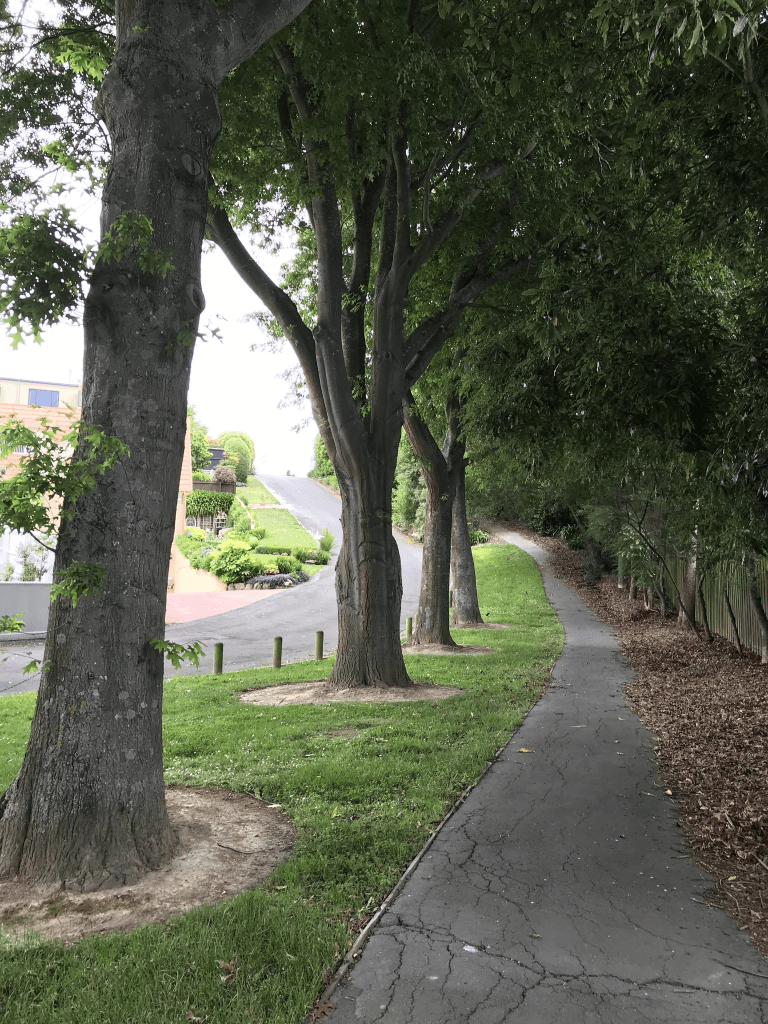
Willow Dell in Westmorland. Nothing on the library website yet the houses all date from 1990s. It is possibly because it is a private lane yet other private lanes are mentioned on the library website. There wasn’t a footpath but there is a walkway next to the street. There is a nice wee reserve called Willow Dell Reserve and yes I was geocaching in the area. A couple of nice houses but nothing stood out for me but I did like the reserve.
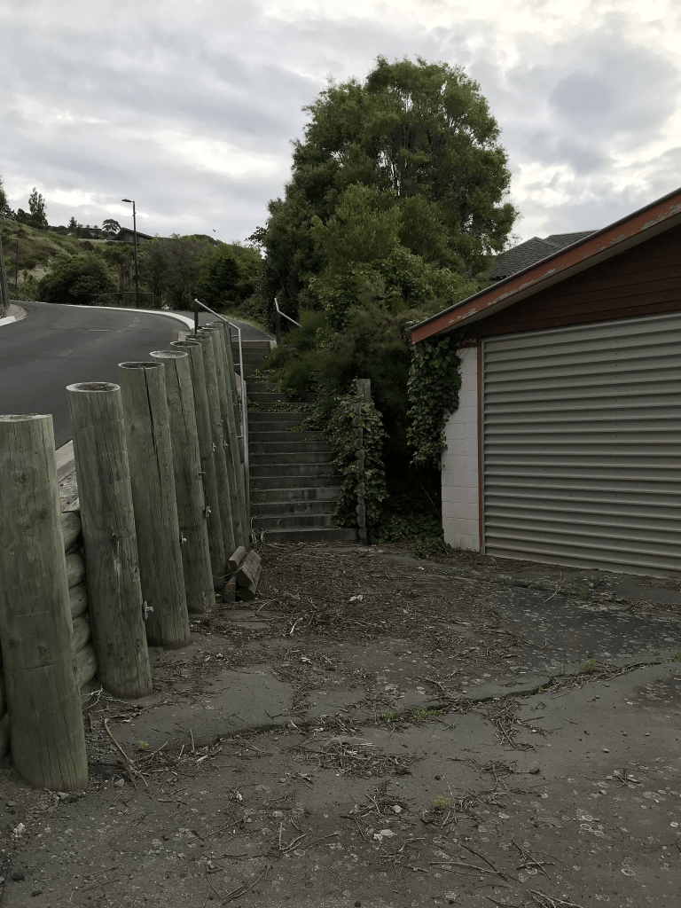
Emily Heights in Moncks Bay. Nothing on library website but this street would be too new. It is on google maps but no street view as there was a very clear locked gate preventing access. I didn’t actually walk this street for the same reason. A website called housenode claims there are 11 houses here but QV website doesn’t have this street on their website. It looks like the street has been developed at the back of 14 Cliff St. My best guess for the name is that it is connected to the developer or the owner of 14 Cliff St.
This is a copy and paste of what I wrote in February 2021 and there is no longer a gate blocking the road. At the start of the road there isn’t a footpath but you go up some steps that look like they are on private property. Worked out that the garage next to the steps belong to a demolished house on Cliff St. The road is fairly steep and you get fantastic views from the top. There seem to be only a couple of unfinished houses on this street when I walked up it last night.
Moncks Bay Lane in Moncks Bay – nothing on library website for this street and it is obvious how it got it’s name. There wasn’t anything on Papers Past yet there are houses here dating from 1960s and 1970s plus there is an ugly modern house. I didn’t actually walk this street as is just looked like a driveway to a couple of houses yet there is supposed to be 12 houses here.
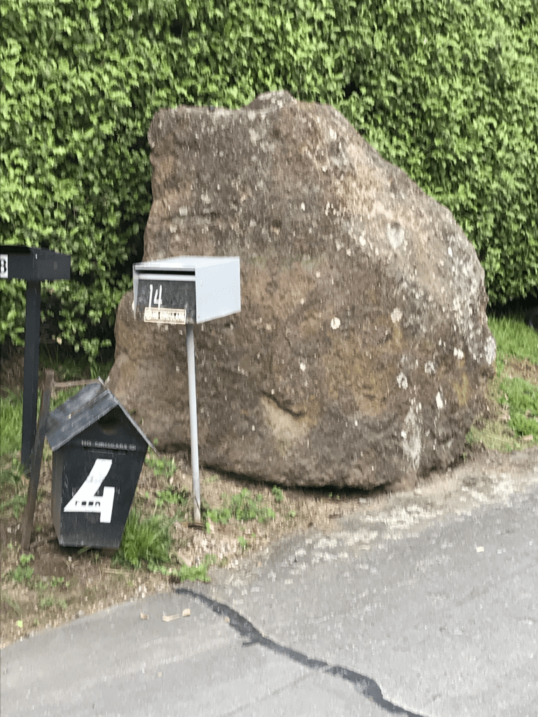
Red Rock Lane in Moncks Bay – Named because the street is on the site of the old quarry from which the red rock, readily seen in Sumner and Redcliffs, was extracted. A right-of-way named in 2003.
A small amount of information from the library website.
There is supposed to be 15 houses here but I couldn’t see that many. I didn’t actually walk this street as it just looked like a driveway to a couple of houses plus there wasn’t a footpath. I should have realised that there were more houses from all the letterboxes at the entrance to the lane. There is a big lump of red rock next to the letterboxes.
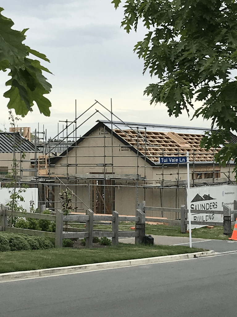
Tui Vale Lane in Halswell and it is too new for the library website. The street is part of the boutique new Stoneridge subdivision at 823 Cashmere Road. There are 7 sections here and just to be confusing google maps have the street as Tui Vale Rise but signpost and the developer’s noticeboard has the street as Tui Vale Lane.
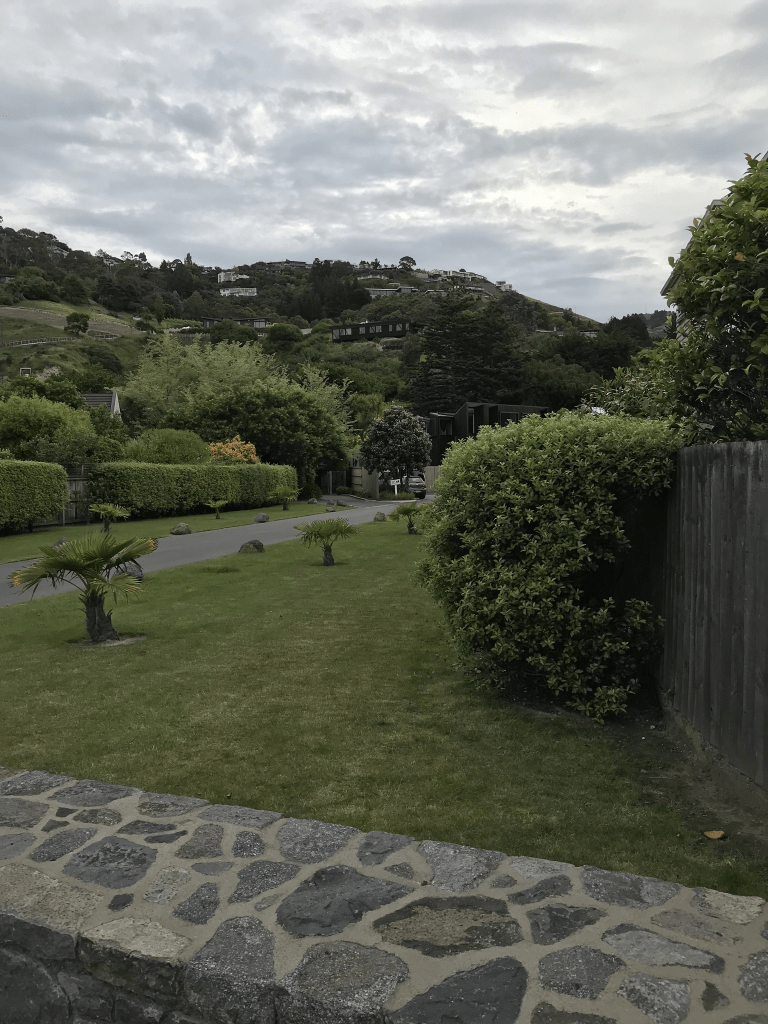
Saddle Vale Rise in Halswell and it is too new to be on the library website, It is part of the new Stoneridge Down boutique subdivision. There are two houses here that look like they are finished being built and they are interesting designs. I couldn’t decide if I liked them or not. Seriously well beyond my budget. At the end of this street is a small reserve with a picnic table and a walkway. I was geocaching in the area. I continued along the walkway and it ended up on a private driveway with several keep out and private property signs. The driveway seemed to lead to a house that possibly is the original house for 823 Cashmere Rd going by google maps.
Kepler Ridge Lane in Halswell and it is too new to be on the library website. It will be named after the Kepler Mountains and Track and the street is in the new Stoneridge Down subdivision at 823 Cashmere Road. I couldn’t find out how sections will be here and at least one house looks like it is nearly finished being built. This subdivision is described as boutique and trophy countryside which always means expensive.
Stoney Creek Lane in Halswell and it is too new to be on the library website. There are 8 sections here and it is part of Stoneridge Down which is a new subdivision at 823 Cashmere Rd. The ads use words like boutique and trophy countryside. In other words expensive.
Sharlick St in the red zone of Avondale – Named after Martin Sharlick (1866-1944). Sharlick was a farmer of Marshland Road. He worked with Reginald Gordon Vivian Muirson (1913-1990), a builder. First appears in street directories in 1960. Information researched during the 1970s by Guy Bliss, a teacher and local historian.
A small amount of information from the library website and I am not sure that all of the information is correct but I could be wrong. Martin Sharlick was a farmer and would have been in his late 60s when Reg Muirson was starting out in business. Martin Sharlick’s grandson was a carpenter and he also lived at 10 Sharlick St. Their real surname was Szaluga and the ancestry website family trees give a couple of place for his birth. Either Prussia or Bavaria and as Prussia was in the north I think that this is more likely. Not a lot of information on Papers Past apart from houses for sale in the 1960s.
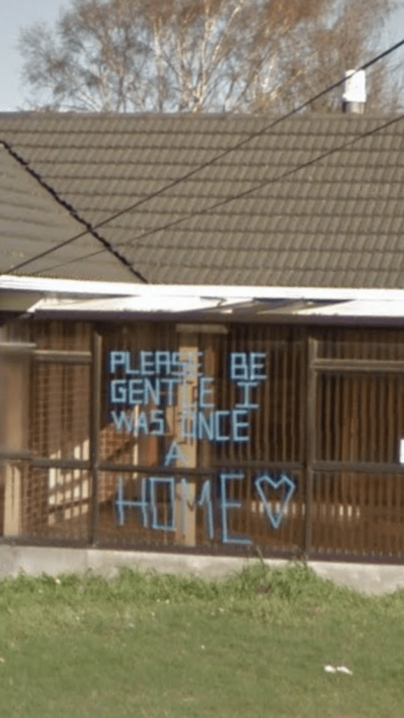
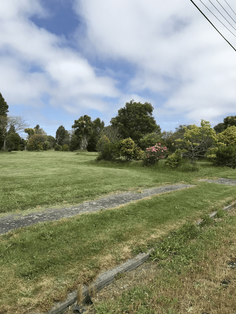
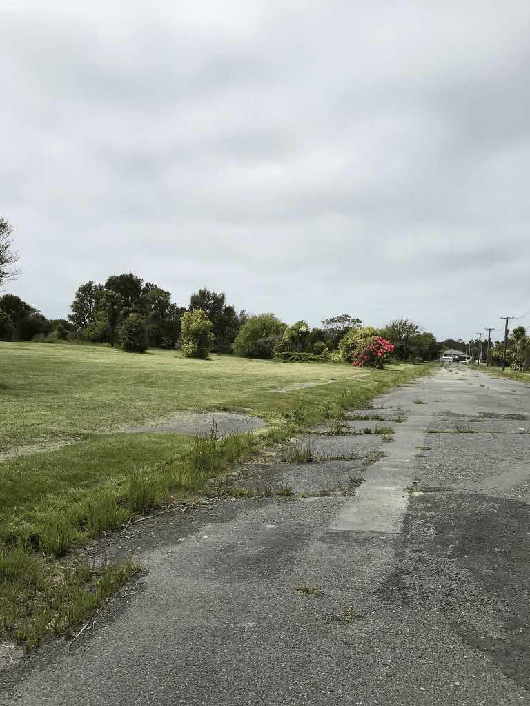
Street view from 2007 shows an ordinary looking street and street view from 2012 show that only a couple of houses were looking as if they were occupied. There was one very sad house which was obviously in line to be demolished and the owner had written on the front of the house Please be gentle as it was once a home. I took a screenshot of this. Obviously there are no longer any houses here.
Edna St in the red zone of Avondale – Named after Edna May Muirson (1913-1986). Edna Muirson was the wife of Reginald Gordon Vivian Muirson (1913-1990), a builder. First appears in street directories in 1962. Information researched during the 1970s by Guy Bliss, a teacher and local historian. The Muirson’s dates supplied in 2008 by Marie Shears, formerly Woolley.
A reasonable amount of information from the library website. The ancestry website family trees all have Edna as private which normally means the person is still alive but she obviously isn’t still alive. Papers Past had several ads for the sale of sections and the street was described as running off Avonside Drive extension. A few death notices ad engagement notices. In 1966 a 13 year old girl getting off the bus at 11pm was attacked by a man who attempted to indecently assault her. The saddest was a 16 month old boy who drowned in the river. He is likely to have been related to the Muirson family. In July 1977 there was a huge storm in Christchurch which was described as the worst since the Wahine storm. This street being close to the river had flooding issues along with every other street near the two rivers in Christchurch. The troops were called in to help. Reginald Muirson had a business called Reg Muirson Homes so he probably built most of the houses in the street. His business partner was a J Woolley.
Street view on google maps for 2007 shows an ordinary looking street with nothing outstanding. Many of the houses were still standing in 2012 but it didn’t look like anyone was still living in them. No longer any houses here and it is in the red zone.