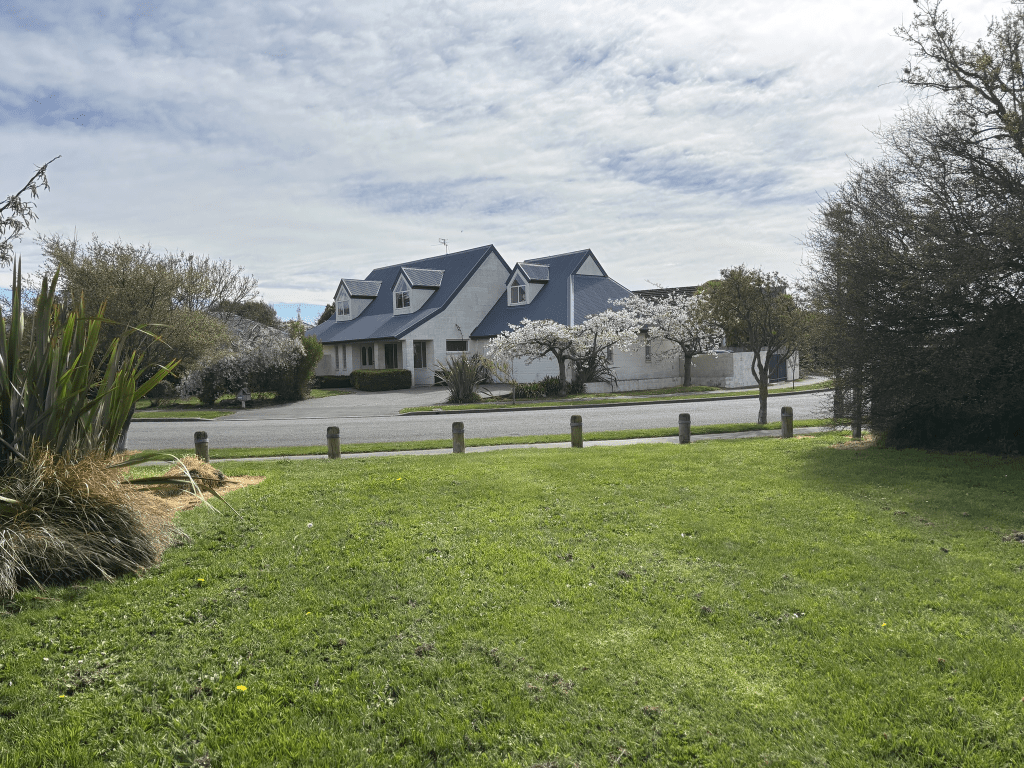
Sails Street in the suburb of Papanui, Christchurch

Sails Street formerly Sail’s Road. in Papanui – Named after James Sail (1819- 1908). Sail arrived in Canterbury on the Charlotte Jane in December 1850 and lived on Harewood Road, Papanui for 54 years. He helped form the Bridle Path and was for some time employed by the Hon. John Watts-Russell at Ilam. He also helped print the first issue of The Lyttelton Times. Sail’s Road appears on an 1880 map. Sails Street first appears in street directories in 1901 with a see ref. to Harewood Road. First appears as a separate listing in 1906. Referred to as Sail’s Road in an advertisement in the Star in 1909

A reasonable of information from the library website and the information about James Sail is almost the exact same information that was in his obituary.

Papers Past had both Sails Road and Sails Street right up to the 1960s. In 1895 and 1986 there were ads for building sites. It was mostly death notices and ads for both names. There must have been a milkman in the street between 1910 and 1920 as he was wanting to employ someone for milk delivery and no milking was required. By the 1950s the word street being used was starting to outnumber the word road being used. A few accidents over the years especially on the Harewood Rd corner. There were complaints about the state of the footpaths in 1924. In the 1940s and 1950s there was mention of best street garden competitions.

At the Harewood Rd end there is an entrance to the Golden Age Retirement Village and this village takes up one side of the street between Harewood Rd and Hoani Street. There is one house dating from 1905 but it has been altered so much that I couldn’t tell the age of it. A few from 1920s and then every decade until recently. Street view only shows up to 2015 and there is a lot of units built in 2022 and 2023. I had a nice chat with a resident on this street as he had an interesting bike in his driveway.

Langstone Lane in the suburb of Papanui, Christchurch

Langstone Lane – Named because the developer wished to continue the “lang” theme of Langdons Road. Named in 2001.

Small amount of information from the library website.

Information from Council website – PAP/20007506 154-160 Langdons Road C Inns – Papanui Ward An access allotment and right of way has been constructed to serve three residential and nine business allotments. There is a shortage of property numbers available for the allotments, creating the need for a name for the access lot and right of way. The applicant has submitted two names, and wishes to continue the “Lang” theme from Langdons Road. The names proposed are Langwood Lane and Langstone Lane. The only existing name similar is Lancewood, which in handwritten form could possibly be confused with Langwood. Recommendation: That the Board approve the name Langstone Lane for the above

There isn’t a signpost for the street and I just thought that it was a driveway for the funeral directors so I didn’t walk the street. When I checked the photo that I had taken I realised that there was a street name in the photo. I thought that the business was part of Langdons Road. When I looked at older street view there was a signpost for the street plus there were houses here with at least one of them dating back to 1950. This house is now the premises for funeral directors business and there doesn’t seem to be any residential houses left on the street.

Ellery Street in the suburb of Northcote, Christchurch

Ellery Street in Northcote and nothing on the library website for this street. The valuation website that I use claims that the houses here were built between 1980 and 2010 but most were actually built in the 1950s. The earliest mention on Papers Past is a MED ad in 1954. Can anyone else remember when they would cut the power on a Sunday to do maintenance on the power lines. Everyone would be rushing to get the Sunday roast cooked in time. In 2019 there were at least 3 state houses on this street and I suspect that at one stage the entire street was state housing. I would have expected it to have been mentioned on Papers Past but nothing. I checked for the surname Ellery but couldn’t find a link. There was an amateur boxer but he didn’t live in the area. There was a bricklayer and he is a possibility. More likely to have been named after some obscure government worker in Wellington.

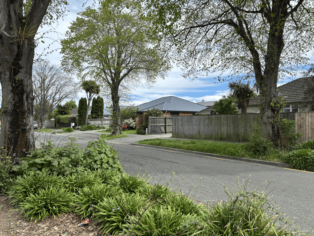
A tree lined narrow street with limited parking. None of the houses stood out for me but what did stand out were the tree roots creating cracks in the footpath. I had to be careful that I didn’t trip over them.

Chapel Street in the suburb of Papanui, Christchurch

Chapel Street in Papanui – Formerly Myrniong Street. Named after Myrniong, a large house which once existed in this street. The house was named after Myrniong, a small town near Melbourne. This, in turn, was named after the murmong plant, an Aboriginal name for the yam daisy. Re-named Chapel Street. Named because of the Wesleyan (Methodist) Chapel standing near the corner. Myrniong was an 8-room, two-storey weatherboard house on eight acres built by John Thomas Matson (1845- 1895) and named because of the Australian connection. He was born in Victoria, coming to New Zealand in 1866. He actually lived at Springfield on Papanui Road. In 1880 he gave Myrniong to the Rev. Phillip Cuthbert Anderson (1848-1932) rent-free for a year to start a private school. Anderson also held a temporary licence-in-charge at St Paul’s Papanui Church Feb-July 1883. He left Christchurch for Australia in July 1883. Matson’s son, John Thomas “Jack” Matson (1865-1892), was living at Myrniong at the time of his death. A parishioner wished to attend the Wesleyan Chapel so Matson opened a lane, 5 yards wide, from Langdon’s Road to Harewood Road. This became known as Myrniong Street. Later owners of the property were William Barnes Robinson (1855?-1919), Charles Edkins (1833?-1924), an accountant with Messrs P. & D. Duncan Ltd, who sold the property in 1901 and H. Hargreaves. Mrs Hargreaves of Myrniong advertises for staff in the Star in 1903. Myrniong Street does not appear in street directories. It appears on an 1880 map. Mentioned in The Press 1880-1896. Chapel Street is first mentioned in street directories in 1901 and first appears as a listing in 1903.

A huge amount of information from the library website for a tiny street. A few mentions of Myrniong Street in 1880s and 1890s in Papers Past and it was mostly ads for the sale of land. Myrniong was mentioned in a few birth and death notices but without the word street included. Searching for Chapel Street was difficult as there were so many streets with this name including at least two or three of them in the Christchurch area. The Chapel Streets in Melbourne and Auckland seemed to be interesting streets going by news reports. There was a Methodist Church on this street from 1858 and church services were held in James Reese’s barn until a church was built. There was a church built in 1859 and then a new one built in 1869 which was connected to the older church. In 1912 the foundation stone for a new church was laid and going by an article in 1934 the old wooden church was eventually demolished. A concrete culvert was to be built over the creek in 1898 and it is mentioned again in 1909. The name of the creek was Kruse’s Drain. The drain is mentioned again in 1925. In 1914 the Methodist Orphanage scheme secured land on the corner of Chapel Street and Harewood Road to build the orphanage. This is confusing as the website for the Methodist Church has the orphanage on Harewood Road opposite Chapel Street. A few birth and death notices over the years. From 1924 onwards the Sanitarium Health Food Company is mentioned as being on Chapel street but from the 1960s all the articles say that it is on Harewood Road. From 1968 onwards The Golden Age Rest Home at 7 Chapel Street is mentioned.

This was a very confusing street to research because of the other streets in Christchurch with the same name including one only a few blocks away from this one. The Sanitarium factory frequently won awards for the factory garden.

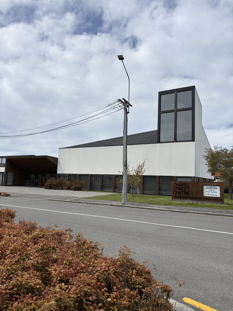
I walked this street today and a huge Mitre 10 takes up a large part of one side of the street. I checked google maps and the Mitre 10 has only been here since 2019 and before that it was the Sanitarium factory. There are a few houses on the other side of the street and they were mostly built in 1915 and 1920 apart from a couple that date from 1970s. The Golden Age Rest Home is now the Golden Age Retirement Village and it takes up a huge block of land. On the opposite side is the modern looking church. The old brick church was demolished after the earthquakes. The Reese Room is named after James Reese and houses an anti smoking group. They are a group helping people to give up smoking. I took screen shots of the church and Sanitarium factory from before the earthquakes.

Shadbolt Boulevard in the suburb of Woolston, Christchurch

Shadbolt Boulevard in Woolston – Formerly Staunton Street. Named after Cora Bessie Staunton (1902-1948). Re-named Shadbolt Boulevard. Named after Howard Leslie Shadbolt (d. 1999). Cora Staunton was the matron of the North Canterbury Hospital Board’s Jubilee Home 1938- 1948. At the time there was an entrance to the Home from the street. Named in 1958. Staunton Street was legally stopped as a road in 1998 when it became part of the Independent Fisheries’ landholding and was used only for access within the property. Independent Fisheries also purchased the former Jubilee Hospital site. Re-named in 2007 to honour Shadbolt who managed Independent Fisheries 1959- 1999.

A reasonable amount of information from the library website and I was surprised that it had information about the street. A few entries on Papers Past and the earliest entry in 1958 is difficult to read and the only part that I could read said that the street ran parallel to Bamford Street. Sewage was mentioned in 1965 and from 1966 onwards it was mostly ads and the land was described as heavy industrial. Independent Fisheries is mentioned a lot and they are still on this street. A nearby company was refused the right to take water from the river. A body was recovered from the river near here in the early 1970s and there were a few burglaries. In 1979 a car testing station for warrants and certificate of fitness was opened. The 1980s saw nearby residents complaining about the smell from the fish meal plant in the street. My sister-in-law has a geocache nearby on a walkway behind the factory called Stinky Corner. In 1948 a memorial to Cora Staunton was unveiled at the Jubilee Home.

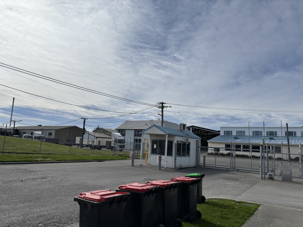
I obviously didn’t walk this street as it is fenced off and it wasn’t until I was researching Jubilee Street that I realised it had been a street. For some reason both google maps and Apple maps show it as a street. Apple maps doesn’t show it as a closed street but why I am I not surprised. Reminds me that I must check Apple maps to see if it still shows the Burnham Golf Course as being in Central Christchurch. Yes I get a lot of amusement from Apple maps. I went checking old maps and it isn’t on the map from 1930 but it does show up on maps for 1941, 1950 and 1958 but with no name. I don’t know how old the paper map for Christchurch that I own is but it doesn’t show this street as being a street. I have worked out that my paper map must be older than 2007 as it still shows NZ Post as being on Hereford Street in the building which is now the Council Buildings.

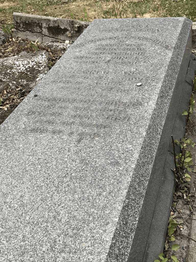
Captain William Charlesworth of Charlesworth Street in Woolston, Christchurch

William Charlesworth known as Captain Charlesworth lived in a house on Ferry Road called Saxon Villa. Saxon obviously had some meaning for him as he was the captain of a barque called Royal Saxon and one of his sons was called William Saxon Charlesworth. Captain Charlesworth died in 1875 from an axe wound which he received while watching his men cut down a tree. His friends were upset when the police stopped the funeral because there hadn’t been an inquest. Dr Frankish had signed the death certificate stating that the cause of death was erysipelas. I had to google it and these days it would be treated with antibiotics.

William Saxon Charlesworth was a civil engineer who died in Wellington in 1929. He is unlikely to be the William Charlesworth who was admitted to hospital in 1920 after cutting his throat but you never know as this William Charlesworth did recover.

Frederick Thoms Charlesworth died in 1891 aged 23 and he was a keen sportsman.

Captain Charlesworth was occasionally offside with the council and there was a land dispute at one stage.

Kotuku Crescent in the suburb of Woolston, Christchurch

Kotuku Crescent in Woolston and nothing on new or old library website. Kotuku is an Eastern Great Egret known as a white heron or Kotuku in New Zealand. Most houses were built in the 1990s with a few built a bit later.

It looked like a lovely street with nice gardens but a noise control officer was assaulted here in July this year. There was a house fire in 2021. The street sign plaques are missing at both ends of the street. There is a reserve and a playground on this street and the footpath is on both sides of the street. I visited the reserve as I was wanting to replace my sister-in-law’s geocache here but I couldn’t find the damaged one so I will have to go back and have another look. I liked this street.

Sweet Waters Place in the suburb of Woolston, Christchurch

Sweet Waters Place in Woolston – Named to continue the theme of street names in the Brookhaven subdivision. Developed by Enterprise Homes. Named in 1999.

A small amount of information from the library website and nothing that I can add about the name of the street. Most houses here were built in 2005 with a couple in 2000 and some in 2014.

The footpath was on only one side of the street and the houses and lawns were immaculate. Street plaque missing here as well. I didn’t take any photos as nothing stood out for me.

Teal Close in the suburb of Woolston, Christchurch

Teal Close in Woolston and nothing on old or new library website. It would have been named after the bird to keep within the theme of the rest of the subdivision.

Most houses here were built in the 1990s and 2000s and they are fairly large. The footpath is on only one side of the street and we know how much I dislike this. Nothing stood out for me on this street but the name plaque for the street is missing.

Delta Way in the suburb of Woolston, Christchurch

Delta Way and nothing on either old or new library website. I checked the council website and they seem to have changed the way you can search so I couldn’t find any information there. I suspect that it gets it name from a river delta.

The houses here were all built between 1990 and 2018 and none of them stood out for me. A neat and tidy but boring street. At least there was a footpath on both sides of the street.

My only photo is of the sign at one end of the street say Delta Way. It is the only one left in the subdivision as all the rest of them have been stolen. I have spoken with a city councillor and someone in the media about signs and plaques going missing and that they need to investigate scrap metal dealers. The situation hasn’t improved.