Waipara St in Cracroft – Named after the Waipara River. In a subdivision where the streets are named after rivers and sheep stations in North Canterbury. First appears in street directories in 1964.
A small amount of information from the library website and nothing that I can add about the name of the street. Most the entries on Papers Past were ads. The houses here were built in the 1960s and none of them stood out for me. The Waipara Playground was on this street and I liked the seat made out of a tree stump. I remembering finding a geocache here a few years ago. At the end of the street before it turned into Waiau St there was a colourful street pantry.
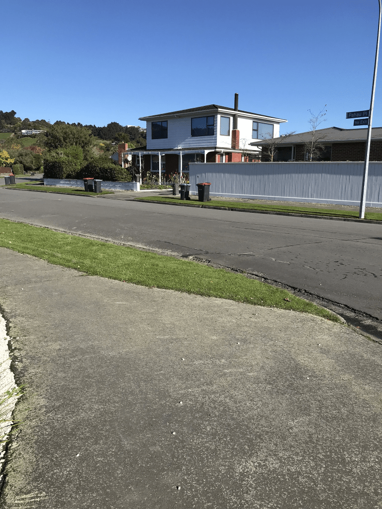
Pahau Place in Cracroft – Named after the Pahau River. In a subdivision where the streets are named after rivers and sheep stations in North Canterbury. First appears in street directories in 1964.
A small amount of information from the library website and nothing that I can add about the name of the street. The 1964 entry in Papers Past about streets in the area being named after rivers and properties in North Canterbury is a bit more detailed. The other entries in Papers Past were mostly ads for selling houses.
Most the houses here were built in the 1960s and many have been extended. They have either had a second story added or had a conservatory attached. Big sections on this street. At the end of the street there is a walkway through to Waipara Playground and Reserve. I did like a couple of the houses but I wouldn’t like all that lawn mowing.
Opihi St in Cracroft – Named after the Opihi River. In a subdivision where the streets are named after rivers and sheep stations in North Canterbury. [This name was a mistake by the Christchurch City Council as the Opihi River is in South Canterbury. Local residents say the street was intended to be named Omihi Street.] First appears in street directories in 1964.
A small amount of information from the library website. There was only a couple of ads on Papers Past for this street apart from a request from a builder wanting permission to build a block of lock up shops. He obviously didn’t get permission to build these shops. Most houses here were built in 1960s. This street didn’t really stand out for me but many of the gardens had an issue with wet and soggy grounds.
Hurunui St in Cracroft – Named after the Hurunui River. In a subdivision where the streets are named after rivers and sheep stations in North Canterbury. First appears in street directories in 1964.
A small amount of information from the library website and nothing that I can add about the name of the street. There was an article in 1964 about the names of streets in the new subdivision being named after rivers and properties in North Canterbury. The rest of the entries on Papers Past were mostly ads. I was amused by a couple of ads spelling Cracroft as Craycroft. Most of the houses were built in 1960s but I liked the house built in 1990s. The street couldn’t make up it’s mind if it was in Cracoft or Lower Cashmere.
A pleasant street and it was a pleasant walk on a nice day.
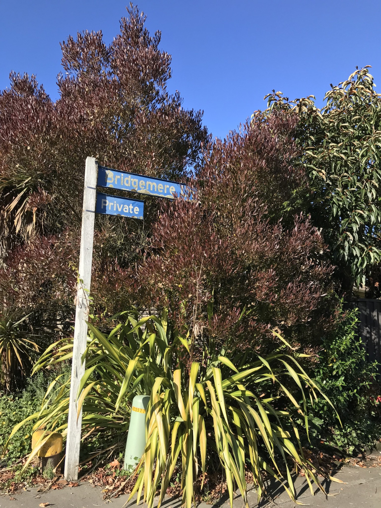
Bridgemere Lane in Cracroft and nothing on library website. This was a bit of a surprise as the houses here were built in the 1970s. I couldn’t out why this name for the street as I couldn’t find a connection to the Cracroft – Wilson family. There is a Bridgemere in the UK but none of the Cracroft – Wilson lived anywhere near this village. All the other street names in the area have a connection to the Cracroft- Wilson family.
A possible reason for the name is that there probably was a bridge over a ditch or a pool here as mere means lake or pool.
I didn’t actually walk this street as there wasn’t a footpath and was a private lane. I am surprised that I hadn’t already written about this lane as I had already walked Holmcroft Court a couple of years ago when The Old Stone House had an open day.
Hendersons Road in Hoon Hay – Named after William Henderson (1830?-1902). Henderson was one “of those engaged in farming or allied enterprises” who had roads named after them. He farmed at Creekside, Hendersons Road and was a member of the Halswell Road Board. Henderson’s Road is first mentioned in The Press in 1878 when tenders were invited for its formation. First appears in street directories in 1930.
A small amount of information from the library website and they seem to have muddled up the father and son. William Henderson senior died in 1902 aged 72. He was born in Scotland and was a builder. He came to New Zealand in 1863 on the ship Tiptree with his wife and five children. He helped build several early buildings in Christchurch including the railway station. He went to the West Coast for a while to look for gold. William returned to Christchurch in 1868 and farmed land at the back of the railway station. He then purchased Spreydon Farm on Lincoln Rd. Note Lincoln Rd went all the way to Halswell those days. He also had a butchery business in Sydenham. His son who was also called William owned Creekside and this would have been closer to Sparks Rd.
Papers Past had a couple of entries about the request by Mr Henderson to have the road formed. The Cashmere kennels on Hendersons Rd would have been at the Cashmere Rd end of the street. Several entries in the 1960s about the subdivision of Crown land known as Free Block. The subdivision was complicated by one half of the road being under city council and the other half under Halswell County. In 1960 a farm was purchased for State Housing and in 1971 the request to change the zoning of the farm land to residential lane was opposed. There seemed to be a lot of accidents on the corner of Sparks Rd and Hendersons Rd. They eventually built a roundabout but it now has lights. There were still at least one farm here in 1970s as a farmer complained about dogs killing his sheep.
There is one house here from 1920s but most houses were built in 1960s and 1970s. There are still Housing Corp houses here but the they go under a different name these days. I parked up at the car park at the Sparks Rd Wetlands and walked through the Wetlands to the Hendersons Rd entrance. There isn’t a footpath on this part of the road but the verge was wide enough to walk on. I had to walk fairly carefully as it was slippery and I didn’t want to fall into the ditch. On the corner of Hendersons Rd and Cashmere Rd there is an older house but technically this house is on Cashmere Rd. Between Cashmere Rd and Sparks Rd there isn’t any houses apart from this older house. The wetlands is on one side of the road next to farmland. There is also farmland on the other side of the road but a large part of it was under water. Between Sparks Rd and Halswell Rd is where the houses are. One side of the road has houses on only half the road and the other half is still possibly farmland. Near the Sparks Rd end there was a large house on a very large section of land. There are now houses being build on this land and it isn’t possible to see the large house any longer when you are driving past. Some of the houses had interesting and lovely garden decorations. Wish I could have taken photos. St Johns have a hub here. I couldn’t remember which house was the one that used to be decorated for Christmas and have open days for charities. This was over 20 years ago and the owners eventually moved to Blenheim. Near the Halswell Rd end there is a large house called Henderson Home where disabled people live. It used to be a private house and it became a home for the disabled when the owners sold up and moved to Australia. After a few years Henderson Home purchased the house next door and expanded. When I lived in the area I knew several people who lived in on this street but this was over 20 years ago. In recent years at least three roads have been developed off the west side of the street.
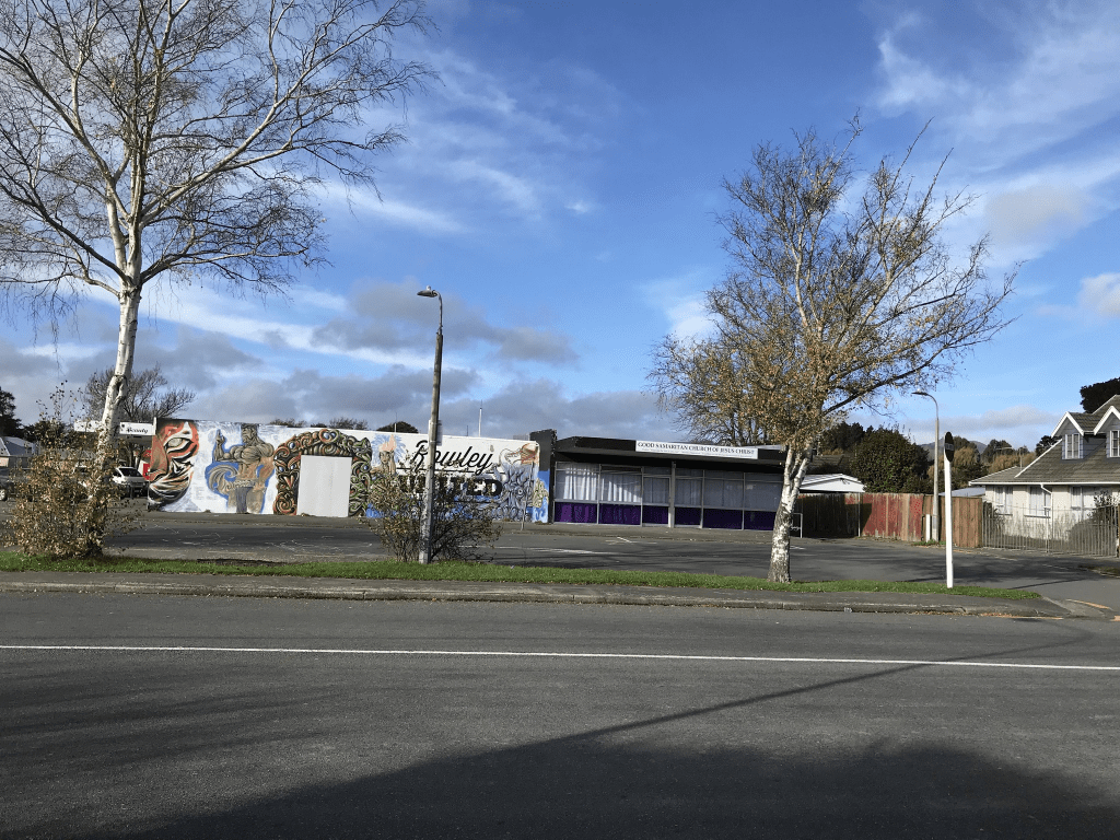
Rowley Ave in Hoon Hay – Named after the Rev. Thomas Rowley (1797?- 1877). Rowley was the son of the Rev. Richard Rowley of Middleton Scriven, Shropshire. He had been Dean-designate of
Christchurch Cathedral but never came to take up his position. He bought several blocks of land, among which was Rural Section 85, 200 acres on Riccarton Road. His son, Thomas, arrived in Canterbury in 1853 and claimed the land on behalf of his father. He built a cob cottage, Middleton, which is now the site of Middleton Grange School. First appears in street directories in 1962.
A reasonable amount of information from the library website. I got a bit confused with all men called Thomas Rowley and many of the family trees on Ancestry website were equally confusing especially the one who claimed that they can trace their family tree back to Adam and Eve. There is a wikipedia page for the family. The first Thomas Rowley was born in 1740, his son Richard Rowley was born 1767 and next Thomas Rowley was born 1796 and died 1877. The Thomas Rowley who came to New Zealand was born in 1831 and died in 1903. His brother John Cotton Rowley also came to New Zealand. Thomas came to New Zealand in 1853 on the Minerva and returned to England in 1863. In 1874 he gave ferrets to the Canterbury Acclimatisation Society and they were released into high country of Canterbury. Thomas Rowley owned a lot of land in Canterbury including most of the Square. He named his property Middleton and built a cob cottage on the land. He sold the property to Charles Bowen when he left New Zealand. Charles Bowen renamed it Middleton Grange.
Information from Papers Past mentions new subdivision in 1960. Many entries were in 1972 when there was a ballot for crown sections.. Same year there were tenders for building new kindergarten, new school and new shops including a Post Office. The Rowley Ave Community Hall wasn’t actually on Rowley Ave but on McCarthy St. The Chapel gets a mention from 1977 onwards. At least half the houses on this street were Housing Corp houses. The NZ Labour Party held meetings at 59 Rowley Ave and that will because there was a connection to the Kirk family. I can’t remember if John Kirk lived there or if his mother Ruth Kirk lived there. I do remember meeting Ruth Kirk and John Kirk’s ex-wife at this address. There were entries in the 1980s that I remember. The kindergarten was burgled in 1983 and I was on the Kindergarten committee those day and they made such a mess. In1986 several homes were raided by the police looking for weapons and the children from these homes were badly behaved that day at the kindergarten. In 1986 there was an explosion in a house and five youths were hurt. They had been doing something called huffing. In 1987 the Post Office was closed and I had occasionally worked at this Post Office.
I walked this street today and it hasn’t changed that much from when I had lived nearby. There is still a chapel as well as the school and kindergarten. There have been a few changes in the shops since I knew the area. The valuation website said that all the houses were built in 1960s and 1970s. Recently some of the Housing Corp houses have been demolished and replaced with two or three houses on the sections. There used to be a large house which if I am remembering correctly had disabled people living there. I couldn’t tell if it is still used for the same purpose. There is a powerbox in the process of having street art painted on it so I will have to go back to see it when it is finished.
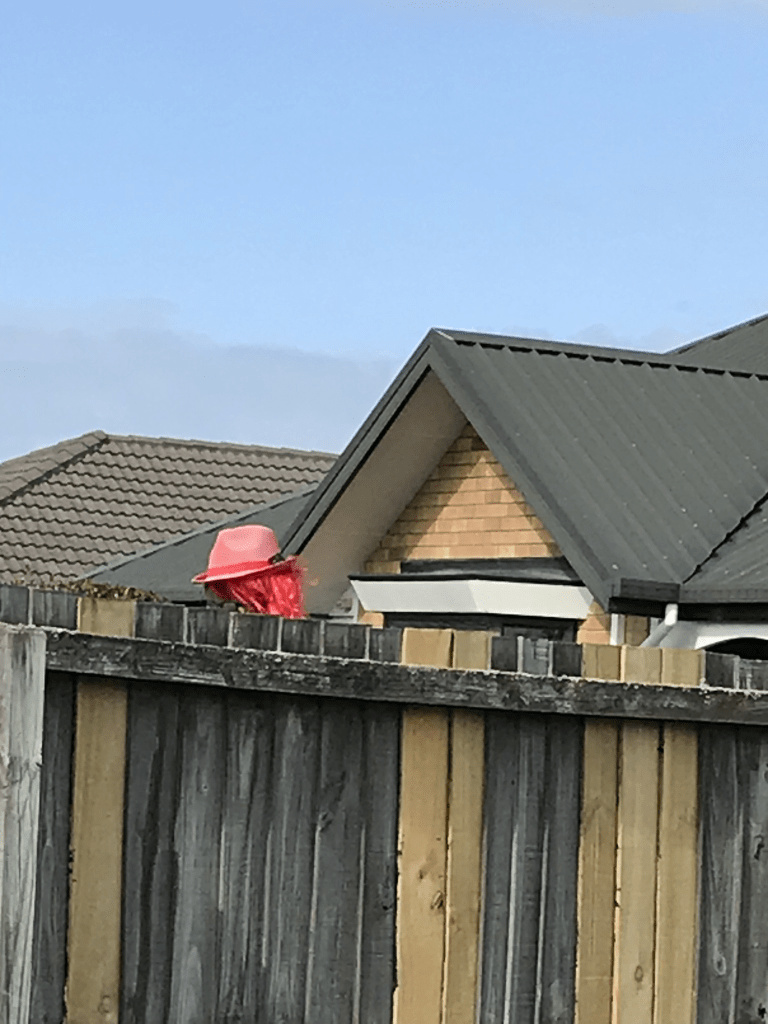
Kintyre Drive in Broomfield – Named after Kintyre, a peninsula situated on the south west coast of Scotland. First appears in street directories in 1995.
A small amount of information from the library website and nothing that I can add about the name of the street. I actually walked this street back in April when I was geocaching. All the houses here were built in the 1990s and most are made from brick. A pleasant looking street and there were some nice gardens. At the end of the street there is a walkway to Masham Reserve Playground. In a garden near the walkway there was an interesting item. It looked like a mannequin wearing a wig but couldn’t see it properly because of a high fence.
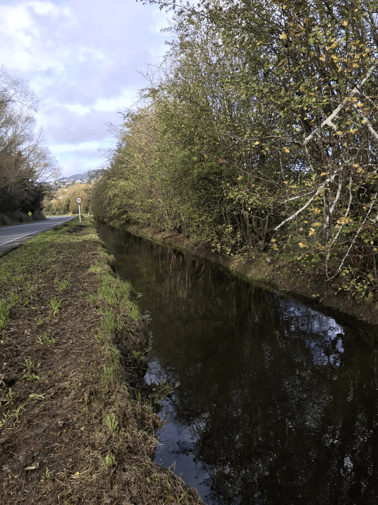
Kennedys Bush Rd in Halswell – Formerly Quarry Road. Named because it is the route to the Halswell Quarry. Also named Paterson Avenue. Named after Edward Paterson (1870?-1956). Re-named Kennedys Bush Road. Named after Thomas Kennedy (1819- 1881). Originally a track which was used by bullock drays to draw firewood etc. out of Kennedy’s Bush and Hoon Hay Bush. Quarry Road first appears in street directories in 1903. By 1914 it has the alternate name of Patersons Avenue. Paterson, a Old Tai Tapu Rd quarry manager, is a resident. The two names both appear in street directories until 1958 when it becomes just Paterson Avenue. Kennedys Bush Road first appears in street directories in 1939. Paterson Avenue appears in street directories until 1970 when it is incorporated into Kennedys Bush Road. Kennedy purchased eleven hectares of native forest there in 1856.
A reasonable amount of information from the library website. There were several entries for Quarry Road and there were many different Quarry Roads in Christchurch. The cost for forming the road in 1874 was £220. In 1890 the Halswell Quarry Company complained about the state of the road. In 1906 Mr Pitcaithly was granted permission to erect telephone poles on the street. In 1917 there was a death notice for Alfred Streeter and Thomas Kennedy was married to Sophie Streeter. In 1928 there was an article by F W M Blowers about when he arrived in New Zealand in 1863. He stayed with the Mumford family as he found out that Thomas Kennedy had moved from the bush that was named after him. He had moved to the foothills near the Halswell Quarry which was known as Brittan’s Quarry those days. In 1948 a house occupied by E W Gilder was broken into. In 1964 the Halswell Post Office Telephone Exchange is to be built on the Post Office site on Quarry Rd. Note I previously found articles saying that the Post Office site was on corner Paterson Ave and Sparks Rd. Both Quarry Rd and Paterson Ave seemed to be used for the road for several decades. The earliest entry that I found for the Paterson Ave name was 1914 where a building site was for sale. Both Quarry Rd and Paterson Ave ran from Sparks Rd to the bottom of the hill. Kennedys Bush Rd seemed to have been used for the hill part of the road from as early as 1927. The reserve which is now Halswell Quarry Park was suggested in 1953. Residents in 1955 requested a footpath for the road. There was a proposal in 1979 to close Kennedys Bush Rd at the intersections of Sparks Rd and Halswell Rd but this was rejected. In 1910 there was an event called The Battle of Halswell which took place above Kennedys Bush Rd. It was a mock battle staged for the visit of Lord Kitchener.
I walked this street in two parts. I walked the hill part earlier in the week and then the flat part yesterday. Houses date from 1920s onwards. There was a house built in 1920 and another built in 1930 but I couldn’t see them as they were down long driveways. Being a long street there was a variety of building styles. A few houses were looking rundown and a couple looked abandoned. Starting from Sparks Rd end then is a block of shops, a bit further along there is Halswell School. Near the school there is a block of cottages that look like pensioner cottages. Houses are also being built where there used to be a tennis court. Once past Glovers Rd there used to be houses on only side of the road but now there is a huge subdivision on the other side of the road. A huge number of trees have been cut down because of this subdivision. Just before the start of the hill there is the flat part of Halswell Quarry Park. There are a few entrances to the Halswell Quarry Park on this road. At the top of the road there used to be an entrance to Kennedys Bush Track but it is blocked off at the moment. I hope that they aren’t planning on building more houses on the track. When I was in a tramping club we used to occasionally walk this track and there used to parking at the top of the road. The track also used to start further down the road but there are now houses here.
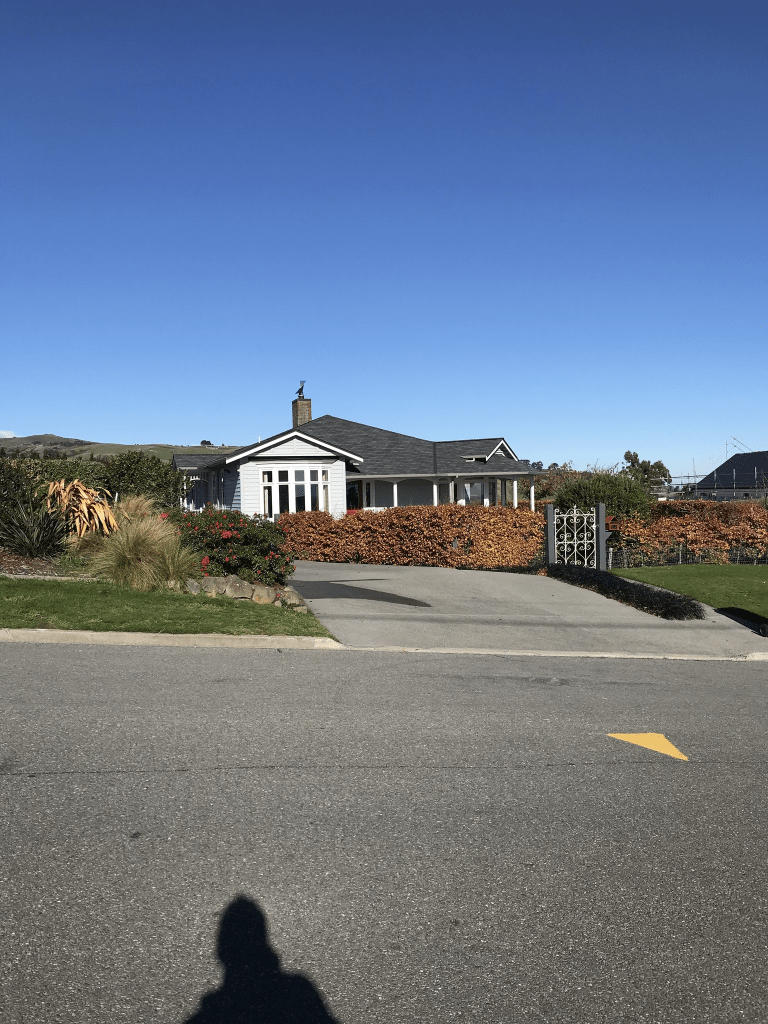
Glovers Rd in Halswell – Named after Hawley William Glover (1836?- 1910). Glover was a farmer of Halswell. Glover’s Road is first mentioned in The Press in 1877.
A tiny amount of information from the library website. Papers Past didn’t have as many entries as I expected. First mention was in 1877 about reforming the road. In 1931 a William Rogers Jackson who owned a farm of 52 acres was declared bankrupt. In 1954 there was a death notice for Walter Streeter. Note Thomas Kennedy was married to Sophia Streeter. Mr R Caesar had a farm on the corner of the street near Halswell Rd. In 1957 there were sections for sale plus a big section was for sale in 1975. In 1982 the farmlet belonging to E J Adams was for sale. In 1974 there was an application for a subdivision by Charles MacKay Usher.
Hawley Glover came to New Zealand in 1860 in the ship Clontarf and in 1861 he married Fanny Craythorn. They possibly had three children but in 1865 Hawley Glover put out ads to say that he isn’t responsible for debts contracted in his name by his wife. The story with his wife got very interesting as she was convicted of bigamy in 1868 as she married Robert Gibbs while still married to Hawley Glover. In between marrying Hawley Glover and Robert Gibbs she had a child to Henry Gordon. Henry Gordon died in 1866 and she claimed to be Henry Gordon’s widow. She had a daughter in 1868 and the entry on Papers Past said that it was the first birth in Wellington Goal.
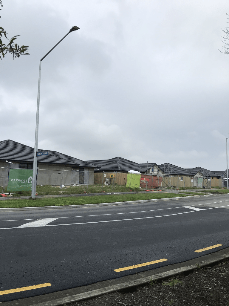
At this stage there are only 34 houses here but there are many sections for sale. The houses cover all decades between 1950 and 2023. It was interesting walking this road to see all the changes. I have frequently driven along this road when going to Kennedys Bush for walking or geocaching. The houses used to be only on one side of the road while the other side had at least two farms plus a cattery called St Claws. I have watched them cutting down the trees and for a while recently it was difficult to drove down the road as they were building a roundabout because of the new subdivision. I hate trees being cut down.