Reservoir Lane in Hillsborough – Named because it is next to a Christchurch City Council reservoir. Named in 2006
A tiny amount of information from the library website and the developer needs to get his eyes tested as it isn’t next to the reservoir. The reservoir isn’t too far away but the reservoir is actually at the end of Stonehaven Terrace.
Valuation website said that there are 6 properties here but at this stage there are only 2 houses that have been built. The houses are huge. Great views but I wouldn’t like to live here. Google maps show a sign saying Reservoir Lane but yesterday there was only one sign saying private lane. There is another sign that says residents and delivery vehicles only. The footpath was only on one side of the narrow street.
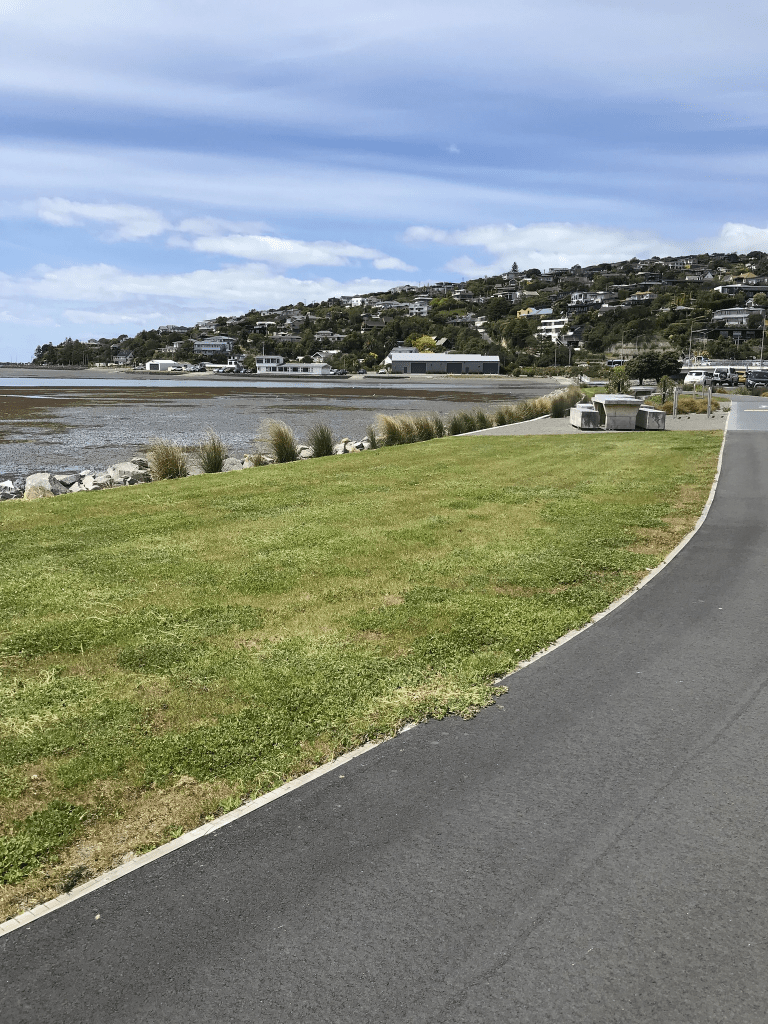
Main Road in Redcliffs, Clifton, Mt Pleasant and Moncks Bay – A continuation of Ferry Road after Ferrymead Bridge through to Sumner. First appears in street directories in 1910.
A tiny amount of information from the library website. I ended up looking at several older maps for this street. In earlier maps the road from the Ferry Road Bridge to The Causeway was called Christchurch and Sumner Road. The Main Road was mostly just in Redcliffs and from Redcliffs to Sumner much of it was called the Sumner Causeway. When looking at Papers Past most entries for Main Road were ads and death notices. Starting at the Sumner end there is Peacock’s Gallop and this was mentioned as early as 1886 when there was a slip on the road known as Peacock’s Gallop and the workmen soon cleared the obstruction. In 1905 the Hon J T Peacock said to the Tramway Board that he was in favour of widening the road the went under the Sumner cliffs. He then stated that he used to gallop along that part of the road in order to get over it as fast as possible and that it used to be known as Peacock’s Gallop. This was in reply to the Tramway Board who said that some 7 million passengers had been carried on the trams over Peacock’s Gallop during the last 16 to 17 years and that there had only been one disruption due to falling rocks. In 1915 the construction of the Sumner Causeway was started and this causeway was for trams to run from Shag Rock corner to the viaduct. In 1916 the new Sumner Causeway was opened and this ran between Shag Rock corner and the Tram Bridge and this removed the headland danger. The viaduct and Tram Bridge would have been other names for the McCormacks Bay Causeway. In 1928 there was opposition to the forming of a road next to the tramway at the front of the Sumner cliffs. There was very little mention of the part of the road that went from The Causeway to Ferry Rd. Redcliffs School was opened in1907. The Redcliffs Methodist Church was opened in 1926 and the new Presbyterian Church was opened in 1927. St Andrews Mission Church was also mentioned. The library was mentioned as early as the 1920s. Several sections were available in 1913. In 1959 there were moa hunter traces found in the garden of a house. This road seemed to have a lot of accidents especially ones where cars ended up in the estuary.
The houses here cover every decade from 1905 to 2023 with most built in 1970s and 1980s. Too many styles to describe ranging from boring to fairly quirky.
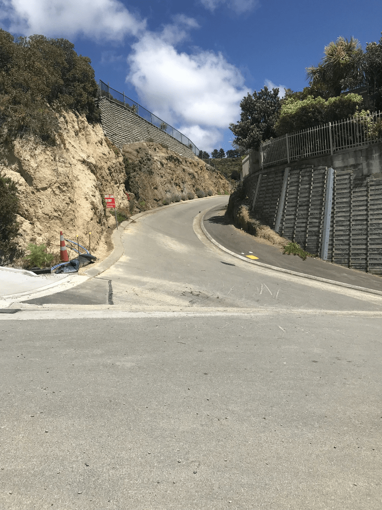
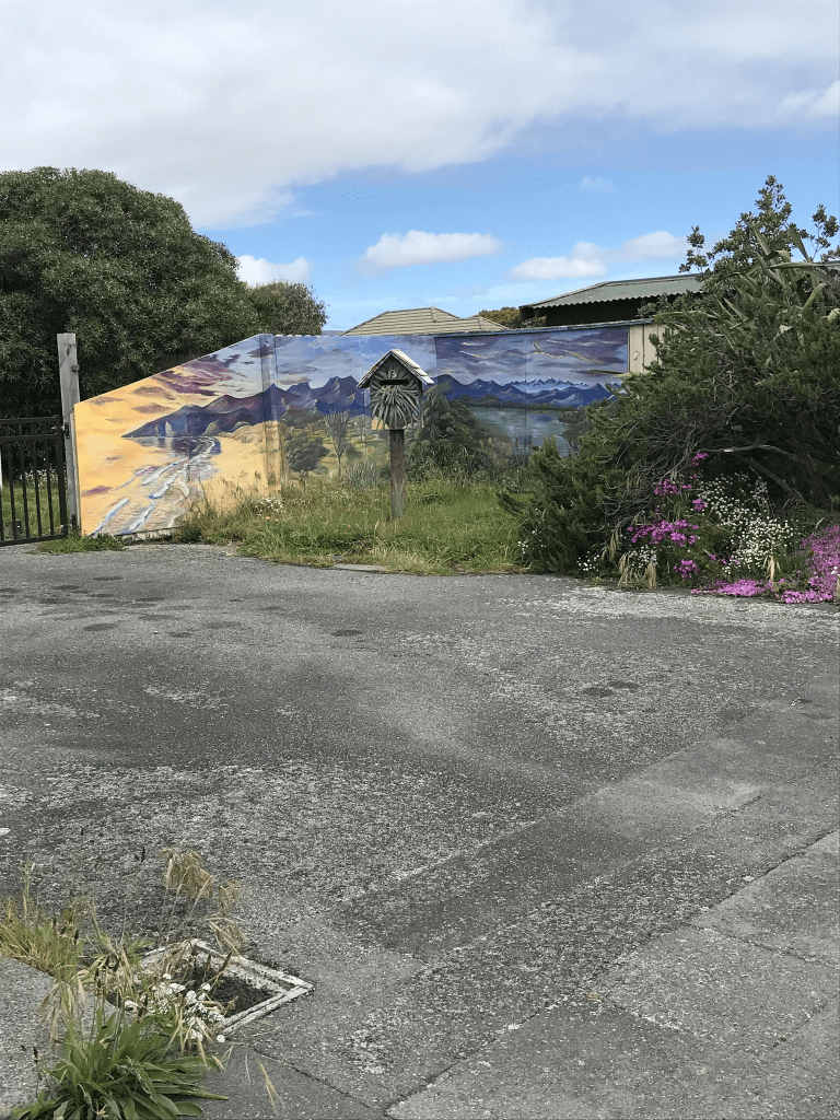
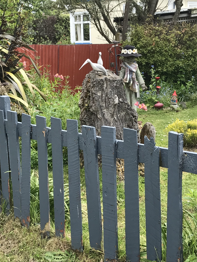
I took the bus to Sumner so that I could walk this road. The road starts by the Sumner Surf Life Saving Club and there is a walkway that I could follow. There is the estuary on one side and a cliff face on the other side. The cliff face is where Peacock’s Gallop was and I remember when there was a nice grassy reserve here. This would have been where the original trams used to run. It is now covered with rocks from the cliffs which fell during the earthquakes. Then you come to the Christchurch Yacht Club by the estuary side with a few houses on the other side. From the yacht club onwards it is mostly houses until you come to the shops. On the other side there were houses plus Barnett Park. The supermarket is now closed. I managed to resist popping into the library where they were having a book sale. A few more shops before there are more houses. On the other side there were a few houses including a big house that is called Brigadoon. It used to have the most wonderful garden decorations but they are no longer there. There is a large empty section where the school used to be. The school is now on the other side of the road. Just before you get to the Moa Cave there used to be a bright yellow house but it was destroyed in the earthquakes. The original owner of this house used to hold charity functions in the cave on his property and he was kind enough to show a group of us around the cave. I then walked across the Causeway to rejoin the Main Road. From this part of the road the estuary is on one side with a mixture of cliffs and houses on the other side. It is then Scott Park and the Mt Pleasant Yacht Club just before you reach the Ferry Road Bridge. The cob cottage now has a permanent cover over it and the cottage looks very sad. I found an article from 2018 that said that the cottage will be repaired. This obviously hasn’t happened and it looks worse now than what it did after the earthquakes. One interesting item that I came across when reading Papers Past was that a local group wanted a causeway to be built from Shag Rock to the Southshore Spit. This obviously didn’t happen.
When I was at High School I used to occasionally stay with a friend who lived on this road. The house that she lived in was originally a shop before it became a private house. After the earthquakes it was eventually demolished and a new house built. When I was a teenager I also knew a few other teenagers who lived on this road.
The Causeway in Redcliffs – In the 1880s, tramway companies put tram tracks across the waters at the entrance to McCormacks Bay. In the Depression of the 1930s, one of the major public works programmes was to fill in the area under the tracks and put a roadway on top
A small amount of information from the library website. This is the short stretch of road that goes across McCormacks Bay and I have always known it as The Causeway. Google maps have it as Main Road yet I have found articles as late as 2011 calling it The Causeway. I do have an AA map of Christchurch which calls it Main Road but I remember getting this map in about 2019 to help me with my street project. My original idea for my street project was to walk a street and then highlight it on the map but I obviously decided to do my street project a bit differently.
The tramway was extended to Sumner in 1888 and until that date it finished at the Heathcote Bridge. There were two parts of the tramway that were called causeways but I am only talking about the McCormacks Bay tram causeway. Not much information on Papers Past about the tramway but I do have to mention a drowning here that happened in April 1906 as the man was my great, great grandmother’s second husband.
Lots of articles in the 1930s as this is when they widened the causeway so that it could take cars. The first step was to extend the old spur that jutted out from the current road to join the causeway. They also had to get permission from the Lyttelton Harbour Board for the construction. Part of the existing tramway causeway was over bridges and McCormacks Bay had at least two outlets to the estuary. There was work for 300 men to help construct the road alongside the tramway on the seaward sea of the causeway. Note the men employed were relief workers and relief workers were unemployed men who were paid to do this work. From some of the articles that I have read it sounds like they were paid less than normal workers. There were several photos in Papers Past and they were interesting. There were two groups opposed to this road being formed. One group opposed the cost of the project. The second group were wanting to build Christchurch Port at McCormacks Bay and the Causeway was blocking access to the bay. Obviously Christchurch never got a port. The tramway Company had a quarry at McCormacks Bay and this is where they got the material to build the road. Before this road you had to drive around McCormacks Bay and in 1913 a car managed to miss the turn off and drove onto the tramlines. It was foggy conditions. Over the years several cars have managed to drive off the Causeway and into the estuary. Speed was usually the problem. In 1920 a moa bone that had been found here when the tramway was built was gifted to the museum.
In 1978 the Causeway was widened plus they added a footpath. A cycleway was considered unnecessary. It obviously now has a cycleway as it is part of the Coastal Pathway Project.
Yesterday when I walked here I ended up walking with another person and we had a great chat. She was amazed that I had caught a bus to Sumner just so that I could walk home to Addington.
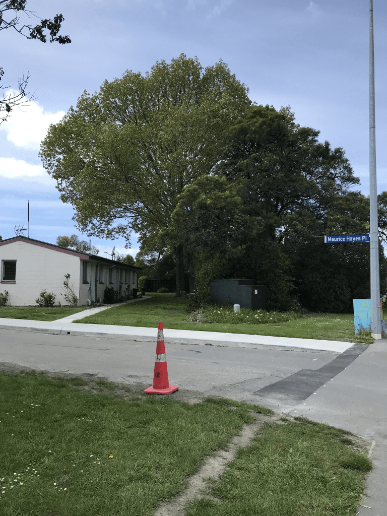
Maurice Hayes Place in Woolston – Named after Maurice Bernard Hayes (1913- 1994). Hayes was town clerk for the Christchurch City Council during the 1960s and 1970s. A complex of 19 units
built for the elderly in 1975. First appears in street directories 1977. Information supplied in 2007 by Richard Greenaway.
A small amount of information from the library website. Papers Past only had death notices for the street. There is still 19 units here and it is still social housing.
I didn’t actually walk this street but it did have a footpath. I never feel comfortable walking such streets and if there are still elderly people living here then I don’t want to frighten them. So many pensioner cottages now seem to have other residents rather the the elderly and in those cases I don’t feel safe walking these types of streets.
Tidal View and there wasn’t anything on the library website for this street. I would have put the street in Ferrymead but some websites have it in Woolston as well. I couldn’t find out when the street was named and formed but it was possibly around about 2008.
Waters Edge Apartments were built in 2008 on the site of the Ferrymead Tavern. The Ferrymead Tavern was originally called the Heathcote Arms and I found entries on Papers Past as early as the 1880s. The Ferrymead Tavern’s address was 1099 Ferry Road. Several articles about the area included bodies being found in the estuary. Obviously leaving a pub drunk and being so close to water wasn’t a good combination. The Waters Edge Apartments were seven stories high and had 34 apartments. The developers had wanted the building to be 14 stories high. The building was badly damaged in the earthquakes and eventually demolished. Many locals were pleased about this as the building was considered to be an eyesore and not suitable for the area. I don’t recall ever having seen these apartments but I did leave New Zealand in 2009 to live in the UK for 5 years. I also can’t visualise the Ferrymead Tavern and I couldn’t find any images online.
The street has a joint cycleway / walkway and there is a fitness gym and an outdoor shop at one end and a bar / cafe at the other end. In the middle it is a building site and this is a development to replace the Waters Edge Apartments. The new apartments are supposed to be restricted to being only 4 stories high but it wouldn’t surprise me if this is ignored.
The name of the street is obvious as it overlooks the estuary and today it was a short detour for me on my walk from Sumner to Addington.
Edited to say that after looking at old maps that Tidal View was part of Humphreys Drive and Humphreys Drive was altered
Bridge St in New Brighton – Named after Admiral Sir Cyprian Arthur George Bridge GCB (1839- 1924). Bridge was a British Royal Navy officer. This name continues the theme of naming streets in New Brighton after British Admirals, explorers and fighting seafarers. First mentioned in The Press in 1911. First appears in street directories in 1919. [The street was formed long before the South Brighton bridge was opened in 1927.] Information supplied by Bob Pritchard, subdivisions officer, Christchurch City Council.
A small amount of information from the library website and Bridge St seems to be the boundary between New Brighton and South Brighton.
There were thousands of entries on Papers Past as there were so many Bridge Streets in New Zealand. I tried narrowing it down to four local newspapers but again there were too many entries so I limited myself to using various combinations of Brighton or New Brighton or South Brighton. There were several entries between 1924 and 1927 about the building of a bridge and in October 1927 there was the official opening of the bridge. In 1977 and 1978 there were several entries about a new bridge to replace the old one. The council wanted it to include a footpath and cycleway but the Roads Board were against this. Several entries about a church hall on the corner of Estuary Road and Bridge Street as early as 1930s and as late as 2007. It is still there but no longer a cross on the building and it is called The Bridge. There was also a cafe here but it didn’t seem to be open when I walked past on Monday. I googled and it seems to be fairly new. In the 1960s there was a business called Randall Motors and in the 1980s it was called Norm Bedford Motors. It is now a petrol station. Between 1912 and 1935 there were frequently sections available with eleven sections available in 1920. Many of the early houses were baches ( holiday homes) and this was true for much of New Brighton in the early days. I n 1975 there were 29 elderly persons housing units planned for Bridge St. The council wanted one of the units to be reserved as a holiday home but this request was refused. There were 700 people on the waiting list for a pensioner cottage.
Several entries for a Gasson family who lived on this street and they had a son killed in WWI. The father Herbert Arundel Gasson died in 1931 after hitting a train at Washdyke. The inquest mentioned that he was driving at high speed and that he ignored the train whistles warning him of a train coming.
Several scrub fires which was a common theme in the Brighton area. The Bridge Street Reserve had a few mentions and it used to be a plantation. This explains my memory of trees and I had a look at street view and in 2007 there were still trees but the street view from 2012 shows a complete slaughter of the trees. I hate trees being cut down. My map says that it is now called Bridge Reserve.
A general store was for sale in 1946 after the death of the owner. I remember a shop being here but it is now an empty section called Common Ground. I checked street view and there was a cafe here in 2012 but by 2019 it had been demolished.
The Beachcomber Motels were brand new in 1967 and the buildings are still there but look dreadful. Apparently people are still living here under the name of an organisation called a community housing trust. Several birth and death notices and I even found my father’s death notice. He only lived here for a couple of years before dying at a fairly young age. He was in a back flat and there was another ex-Lyttelton person living in the house in front of the flats. I can’t remember her name but have a feeling that she was a distant relative. It was a long time ago.
There is such a variety of houses and buildings on this street and the oldest house from the 1920s hasn’t been well maintained. Most houses are from between 1960s and 1970s with another big group built in 2014 and 2015. I did have a good look at the empty section called Common Ground but they had two book fridges so of course I stopped. The street starts at Marine Parade and finishes at the roundabout at Breezes Rd, Dyers Rd and Anzac Drive. I hadn’t realised that Anzac Drive started at this roundabout. I actually finished my walk at the Bridge Reserve as I didn’t feel safe walking across the bridge. I possibly would have been OK but the traffic seemed to go fairly fast here.
Drake St in New Brighton – Named after Sir Francis Drake (1540?-1596). This name continues the theme of naming streets in New Brighton after British Admirals, explorers and fighting seafarers. Named on 26 February 1964. First appears in street directories in 1966. Date of naming supplied in 2000 by Bob Pritchard, subdivisions officer for Christchurch City Council.
A small amount of information from the library website. Mostly just death notices on Papers Past. When looking at Papers Past I found lots of entries for Drake St going back as far as 1914 so checked old maps and I couldn’t find a Drake St plus Papers Past said that it ran off Estuary Rd. I checked information on library website for the nearby streets and found that Falcon St used to be named Drake St.
This street has only been in existence since 1960s but there are at least two houses that date from 1920s. The street was probably built around the original houses.
The street looks fairly rundown but one house looked looked fairly modern.
Bellamy Ave in New Brighton – Fox Street was incorporated into Bellamy Avenue. Named after William Henry Bellamy (1858- 1923). Bellamy was a coachbuilder with Messrs Boon & Company. He served on the New Brighton Borough Council as a councillor over a period of 21 years. He also served as mayor. “He was responsible for the success of the negotiations which ended in the purchase of necessary land connecting Estuary Road with Fox Street, and the Council decided to name the road “Bellamy Avenue” in his honour”. Fox Street first appears in street directories in 1936, running off Pine Avenue. It was incorporated into Bellamy Avenue in 1954
A reasonable amount of information from the library website. Reasonable amount of information from Papers Past and there were several Fox Streets in New Zealand. William Bellamy’s obituary in 1923 mentioned Bellamy Ave being named after him. I found Fox St mentioned as early as 1892. Several mentions between 1916 and 1918 about extension to Fox St. Fox St was on a map from 1922 but not Bellamy Ave. There was an opening ceremony in 1923 at McClinlock’s Store on Estuary Rd. In 1926 Mr D McClinlock asked for permission to erect a petrol bowser at his store. Permission was granted. In 1954 there was a tiny entry saying that Fox St was changed to Bellamy Ave as the two streets were practically continuous. There was an article in 1922 about New Brighton which said that Fox St was one of the earliest streets in New Brighton.
I wasn’t sure if I liked this street or not. The houses here date from 1920s to 1990s but the one that I really liked is from the 1940s. I am assuming that it has been altered as it definitely isn’t a typical style from the 1940s. There was also a cute cottage that I liked. There is a very definite kink in the street here and it is obvious it was originally two different streets.
Blake St in New Brighton – Named after Admiral Robert Blake (1599-1657). Blake was also an English parliamentarian. This name continues the theme of naming streets in New Brighton after British Admirals, explorers and fighting seafarers. First mentioned in The Press in 1912 when the New Brighton Borough Council decided to recognise it as a private street. First appears in street directories in 1916. “False assumptions”, The Christchurch Mail, 16 February 1999, p 15
A small amount of information from the library website and the link about the article False Assumptions didn’t work so I will have to visit the library. I probably didn’t get as much information from Papers Past as I could have but there were several streets with the same name including ones in Rangiora and Greymouth. The usual death notices plus several sections for sale between 1914 and 1920. A couple of interesting articles and one was about a missing 14 year old boy in 1948 and he was eventually found in Invercargill. The other article was in 1933 and a resident on the street had in her possession a violin that was possibly a stradivarius.
I had been geocaching in the area today and I then walked a few streets. At the reserve end of the street there is a huge empty section so I checked google maps for 2007 and it looks like it was a big block of social housing. The houses on this street range from 1910 to 2018 with a large number built in the 1970s. I liked this street as there were some quirky features with some of the houses. There were some ordinary looking houses as well. I was pleased that the older houses were looking in good condition. There was an art deco house which looked like it could have been interesting but it was almost impossible to see from the street. Some fun gardens as well. I am fairly sure that I knew some people who used to live on this street but don’t know if they still live here. Last time I saw them would have been the ex-husband’s 70th birthday as they were his friends.
Sturdee St in South New Brighton – Named after Sir Frederick Doveton Sturdee (1859-1925). Sturdee was the flag officer of the squadron sent to avenge the destruction of two British cruisers by the German Admiral Graf von Spee in 1914. He became Admiral of the Fleet in 1921. This name continues the theme of British Admirals, explorers and fighting seafarers used for street names in New Brighton. First mentioned in The Press in 1917 when land is advertised for sale there. First appears in street directories in 1940.
A reasonable amount of information on the library website. There were lots of entries on Papers Past but only a few were for this street. Auckland, Wellington and Dunedin also had streets with the same name. The sections on this street were all sold by 1919 but for some reason the owners weren’t allowed to build. In 1932 the council started to form the street and in 1933 relief workers were building the footpaths. As a result at least one owner of a section decided to build on his section. Over the years there were a few scrub fires on the street. There were the usual death notices. The letter to the editor in 1957 about the street signs amused me. Apparently at the Marine Parade end of the street the sign said Sturdee St but at the other end it said Sturgee St.
This street only had 9 houses and they were built in 1940s and 1950s. The street had a very rundown look about it and it didn’t appeal to me.