Jarrow Place in Halswell – Probably named after Jarrow, a town in the north-east of England. In the Oaklands subdivision. First appears in street directories in 1968.
A tiny amount of in information from the library website and the new library website says Probably named after Jarrow, a town in the county of Tyne and Wear in the north‐east of England.
The developer might have been a Catherine Cookson fan but I doubt it.
Very little information on Papers Past. In 1962 the water mains and services were connected. A few ads and a couple of death notices.
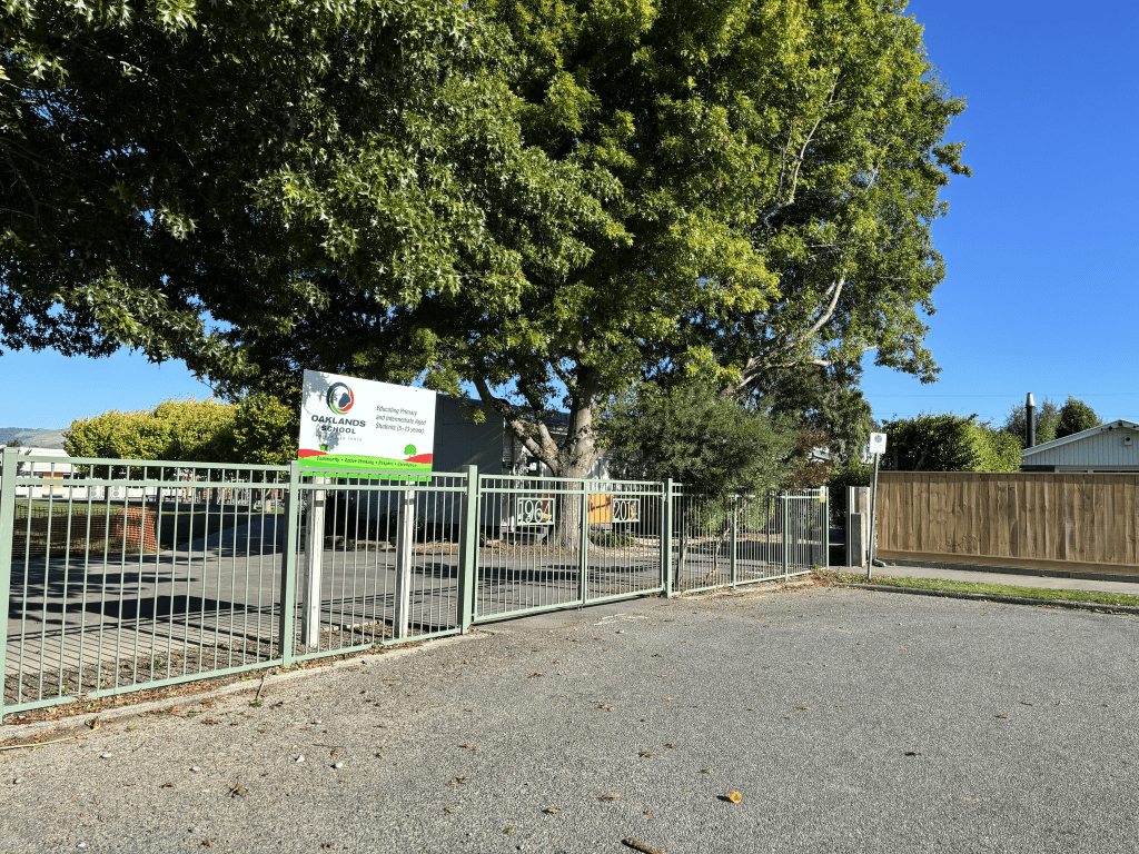
It is a small street with a back entrance to Oaklands School. Most of the houses were built in the 1960s and the school gate had the years 1964 to 2014 on them. None of the houses stood out for me and I imagine that parking here would be a nightmare at the beginning and end of the school day.
Tomes Road in St Albans – Named after Thomas Bennett Tomes (1821?- 1875). Tomes, a grazier, bought Rural Section 276, 50 acres in Papanui Road. His daughter, Emma, married John Stanley Monck (1845- 1929). A Papanui war memorial street. First mentioned in the Star in 1882 and first appears in street directories in 1892.
A small amount of information from the library website. Thomas Bennett Tomes died in September 1875 at Scotstown aged 54. His wife died October 1875. I found another Thomas Bennett Tomes who died in 1945 and he was the grandson of the other Thomas Bennett Tomes. The ancestry website’s family trees weren’t much help as they had too many mistakes. Several had Thomas living in the UK in 1881 which was a few years after he had died.
The earliest entry that I found in Papers Past was in 1887 and in 1888 there were complaints about the state of the road. I found the street name spelt as Tome’s Rd and Tomes’ Rd and possibly Toome’s Rd. In 1895 there was a bakehouse for let. In 1898 the Avon Road Board received correspondence asking if they were planning to rename the street. They replied that as it was one of the first streets in the area that they wouldn’t be renaming the street. There were sections for sale in 1898. In the 1910s it was mostly war information. In 1924 there was an application from residents concerned for the permission to lay out the new road which would be an extension of Tomes Rd. In 1925 there were sections for sale in the Tomes Rd extension. From 1930s onwards there were many entries about the best gardens competitions. The 1950s saw articles about Rutland St to be extended to Tomes Rd. A few complaints about this extensions not being done in time for the opening of Paparoa St School. There was a back entrance to the school om Tomes Rd. The extension was finally finished in 1961. There was a massage parlour on the street in 1976 and the owner claimed that her staff weren’t doing extras for the clients. I recognised a couple of surnames connected to this street and in 1975 I recognised a Lyttelton name. Hugh Collett got engaged to a girl who lived on this street. We used to travel in the same train carriage when going to high school.
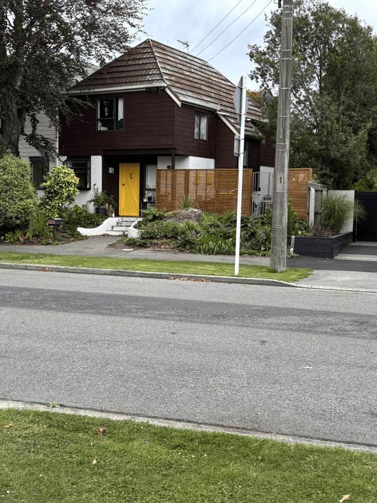
I walked this street on Tuesday afternoon and made the mistake of doing this at the end of the school day. The street was full of parked cars from the parents and some were badly parked. Don’t get me started about cyclists on the footpath. The houses covered every decades from 1920 to 2024. Most houses were built in the 1920s, 1970s and 1990s. There was a wide variety of styles and there were some lovely older houses. I started my walk at the Rutland St end where there is the Rutland Reserve. Next to the reserve there is the Paparoa Primary School. It was a pleasant tree lined street but the school parking puts me off. I managed to get a couple of photos of houses that were a bit quirky. The war memorial street plaque was at the Papanui Rd end of the street.
Scotston Avenue in St Albans – Formerly Worcester Street. Named after Worcester in England, the county of origin of the early landholder, Thomas Bennett Tomes (1821?- 1875). Re-named Scotston Avenue. This was derived from Scottston or Scotstown, the name given to the block of land when owned by William Thomson (1818-1866). Tomes, a grazier, bought Rural Section 276, 50 acres in Papanui Road. He was formerly of Cleeve Prior, Worcestershire. His son, John Bennett Tomes (1854?- 1914) advertises land for rent on Scotson Farm, Papanui Road, in 1881. Worcester Street is first mentioned in the Star in 1882 and in street directories in 1892. Mrs John Tomes is a resident. Re-named Scotston Avenue in 1913. Thomson was the Provincial Auditor who had emigrated from Scotland. This land was later bought by Thomas Ingham Joynt (1830-1907), Provincial Solicitor. A Papanui war memorial street. [When the kerb and channel was renewed in 2008 efforts were made to retain the appeal of the liquidamber trees so they could remain a WW2 memorial for the community.]
A large amount of information from the library website. This is from the old library website and the new library website for streets has less information.
On Papers Past there were huge number of entries for Worcester St but most were for the Worcester St in the Central City. The only entries that I could find for this Worcester St was for sections for sale between 1884 and 1898. The first entry that I could find for Scotston Ave was in 1912. Several death notices including ones for John Bennett Tomes and wife of the late George Brett. There were entries for best garden competition from 1930s onwards, A couple of large properties were sold in the 1940s.
William Thomson died in 1866 aged 48. He had a military style funeral because he had been a Captain in the Canterbury Yeomanry Cavalry. In 1866 the property called Scotstown was for sale in 1866 and as William Thomson was born in Scotland this would be a reason for the name of his property. There is also a hamlet called Scotstown in Scotland.
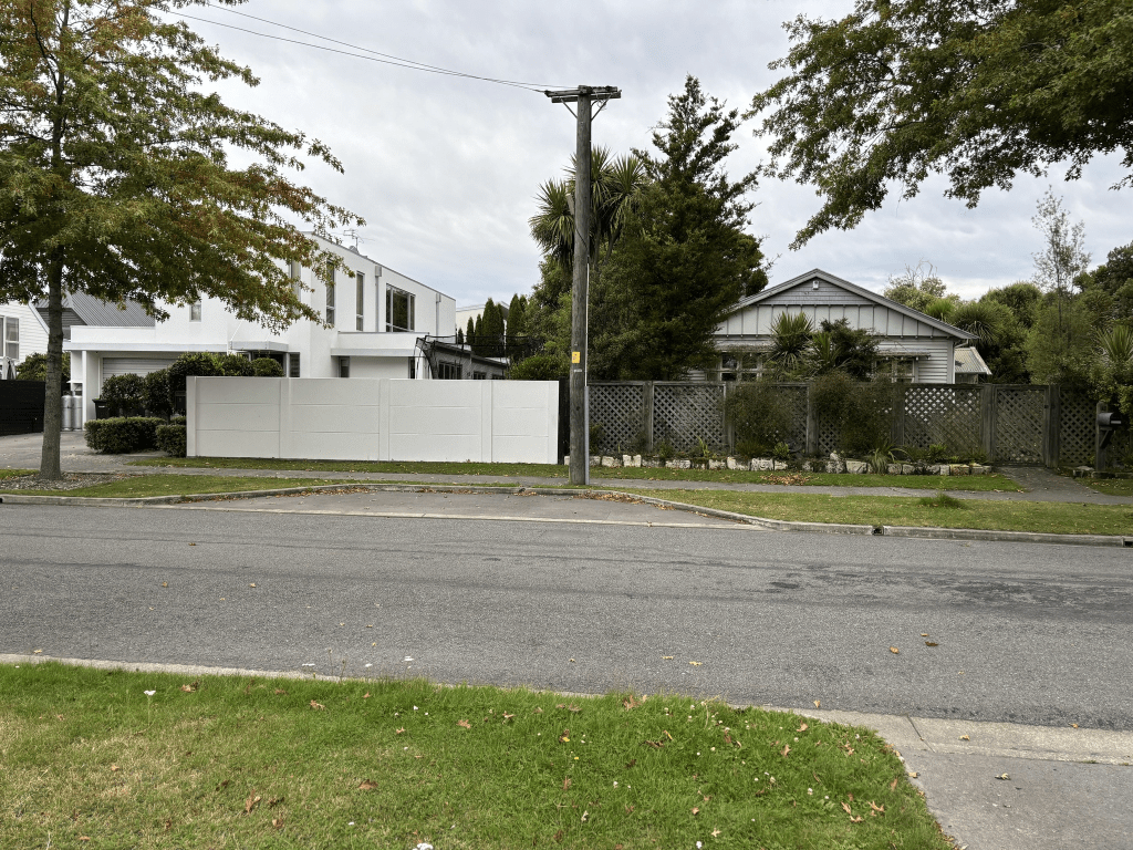
This tree lined street runs between Tomes Rd and Mays Rd. A few houses date from 1920 plus one dated from 1910. Several houses were built between 1960 and 1980 with one house built in 2000.
I walked this pleasant street on Tuesday afternoon and I liked the older houses and I almost liked the modern house. Managed to get a photo of the oldest and newest houses together. This is also a War Memorial street.
Bennett Street in St Albans – formerly Bennett’s Street. Named after Thomas Bennett Tomes (1821?- 1875). Tomes, a grazier, bought Rural Section 276, 50 acres in Papanui Road. Bennett’s Street first appears in street directories in 1892. Becomes Bennett Street in 1918.
A small amount of information from the library website and I couldn’t find anything to show that the street was ever called Bennett’s Street.
I did found a couple of entries as Bennett’s Street in 1923 and 1930. Papers Past had entries between 1882 and 1900 for sections for sale for Bennett Street. The sections were a subdivision for the Tomes Brothers in an area known as Scottston. In 1906 there were plans for extrending Bennett Street. There were several birth and death notices. In the 1950s and 1960s there were entries for the best garden competitions.
There were several houses built between 1910 and 1920 and they were all between Tomes Rd and Paparoa Street. The houses built between 1970 and 1990 were between Tomes Rd and Mays Rd. There were a couple of rebuilds amongst the houses.
A pleasant street that I walked on Tuesday afternoon. Some of the older houses were really lovely. Because I walked this street at the end of the school day there were lots of cars parked on the street plus I had to worry about cyclists speeding on the footpath.
Lingard Street in St Albans – Named after Archdeacon Edward Atherton Lingard (1839-1903). Lingard was a schoolmaster and later vicar of St. Luke’s Anglican Church 1867-1902. The street was formed on land formerly owned by the Anglican diocese. Described as a “new” street in The Press in 1926 when the Church Property Trustees advertises sections for sale in their St Albans West subdivision. First appears in street directories in 1928.
A reasonable amount of information from the library website. Not much information on Papers Past. The article in 1926 said that the road was formed as part of the extension of Chapter St. In 1929 there were sections for sale. A few death notices and ads plus in the 1950s and 1960s best street competitions were mentioned.
This was a short street that I walked on Tuesday afternoon and half of the houses were built in 1920 and 1930s. A couple of ugly modern houses on the street.
Claremont Avenue in Papanui – formerly Wakefield Avenue. Probably named after Claremont House, a large 18th century mansion near Esher in Surrey. Wakefield Avenue first appears in street directories in 1924. Re-named Claremont Avenue on 1 September 1948 when 120 streets were re-named. A Papanui war memorial street.
A small amount from the library website. I thought that it was highly likely to have been named after Claremont House in Surrey as the Claremont area near Timaru was supposed to have been named after Claremont House. I then looked at the Rhodes family who had owned Claremont Estate near Timaru and they were from Yorkshire. A quick google gave me Claremont House in Yorkshire near Leeds. Several streets in this area have streets names connected to the Rhodes family.
Very few entries on Papers Past and for Wakefield Ave most entries were for Wakefield Ave in Sumner. For the Papanui street there were just a few ads. As Claremont Ave there was mostly entries for best garden competition plus a few death notices.
I walked this street yesterday and made the mistake of walking it near 3pm. This street was full of cars parked up waiting for children to get out of a nearby school. At least half of the houses on this street were built in 1920 and the rebuilds since the earthquakes looked out of place. It is a tree lined street but the trees were on the road rather the the footpath which I haven’t seen before. I totally missed the plaque for this street being a War Memorial street which annoyed me as I like to get photos of the plaques. Still all the plaques have the exactly same wording on them.
Norfolk Street in St Albans – Formerly Fisher Street. Named after Robert Fisher Tomes (1856- 1923). Re-named Norfolk Street. Tomes was a son of Thomas Bennett Tomes (1821?-1875). Fisher Street is first mentioned in the Star in 1879 in a report of a meeting of the Sydenham Borough Council. First appears in street directories in 1894. Re-named Norfolk Street in 1905 when a “Mr T. M. Abbott” wrote to the Avon Road Board asking for the name change. A Papanui war memorial street. [When the kerb and channel was renewed in 2008 efforts were made to retain the appeal of the oak trees so they could remain a WW2 memorial for the community.]
A reasonable amount of information from the library website and I will cover the Tomes family when I write up Tomes Rd. There is a mistake in the library information as the Fisher St mentioned in the Sydenham Borough Council meeting in 1879 is a totally different street. There were three streets named Fisher Street as there was also one in New Brighton. The one in Sydenham was renamed Fisher Avenue.
The first mention in Papers Past of the Fisher Street in St Albans / Papanui was in 1892 when the Tomes Brothers subdivided a property known as Scottston into 72 sections. There were also sections for sale in the 1920s and 1950s. In April 1905 Mr T M Abbott wrote in on behalf of the residents that they were prepared to guarantee the amount required for the formation of the street. In June of that same year Mr T M Abbott requested the name change to Norfolk St. I couldn’t find a reason for the Norfolk name as there didn’t seem to be a connection to Norfolk for the Abbott family. The Abbott family owned a business called Exeter Nursery in Papanui Rd. There were several death notices including a very young child who was the young son of Thomas Mason Abbott. I needed to check the ancestry website as the cemetery database had Thomas Mason Abbott death in 1904. The Thomas Mason Abbott mentioned in 1905 is the grandson of the Thomas Mason Abbott who died in 1904. The young child who died was also Thomas Mason Abbott.
This street is a pleasant tree lined street and it is one of the Papanui Memorial Streets. There is at least one house from every decade and I managed to get a photo of the house that was built in 1905. The house built in 2024 is extremely ugly. I walked this street yesterday before going to my son’s house to babysit my granddaughter.
I can’t believe that I missed this when I walked Mays Rd a few weeks ago. There was a bridge built here in 1913 that went over Dudley Creek. Dudley Creek is a very long creek that goes through several suburbs. In Christchurch there are lots of creeks running under the city. In the old days there were bridges over the various creeks but they are now hidden under the roads
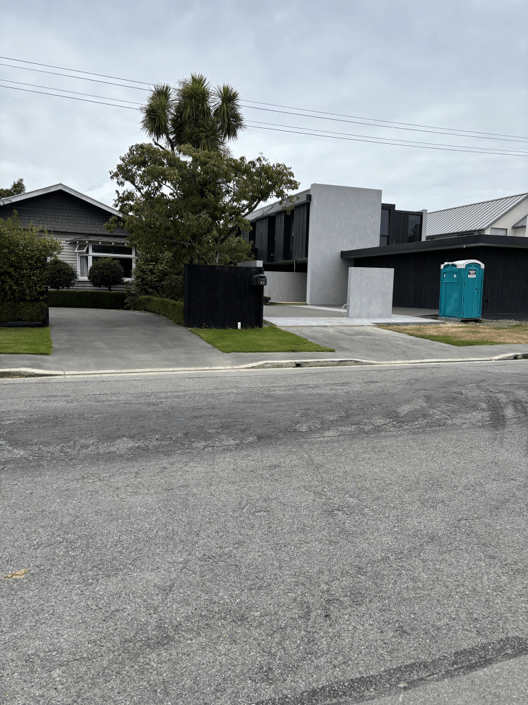
Campana Lane in St Albans – The Riach family owned the Campana Hardy Plan Nursery for eighty years before selling the land to Mike Greer Homes in 2014. Named in 2016. Mike Greer homes development of 6 plots off 84 Tomes Street.
A small amount of information from the update library website. It was actually developed at 84 Tomes Road.
Managed to get information from Papers Past and the ancestry website. For the street it was mostly just ads on Papers Past. I got a reasonable amount of information about the owner of 84 Tomes Road once I sorted out the correct member of the Riach family. There were two men with the name Douglas Riach but eventually found Desmond Douglas Riach. In 1955 Desmond Riach had returned from Britain after being a student gardener at the Royal Botanic Gardens in Kew. He had received high marks. Before his trip to Britain he had worked for the Reserves Dept of the Christchurch Council. He was one of the judges for the Papanui Beautifying Society. Desmond and his family lived at 84 Tomes Rd and he was described as a nurseryman. His parents lived next door at 94 Tomes Rd and his father was described as a dairyman. Desmond died in Oxford in 2021 and there was an obituary for him in the NZ Garden Journal. In 2024 his collection of Botanical Book Collection was auctioned off.
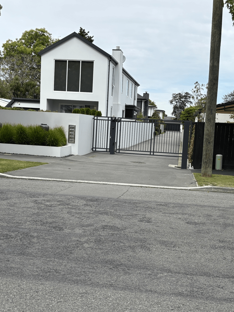
There are only 6 houses here built in 2017 and it wasn’t possible to walk this street as it had a locked gate blocking it. This is the first time that I have come across something like this.
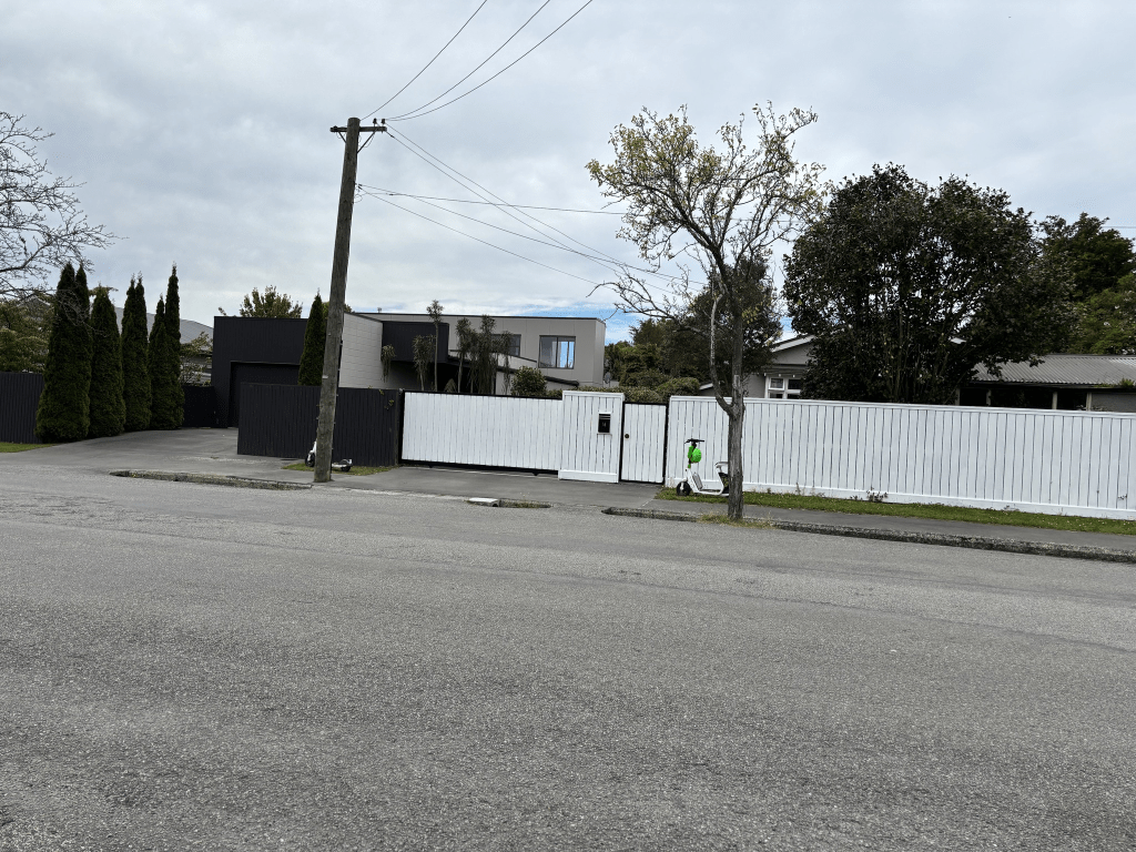
Jed Lane in St Albans – A private right-of-way named in 1967. A tiny amount of information from the library website. The updated library website had added that it was possibly named after HMS Jed.
There were two ships named HMS Jed and one was in service between 1904 and 1919 and the second one was in service between 1942 and 1957. They were named after a river in Scotland.
There was very little information on Papers Past and it was mostly a few ads. In April 1967 this street was mentioned in the article that had the headline Navel Names for Streets.
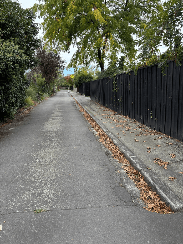
The houses here were built in the 1960s and there was a footpath that went a short way up the lane but I didn’t walk this private lane. Sometimes it just doesn’t feel comfortable walking such streets.