Cooks Lane in the suburb of Heathcote, Christchurch

Cooks Lane in Heathcote – formerly Cook Street. Named after William Cook. Cook, a timber merchant, built the homes on Cooks Lane. He is listed living there in 1907, the year Cook Street first appears in street directories. Becomes Cooks Lane in 1936.

A small amount of information from the library website and I couldn’t find anything on Papers Past for Cooks Street in Heathcote. There was a very interesting boarding house on a Cooks Street that ran off Colombo Street.

The first entry that I could find for Cooks Lane was in 1939 under military service call up and it was for Francis Andrew Stechmann a farm labourer of 3 Cooks Lane. Francis was my Dad’s cousin and my memory of him is when he lived on Canterbury Street in Lyttelton.

In the 1940s there were a couple of ads plus a new name was proposed for the street but the name was undecided. It obviously didn’t happen. Nothing in the 1950s and just a few ads in the 1960s. In 1972 there was a discussion about the disposal of night soil. From 1983 onwards only the Heathcote Riding School is mentioned.

I seriously sidetracked with William Cook because of his will. William Cook was a busy man and had been a butcher with his brother. Owned property in Lyttelton, Governors Bay, Teddington as well as the property in Heathcote. William Cook died in 1917 aged 61 and there was a big court case regarding his will as he only left a weekly allowance of £2 and 5 shillings to his wife Annie. This not only was to support his wife but also seven children. Two of the children were working and paid board plus Annie had to work as a part time nurse. William and Annie separated in 1903 and she lived in a house on the corner of Exeter St and Oxford St in Lyttelton. Reason for the separation was William’s relationship another woman. This woman was the wife of Annie’s brother and William was living with Annie’s brother Richard and Richard’s wife. William left most of his money to Richard’s wife and her children plus money to another woman and her children. The courts agreed to increase the weekly allowance to Annie. I didn’t read all of the will online as there were over 100 pages to it but I read enough to see that he had left most of his money to the two other women and their children. There could be two or three Lyttelton families who could get a surprise if they get their DNA done. Edited to say that Alice the wife of Richard Wakelin was living at William Cook’s property on Cooks Lane while Richard was living in Governors Bay. The widow of William’s brother Colin said that the business partnership between William and Colin was dissolved because of William’s relationship with Alice Wakelin. There was a child born in 1904 who was adopted by Alice Wakelin and William left this child a fairly large sum of money.

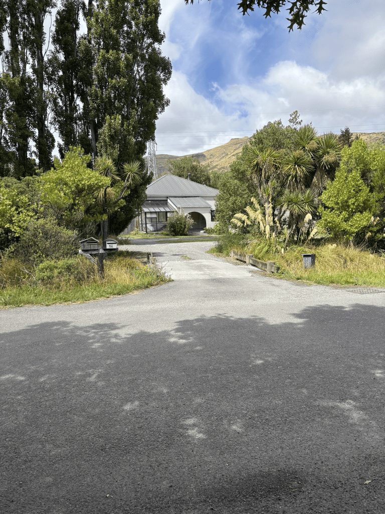
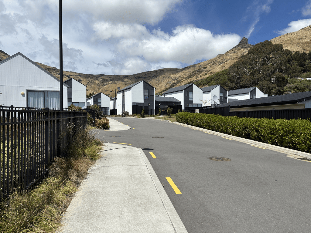
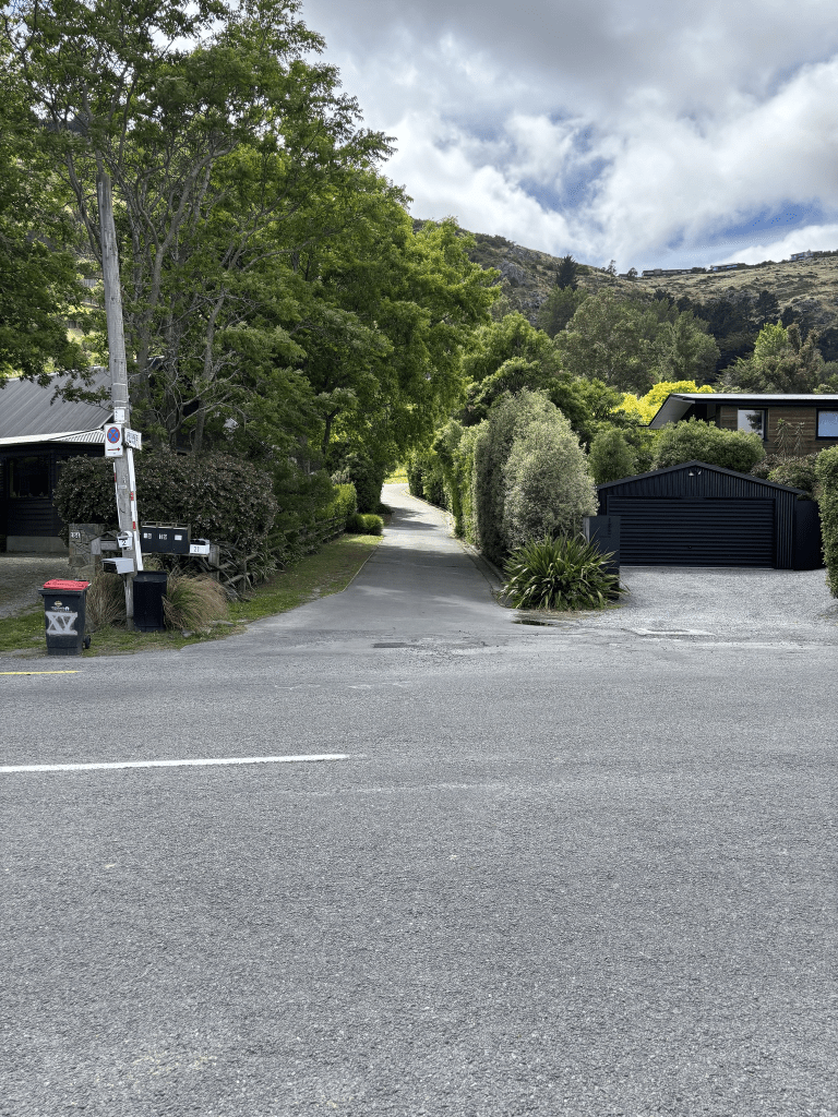
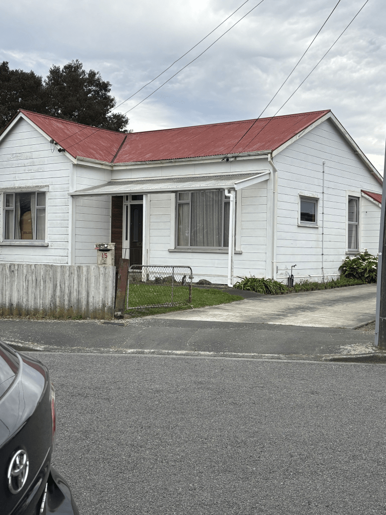
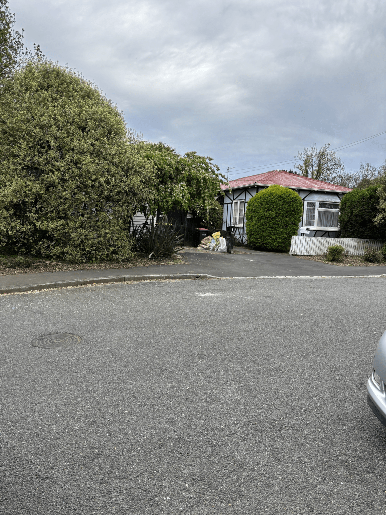
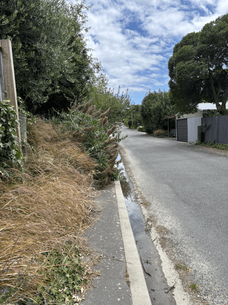
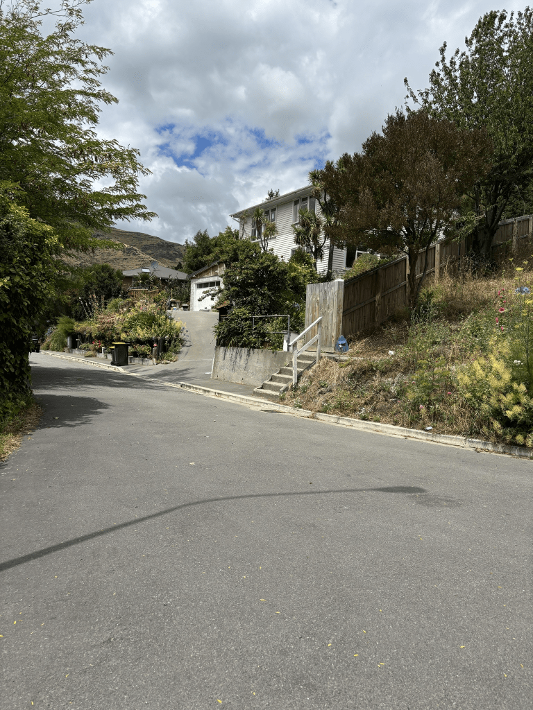
Most of the houses in this street were built in 2005 and later but there are two houses from 1910 and I managed to get a photo of one of them. The other one was hidden by lots of trees. There is a walkway here that leads to Ferrymead Reserve. There was a large green space that looked like it could have been a community garden but there wasn’t any signs. I checked google maps and it is possibly a private section.

Cross Street in suburb of Heathcote Valley or Ferrymead, Christchurch

Cross Street in Heathcote/ Ferrymead and this street no longer exists. It is named on a map from 1930 but maps previous to that showed it but with no name. It was mentioned in Papers Past in 1933 as keeping the name Cross Street. I have checked old maps to compare with modern maps and it was possibly where the old Ferrymead House / Ferrymead Hotel stood. There used to be another house next to it but it was demolished several decades ago because of borer in the timber that the house was built from. Apart from ads for the Ferrymead Hotel there wasn’t much information on Papers Past. In the 1860s a Stephen Curtis ran the hotel and his nickname was Yankee Doodle Curtis. There have been a few owners over the years and one had a massive dispute with the Tramway Historical Society. I thought that I had taken a photo when I was walking in the area a few days ago but obviously hadn’t so it is a screenshot from street view. I think that there might have been someone working on the property and I try to avoid taking photos of people. There is a lot of information online about Ferrymead House / Ferrymead Hotel which has a Bridle Path Road address. If anyone has better maps for this area to show if I am correct or incorrect about Cross Street I would love to see the maps.

Wheatsheaf Lane in the suburb of Heathcote Valley, Christchurch

Wheatsheaf Lane in Heathcote – Named after wheat, one of the grains used in the making of malt extract (barley is the predominant grain). The sheaf of wheat is a common agricultural symbol. Additional information: Date Named: 17 February 2021 Subdivision: 68 Port Hills Road. The road names are themed for the historic use of the site.

A small amount of information from the new library website and nothing that I can add about the name.

The houses here were all built in 2021 and there isn’t a footpath to walk on .

On Friday when driving back from walking the Bridle Path I noticed the sign saying Wheatsheaf Lane but it just seemed to point to the car park for the cafe and shops on Port Hills Rd. Yesterday when walking in the area I checked my maps and it looked like I could through Stead Lane to Wheatsheaf Lane so this is what I did. I was going to have an iced coffee at the cafe as I had walked about 8km but it was so busy that I just continued back to my car. All the houses here look exactly the same and I took a photo from Stead Lane looking towards Wheatsheaf Lane. It shows the back view of the houses on Wheatsheaf Lane and there is a wee path that takes you to the car park. I ignored the wee path and actually walked Wheatsheaf Lane which is why I know that there isn’t a footpath.

Matuku Lane in the suburb of Heathcote Valley, Christchurch

Matuku Lane in Heathcote – Matuku is a te reo Māori name for the white-faced heron. Matuku Waterway is the name of the stormwater drain that runs down the boundary of the development. Matuku is the name of the Council stormwater management area in the valley floor. Matuku, the white-faced heron, (Egretta novaehollandiae) is a medium-sized heron, pale, slightly bluish-grey, with yellow legs and white facial markings. It can be found almost anywhere near shallow water, fresh or salt.

Additional information: Date Named: 16 February 2022 Subdivision: 86 Bridle Path Road

This information was from the new library website and I will confess to being surprised that they had any information. Obviously the old library website didn’t have any information.

The houses here were built in 2023 and 2024 plus it is still being developed. Only partially walked the street as the footpath is only a few metres long.

Castleview Lane in the suburb of Heathcote Valley, Christchurch

Castleview Lane in Heathcote – Named because the street has a view of Castle Rock. Developed at 162 Port Hills Road. Named in 1999.

A tiny amount of information from the library website. There isn’t anything else that I can add about this street. Most of the houses date from 2000 with one dating from 1980. I am surprised that I didn’t do this street when I walked Port Hills Road. The footpath here is only a few metres long so I only partially walked it. Forgot to get a photo so it is a screenshot from street view.

Hammerton Lane in the suburb of Heathcote Valley, Christchurch

Hammerton Lane in Heathcote and nothing on the library website. The article Heathcote’s Lovely Lanes by Barrie Wood has the best information. Hammerton Lane takes its name from the 150 acre

Heathcote Valley estate owned by early pioneer Isaac

Cookson. The estate was named after ‘Green Hammerton’ a village in North Yorkshire, England. The name Hammerton was also given to the first ‘township’ in Heathcote Valley, which was located around the area where the Valley Inn is now located. This was part of the original Hammerton Estate and allotments were sold from about 1863. The name ‘Hammerton’ did not endure for the settlement, which eventually became known as Heathcote. Today it is remembered as Hammerton Lane.

Papers Past didn’t have anything for Hammerton Lane. Under Hammerton Green the earliest mention that I found was in 1854 relating to Isaac Cookson’s address. All strange horses and cattle found wandering on the land will be impounded. In 1860 there were ads for the sale of the freehold property Green Hammerton which was 150 acres and included the house and paddocks plus the Inn known as Martins Cottage. in 1862 there was a farewell dinner for Mr and Mrs Cookson as they were returning to England. They were returning to England as their daughter in England was ill. Sadly the daughter died before they arrived back in England.

In 1863 there were sections for sale adjacent to the railway station in the village of Hammerton. Some ads called it the township of Hammerton. Cookson is supposed to be responsible for the first beehives in New Zealand.

There are only about 4 or 5 houses here on a very narrow lane and I didn’t feel comfortable to walk this tiny lane. Basically the narrow short lane leads to houses which have very long driveways.

Godley Cross on the Bridle Path, Heathcote Valley

When researching Heathcote streets I came across several mentions of The Godley Cross and I found a page with a reasonable amount of information plus an image of the first cross. I also looked at Papers Past. Various articles mention that there had been at least four crosses erected but all were subject to vandalism. The original was erected in either 1856 or 1857. Interesting that this article says that Chaney carved the first cross. He possibly did but the only mention of him carving the cross is in 1864 when he carved a white stone Celtic cross to replace the original cross. There was another replacement cross in 1898 and in 1899 a fence was placed around the cross. Mentioned in 1909,1931 and 1932 with discussion about the vandalism and if it was worth replacing. In 1932 only the pedestal was remaining and this was repaired. A fountain at the same spot was also frequently mentioned but it was decided not to replace it as the water was contaminated by sheep and dogs. I am now going to have to walk the Bridle Path to see if I can figure out where this cross was.

I did walk the Heathcote side of the Bridle Path yesterday and took several photos. On a noticeboard at the start of the walk it is mentioned as being a memorial to women. I reread the information on Papers Past and nowhere is it mentioned as a memorial to pioneer women. It was a way marker to show where the fountain at spring was plus Charlotte Godley said it was for all the early pioneers and she was grateful for the spring. It was also partly a memorial to her husband. By this time she was back in England. I have walked the Bridle Path hundreds of times and I haven’t really considered the history of this monument. I was amused by the younger woman who stopped me to say hello and then tell me that it is a very hard walk and that I probably shouldn’t do it. She told me that she had also stopped an older man who was 80 years of age and told him that he shouldn’t be doing the walk. Note it was the first time that this young woman had walked the Bridle Path. This 71 year old did have a chuckle about the encounter and yes I got to the top and back again without any problems. I was obviously looking old yesterday.

Edited to say that I had really strange coincidence happen to me last week in connection with this monument. I was walking through The Square on my way home after going to the Banksy Exhibition and I stopped to look at the workmen working on the Chalice. They had a wee crane for lifting the leaves into place and I ended up chatting to the young woman who was supervising. I can’t remember how we got onto the subject of the Bridle Path and she mentioned the Charlotte Godley Cross. She was so pleased to find out that I had walked the Bridle Path especially to see the monument. Along with two stonemasons she had done the repair work on the monument last year. I showed her my photos and she pointed out where they had done the work on it. Her work colleagues call her the statue lady. Apparently the grass around the monument was so long that you wouldn’t have seen it before they had done the repair work on it. This encounter made my day.

Vogel Street in the suburb of Richmond, Christchurch

Vogel Street in Richmond – formerly Tweed street, from Vogel street to Forth street, was incorporated into Vogel Street. Named after John Conrad Vogel (1833-1910). Vogel was a baker and came to New Zealand in 1859. He farmed a block of land fronting onto Worcester Street between the East Belt and Stanmore Road. First appears in the Star in 1881 when land for sale in Vogel Street, Bingsland is advertised. First appears in street directories in 1887. Tweed street, from Vogel street to Forth street, was renamed Vogel street on 24 May 1926.

A small amount of information from the library website and when I walked the street I assumed that it would have been named after Julius Vogel but I was wrong. John Conrad Vogel was born in Hesse, Germany. When he was born Hesse would have been a Grand Duchy rather than part of Germany. He also has no connection to the Vogel bread that is sold in New Zealand.He came to New Zealand on the ship Oliver Lang. He married twice and he died on the same day as his second wife and I had to read the death notices a couple of times to make sure I was reading it properly.

The renaming of Tweed Street to Vogel Street was confusing so I looked at old maps. Took a photo of the 1912 map which clearly shows the streets and it made sense changing that part of Tweed St to Vogel St.

The earliest entry on Papers Past that I found was in 1879 when the council refused to grant a license for a hotel on the corner of Vogel Street and Stanmore Road. In 1884 the Foresters Hall was mentioned. I ended up only looking at articles as there were so many ads and they were mostly for a business in Dunedin. Most entries in 1888 were about something called Richmond Poisoning Case. Lots of death notices over the years and drainage issues were also frequently mentioned. The corner of Stanmore Road and Vogel Street had lots of speakers especially at election time. I don’t know if modern politicians would stand on street corners these days to speak with people.

I walked this street back in October when I was visiting Avebury House as part of Heritage Festival. Parking was a nightmare and I ended up going around the block a couple of times and ended up parking several streets away. The houses here date from 1890 to 2024 and a huge variety of styles. I managed to get a photo of a house from 1915. Some of the older houses were in a reasonable conditions but other ones were looking a bit rundown. Most houses seem to have been built in the 1970s. When I was looking at street view from before the earthquakes I was surprised to see a care home. It has now been demolished and Richmond Market uses the empty section. There wasn’t anything on Papers Past about the care home which was surprising. I walked through this section to get to Avebury House and the market was on so it was very busy. I came back out through the walkway and Vogel Street ends at the corner and Forth Street begins. I would hate to live on this street as parking was a nightmare. One house that has an older looking style is actually a modern house.

Forth Street in the suburb of Richmond, Christchurch

Forth Street in Richmond – Probably named after the River Forth in Scotland. First mentioned in street directories in 1902 with a see ref. to Stanmore Road. First mentioned in the Star in 1904 in an advertisement. Not listed in street directories with residents until 1905.

A small amount of information on the library website. There were so many streets in New Zealand with this same street name.

So many entries on Papers Past that I eventually only searched articles which is a pity as ads can often give great information about streets. In 1902 it was described as a new street. Mostly death notices with a few birth notices and during World War I there were ballot notices and roll of honour mentions.

In the 1920s and 1930s there were several birth notices where babies had been born at Nurse Bunn’s house. Elizabeth Bunn died in January 1940. Her mother had died in 1935 aged 82 and her father had died in 1931 aged 80. They had all lived at the same address.

After this date apart from a few death notices there is practically no mention of this street. In 1988 a stolen car used by men who had robbed the nearby supermarket was dumped in the street.

There are still a few older houses left on the street and I managed to get a photo of one of the houses dating from 1910. I wish that I could have managed a photo of the 1905 house but it was hidden behind lots of trees. Most of the houses were built between 1970 and 1990 with a few built more recently.

I actually walked this street back in October and I had been at a Heritage Festival open house at Avebury House. I walked through a walkway to get to this street. Near the walkway entrance on this street there is a painted powerbox. I love street art. I was verbally abused by a local here. He was parked blocking the footpath and I was trying to get a photo of the powerbox. I hadn’t even said anything to him about his parking when he started abusing me. I obviously replied and pointed out that the yellow lines means no parking plus it is a footpath. Apparently the fact that he lives nearby means he is allowed to park on the footpath. Yes I possibly then called him an idiot with an extra adjective attached to the word idiot. Sometimes I have extra fun when out walking.

The newer houses are ugly and the ones from the 1970s and 1980s are nothing startling. One modern place looked more interesting and it would have been built by the developer who does the nicer looking modern places. For some reason one of the older houses had an old red telephone box in the backyard.

Railway Terrace in the suburb of Heathcote Valley, Christchurch

Railway Terrace in Heathcote and nothing on the library website. The following information is from Barrie Woods’s piece called Heathcote’s Lovely Lanes. Actually a private right of way, Railway Terrace was named because it follows a terrace above the railway

line. Original properties in this area were part of the Pawaho settlement, which was a government village settlement designed for workmen with jobs in Lyttelton.

The only entry on Papers Past was a death notice from 1994. There were so many entries for streets named Railway Terrace but not for the one in Heathcote. It also doesn’t show on early maps.

There is supposed to be a house here dating from 1900 but I am not sure if I managed a photo of this house as there isn’t any street view on google maps.

There is a footpath on this street but I mostly had to walk on the road as the footpath was overgrown with vegetation. I was expecting lots of history for this street and was disappointed to find very little information. I vaguely recall that I knew someone who had moved to this street after living in Lyttelton for most of their lives but can’t remember who it was.