Maunsell Street in the suburb of Woolston, Christchurch

Maunsell St in Woolston – Named after Charles Thomas Maunsell (d.1859) Maunsell, an original subscriber of the Canterbury Association, bought Rural Section 14, 100 acres between Ferry

Road and Heathcote, and Rural Section 67, 50 acres in Heathcote, near Christchurch Quay. He arrived in Lyttelton on the Castle Eden in February 1851 and lived at what the Godleys called Singleton Lodge in Lyttelton. He became the first treasurer of the Canterbury Jockey Club. He returned to England and died in Limerick, Ireland, leaving money for the establishment of a Provincial Hospital. When this was built a ward was named after him. First mentioned in The Press in 1880 when land is advertised for sale there. First appears in street directories in 1892.

A reasonable amount of information from the library website. There wasn’t any information on Papers Past about Charles Thomas Maunsell which surprised me. The ancestry website didn’t have much information about him either but the records say that he lived at Singleton House rather than Singleton Lodge. He actually returned home to Ireland rather than England. His father was Anglican Archdeacon for Limerick and Charles Thomas Maunsell died at his father’s house in Limerick. He was probably only 36 years old when he died as the various family trees say that he was born in 1823 but I couldn’t find the birth record. It is unlikely that he was married. His brother a few months after Charles died named his son after him.

Found the same ads for the sale of land in 1880. Not a lot of information on Papers Past but Mr Garland had a property on the street which he sols in 1914. The sewers were laid in 1930. Sewers were actually a big issue in Christchurch because of the city having been built on a swamp. Typhoid was a big problem in Christchurch. I was amused by an entry in 1929 about Mrs Terry having a hen that laid very big eggs. Lots of birth and death notices. The area was eventually industrial with a big industrial expansion in 1954.

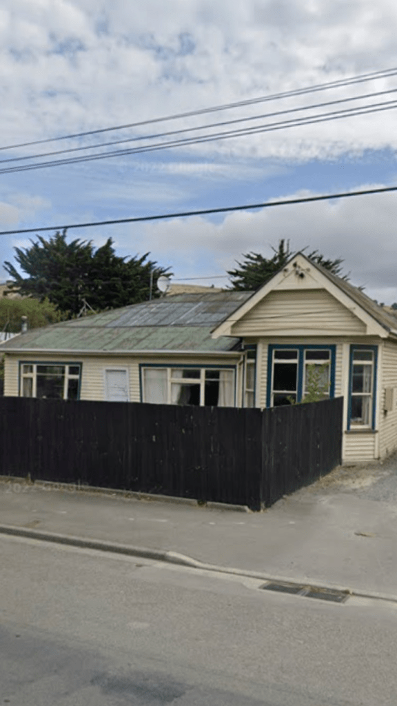
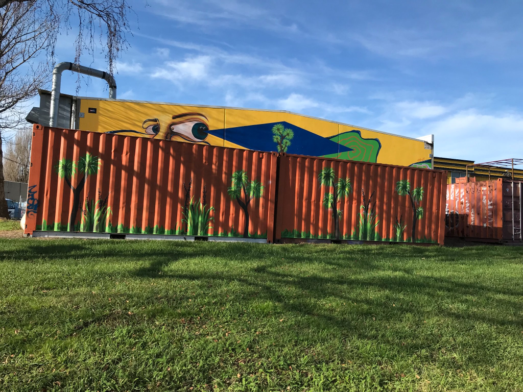
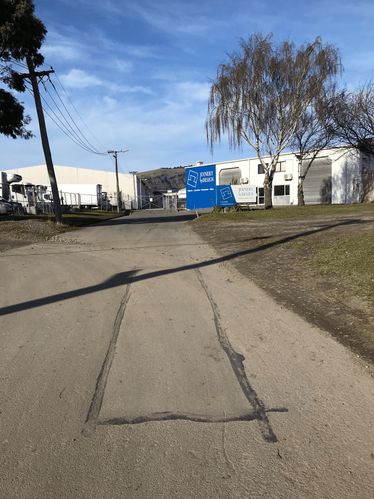
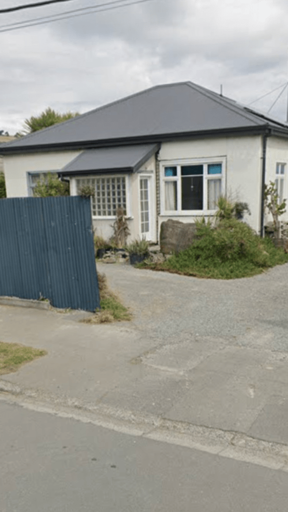
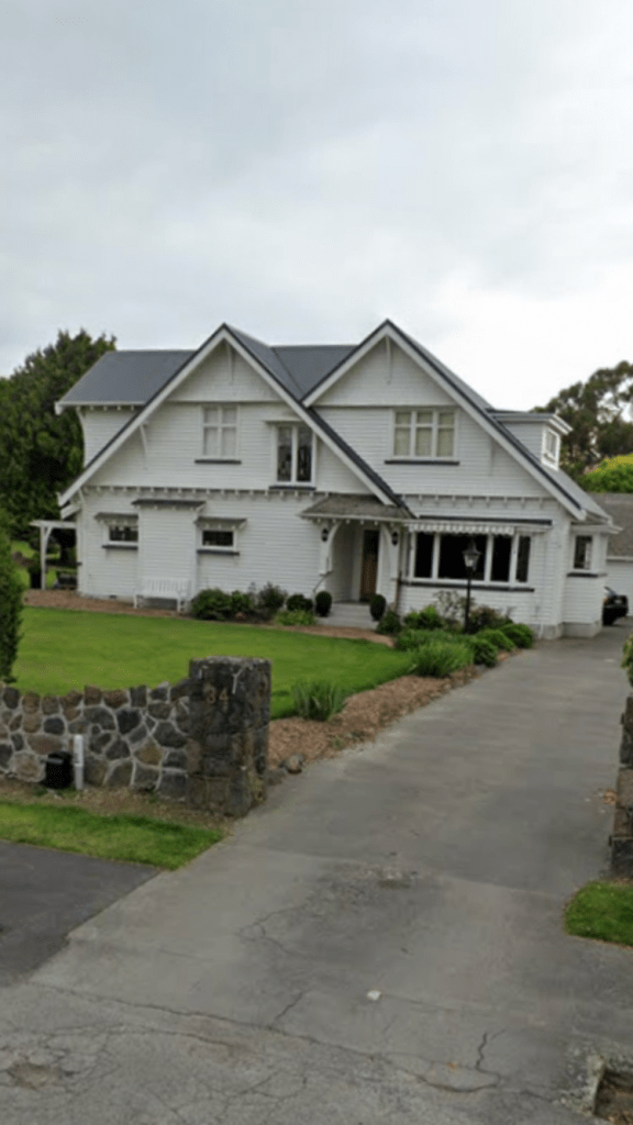
I walked this street in the weekend and it runs from Garlands Rd and then becomes Cumnor Terrace. When the passenger trains were still running the Woolston Railway Station would have been at the Cumnor Terrace end. I wish that I could remember what the station looked like but it was in the 1960s and 1970s when I travelled on the school train. The street has a mixture of houses and businesses on it and the oldest house is from 1890 plus there are houses from 1905 and 1910. A few from 1940s and 1950s. There is a house called Bloomsbury that is on Heritage NZ list and it was hard to get a good view of it but it looked like it was a lovely house. A couple of the houses looked a bit rundown but most looked OK.

King Edward Terrace in the suburb of Woolston, Christchurch

King Edward Terrace In Woolston- Named after King Edward VII (1841-1910).First appears in street directories in 1908. [In 1985, because of the Woolston Cut flood relief development, the council proposed that this street should disappear. This did not happen.]

A small amount of information from the library website.

A reasonable amount of information on Papers Past and flooding issues mentioned frequently. Lots of death notices but no birth notices. In 1920 there were complaints about the new tip on the corner of King Edward Terrace and Bamford St because of the smell from the nightsoil being dumped. The company G L Bowron was frequently mentioned. Lots of ads for workers plus a big fire fire in 1953. The saddest entry that I found was from 1920 when the founder of G L Bowron committed suicide. He was only 33 years old and financially well off. He left two letters behind and one was to his father and the other to a young woman.

I ended up looking at old maps of Christchurch to confirm that this street used to be a much bigger street. I looked at maps from 1911 to 1955 and this street ran from Rutherford St / Garlands Rd by the bridge and followed the river to Ferry Rd. The street is now much shorter and runs from Atom Lane to Bamford St. The part between the bridge and Atom Lane is now part of Rutherford St. There is a walkway following the river from Bamford St end to Long St. The part of King Edward Terrace near Ferry Rd was added to Long St.

Papers Past only goes up to 1971 and the changes to the street would have happened in the 1980s because of the Woolston Cut. It is now a tiny street with the river on one side a few businesses on the other side. Caddyshack is on this street. I was geocaching here yesterday on the walkway and I was overdressed for the unexpected warmth of day.

Atom Lane in the suburb of Woolston, Christchurch

Atom Lane in Woolston – Named because of its proximity to Rutherford Street. Ernest Rutherford (1871-1937) was a scientist who is widely credited with first “splitting the atom” in 1917. First appears in street directories in 1987.

A small amount of information from the library website and I honestly wasn’t expecting any information on their website as this lane just looks like a driveway to a couple of businesses. Nothing that I can add about the name of the lane and nothing on Papers Past as that only goes up to 1971.

Tanner Street in the suburb of Woolston, Christchurch

Tanner Street in Woolston – formerly Scott Street and Station Street. Named because of the street’s proximity to the Woolston Tanneries. OR Named after William Wilcox Tanner (1851-1938). Scott Street, or alternatively Station Street, first appears in street directories in 1896. The only resident is William P. McNeil, the railway station master. By 1900 it leads to the Woolston Railway Station and is named Scott Street only. Re-named Tanner Street in 1922. Tanner, a boot maker, was on the Woolston Borough Council 1893-1900 and also the member of parliament for Heathcote and Avon 1890-1908.

A reasonable amount of information from the library website. There were so many Station Streets and Scott Streets on Papers Past that it was impossible to get information on this one. Changing the name from Scott St to Tanner St was mentioned in 1922 and 1924. It was changed because of duplicate street names. One of the articles included a very long winded and confusing sentence about streets names in Woolston. This sentence convinced me that the street was named after William Wilcox Tanner. I thought briefly that the street might have been named after Rev William Tanner who was a minister at a church on Ferry Rd. Both of them died in 1938.

In 1930s it was mostly birth and death notices. In 1940 the town planning said that this area was to be a heavy industrial area. Most entries after this date relate to businesses.

This tiny street runs from Garlands Rd to Curries Rd. The valuation website said that there were only 7 properties here with one built in 1900 and rest in 1940s. The house from 1900 is in reasonable condition. I double checked google maps as I remembered seeing a block of apartments. The block of 12 apartments are on Tanner St but not included in the valuation website which is unusual. There are also several businesses on this street plus it runs along the back of The Tannery. I had been geocaching in the area yesterday and it was much warmer than I expected.

Meadow Street in the suburb of Papanui, Christchurch

Meadow Street in Papanui – Named after The Meadows, a property belonging to Alfred Edward Tutton (1856- 1910). Tutton was a butcher. The Meadows was subdivided and sold by auction in 1908 and Meadow Street formed. First appears in street directories in 1911.

A small amount of information from the library website. Lots of information on Papers Past and it was mostly birth and death notices. The ad about the subdivision said that there was a total of 31 sections for sale. There were several Meadow Streets throughout the country including Kaiapoi. There were also several properties called The Meadows in Canterbury. In 1963 the Meadow Park Camping Ground was mentioned and this is likely to be now the Top 10 Holiday Park that is at the end of the street. The obituary for Alfred Edward Tutton dated 31st December said that he was born 1854 but he was actually born 1856. He was born in Biddisham in Somerset and came to NZ in 1876 in the ship Border Chief. He started his butchery in Papanui soon after arriving in NZ. He had several properties including Bramdean in Amberley where he died. He was only 54 when he died. The family trees on ancestry website didn’t have much information.

For a small street there are a lot of houses but most are multi dwellings. There is one house from 1910 but it didn’t really stand out as an older houses. There are houses from every decade but most are from 1970s and 1990s. There is a block of houses built this year. Looked like a pleasant street but I imagine the street could get busy with campervans and holiday makers with the Top 10 at the end of the street. I did find the geocache that I was looking for today.

Gregory Avenue in the suburb of Islington, Christchurch

Gregory Ave in Islington – formerly Gregory Road. Named after William Henry Gregory (1877?- 1959). Gregory was an electrical engineer with the electricity department. Formed near the Islington substation. Gregory Road first appears in street directories in 1977. Becomes Gregory Avenue in 1983. Information supplied in 2006 by Bob Pritchard, subdivisions officer, Christchurch City Council.

A small amount of information from the library website and they have the birth and death dates for the wrong William Henry Gregory.

The William Henry Gregory who was the engineer was born in 1893 in Melbourne Australia and he studied at Manchester School of Technology in the UK. Was resident engineer for Canadian General Electric Company and married his wife Florrie in Montreal. He came to NZ in 1925 and worked at various power stations in both North and South Islands. He was district engineer of State Hydroelectric Dept from 1948 to 1958. This was a period of grave power shortages in NZ after the war. This was from his obituary dated 10th January 1967 in Papers Past. The ancestry website wasn’t much help and the various family trees were confusing. I couldn’t find death details anywhere and it is possibly because they are at the crematorium.

The library have the birth and death dates for a travelling saleman with the same name.

Very little information on Papers Past for the street apart from a few ads for people selling stuff. There are 38 houses here and most were built in 1950s and several in 1990s. None of them stood out and were typical 1950s style. At the end of the street there is a walkway that leads to Kaplan Ave.

Kaplan Avenue in the suburb of Islington, Christchurch

Kaplan Ave in Islington – Named after a propellor-type water turbine widely used throughout the world in highflow, low-head power production. Formed near the Islington substation. First appears in street directories in 1962. Information supplied by Bob Pritchard, subdivisions officer, Christchurch City Council.

A small amount of information from the library website and nothing that I can add about the name. I wasn’t actually planning on walking the streets in Islington but I was geocaching nearby. I also didn’t find the geocache.

There were only 8 entries on Papers Past for this street and two were ads for selling of sections. A couple of death notices and an engagement notice. Only 11 houses on this street and most were built in the 1950s and are typical style for that era. There are a couple of more modern houses but they were on back sections so couldn’t tell what they looked like. The houses were only on one side of the street and Transpower were on the other side of the street. Corner of Kaplan Ave and Gilberthorpes Rd was Gilberthorpes Reserve. Personally find it strange that such a small street is called an avenue. There was a wee walkway at the end of the street that led to another street.

Plynlimon Road in the suburb of Fendalton, Christchurch

Plynlimon Rd in Fendalton – Named after the highest point of the Cambrian Mountains in Wales. Named to continue the Welsh theme of street names in the area. First mentioned in the Star in 1888 when a house is advertised for sale in Plynlimon Road. First appears in street directories in 1894.

A small amount of information from the library website. I thought that I knew the names of Welsh mountains but I didn’t know this one. I have climbed Mt Snowdon and Pen y Fan in the Brecon Beacons.

The oldest entry that I found in Papers Past was in 1887 when a section of land was for sale. Also found ads for the sale of sections in 1893, 1896, 1907 and 1927. In September 1943 a well known property called Leigh was for sale and in October 1943 there were plans for a subdivision at the property.

Papers Past had several entries about a rubbish dump on the street. In 1942 it is mentioned that a dump was opened near the railway lines. In 1943 there were many complaints about the dump and the council reply to the complaints was that the flies and smell was because of unauthorised dumping of rubbish at the dump. In 1944 the dump was closed over the summer period. The dump was sited on a disused shingle pit. In 1953 a new park and playground was being developed on the street and they had to keep topping the ground with soil as it kept sinking. The park was being developed on the old dump and shingle pit site so that probably explains sinking issue. In 1958 the council refused permission for a kindergarten to be built in the park.

There are at least two houses dating from 1920 and several from 1940 which will be from the subdivision mentioned on Papers Past. Several houses date from 1960s but most decades have at least one or two houses. The original houses on the street would have had large sections and would gradually have sold off the land for houses. Between 2013 to 2017 there was a large number of houses built.

I had parked my car on this street near the park so that I could do a multi cache and after I found the cache I decided to do more walking. The street runs from the park end to Garreg Rd and I had to cross Idris Rd which wasn’t easy because of the traffic and this was on a Saturday. A pleasant street with many different styles of houses. I did like the 1920s villa and there was an Art Deco house. The new houses I didn’t really like as they looked sterile and only had immaculate lawns and no gardens. There was a small garage that did car repairs on this street and it was called Sadlers Garage and I am not trying to promote the business. When reading Papers Past there were several entries for a family with the surname Sadler so it would be interesting to know if there is a connection.

Allister Avenue in the suburb of Strowan, Christchurch

Allister Ave in Strowan – Developed to give public access to Elmwood Park from Leinster Road. The land for the street was donated by Charles Wood (1864?-1957), a sheep farmer of 95 Leinster Road. A petition was circulated around local residents in 1920. They wanted a handsome” street developed rather than a right-of-way. Named in 1921. [In 1922 the Elmwood School Committee described Allister Street as an unsuitable name, suggesting Elmwood Avenue instead, because the street connects Elmwood School with Elmwood Park.] First appears in street directories in 1928.

A reasonable amount of information from the library website. I searched Papers Past and ancestry website but couldn’t find a reason for the street name.

Found an article in 1921 about the formation of the street under the relief work scheme for the unemployed. In 1922 there were barriers put up and lights at the Leinster St end because of Elmwood School. Sections for sale in 1926. This street runs between Heaton Street and Leinster Road but in 1927 there were at least two letters to the editor suggesting that the street be extended to Aikmans Rd. The school was building a school pool at the time but the letter writers would have preferred a road which would have gone through the school grounds where the pool was being built.

Charles Wood was the son of William Derisley Wood of Wood’s Mill.

There were some nice houses here and it was a pleasant street. Quiet on Saturday when I walked it but I imagine during the week because of the school it would be busy. Only 10 houses on the street and the oldest was built in 1920 but the one I actually liked was built in 1990. I don’t normally like modern houses but this one was different.

Circuit Street in the suburb of Strowan, Christchurch

Circuit Street in Strowan – Named after Sophia Circuit Rhodes, née Latter, (1833- 1906). Sophia Rhodes was the daughter of merchant, Edward Circuit Latter (1829- 1896), wife of farmer and businessman Robert Heaton Rhodes (1815-1884), and mother of politician, philanthropist, farmer and landowner, Sir Robert Heaton Rhodes (1861-1956). It is referred to as a “new road” in the Sun in 1914. First appears in street directories in 1916.

A reasonable amount of information from the library website and nothing that I can add about the name of the street. The Rhodes family is well known enough that I don’t think that I need to research them. Papers Past has mostly social entries for the street and I found the same 1914 entry about it being a new street. There was a letter to the editor in 1927 complaining about street names and they included Circuit Street. The person obviously didn’t know the reason for the name. From the 1950s onwards there many entries for Elizabeth House and these were all for meetings and social events. I found an article from 1953 that mentions that the Empire Societies purchased the property of A K Firth for their headquarters and to be known as Elizabeth House. The Empire Societies were Royal Empire Society, Victoria League, Navy League and English Speaking Union. When A K Firth owned the house it was called Oakbrook. I googled Elizabeth House and it was gorgeous and it was built in 1914 and the architect was Samuel Hurst Seager. Sadly it was damaged in the earthquakes and demolished in 2011. There is now an ugly modern house on the site.

There are three houses from 1920s and a couple from 1940 and 1950 but most houses have been built in the last few years. The older houses are lovely but I didn’t particularly like the modern houses. The street runs from Heaton Street to the grounds of St Andrews College, I walked this street on Saturday and it was very busy with plague carriers AKA children because of sports at the college.