Olmstead Lane in Huntsbury – nothing on library website and it is possibly because it is too new or because it is a private lane. Probably named after Olmstead Green in England which would be in keeping with the general theme of naming streets after places in England. When googling I found a Frederick Law Olmstead who was one of the creators of Central Park in New York.
Another street that I didn’t walk as it looked like a private driveway and google vehicle avoided it as well. Only 6 houses here built between 2000 and 2014.
Kimbolton Lane in Huntsbury -Formed post-1997.Tiny amount of information from the library website and it is most likely to have been named after Kimbolton in the UK. The most famous fact that I found out about Kimbolton in England was that Catherine of Aragon died in Kimbolton Castle.
I didn’t walk this tiny street as it was another that just looked like a private driveway and I am not comfortable with walking them. Besides there wasn’t a footpath. Only 4 houses here built in 1990s plus one empty section. Great views over Christchurch and to the mountains.
Holbank Lane in Huntsbury – nothing on library website but street is probably too new. Only 3 houses here and one is brand new. Name is probably from Holbank Crags which is in the Hadrian’s Wall area. It would fit in with other streets in the area being named after English places. I couldn’t actually find it on google maps but it is in Sewingshield Crags area. It would be close to the YHA that I stayed in when I visited Hadrian’s Wall.
For this street I had walked up through Coronation Reserve and was on my way back to my car. Fantastic views from here.
Great Gables Lane in Huntsbury – Named after Mount Great Gables, a mountain in the Lakes District in England. Formed post-1997.
A small amount of information from the library website and the mountain is actually called Great Gable and doesn’t have an s on the end of it.
I didn’t actually walk this tiny street as it definitely looked like a private driveway. There are 9 houses here dating from 1990 through to 2022. Google Street view is from 2019 and only shows about 5 or 6 houses.
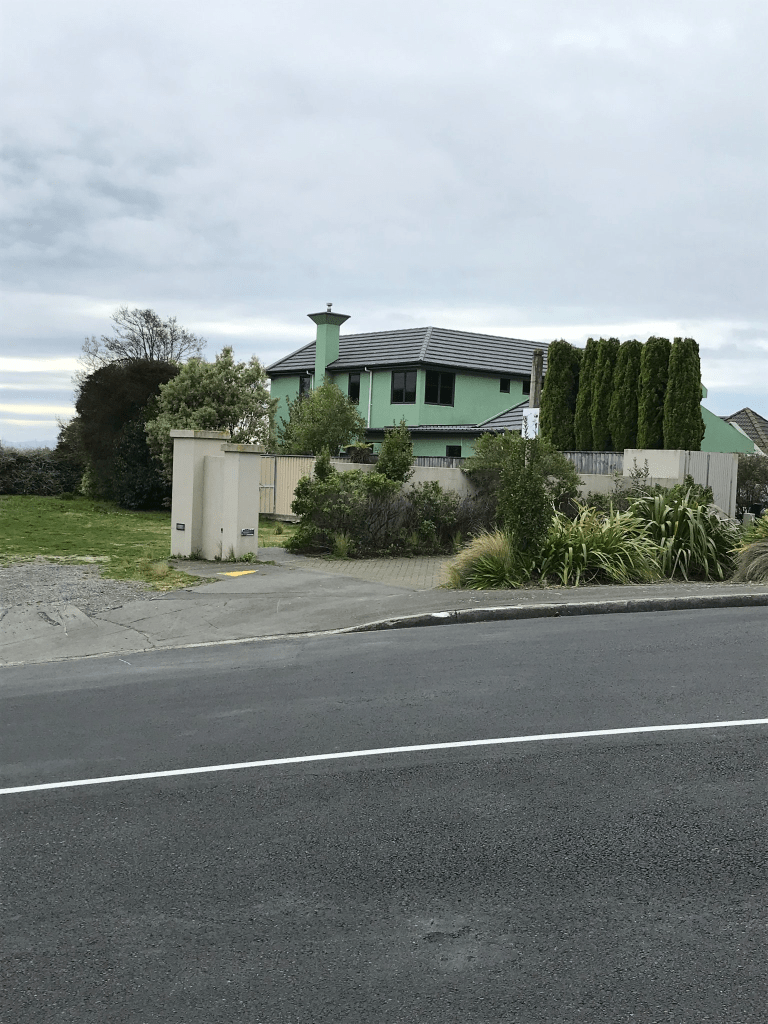
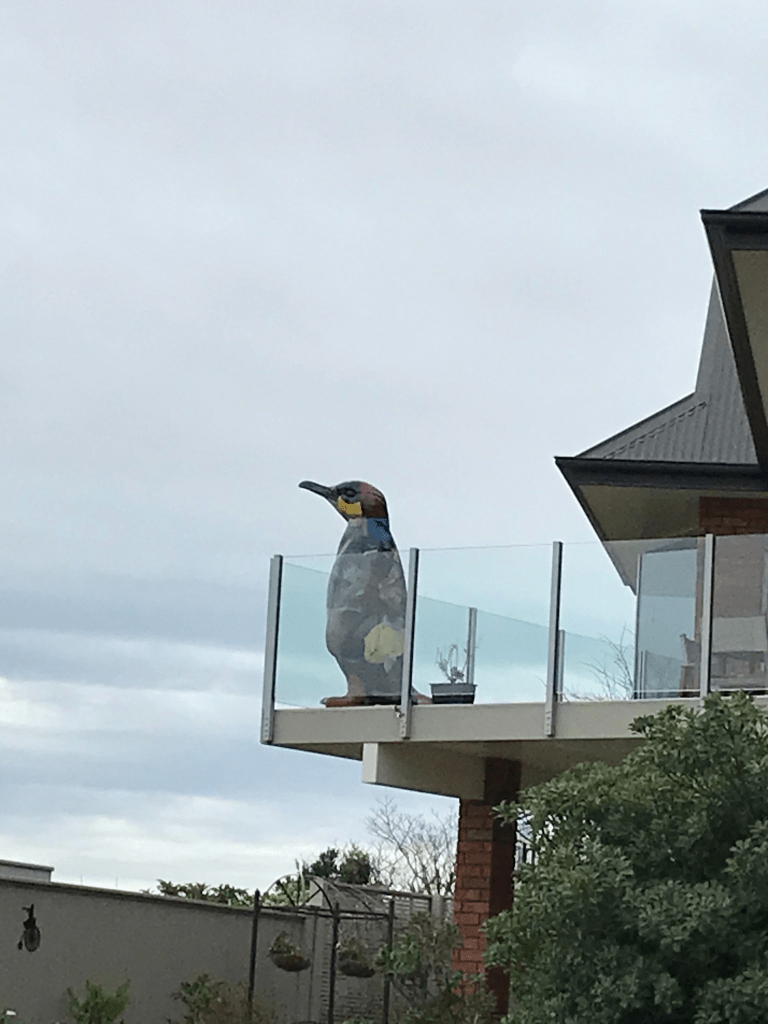
Eridge Place in Huntsbury – nothing on library website for this street. Only 6 houses here and they were all built in 2000. The street is probably named after a place in Kent in the UK. The library website for other streets in the area mentions naming streets after English villages. A couple of the houses I quite liked but there was at least one toilet block style. What I did like was the giant penguin on a balcony. I had fun when the penguins were on display in Christchurch back in 2019. Great views
Enticott Place in Huntsbury – Named after Dr. Thomas Oliver Enticott (1918- 1999). From 1946 Dr Enticott was on the staff of the Cashmere Sanatorium and involved with the treatment of tuberculosis. The Sanatorium was converted to a geriatric hospital in 1956 and re-named Coronation Hospital. Dr. Enticott was appointed medical superintendent and served until his retirement in 1985. First appears in street directories in 1995.
A reasonable amount of information from the library website. Nothing on Papers Past about Thomas Enticott. Most houses were built in the 1990s and a few were quite nice. It was a pleasant street but houses too big for this single person. The street is just below Coronation Reserve.
Caldwell Lane in Huntsbury – Named after Dorothy Susan Johnstone, née Caldwell, (1910- 2004). Mrs Johnstone was a pioneer of geriatric nursing at Coronation Hospital 1956-1971. Named in 1993.
A small amount of information from the library website. No information on Papers Past. I didn’t walk this tiny street as it definitely looked like a private driveway and there wasn’t a footpath. Even the google vehicle didn’t drive up this street. Only 6 houses here and they were built in 1990 except for one more recent house.
Benjamin Lane in Huntsbury – Named after Kate Elizabeth Benjamin (1868-1938). Kate Benjamin was the matron of the Cashmere Sanatorium 1911-1915 and 1919-1924. Named in 1993.
A small amount of information from the library website. I am pleased that this woman has a street named after her as she sounds like a great person. She was the daughter of Mr and Mrs Benjamin of Templeton. She trained at Christchurch Hospital. During World War One she took leave from the Sanatorium to work for the Red Cross at the front. She was working at Cook Hospital in Gisborne when she retired in 1933. She is buried at Bromley Cemetery. There was an obituary on Papers Past for Kate Benjamin.
I didn’t actually walk this street as it looked like a private driveway and there wasn’t a footpath. When I checked google maps the street was bigger than I thought and has seven houses here and most were built in 1990s. I don’t normally like modern houses but one house I really loved. Obviously well beyond my budget plus I like living within walking distance of the central city.
Karaka Place in Somerfield – Named in 1966. First appears in street directories in 1970. Information on date of naming in a letter sent to the City Librarian from the Town Clerk dated 13 December 1966.
A small amount of information from the library website and Karaka is a New Zealand tree. Most of the entries in Papers Past were ads for sections. The street runs off Woodbank St and most houses were built in the 1970s but one modern one from 2016. There was a footpath on both sides of the street so I was happy. It was a pleasant street and most houses had been built on raised land and were above the street. A couple of really nice gardens and it is funny how I like nice gardens but my own garden I usually describe as a wildness area for flora and fauna.
Ferniehurst Street in Somerfield – Named after Ferniehurst which is 24 km from Cheviot. In a subdivision where the streets are named after rivers or properties in North Canterbury. Named in 1966. First appears in street directories in 1970.
A small amount of information from the library website. Ferniehurst is possibly a place name from Scotland as I found a castle called Ferniehurst Castle near Jedburgh. When googling Ferniehurst Station it reminded me that I haven’t yet found the geocache with the same name. In Papers Past there was mostly ads for the sale of sections. The street was described as being in the suburb of Cashmere or Lower Cashmere in the ads. In a map from 1958 the area looked like one big property. The street runs between Woodbank St and Ashgrove Tce. Most houses were built in 1960s and 1970s with a couple built in 2016. As the ones built in 2016 were close to the river it is possible that they are rebuilds after the earthquakes. Looked like a pleasant street but nothing stood out for me but Ashgrove Reserve is partly on this street. I walked this street yesterday and did have success with my geocaching.