Postbridge Lane in Huntsbury and nothing on the library website. The name sounded familiar and when I googled I realised why I recognised it. Postbridge is a hamlet in Dartmoor and I recommend googling Hairy Hands. Only 7 houses here and no footpath. Because of the sign at the beginning of the lane I thought that there was going to be a show home here but there wasn’t. Great views.
Swanton Drive in the suburb of Huntsbury, Christchurch
Swanton Drive in Huntsbury – This name continues the theme used in the subdivision of naming the streets after English villages and localities. Named in 1998.
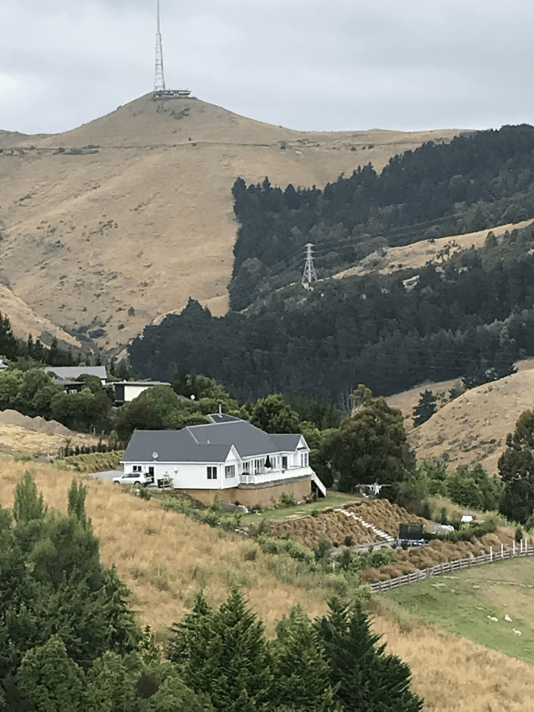
A small amount of information from the library website. Most houses were built in 2000s but a few were built between 2017 and 2022. Great views over Christchurch and many houses looked like goldfish bowls with so many windows. Near the top there is a big paddock with two very friendly horses in it.
Tideswell Lane in the suburb of Huntsbury, Christchurch
Tideswell Lane in Huntsbury and nothing on library website. Probably named after the village Tideswell which is in the Peak District. There is one house from 2000 but the rest are after 2015. Looks like there is at least two more houses being built with the fencing blocking the top of the street and there was a portaloo. A narrow and tiny street with no footpath so I really just poked my nose into the street but didn’t really walk it. Seemed to be modern houses and none stood out for me.
Westview Place in the suburb of Huntsbury, Christchurch
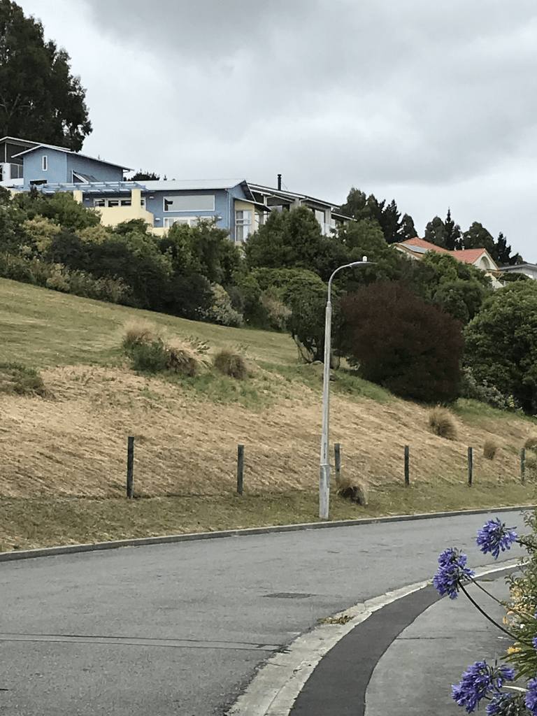
Westview Place in Huntsbury and there wasn’t anything on library website about it yet most houses were built in the 2000s. The name is probably because of the views to the mountains.
Great views and there are still houses being built here. There was one house that really appealed to me and I actually got better views of it from across the valley. I was so positive that it was an older house but it was probably built in 2020 as it wasn’t on street view from 2019. I quite liked the street but it would be a nightmare driving up or down Huntsbury Ave in winter conditions.
Tiroroa Lane in the suburb of Huntsbury, Christchurch
Tiroroa Lane in Huntsbury – Tiroroa means: long view or extensive view. Developed at 200 Huntsbury Avenue. Named in 1998.
A tiny amount of information from the library website. Not many houses here and most were built in 2000s with a couple of more recent houses. It does have a footpath but I gave up and didn’t bother finishing walking the street as there were so many cars blocking the footpath especially at the top of the street. Good views. Best view of the houses was from the street below.
Chittagong Lane in the suburb of Cashmere, Christchurch
Chittagong Lane in Cashmere – Named after Chittagong, a city in southeastern Bangladesh. One of the streets in Cashmere given the name of a place in India. Formed post-1997.
A tiny amount of information from the library and Chittagong is actually in Bangladesh which has been a separate country since 1947.
A slightly confused little lane as all the houses on it have Delhi Place as the address. The street doesn’t exist on the valuation website. I actually walked it when I walked Delhi Place as the maps said it was Delhi Place. There wasn’t any signposts saying it was a separate street.
Garth Terrace in the suburb of Cashmere, Christchurch
Garth Tce in Cashmere – Walkers Valley Road and Walker Terrace. Both Walkers Valley Road and Walker Terrace appear for the first time in street directories in 1928. Re-named Garth Terrace which first appears in street directories in 1950.
A small amount of information from the library website. Very little information on Papers Past. In 1933 under Walker Tce the residents requested that the council plant trees along their road but the council refused because of the number of trees being vandalised in the Cashmere area. The only entry under Walkers Valley Rd was from the egg marketing board. Under Garth Tce in 1966 the storm water drains were being extended.
A very steep and narrow street with 5 houses and one dates from 1930. At least one resident isn’t worried the the new water rates as they were managing to water the road as well as their garden and I got wet. There was one lovely house at the top but my photo didn’t turn out very well and nothing on street view. There is a walkway at the top which takes you to Dyers Pass Rd.
Gwynfa Avenue in the suburb of Cashmere, Christchurch
Gwynfa Ave in Cashmere- formerly Hawthorn Avenue or Hawthorne Avenue. Re-named Gwynfa Avenue. Named after a loop on the hills extension of the tram on Hackthorne Road. This was named because the name Gwynfa was on a gate immediately opposite this stop. There was some argument about the name of the loop, and this was regarded as rather amusing as Gwynfa is the Welsh for place of happiness. Hawthorn Avenue or Hawthorne Avenue first appears in street directories in 1924. It was a private street until officially re-named Gwynfa Avenue in 1933 by the Public Utilities Committee of the Heathcote County Council.
A reasonable amount of information for a tiny street. Not a lot of information on Papers Past. Nothing for Hawthorn Ave and for Hawthorne Ave it was mostly personal notices plus a subdivision of a property in 1931. Under Gwynfa Ave there was an obituary for Miss West-Watson who opened a convalescent home in the avenue but closed it when her sister-in-law died. She had to be housekeeper for her brother Bishop West-Watson after his wife died. A Dr R B Phillips of Hackthorne Rd owned the property called Gwynfa.
A tiny private street with no footpath but it was wider than normal private streets so I did walk it. A couple of modern houses but there are four houses from 1920s and they are lovely.
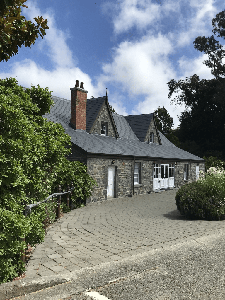
Shalamar Drive in the suburb of Cashmere, Christchurch
Shalamar Drive in Cashmere – Named after the Shalimar Gardens in Lohore, Pakistan. [The misspelling of Shalimar (Shalamar) happened when the subdivision was registered.]Sir John Cracroft Wilson (1808- 1881), a judge, farmer and politician, lived in the Old Stone House and employed a number of Indians who lived here in small structures by the roadside. One of the streets in Cashmere given the name of a place in India. First appears in street directories in 1979.
A reasonable amount of information from the library website and as I mentioned when writing up another street Lahore is in Pakistan and not India. They have also spelt Lahore incorrectly.
Papers Past actually had a travel article in 1925 where Lahore is described as the garden of India but it has been the capital of Pakistan since 1947. As for Kashmir that place gets very confused about which country it is in. Apart from ads for The Stone House most entries were sections for sale between 1977 and 1979.
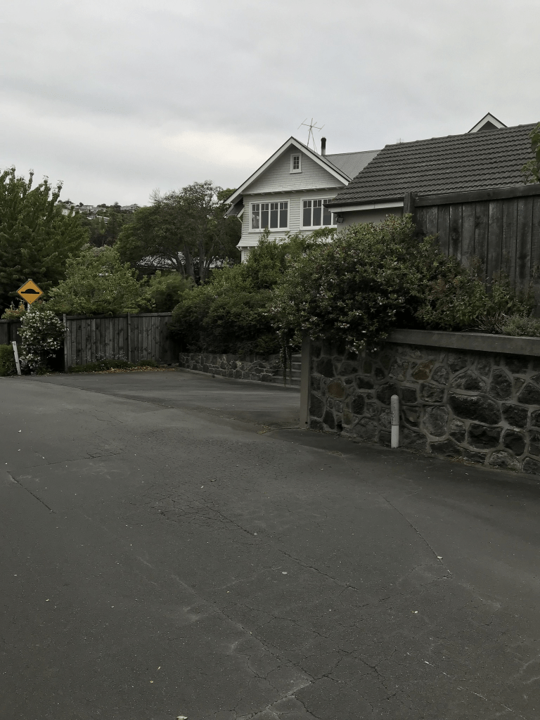
I have walked the first part of this street frequently and many years ago I went to weaving classes at the Old Stone House. There is footpaths at the lower end of the road which is where most of the houses are situated. As you continue walking there is no longer a footpath and the road is narrow. Luckily it is rare to get traffic here. At the top I couldn’t go any further as there are private property signs and these signs weren’t there last time I was up here.
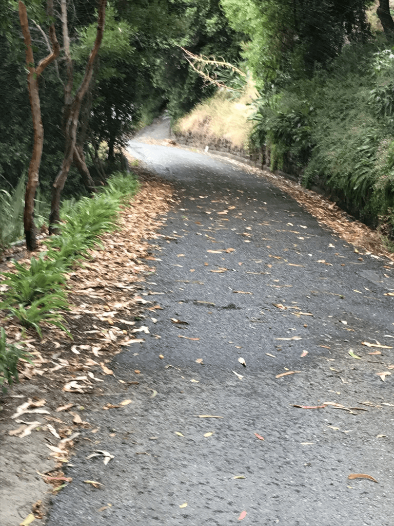
On my way down and next to the Shalamar Reserve I ended up chatting to a former local. He said that the owners at the top of the road had to put up signs as tradesmen working on the new subdivisions were trying to use their property as a short cut and causing problems. He said that the reserve comes to a dead end and only leads to four houses. He had been visiting his sister. They grew up in the area and he said that it has changed a lot. I was looking for a short cut to Bengal Drive. He also told me that the developers as part of the subdivision agreement had to provide a reserve. I have had some great conversations when walking the Cashmere Hills. Obviously the best building on the street is the Stone House. I did eventually find a shortcut to Bengal Drive after at first mistaking someone’s steps as the walkway.
Darjeeling Lane in the suburb of Cashmere, Christchurch
Darjeeling Lane in Cashmere – Named after Darjeeling, a district in the state of West Bengal in India. One of the streets in Cashmere given the name of a place in India. Formed post-1997.
A tiny amount of information from the library website. This wasn’t on my list as website where I get which streets are in the various suburbs didn’t have this street. The valuation website didn’t have this street either. Looks like there are houses there but today it was blocked off by builders who are building at least one new house here.
