Bowen Street in the suburb of Upper Riccarton, Christchurch

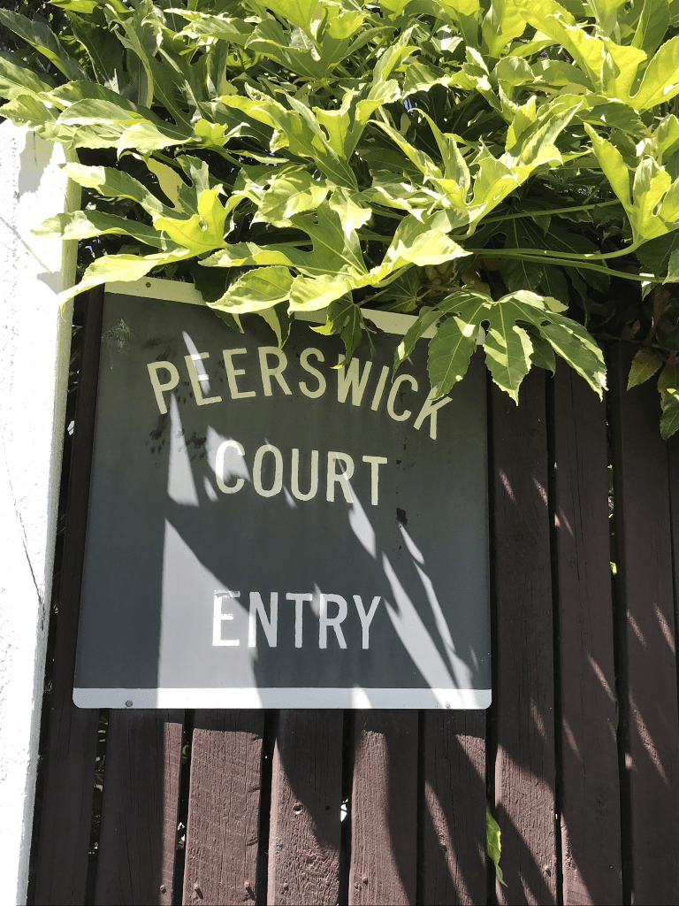
Bowen St in Upper Riccarton- Named after Charles Christopher Bowen (1830-1917). Bowen was an administrator, politician, poet, magistrate and educationalist. His home was Middleton Grange, in Riccarton. One of the five residential streets containing mainly workers’ cottages making up the area known as Peerswick. First mentioned in The Press in 1882 in a report of a meeting of the Riccarton Road Board when a number of residents of the Peerswick Tavern asked the Board to form Bowen Street so the adjoining properties would have better drainage. First appears in street directories in 1903.

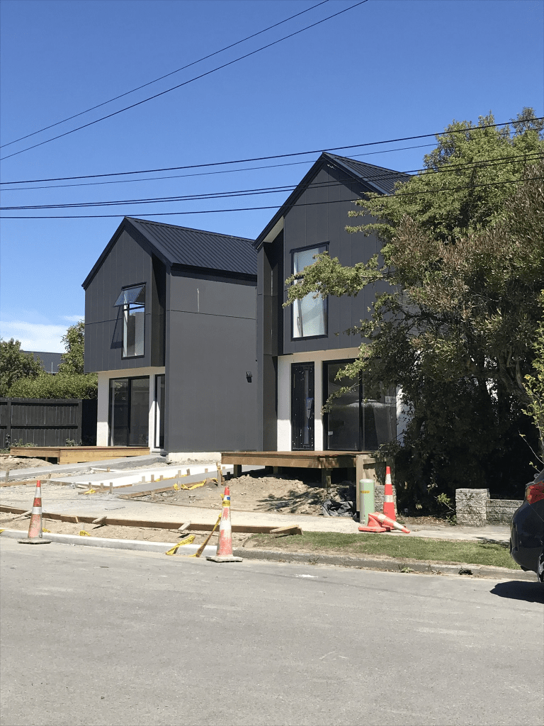
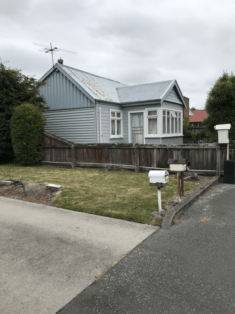
A reasonable amount of information from the library website and that I can add about the name. I found the same article on Papers Past about forming the street. The rest of the entries were about Bowen St in Sydenham. In 1903 Peerswick Villa was mentioned. Lots of death notices. In 1964 pensioner flats to be built and 56 units planned. Most houses here were built between 1060 and 1990s with most built in 1970s. Still 3 older cottages from 1910 and 1920 but I couldn’t get a photo of them. None of the houses stood out for me but there were some nice gardens. A friend told me that it is very convenient because of the Mall and the buses.

Brulay Courts in the suburb of Upper Riccarton, Christchurch

Brulay Courts in Upper Riccarton and nothing on library website. It is on google maps and on NZ Postcode website but there isn’t a street sign actually at the street. It is possibly social housing or over 60s units. It is also possible that it is just a right of way for the 10 units at 59 Waimairi Rd and it was going to be named Brulay Courts but this didn’t happen.

Peerswick Court in the suburb of Upper Riccarton, Christchurch

Peerswick Court in Upper Riccarton and nothing on the library website. Technically this isn’t a street but is a right of way for the 12 houses at 43 Waimairi Rd. Peerswick is from the fact that this area used to be called Peerswick Township after the huge property that was owned by one of the Wakefield family. Peer was a horse and apparently wick means village. The houses were built in 1970s.

Reading Street in the suburb of Upper Riccarton, Christchurch

Reading St in Upper Riccarton and nothing on the library website yet most houses here were built in 1960s I walked this street by accident as I thought that I was still on Kiltie St. There wasn’t any signpost to say that I was on a different street. I originally was going to comment that Kiltie St was a T shape but looking at the map I quickly realised that the T shape was actually Reading St. I am assuming that it is named after Reading in the UK. Not much information on Papers Past. There were 12 sections available in 1964. In 1971 the residents objected to a hospital for the aged being built at 43 Waimairi Rd as it would cause traffic issues so a site was found elsewhere. In 1973 the 7 residents objected to 15 ownership flats being built on the street and these flats would have a right of way to Waimairi Rd. None of the houses stood out for me but there are two new houses being built at one end of the street. It was at this end that I got slightly confused as there is a sign saying Peerswick Court entry but google maps say that it is part of Reading St. I suspect that the private right of way is actually Peerswick Court and I am basing this on how the houses in Reading St are numbered.

Kiltie Street in the suburb of Upper Riccarton, Christchurch

Kiltie St in Upper Riccarton – Named by Joseph Irvine Colligan (1910-1965). Colligan, a hairdresser, was chairman of the Waimairi County Council 1960-1965. His cousin, Charles “Charlie” Gibson, lived at 40 Waimairi Road, opposite where Kiltie Street was formed. He was a member of the Caledonian Pipe Band, members of which wore a kilt when performing. Named in 1961. First appears in street directories in 1964. Information supplied in 2004 by Aileen Colligan (d. 2010) in an interview with Margaret Harper. Waimairi County Council minutes book, 1961, CH357/50, p 1093,held at Christchurch City Council archives.

A reasonable amount of information from the library website and what surprise to find out that members of a pipe band wore kilts. Yes that last comment is dripping with sarcasm.

Not much information on Papers Past apart from the usual death notices. Should we be concerned that there are lots more death notices than birth or marriage notices on Papers Past. In 1962 it is described as an executive subdivision and 15 sections were available. I found Pipe Major Charles Gibson of the Caledonian Pipe Band mentioned in 1934. He was also mentioned in 1920 when he married Barbara Irvine at St Andrews Church. Reason he was mentioned was because he wore a kilt at his wedding.

All the houses on the street were built in 1960s and none stood out for me but 2 or 3 had an unkempt look about them. If you look at street view for September 2022 the same properties look nice and tidy. They possibly belong to the water rates protest group. Fr some reason this street didn’t have a street sign saying which street it was and I had to double check my map to make sure that I had the correct street. I am very disappointed that there wasn’t a kilt in sight. I don’t have an obsession with pipe bands and men in kilts. Honestly I don’t. I also have no idea why there was a sign of an arrow in a tree here.

Leslie Street in the suburb of Upper Riccarton, Christchurch

Leslie Street in Upper Riccarton – Formerly Harper Street. Named after Dr Henry John Chitty Harper In 1886 John Hanson and others wrote to the Riccarton Road Board requesting that Harper Street be formed. Harper Street first appears in street directories in 1887. Harper was the first Bishop of Christchurch and the second Primate of New Zealand. One of the five residential streets containing mainly workers’ cottages making up the area known as Peerswick. Re-named Leslie Street by the Waimairi County Council on 8 February 1933 when the problem of duplicate names was addressed with a number of streets.

A reasonable amount of information from the library website. I couldn’t find out where the Leslie name came from. I had to limit my research on Papers Past for Harper St because of the number of entries. Between the Riccarton Harper Street and the Sydenham Harper St there was a lot of information. The usual lots of birth and death notices. At least two residents in 1909 were farmers and one resident in 1915 was fined for allowing his horses to roam. In 1916 one resident died after breaking his neck while driving a mob of cattle in the area. There was the name change in 1933.

In 1968 the Church Corner Mall was built and it was owned by the Fletcher Staff Super Fund. In 1970 DMS Mutual Retirement Fund purchased it from the Fletcher trustees. I have no idea what shops are in this Mall now but I remember that there used to be a bike shop as I purchased my sons bikes here. I am fairly sure that there used to be a secondhand bookshop as well. The car park for this Mall is on Leslie St.

In 1978 Fletcher Development had an application for a meat processing plant on the corner of Brake St and Leslie St declined because of how close it would have been to residential areas. In 1979 Tenderkist Meats applied for a meat processing plant on the same block of land.

The Mall car park takes up one side of the street and there are houses on the other side of the street. Most houses were built in the 1980s with a couple built earlier and a couple built in 1990s. I would hate to live on this street. Just walking it yesterday I saw car drivers blocking driveways and more than one household had a notice up saying private property do not park here.

Owens Terrace in the suburb of Upper Riccarton, Christchurch

Owens Tce in Upper Riccarton – Formerly Curletts Terrace. Named because it runs off Curletts Road. Re-named Owens Terrace. Named after John Owens (1833?-1930)Curletts Terrace first appears in street directories in 1936. Re-named Owens Terrace on 8 June 1948. Owens settled in Upper Riccarton about 1872. His wife recalled in his obituary that at that time there were only two houses between their own and Cathedral Square. They lived in Curletts Road. Owens worked for the Paparua Council until 1928. Date of re-naming supplied in 2007 by Bob Pritchard, subdivisions officer, Christchurch City Council.

A reasonable of information from the library website. John Owens was 97 years old in 1930 when he died and he had only retired 2 years earlier going by his obituary on Papers Past. He was originally from Tipperary, Ireland. It might have been renamed Owens Tce in 1948 but for some reason after that date both Owens Tce and Owens St were used and in 1969 the street was changed from Owens St to Owens Tce. A bit confusing. In 1950 there were crown sections available with preference for servicemen. A few death notices including John Owens’s son William who died in 1949. I also found a death notice for an uncle of the ex-husband.

Most houses were built between 1950s and 1990s but there was one house from 1915 and two from 1920. I quite liked the street.

Roche Avenue in the suburb of Upper Riccarton, Christchurch

Roche Ave in Upper Riccarton – In a block of 28 acres bought by the government for state housing in 1953. The land was formerly owned by Pyne, Gould Guinness Ltd and was in Curletts Road between Blenheim Road and Riccarton Road. First appears in street directories in 1958.

A small amount of information on the library website. The article in Papers Past about the land didn’t mention this street by name. I suspect that the street was named after a person but couldn’t find out who. My best guess is a government employee John P Roche but it is a guess. Not a huge amount of information on Papers Past. There was flooding issues in 1961 and the council was blamed. The footpath was resealed in 1962. A few death notices. This is a treelined street and most houses were built in the 1950s. They definitely had a state house look about them. I was going to use the walkway through to Hillary Crescent but it was blocked. There is a big building project for Kainga Ora on this street and this is why I couldn’t use the walkway.

Haynes Avenue in the suburb of Upper Riccarton, Christchurch

Haynes Ave in Upper Riccarton – Named after Mary Jane “Jennie” Ballantyne, née Haynes, (1869- 1952) of the family of Herbert, Haynes & Co. of Dunedin. The family of William Ballantyne (1864-1934) and his wife, Mary Jane, lived on a one hundred acre farm there 1896- 1946. Their family home, Nydfa, was in Hansons Lane. William Ballantyne and his older brother, Josiah, both married daughters of Daniel Haynes. Josiah married Jessie Montgomery Haynes in 1886; William married Mary Jane (Jennie) Haynes in 1891. First appears in street directories in 1952.

A reasonable amount of information from the library website and nothing that I can add about the name of the street.

Papers Past had several entries about the kindergarten. In 1950 a section was set aside for the kindergarten and in the same year they started raising money to build it. It was decided that it would be called Church Corner Free Kindergarten. They called for tenders in 1955 for building it and it was opened in 1957. When it was opened it was called Lady May Free Kindergarten and it is now called Kidsfirst Kindergartens Lady May.

There was a serious sewer blockage in 1953. In 1967 there was a proposal from the Rotary Club to use 2 acres of land as a reserve. The land was being used a plant nursery for the Ministry of Works. The Rotary Club wanted more recreational space for the nearby Maori Boys Hostel. In 1973 it was proposed to use the Crown Reserve for a geriatric hospital but a new site was found for the hospital and the reserve is still there and is called Hansons Reserve. It is bordered by Hansons Lane and Haynes Ave.

Most houses were built in the 1950s and the street had a state house feel about it but I couldn’t find any evidence of state houses here. There were ads promoting flats for students. The reserve has a nice playground here.

Ballantyne Avenue in the suburb of Upper Riccarton, Christchurch

Ballantyne Ave in Upper Riccarton- Named after the Ballantyne family, of Ballantyne’s Department Store. The family of William Ballantyne (1864-1934) and his wife, Mary Jane, née Haynes, (1869?-1952), lived on a one hundred acre farm there 1896-1946. Their family home, Nydfa, was in Hansons Lane. First appears in street directories in 1952.

A small amount of information from the library website and nothing that I can add about the name of the street. Not a lot of information on Papers Past and the earliest entry that I found was an ad in 1952.Several houses for sale in the 1960s. Seemed to be an accident prone lot living on this street going by some of the entries.

It is a tree lined street and most houses were built in the 1950s. There are some fairly new Kainga Ora houses (state houses) at one end of the street. A company promotes student flats on the street and at least one over 60s unit was for sale. At one end there is a walkway to Riccarton Rd and at the other end it is blocked by a new cycleway. The street didn’t do a lot for me and a few houses were looking a bit rundown.