Campion Place in the suburb of Halswell, Christchurch

Campion Place in Halswell – First appears in street directories in 1993.

Tiny amount of information from the library and I couldn’t find anything online about the reason for the name. It sounds like it could be a person’s surname. As usual with modern streets of this type there was a footpath on only one side of the street. The houses were all built in the 1990s and they actually looked quite nice. This street runs off Westlake Drive.

Kairua Road in the suburb of Hornby, Christchurch

Kairua Road in Hornby and this street is too new to be on the library website. This is a Ngai Tahu development and is an industrial subdivision. There are footpaths on both sides of the road which surprised me for a new street. Only one building here and the rest of the sections are for sale. The street curves around like a crescent and runs off Wilmer Rd. The road is named after Hapukuku Kairua who was a leading chief from Kaiapoi in 1860s.

Wilmers Road in the suburb of Hornby, Christchurch

Wilmers Road in Hornby – Wilmer’s Road is first mentioned in the Star in 1898. Teams were engaged in the formation of Wilmers Road in 1933. First appears in street directories in 1960. Streets in Hornby are not listed separately until then.

A small amount of information from the library website. I found the same information on Papers Past. The road was probably named after George Wilmer and Wilmer St in the central city is named after the same person. George lived at his property in the central city but he also owned a rural property where he had his racehorses. Sounds like he was good cricketer. He was born in Sussex in 1817 and married Mary Ann Kidd in 1848. Still in England in 1851 but didn’t find the date of when he came to NZ. In 1958 a new animal home for SPCA was opened on the road and lots of information on Papers Past about the SPCA. In 1940 a property that had been a sheep farm was for sale. In 1970 two blocks of land were for sale and they had crops of lucerne but no buildings. In 1971 a market garden was for sale.

I was geocaching in the area and was surprised to see houses here. There are 12 houses and apart from one dated in the 1960s the rest were built in the last few years. The street runs from Awatea Rd to Springs Rd and Warren Park is on one side of the road. The houses are at Awatea Rd end of the road and then there is a big section being developed for industrial businesses. The Wigram Fire Station is near Springs Rd. Wilmers Road divides into two and you can walk past the fire station but the other part is blocked off as it belongs to Meadow Mushrooms but there is a walkway that leads to a combined walkway / cycleway that takes you to Addington. A few years ago I took a bus to Springs Rd and then walked home to Addington. The SPCA is still on this road. There is water reservoir with an interesting building on the site. I believe that the design on the building is a map of Canterbury.

Doyle Place in the suburb of Avondale, Christchurch

Doyle Place in Avondale and there wasn’t any information on library website. There are only 8 houses here all built in 1970s and one has been modernised and looked weird. It is possible that this street is named after Arthur Conan Doyle as he lived in Hampshire for many years. I visited his grave when I was working in the New Forest area. The library mentioned that the other streets in the area were named after places and people connected to Isle of Wight.

Cowper Place in the suburb of Avondale, Christchurch

Cowper Place in Avondale – Named after William Cowper (1731-1800). In a subdivision between the Avon River, west of the Bower Bridge, and the northern end of the Avondale Golf Course of a 50 acre farm formerly belonging to Stewart Clendinning Hampton (1908- 1993). Developed from 1969 by Merrit-Beazley Homes Ltd. All the streets are named after places on the Isle of Wight. Cowper was an English poet and writer who often holidayed on the there. First appears in street directories in 1976.

A reasonable amount of information from the library website and nothing that I can add to it. Only 12 houses in this small street and they were built in 1970s. Very ordinary street with nothing outstanding but there was a cattery and bunny boarding business here.

Besant Place in the suburb of Avondale, Christchurch

Besant Place in Avondale and there wasn’t any information on the library website. This street runs off Orrick Crescent and the houses were built in 1970s so I was surprised that there wasn’t anything on the library website. I searched Papers Past and Ancestry website with no luck. It sounds like a surname but couldn’t find anyone with that name living in the area. Couldn’t find a place name to match either. The houses were typical for 1970s and nothing stood out for me.

Library information for a nearby street said that streets in the area were named after places or people connected to Isle of Wight. I found three brothers with the surname Besant. William was a mathematician, Walter was a novelist and Frank’s wife Annie was better known than Frank.

Sheraton Place in the suburb of Redwood, Christchurch

Sheraton Place in Redwood- nothing on library website. I was surprised that there wasn’t any information on the library website as at least half the houses were built in 1980 and the rest in 2000. None of the houses stood out for me but there was one two story place that was OK. The street runs off Grimseys Rd and is near the new cycleway that runs along the side of the new motorway. I was geocaching in the area. The street is possibly named after a place in Northern England but couldn’t find out much information about the street. My usual complaint of there being a footpath on only one side of the street

Grahams Road in the suburbs of Burnside, Ilam, Bishopdale and possibly Avonhead, Christchurch

Grahams Road in Burnside and Bishopdale and Ilam – Named after Douglas Graham (1818-1872). Graham arrived in Canterbury in 1852 and was the manager of John Deans’ cattle from 1854 until his death. Grahams Road was cut through his holding of 141 acres which he leased to William Boag. His home was near the corner of Grahams Road where Flay Park is now located. The Star in 1892 refers to a sale of land at Graham’s Estate and describes it as the largest and most important sale of suburban properties held in Canterbury for many years. First appears in street directories in 1912, running from Greers Road to Wairarapa Road (later Wairakei Road). Two residents are listed – both farmers.

A reasonable amount of information from the library website. I did find out that his widow when she died was living at a property called Springbank which explains one of the street names in the area. This street covers at least three suburbs and possibly four suburbs if you included Avonhead.

I found Grahams Rd mentioned in Papers Past as early as 1884 when the road board had to consult the trustees of Douglas Graham’s estate. In 1885 the contactor building the road asked for extension for completing the road. I found Grahams Rd on a map dated 1879. In 1906 there is talk of acquiring land for a cemetery. In 1932 Waimairi Council requested that the name of Grahams Rd be retained. There was a Grahams St in Woolston. In 1938 property owned by Mr Royds with frontages on Grahams Rd was sold and it had been a Suburban Stud Farm. Most entries in Papers Past is in the 1950s and 1960s as the government acquired large section of land for housing especially for state housing. There were at least three estates they took over. In 1969 Crown land from the Flay estate was intended to be Flay Park but 10 acres went to Burnside High School and the rest used for housing. Flay Park is still there but much smaller than the original plan.

In 1956 the Burnside Rd property belonging to the University of Canterbury was taken over as Crown Land. This was 56 acres bounded by Greers Rd, Burnside Rd ( Memorial Ave) and Grahams Rd. The college council agreed to surrender the land to offset the new Riccarton site. Also in 1956 it was recorded that 400 houses to be built on land taken over by the state and this was the Gregan Housing Block. Most of the housing was state houses and it was said that the population of the area would increase by 13,000.

Most of the houses on the street were built in the 1960s but there are a few houses built in other later decades. Walking the street none of the houses stood out for me. Many still have a state look about them and a big block of state houses from 1950s have been demolished. They will be rebuilding more state houses and I can’t remember the current name of this government dept. I am showing my age by calling them state houses. There is a cemetery on this street plus a modern church. Flay Park is at the Memorial Ave end of the street. I then had to cross Memorial Ave and even with lights it isn’t my favourite street to cross. I eventually end up at the roundabout where Grahams Rd becomes Merrin St. Returning to where I had left my car I stopped briefly at Bullock Reserve which has an entrance on Grahams Rd. There is a medical centre in an interesting looking building that almost looked Art Deco. I crossed Memorial Ave again having another good look at the houses but again none really stood out for me. I am amused that my friend’s house is built on land that originally belonged to the University of Canterbury. Fed the cat who was hiding from me and then went home.

Kendal Avenue in the suburb of Burnside, Christchurch

Kendal Ave in Burnside – formerly Kendal Street Named after Kendal, a town in the Lake District. Blogg Brothers Ltd. built “half of the streets in the Wairarapa riding including Kendal Avenue and Springbank Street”. Kendal Avenue was one of the first streets in the South Island to have underground reticulation of power and telephone cables. Kendal Street first appears in street directories in 1960. Becomes Kendal Avenue in 1962.

A small amount of information from the library website. I have searched Companies Office and Papers Past and can’t find out much information about Blogg Brothers. None of the entries on Papers Past about the subdivisions in this area mention them.

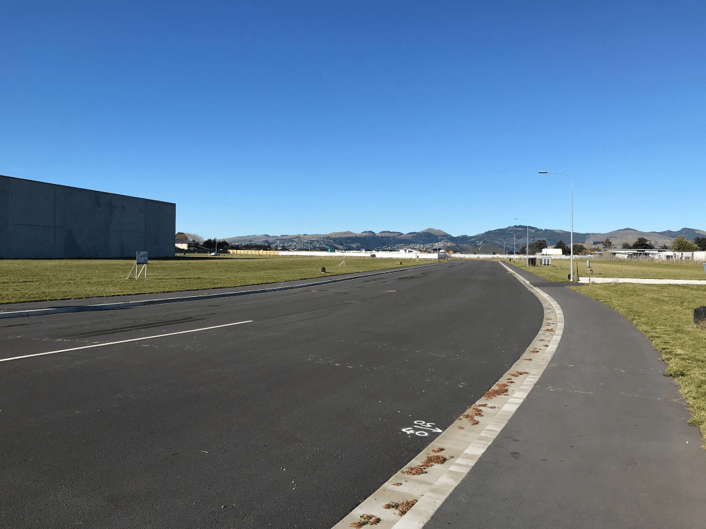
This street runs from Wairakei Rd to Memorial Ave. The houses at Wairakei Rd end were built in 1950s but the majority of the houses were built in 1960s. Three subdivisions were mentioned in relationship to this street and Springridge Ltd development was Memorial Ave end of the street including the shops at that end. The 1950s houses were in the Gregan Housing block. Lands and Survey dept also had a subdivision here including another block of shops. Maurice Carter possibly built houses in the Land and Survey block as I am starting to recognise his style of houses. The sections on the Land and Survey block were offered in ballots. Lots of entries in Papers Past between 1959 and 1961 with sections being sold. Tenders required for building a school and a kindergarten plus the council purchased land in the Gregan Housing block to create a reserve and a playground.

Starting from Wairakei Rd end there are the 1950s houses from the Gregan Housing block. Then it is Kendal Reserve and playground, the school, the kindergarten and Plunket Rooms. Opposite school is St Timothy’s Anglican Church. The bigger group of shops that was built on Crown Land is where Cranbrook Ave ends at Kendal Ave. Several shops including a medical Centre. There wasn’t any mention on Papers Past but the housing on this part of the street has a social housing look about it plus what used to be called State Houses. Continue walking and there is an entry to Ashcroft Reserve. Then a small group of shops which were part of the Springridge development and I then reached Memorial Ave.

None of the houses stood out for me and most of the street was tree lined except for the section which had flats and houses that looked like social housing.

Surprisingly for such a long street I only took one photo which was of the church. Nothing appealed to me. No street art type of artwork at the school which was disappointing as so many schools these days have fantastic street art type of paintings. The trees looked lovely with autumn colours starting to show but as I write this I realise that I found the street boring.

Edited to say that when I visited Kendal in the UK I wanted to buy Kendal Mint Cake for an elderly woman that I frequently looked after. Charlotte loved Kendal Mint Cake but I couldn’t find anyone who had it for sale.

Rembrandt Place in the suburb of Burnside, Christchurch

Rembrandt Place in Burnside – Named after Rembrandt Harmenszoon van Rijn (1606- 1669). Rembrandt was a Dutch artist. First appears in street directories in 1983.

A tiny amount of information from the library website. This street is too new for me to get information from Papers Past. The street runs off Grahams Rd and splits Flay Park in half. Houses were all built in 1980s and more than half were built with brick. A variety of styles and some I liked more than others. There was a mock Tudor house which I actually liked. A pleasant tree lined street and as usual the footpath was only on one side of the street but I did like the street. There was a walkway that lead to a second walkway. The second walkway leads to the grounds of Burnside High School