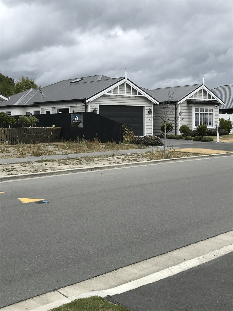
Metehau Street in Marshland – Named after George Williams Metehau, of Ngāi Tuahuriri, Tuahiwi. Metehau was an early Ngāi Tahu leader. Named by Ngāi Tahu Property Group, developer of the subdivision. A small amount of information from the library website. Papers Past had a few entries for George and he sounded like an interesting person. His nickname was Gentleman George. He visited both America and Australia several times. In June 1852 he wrote an interesting letter to the editor and there are at least two different interpretations of this letter. Some people read it as a serious letter and others considered that he was playing a joke. There was also an incident where he chased a W B D Mantell with an axe / mere. An article in Papers Past has a different reason for the dispute from what I found on a website for the history of Kaiapoi. A couple of houses stood out as they have been built in an older style. There were some different letterboxes on this street where rather than the house numbers being written as numbers they were in word form. I started my walk from the reserve on the Lower Styx Rd end and I was expecting to end at another reserve as my map had a green space on it. Instead I was met with fences and it is obvious that the road is being extended.
Raranga Street in Marshland – Raranga means: the art of weaving. In the first stage of the Prestons subdivision. Named by Ngāi Tahu, developer of the subdivision. Named in 2014.
A small amount of information on the library website. All the houses here are on only one side of the street as there a reserve on the other side with a small lake. There is a grassy area and play equipment. There is also gym type of equipment so you can exercise. Personally I prefer to walk for exercise. The houses are all modern ones built in 2014 and 2015 and none stood out for me. There were a couple of businesses and cafes at one end. The footpath was nice and wide so I found it rather weird that two older women decided that they preferred to walk in the middle of the road. I felt sorry for the car driver who had to swerve to avoid them.
Te Aue Street in Marshland – Named after a taonga harakeke variety that, in turn, is named after Te Aue “Daisy” Davis (1925?-2010). Te Aue Davis was a weaver and historian. In the first stage of the Prestons subdivision. Named by Ngāi Tahu Property Group, developer of the subdivision. Named in 2014.
A reasonable amount of information from the library website and there is a wikipedia page for Te Aue Davis.
A street with modern houses and immaculate lawns but one actually had a garden. Nothing stood out for me.
David Palmer Street in Marshland – Named after David Maxwell Palmer (1937?- 1993). Palmer, a lawyer, was a partner in the firm of Weston, Ward and Lascelles. He and Paul Temm QC represented Ngai Tahu in its claims before the Waitangi Tribunal. He was honoured with a tangi at Tuahiwi marae in recognition of his services and support to the tribe. In the second stage of the Prestons subdivision. Named by Ngai Tahu, developer of the subdivision. Named in 2014.
A reasonable amount of information from the library website and nothing that I can add to it. Only four modern houses here and they had immaculate lawns. The footpath was only on one side of the street but it was a nice wide footpath. Nothing stood out for me.
Huntsbury Ave – formerly Dry Bush Road. Named because it runs through Huntsbury. The city section was formerly named Dry Bush Road. Huntsbury Avenue was formed when the Huntsbury Estate was subdivided and sections sold in 1924. Dry Bush Road became part of Huntsbury Avenue on 22 October 1942.
A small amount of information from the library website and the entire road was named Dry Bush Rd at one stage. I looked at old maps and in 1922 and 1930 the maps didn’t have it named. In 1929 map the entire road was Dry Bush Rd. From 1941 until 1958 the maps only show the lower part as Huntsbury Ave and the road just past Aotea Tce is Dry Bush Rd. I couldn’t find a map for the 1960s.
Papers Past had a lot of information apart from the usual birth and death notices. In 1924 there was an ad for big subdivision of the famous estate. The road Huntsbury Ave is promoted as being formed and this will open up a main road to the Children’s Fresh Air Home. In 1927 there are more sections available. In 1935 building a reservoir is suggested and it is completed that same year. Then in 1950 there is a new reservoir being built opposite the children’s playground. There are two reservoirs on this road. In 1942 the Huntsbury Domain is mentioned as they were planning on building a playground.
There were several sections available in 1950 which will explain why so many houses here built in the 1950s. There were complaints in 1975 about the damage that big trucks were doing to the road.
In 1942 there was a complaint about Dry Bush Rd not being signposted and that it was confusing people driving on Huntsbury Ave. Council’s reply was that Dry Bush Rd was a paper road and didn’t require signage.
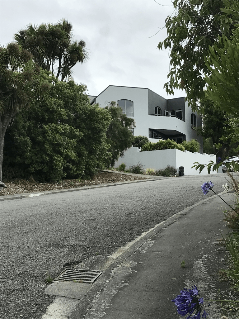
This is a long road and is fairly steep for most of it. There are some lovely 1920s wooden villas still standing. I had a lovely chat with one man who said that his house had been a two bedroomed 1940s house and after the earthquakes he had added the upstairs part. He had done a great job with the house and it looked lovely. He said that it was a lot of work. There are also some modern houses on the street as well and there are houses from every decade here. Eventually you run out of footpath but the grass verge is wide enough to be able to walk safely. Which is why I got rather a fright when one car driver went on the wrong side of the road to avoid me. It is sheer luck that he didn’t hit the car that was driving down the hill. I wasn’t walking on the road and was actually a good foot or more off the road.
At the top of the road there is a Vineyard and Restaurant. There is also one of the reservoirs. There is a track that takes you up to the Summit Road and it is called Huntsbury Track but I noticed that google maps called it Huntsbury Ave. What did interest me was in the valley below the road there was a building. It has a Huntsbury Ave address but I couldn’t find out how old the building is. It looks very similar to the Sign of the Kiwi or Sign of the Bellbird buildings. An interesting road with an interesting history. Gordon Ogilvie has written about the area and I do have one of his books which covers place names for Banks Peninsula and the Port Hills.
Ranelagh Tce in Huntsbury – Probably named after Ranelagh, a suburb of Dublin, Ireland. Named in 1955.
A tiny amount of information from from the library website and it probably is name after the suburb in Dublin but my first thought when I saw the name was Ranelagh Gardens in Chelsea. This is because a favourite author is Georgette Heyer.
There are 15 houses here built between 1960s and 1990s. When I checked Papers Past I got rather confused as the street was named in 1955 but then in 1967 and 1970 there is mention of the name being changed to Parklands Drive. There was talk of a road being closed. I checked several older maps and I am still just as confused. Neither Parklands Drive or Ranelagh Terrace show up in maps for 1950, 1958 or 1963. The map for 1977 shows the streets as being exactly the same as today. When I walked Parklands Drive in 2019 I wasn’t doing quite so much research but I was still working then.
From this street I was able to continue walking up Huntsbury Walkway. I did have to pause briefly on Ranelagh Terrace as a dog took a liking to me. I have no idea why dogs like me and thankfully I am no longer terrified of them.
Edited as I found a couple of maps showing a road that went from Centaurus Rd ( note it had a different name those days) to Huntsbury Ave. This road seemed to be where part of the Huntsbury Walkway is and it might explain what they meant when they talked about closing off a road.
Morven Tce in Huntsbury – Probably named after Morven, a mountain in Caithness in the Highland region of Scotland. There is also a Morven in Aberdeenshire. First appears in street directories in 1981.
A small amount of information from the library website. There is also an area called Morven in South Canterbury.
Only 6 houses here all built in 1980s and I only walked half the street as the very narrow part had a sign saying private driveway so I didn’t walk that part. I had walked up Huntsbury Walkway to get to this street. Another street with good views and most cars were parked half on the footpath but the footpath was still walkable.
Kenmure Drive in Huntsbury – Continues the theme in the Broad Oaks subdivision of naming streets after English villages and localities. Named in 1998.
A tiny amount of information from the library website and the library and the council have managed to insult every Scottish person with that one sentence. Kenmure isn’t in England and therefore the street isn’t named after an English village. I want to visit the original Kenmure for the headless piper.
A street with some ugly modern houses. All the houses are built for the view over Christchurch and to the mountains. The best thing on the street is the reserve and playground.
Millway Place in Huntsbury – Continues the theme in the subdivision of naming streets after English place names. Named in 1998.
A tiny amount of information from the library website and not sure which Millway it is named after in the UK as Millway just seems to be the name of a few suburbs in various towns and cities. I did find a Millway Lodge in Hornby in 1950s and 1960s. It was probably a racing stable but nowhere Huntsbury. Most houses built in 2000s and few built more recently. One unusual house stood out for me and I quite liked it. It isn’t often that I say this about a modern house. Another street with great views.
Edited there say that there were at least 5 mills in this area.
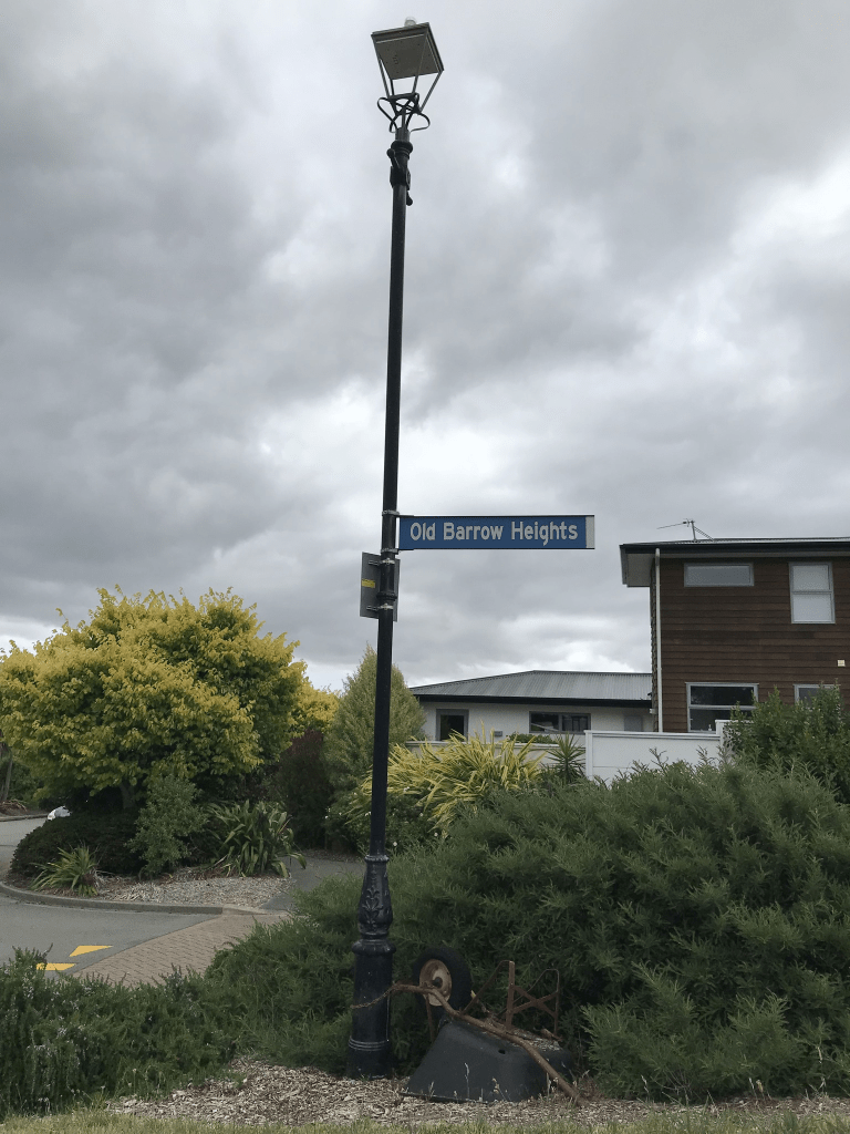
Old Barrow Heights in Huntsbury and nothing on library website for this street. Couldn’t find a reason for the name and there isn’t really a place name of Old Barrow in the UK yet they have used UK place names for the surrounding streets.
Most houses here were built between 2010 and 2018 and a couple are really ugly. The best thing about the street apart from the views is the wheelbarrow chained to the street sign.