Sholto Duncan Crescent in Halswell – too new to be on library website.
This street was named after one of the victims of the 1953 collision between two planes. The planes were part of a fly past that signalled the end of the celebration of the 1953 London to Christchurch Air Race. Sholto was born in 1912 and lived in Nelson. His father owned several hotels and a brewery. During World War Two he was a fighter pilot in the Pacific. He was also a flying instructor. He was on his annual refresher training when he died. Papers Past only had one article about the accident but there was a more recent article when the memorial plaque was unveiled in 2018.
The houses here were built in 2018 and 2019 and are on only side of the street. None of them stood out for me and I didn’t take any photos.
Eric Melrose Lane in Halswell – too new to be on library website.
This street is named after one of the victims of the 1953 collision between two planes. The planes were part of a fly past that signalled the end of the celebration of the 1953 London to Christchurch Air Race. Eric Melrose was aged 21 and he was born in Dunedin. He was on his annual refresher training when he died.
Papers Past only had one article about the accident but there was a more recent article when the memorial plaque was unveiled in 2018.
There are only 15 houses here built in 2018 and there wasn’t any gardens. Just a tiny section of lawn in front of the houses and no fences. The bedrooms seemed to be very close to the footpath and I wouldn’t be comfortable with this.
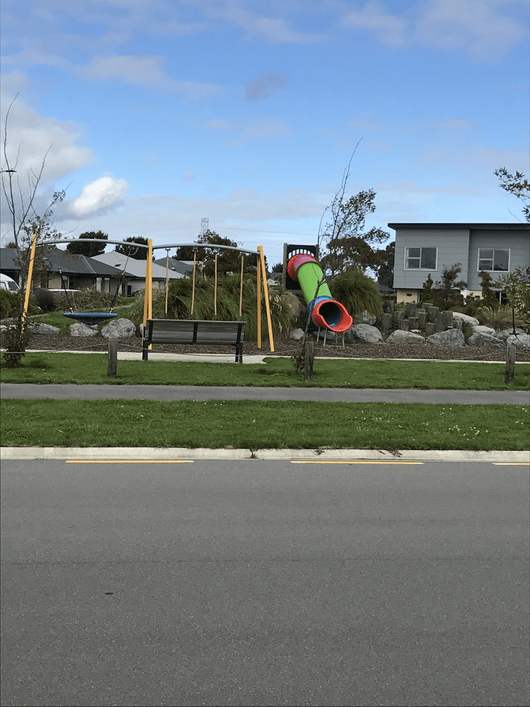
Vildebeest Street in Halswell – too new to be on library website. Vilderbeest is a biplane and the streets here have an aviation theme. The other street names are related to the 1953 London to Christchurch Air Race and this plane wasn’t part of the Air Race.
Only 13 houses mostly on only side of the street and they were built in 2018. The houses didn’t stand out for me and personally I thought that the best part of the street was Vildebeest Park.
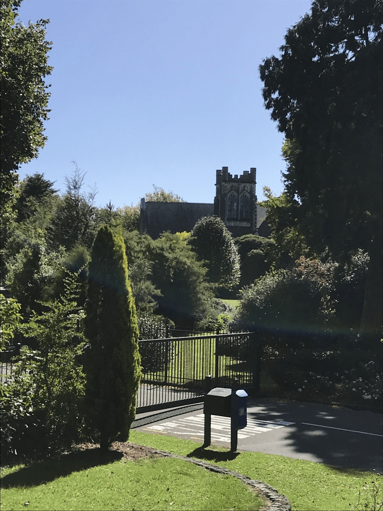
Air Race Lane in Halswell – too new to be on library website. Valuation website put this street into Halswell but it is very close to Wigram. I checked older maps and this area wasn’t part of Wigram Aerodrome but all the names of streets here have an aviation theme. Found a news article dated 16th October 2018 that explained the reason for the street names. A memorial plaque was unveiled on 15th October 2018 on the 65th anniversary of an air collision that killed seven men. The two planes that collided were part of a 27 aircraft fly past over Harewood International Airport ( Christchurch Airport). The fly past signalled the end of celebrations following the 19,756 km London to Christchurch Air Race.
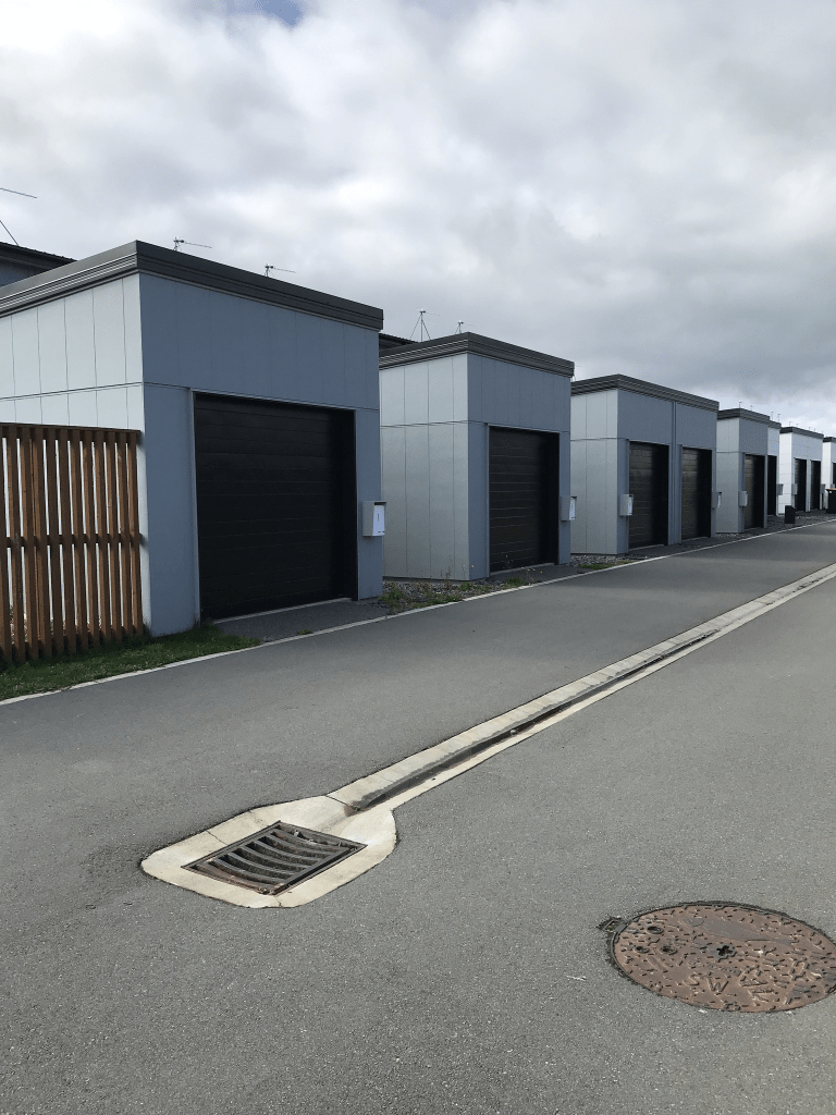
Walked this narrow street yesterday and it is mostly garages that line the street. The houses overlook Vildebeest Park and I thought that they looked like social housing when I walked the street but they are all private homes built in 2018.
Mull Place in Broomfield – Named after the Mull at the extreme south tip of the Kintyre peninsula, Western Scotland. A mull is a headland. Named because it runs off Kintyre Drive. First appears in street directories in 1995.
A small amount of information from the library website. This is a small street with only 17 houses. The houses were all built in the 1990s. None of the houses stood out for me but there were a few nice gardens. Footpath was only on one side of the street. I walked this street a couple of weeks ago when I was geocaching in the nearby park. The song Mull of Kintyre kept running through my head when walking the street. I didn’t take any photos.
Mohua Lane in Upper Riccarton and nothing on library website as it is too new. I found information on the council website and the lane is being developed at 66B Wharenui Rd. I was surprised that 44 houses are being built here. The developer wanted the name Halo Lane but this was declined. Mohua means yellowhead which is a bird. I wasn’t actually able to walk it as it was blocked off as the houses are still being built. I had to go back to it to find out the name of the street as it isn’t on google maps yet but there is a signpost.
A tiny amount of information from the library website. There is an information board in McMahon Reserve which is on the corner of McMahon Drive and Aidanfield Drive which has information about the name. The suburb and street is named after Mother Aidan Phelan and the council approved the name in January 2001. Mother Aidan Phelan came to New Zealand in 1886 and I managed to find out that she came here from Australia which is why I couldn’t find much information on Papers Past or Ancestry. It isn’t as easy to get passenger lists for ships that came from Australia. She was Superior at Mt Magdala between 1907 and 1920 and again between 1929 and 1936. She was named after St Aidan of Lindisfarne.
Also what isn’t mentioned is that going by old maps the portion of Aidanfield Drive from Halswell Rd to Nash Rd used to be part of Nash Rd.
There are only 32 houses here which seems surprising for such a long street but there is a huge amount of green space on this street. The houses were built between 2000 and 2021 with most built in 2010. Near Wigram Rd end there isn’t any houses but there is a large building saying Badminton Courts.
None of the houses stood out for me but a couple I quite liked. I did have a lovely chat with a local man which is how I found out that there is a boy racer problem.
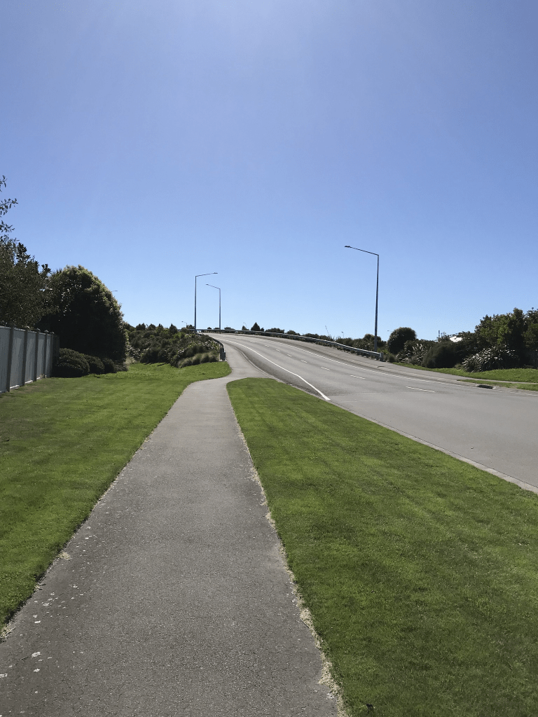
I just can’t remember if Aidanfield Drive when developed always went through to Wigram Rd or if it stopped where the overbridge starts. The overbridge has the date 2011 on it. This overbridge goes over the Southern Motorway and I remember getting totally confused driving in this area when I returned from the UK in 2014. I left NZ in 2009 and only returned home for a couple of quick visits.
Nash Rd – Formerly Magdala Road. Named after the Mount Magdala Convent. Re-named Nash Street. Named after Walter Nash (1882- 1968). Magdala Road first appears in street directories in 1964. Mount Magdala Convent and St. Joseph’s Boys’ Home are listed there. Re-named Nash Road in 1972. Re-named because the boys at the school found difficulty with the word Magdala, plus Nash is an easy name both to spell and pronounce and fits easily on street maps. Nash was a clerk, commercial traveller, shopkeeper, politician and prime minister. Information supplied in 2008 by Bede Cosgriff (d. 2011) in an interview with Margaret Harper.
A reasonable amount of information from the library website but a couple of mistakes. Papers Past has information from the council renaming it Nash Rd in 1969 which was a year after Walter Nash died. The street was also known as Mt Magdala Rd and this name was on early maps. The earliest mention in Papers Past was in 1907 where clippings were donated for the road. I am assuming that clippings is another word for shingle.
Before 1970 most entries are about Magdala home and St Joseph’s Orphanage for Girls. After 1970 the entries mention St John of John Hospital, Marylands Special School and St John of God Chapel.
What the library website doesn’t mention is that Nash Rd used to go all the way to Halswell Rd and on earlier maps what is now is Halswell Rd was known as Lincoln Rd. I am not sure when the portion of Nash Rd that is now part Aidanfield Drive changed to Aidanfield Drive but have 1990s in my head. I should know as I lived not far from here until 2000. We used to get the boys from Marylands School doing their banking in a bank in Addington when I worked in that bank.
I could only walk part of this road as these days there are big signs saying private property and gates blocking it. It meant that I couldn’t get a good photo of St John of God but remember several years ago driving here to get a photo of the building for the website Markeroni. Sadly that website no longer exists. As well as St John of God Hospital there is the Granada Centre, Menz Shed and Halswell Residential College. At the beginning of the street there is Aidanfield Christian School and I recommend that you take extra care if you are a pedestrian here when parents are dropping off or picking up children. Still not impressed with the man who drove across the footpath in front of me so that he could park on the grassy area. Note it wasn’t a driveway and he drove up and over the kerbing.
Euphrasie Drive – Named after Sister Mary of St Euphrasie “Ellen” Fennessy.Sr M. of St Euphrasie Fennessy was the first Australian woman to enter the order and was Mother Superior of Mt Magdala in 1890. In stages 8 and 9 of the Aidanfield subdivision where all the street names are those of former Sisters of the Good Shepherd Order and former residents of the Good Shepherd Sisters Home at Halswell. Named in 2011.
A reasonable amount of information from the library website. There were at least 2 other women who used the name Euphrasie at Mt Magdala. I checked Papers Past and Ancestry website and the only information I found was Mary Ellen Fennessy in electoral rolls for 1905 and 1908 living at Mt Magdala.
I found a map from 1958 and it looks like the street was developed from the driveway that led to St Joseph’s Girls Orphanage.
The houses here were built between 2013 and 2016. There was one house that I actually liked which is unusual for me as I tend not to like modern houses. There were two reserves here and again I was looking for somewhere to hide a cache with no luck. I believe that the residents here have a big problem with people parking here when there are events on at the Sports Hub. It would be OK if they parked properly but they block driveways and park on residents lawns.
Josephine Crescent – In stages 8 and 9 of the Aidanfield subdivision where all the names are those of former Sisters of the Good Shepherd Order and former residents of the Good Shepherd Sisters Home at Halswell. Named in 2011.
A small amount of information from the library website. There wasn’t any information on the plaque in the cemetery and I will need to visit the library for this one.
The houses here were built between 2013 and 2015 and none stood out for me. Mostly immaculate lawns with shrubs. On the long side of the crescent the houses were only on one side of the street. There is a wide green space between this street and Halswell Rd but suspect that you would still get noise from Halswell Rd. I was looking for somewhere to hide a geocache but no luck with that.