Tenby Place in Avondale – In a Paramount Homes subdivision. Named on 15 June 1960. First appears in street directories in 1962. Information on date of naming in a letter sent to the City Librarian from the Town Clerk dated 20 June 1960.
A small amount of information from the library website and the street is probably named after a place in Wales.
Not much information on Papers Past. A few death notices and there were ads in the 1960s for houses. In 1962 there was an issue with flooding in the subdivision. There was one sad story as a young four year old boy who lived on this street was reported missing. The family had been at Birdlings Flat for a picnic and it was suspected that he had been swept out to sea. No body was ever found but that isn’t unusual for Birdlings Flat.
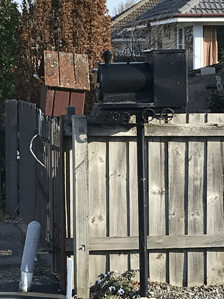
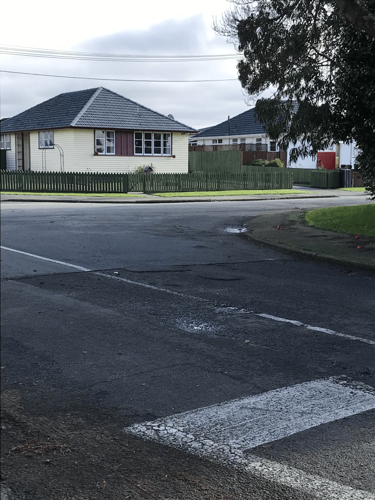
All the houses here were built in the 1960s and none stood out for me but there were some nice gardens. What I did like was a letterbox in the shape of a train. At the end of the street there is an entrance to Chisnallwood Intermediate school grounds.
Newport St in Avondale – In a subdivision by Paramount Homes. Named on 15 June 1960. Information on date of naming in a letter sent to the City Librarian from the Town Clerk dated 20 June 1960.
A small amount of information from the library website and the street was probably named after a place in Wales.
All the houses here were built in the 1960 and it looked like a pleasant street. Not much on Papers Past apart from death notices. There were ads in the 1960s for houses.
I did like a quirky garden on this street and sorry but no photos for it. I did have a nice chat with the owner. I also found out from her that they had flooding on the street this week which would put me off from living here.
Horton Place in Avondale – Named after Edward Beath Horton (1910- 1985) and his wife, Mona Louisa Grace Horton (1914- 2004). Horton was a builder of nearby 54 Breezes Road in 1958. He and his wife were former owners of the site where this street was developed. Their names are shown on the subdivision plan that developed Pembroke Street. Named on 21 February 1962. Information supplied in 2009 by Bob Pritchard, subdivisions officer, Christchurch City Council.
A reasonable amount of information from the library website and nothing that I can add about the name of the street.
Not a lot of information on Papers Past. A few death and engagement notices. Ads for houses in the 1960s. This street runs off Pembroke St and there are only 26 houses here. Most were built in the 1960s but there are several built after 2014. There is still a vacant section on the street. The newer houses are on the side of the street that borders the red zone. Looks like a pleasant street but too close to the red zone for my liking.
A very tiny amount of information from the library website. It is probably named after Pembroke in Wales as other streets in the area are named after places in Wales.
Not a lot of information on Papers Past. A few death notices and a few residents were in accidents. In 1960 the residents complained about the filling in of the land behind their streets which was causing flooding issues. There was flooding on the street in 1989. Most of the houses were built in 1950s but there is an interesting house that was built in 2018. I couldn’t make up my mind if I liked it or not and suspect that it an eco friendly house. There were some nice houses here plus a couple of rundown looking ones. I had walked the red zone part of the street a couple of years ago and walked the full street today after geocaching in the area. The red zone part is near the river at the Avonside Drive end of the street. There is an entrance to Chisnallwood Intermediate on this street near the Breezes Rd end of the street.
Westcott St in Dallington – Appears on a 1954 map. First appears in street directories in 1957.
A tiny amount of information from the library website. The street is possibly named after a place in the UK or it could be someone’s surname. This street runs off Belfield St and there is also a Westcott St in Timaru that runs off Belfield Hill. The Belfield in Timaru is named after a person but I couldn’t find any link to Christchurch so it is probably just a coincidence.
Not much information on Papers Past. A few death notices and for some reason the State Houses on the street occasionally had oven fires.
Most houses here were built in the 1950s but there is a block of State Houses / Housing Corp houses that are fairly new. Going by street view the original houses looked in reasonable condition. This is a very common trend at the moment with these houses. A couple of houses caught my eye. One was because of the topiary garden and the other was for sale. The one for sale said that all earthquake repairs had been done yet it looked very shabby and rundown.
A very tiny amount of information from the library website. The street was probably named after a place in the UK. I personally would like it to have been named after George Henry Claydon who was a master builder and a bell ringer. Papers Past had it described as a new street in 1967 and there were sections available in 1967 and 1970. I was amused to see that in 1968 that the street was described as a quaint little street in an exclusive subdivision. Between 1980 and 1987 there were several mentions of a housing complex for the elderly persons. A community room was also planned. The housing complex was to be called Biddick Courts as it was built on the land that was owned by Miss R Biddick and Miss P D Biddick. Electoral rolls show Phoebe and Racel Biddick lived at 24 McBratneys Rd. I looked at maps and Biddick Courts has an entrance on Claydon Place and the units are on a block of land that goes between Claydon Place and 24 McBratneys Rd. There is still a house at 24 McBratneys Rd.
A couple of nice houses here and one had a lovely garden but none inspired me to take photos.
Bramwell St in Dallington – The street was developed in 1956, the year Banks Avenue School was opened.
A tiny amount of information from the library website and I couldn’t find out where the name for the street came from. Possibly from a place name in the UK. Another possible reason for the name was Roy Bramwell Spear who worked for the Lands and Survey Dept. Another street in a neighbouring suburb was named after his wife but neither of them lived in the area. Not much information on Papers Past apart from a few death notices including a young man who died in the Vietnam War. Another street where the residents seem to be an accident prone lot. Most ads were for the selling of Basset Hound puppies. I was surprised that there wasn’t any ads for selling houses but figured it out when I looked up Banks Avenue School. The ads for houses all mentioned being close to the school.
Most houses here were built in the 1950s and many were built in the last 12 months. A couple of nice houses but many seemed to be State Houses / Housing Corp houses including the recently built houses. There used to be an entrance to Banks Avenue School here but it is blocked off. What I found off-putting about this street was the number of shopping trolleys littering the street.
Belfield St in Dallington – Probably named after Belfield in Dublin, Ireland. First appears in street directories in 1955.
A tiny amount of information from the library website and nothing that I can add about the name of the street. There wasn’t much information on Papers Past apart from a few death notices. I was surprised that I couldn’t find any ads for selling houses. In 1955 the kerbing and channelling was being done on the street. In 1969 the street was extended to Strathfield Ave which explains the 4 or 5 houses dating from 1960s and 1970s. The rest of the houses are from the 1950s. There is new social housing being built on the street and 3 houses are going onto a site that used to have only one house. There is another block of about 3 or 4 houses that are fairly new and also social housing. Some houses look a bit rundown on the street but a couple were in really good condition and I quite liked them.
Ferner St in Dallington Red Zone – formerly Smith’s Road/Smit Street and Queensbury Street/Queen Street. Also Madge Street. Smith’s Road/Smith Street ran from McBratneys Road to Birchfield Street from 1920. No residents are ever listed. By 1930 it had been renamed Queen Street. It became part of Queensbury Street from 1939. It appears on a 1954 map as Madge Street but this never appears in street directories. Madge King (1894-1967) owned a small shop in Birchfield Avenue. Re-named Ferner Street in 1955.
A reasonable amount of information on the library website and I couldn’t out where the Ferner name came from. Raymond Ferner a magistrate lived on Heaton St in Fendalton. His son Martin Ferner an engineer also lived at the same address when he was in Christchurch.
The name changes for the street got very confusing and only one map in 1950 shows it as Queensbury St. None of the maps had Queen St on them. The map for 1958 showed it as Madge St. I checked maps for 1912, 1920, 1930, 1941, 1950 and 1958.
There were so many Smith Streets and Smith Roads in Christchurch. I did find a 1897 entry in Papers Past for Smith’s Rd in Dallington where a Harry Bliss was fined for allowing 15 cows to wander on the street. It is likely that the street was named after someone with the surname Smith.
There was an entry in 1925 which included a photo which showed McBratneys Rd intersected by Smith St and that Smith St leads up to Queensbury St. In 1932 Smith St in Waimairi to become a continuation of Queensbury St. Then in 1954 Queensbury St South to be renamed Madge St in honour of shopkeeper Mrs Madge King who is the daughter of Mrs Howell. In 1955 the southern part of Queensbury St to be renamed Ferner St. Confused yet, as I am certainly confused.
In 1958 there were health issues and the residents were wanting sewage to be installed. They were still on night soil collection.
I didn’t attempt to find the original Smith family as there were far too many on Ancestry website. Madge King was Edna Marjorie Howell and she grew up on Birchfield Ave. Edna (Madge) married Anthony Colin King and they lived on Hereford St.
There are no longer any houses on this street as it is in the red zone. I checked street view for 2007 as it looked like a really nice street. At least 3 or 4 houses looked like they dated from the 1920s.
Halberg St in Dallington – Named after Murray Gordon Halberg (1933-).Halberg was a distance runner and Olympic champion. In a group of streets named after athletes. Named in 1955.
A tiny amount of information from the library website. Sir Murray Halberg died in 2022 and he set up the Halberg Trust to help disabled children to get into sports.
Several entries on Papers Past and in 1962 it was described as a Government block subdivision. There were several death notices. The residents seemed to be an accident prone lot between car accidents, swimming accidents, burns and dog bites. Sadly I recognised one of the names of a car accident victim as I went to High School with her. There were several entries about a family who sued the police for $755,000.00. They won their case and were awarded a payout of $1. It was a weird case and involved a family feud. The son of the family was concerned about his grandmother and reported that she was dead and that there was a body in the house. When the police arrived the family living at the house fought with the police and tried to refuse them entry. It got nasty and the grandmother was still alive .
In the 1960s there were several ads for houses and in the 1980s there were several entries concerning the Magistrates Court.
Most the houses here were built in the 1980s and 1990s plus there are several rebuilds. Most of the street has been red zoned and the houses left are at the McBratneys Rd end with a couple on Landy St end. There is also a Scout Den on this street at the Landy St end.