Connal Street in the suburb of Woolston, Christchurch

Connal Street in Woolston – Formerly Victoria Terrace. Named after HM Queen Victoria (1819-1901). Re-named Connal Street. Victoria Terrace was named in 1884 when the Woolston Town Board decided that “the Cemetery Road, Princess Street and the terrace, from Mardon’s Road (Maronan Street) to Barton Street, (would be re-named) Victoria Terrace”. Re-named Connal Street on 1 September 1948 when 120 streets were re-named

A reasonable amount of information from the library website. I couldn’t found out why the name Connal but suspect that it is named after a person. There were two men with the name Robert Connal and they were father and son and both worked for the railways.

There were so many Cemetery Roads that it was almost impossible to find out information under that name. Most articles were about building bridges to replace the old swing bridge. Several mentions of the nauseous stench in the area. Under the name Victoria Terrace it was mostly ads and death notices. In 1917 there was mysterious outbreaks of fire at the Lane’s Crown Tannery. In the 1920s there was discussion around erosion of the riverbank. The name change in 1948 was because of several streets with the same name. Still several death notices and lots of ads because of all the businesses on the street. The main businesses mentioned were Dunlop Rubber Company and Davis Gelatine Company. In the 1950s and 1960s there were several complaints about smells and pollution. There were several very sad entries in 1981 when a missing child was found drowned in the river. In 1980 a house that was built in 1866 was moved from Connal St to the top of Moncks Spur. It used to house the people who serviced the wharves that used to be here. In 1984 there was a petition from local residents objecting to the closure of the street because of the Woolston Cut. In 1986 a footbridge was built.

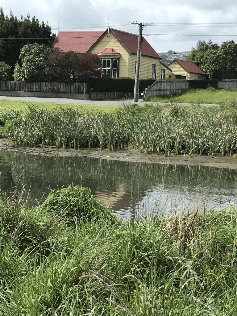
I actually walked this street in October last year and thought that I had already written it up. Today while I was having a tidy up I found my research notes. My excuses for not writing it up last year is that I was still recovering from the weird illness plus I went to Dunedin for geocaching in the long weekend and then disappeared to Adelaide in November. This street is still mostly industrial and buildings are on only one side of the street as the street follows the Heathcote River. Starting at Rutherford St there is the cemetery and you then follow a very narrow road with no footpath. I am not sure if cars are allowed on this part of the road. Some of the businesses look rather rundown here. The road then comes to an end and there is a green space. It looks like a reserve but doesn’t seem to have a name. There are more businesses which have a bit of street art on their walls. Then near the end of the street there are a few houses mostly dating from 1990s and 2000s. I did take 2 or 3 photos of the house that was built in 1880. There is then a footpath that takes to Rutherford St. I crossed the footbridge to walk in the green space on the opposite side of the river. I forgot to look at old maps for this street.

Appian Lane in the suburb of Scarborough, Christchurch

Appian Lane in Scarborough and nothing on the library website. I couldn’t find anything on the council website about the naming of this street. The only Appian that I know is the Appian Way near Rome. I actually walked the Appian Way in 2016 when I was staying in Rome.

I didn’t actually walk this lane as it was a very narrow private lane and I was surprised to realise that there were 9 properties here. They were built in 1990s and 2000s. The Geographic website puts this street into the suburb of Sumner. The same website didn’t recognise Scarborough as a suburb. They would have great views

here

Riselaw Street in the suburb of Mairehau, Christchurch

Riselaw Street in Mairehau – Developed on land previously a farm owned by Arthur William Emmett (d. 1948) and sold after his death. Part of the land was bought by the government for a state housing area “laid out on modern town planning lines”. It was referred to as Emmetts Block. Named on 24 June 1948. First appears in street directories in 1950.

A small amount of information from the library website. Not much information on Papers Past. There were a few death notices plus residents hurt in car accidents. There were two firearm incidents and one was in 1975 and the other in 1980. One year there was a fire in a Christmas tree.

There was another Riselaw Street in Dunedin and the name is possibly from the Ryslaw / Riselaw a place in Scotland.

More than half the houses here are still State houses and most were built in the 1940s and 1950s. Some of the State houses have been demolished and new smaller ones built. For a street with lots of State houses I almost liked the street. There were some quirky features with a brightly coloured house and one with a fun letterbox. I also liked the fairy doors on a tree. What did put me off is that there is obviously a boy racer in the street going by the marks on the road. There are entrances to McFarlane Park here plus an entrance to Shirley Primary School.

Lynn Place in the suburb of Mairehau, Christchurch

Lynn Place in Mairehau – formerly Lynn Street. Developed on farmland previously owned by Arthur William Emmett (d. 1948) and sold after his death. Part of the land was bought by the government for a state housing area “laid out on modern town planning lines”. It was referred to as Emmetts Block. Lynn Street was named on 24 June 1948. First appears in street directories in 1953

A small amount of information from the library website. The only entries on Papers past were a few ads.

Only 6 houses here and 4 of them are State houses. Most built in 1950 but two were built in 2023. These were built on a section where a house had been demolished after the earthquakes.

Dawe Street in the suburb of Mairehau, Christchurch

Dawe Street in Mairehau – Developed on farmland previously owned by Arthur William Emmett (d. 1948) and sold after his death. Part of the land was bought by the government for a state housing area “laid out on modern town-planning lines”. It was referred to as Emmetts Block. Named on 24 June 1948. First appears in street directories in 1950

A small amount of information from the library website. This street was probably named after a person. There was only one entry on Papers Past and it was from the residents requesting a phone box for the corner of Dawe St and Akaroa St. This request was declined. There are only four houses here built in 2000. I was surprised that they weren’t social housing as they looked a bit like pensioner cottages. On the other side of the street it looked like a hoarder’s house but it was actually the backyard of a house on Skipton St. Weirdly their letterbox is on Dawe St.

I didn’t particularly like this street and it is probably because of the hoarder’s house plus there were cars parked blocking the footpath. I think that I did take a photo of the cars blocking the street but attributed it to the wrong street.

Akaroa Street in the suburb of Mairehau, Christchurch

Akaroa Street in Mairehau – Developed on farmland previously owned by Arthur William Emmett (d. 1948) and sold after his death. Part of the land was bought by the government for a state housing area “laid out on modern town planning lines”. It was referred to as Emmetts Block. Named on 24 June 1948. First appears in street directories in 1950.

A small amount of information from the library website. It was difficult researching this street on Papers Past as there was another street with the same name in Kaiapoi. The one in Kaiapoi had a huge number of entries. Most entries on Papers Past said that the street was in Shirley. There were death notices plus a few residents were involved in accidents. The corner of Briggs Rd and Akaroa St seemed to be rather a magnet for car accidents. In 1956 there was a tender for the removal of the substation on the corner of Akaroa St and Hills Rd. As there is a still a substation here it had obviously been replaced by a newer building.

All the houses here were built in the 1950s except for one built in 2000. I was surprised that more than half of the houses here are still state houses as it seemed to be a much nicer and tidier street than Emmett St.

Arthur William Emmett

This is what I wrote in 2021

As I can’t go over to the suburb of Shirley to walk Emmett Street because of lockdown I will do a write up on Arthur William Emmett while it is fresh in my mind.

Arthur owned a large block of land in the Marshlands area running from Marshlands Rd to Quinns Rd and after his death much of it was turned into a state housing area called Emmett’s Block. His son Edwin was still farming at 132 Marshlands Rd until his death in 1966.

The various family trees on the ancestry website give Arthur’s date of birth as 7th December 1860 in Cornwall yet his death record in 1948 gives his age as 65 years which would give a birthdate of 1883. Court details in 1935 gives his age as 74 which would match up with a DOB of 1860 which would mean that he was 88 when he died. This is a huge difference.

Arthur married Jane Dellow in 1890 and sadly she died in 1907 aged 41 of tuberculosis. William and Jane are both buried together in the Linwood cemetery.

Arthur remarried in 1909 to Frances Sarah Brading but by 1935 they were living apart. I thought that the only family family tree with the second marriage recorded might have been a mistake but no Frances was the second wife. Arthur was in the court news in 1935 for refusing to pay maintenance to his wife. Much was made of his property that was of considerable value and govt valuation was £25,000 for the various properties that he owned. This is equal to over a million pounds in today’s money. He earned an income from the various farms plus ran a model farm that he was very proud of. The courts gave his age as 75. In 1937 William appeared in court again and this time for refusing to pay maintenance for his son who was incapacitated through an accident. William was ordered to pay £2 a week to his son. Arthur’s address was Quinns Rd and in 1905 he was living there with his first wife Jane. In 1911 and 1919 he lived at the same address with his second wife Frances but by 1935 Frances was living at 144 North Parade Rd with a daughter Ruth. Arthur had a daughter Gertrude living with him and I suspect that the poor woman was an unpaid housekeeper for her father.

Arthur has a fairly large family but I am only going to write about Edwin Arthur Emmett. Edwin in the 1920s appeared a few times in court for driving offences but that was a minor thing for this man. Edwin married Nana ( Agnes) in 1922 and in October 1927 Edwin was in court as he was refusing to give his wife money to buy food. At that stage they had two children aged 2 and 5. The court mentioned that they were married in January 1922 and that they built a house in April 1922. Edwin took in his mother and brother but kicked them out when they were unable to pay board. As Edwin’s mother died in 1907 it was probably his stepmother and stepbrother. Edwin’s father was refusing to pay maintenance to his second wife so she wouldn’t have been able to pay Edwin any board. The year 1927 was a busy year for Edwin as in March 1927 Edwin was in court for blowing up his house on Lake Terrace Rd with explosives. He claimed it was an accident. In September of 1927 he received severe back injuries when his truck carrying a load of cement hit a tram in Moorhouse Ave. The article gave his address as 59 Bassett Rd in Burwood. I am not sure if Edwin was the son who Arthur refused to pay maintenance for in 1937 as Edwin was running a farm by this time.

Edwin was next in court in 1945 along with his wife Nana and the charge was harbouring a deserter. The deserter was their daughter’s boyfriend and he was living at their farm in Marshland under a false name. The deserter was sent to prison in the North Island and Edwin claimed he didn’t know that he was a deserter even through he knew the man was using a false name. Edwin and Nana are obviously still living together. Edwin and Nana were by this time farming at 132 Marshlands Rd. Edwin died in 1966 and Nana in 1961.

Interesting family and I don’t think that I would have liked either Arthur or his son Edwin.

Emmett Street in the suburb of Shirley, Christchurch

Emmett Street in Shirley – Named after Arthur William Emmett (d. 1948). Emmett was a dairy farmer whose herd of cows on his 100 acre farm in Quinns Road supplied milk to Shirley, Richmond, St Albans and Fendalton. He donated money for the stone fence around the Shirley Methodist Church. For many years his daughter, Ruth Emmett (1910-1987), ran a dairy in the block of shops opposite Shirley Intermediate School. Emmett’s farm was sold after his death. Part of the land was bought by the government for a state housing area “laid out on modern town-planning lines”. Named on 24 June 1948. First appears in street directories in 1950. A reasonable amount of information from the library website. I am amused by Emmett’s name as he was from Cornwall and Emmett is a Cornish slang word for second home owners.

After walking several streets in the area in 2021 I made a note on my Facebook about walking this street once lockdown was finished. I researched Arthur Emmett during lockdown. I am obviously a bit late in walking the street but as it has been in the news lately because of the residents wanting to save the trees I decided to walk it. It is a long street to walk.

The earliest entry on Papers Past that I found was from 1949 where there was a ceremony to make the completion of the 30,000th State House. There was a speech by Mr Semple and the keys to the house were handed over to the new tenants. In December 1950 the foundation stone was laid by Archbishop West Watson for the Anglican church which was on the corner of Shirley Rd and Emmett St. Note this building was demolished after the earthquakes and it is still an empty section. In 1953 the foundation stone was laid for the Presbyterian Church new hall. In 1954 the new hall was opened and it was described as a brick building. In 1958 the new Catholic Church was opened.

Flooding was mentioned in the 1950s and in 1975. The residents on this street seemed to be an accident prone lot as they were frequently mentioned in articles about car accidents. Also several minor house fires on the street. In 1966 the new Post Office at the corner of Emmett St and Acheson Ave was opened. This Post Office was mentioned again in 1987 after an armed robbery. There had been several armed robberies at Post Offices and it was rather nerve racking for those of us working at Post Offices.

I was amused by an article from 1985 where the residents petitioned the council to top the trees on the streets. The council refused to do this as it would spoil the beauty of the trees. I believe that they agreed to give the trees a prune. The reason that I decided to walk the street is because the residents on this street are protesting about the council wanting to cut down all the trees in the street.

I started my walk at the Shirley Rd end where there is a big empty section and this is where the Anglican church used to be. All the houses here look like state houses and I believe that the entire street was originally state housing. Nearly half the houses are still state housing / social housing. I couldn’t tell the difference. Most houses were built in the 1950s. When walking the street I didn’t spot the Catholic church so I checked google maps and in May 2024 it was surrounded by scaffolding. Didn’t look like a church. The Presbyterian church seemed to have survived the earthquakes which is surprising as it was a brick building. The brick has now been painted white and the church is called Emmett Street Community Church. Lots of entrances to McFarlane Park and this is a long and mostly narrow park.

This is a tree lined street and many of the trees had Lorax shaped protest placards attached to them. The footpath was a bit rough in places because of tree roots. When I was in the Port Adelaide area there were a couple of streets where to save trees they had done a raised asphalt cover over the tree roots.

Orcades Street in the suburb of Shirley, Christchurch

Orcades Street in Shirley – Named after the Orcades, a P. & O. liner. Developed on farmland previously owned by Arthur William Emmett (d. 1948) and sold after his death. Part of the land was bought by the government for a state housing area “laid out on modern town planning lines”. It was referred to as Emmetts Block. Named on 24 June 1948. First appears in street directories in 1950.

A small amount of information the library website and I don’t know why the street was named after this ship. The ship was in the news a lot during the 1930s and 1940s. There is another nearby street also named after a ship.

Nothing much on Papers Past apart from a few death notices. The stormwater sewers were done in 1959.

Most houses were built in the 1950s with one built in 1990. Only one house is still a state house and the rest are privately owned. This surprised me as I expected them all to be state houses. I didn’t like this street and it is probably because I had to walk on the road for part of the street because of cars blocking the footpath. We all know how grumpy I get with this.

Lusk Place in the suburb of Shirley, Christchurch

Lusk Place in Shirley – formerly Lush Street. Developed on farmland previously owned by Arthur William Emmett (d. 1948) and sold after his death. Part of the land was bought by the government for a state housing area “laid out on modern town planning lines”. It was referred to as Emmetts Block. Lush Street was named on 24 June 1948. This never appears in street directories. Lusk Place first appears in street directories in 1953.

A small amount of information from the library website. Papers Past only had a few ads and death notices under Lusk Place. One entry under Lush Place and nothing under Lush Street. Couldn’t found out anything about the name of the street but suspect it was someone’s surname.

All the houses here are still state houses from the 1940s. There is an entrance to McFarlane Park here.