Snapdragon Lane in Wigram and too new for the library website. The street would have been named after a plant. The houses were built between 2020 and 2022. I didn’t walk this street as it was a private lane with no footpath. Weird shape for a lane as it was crescent shaped.
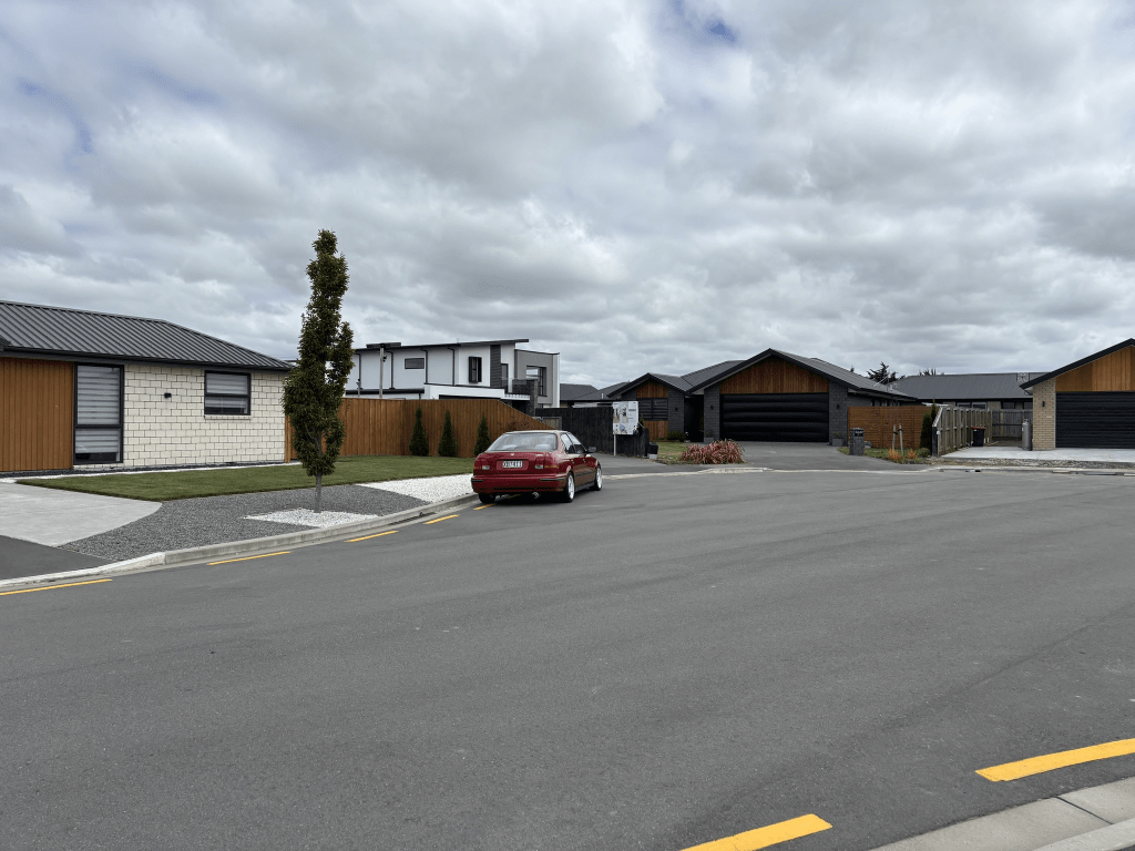
Lotus Place in Wigram and it is too new for the library website. It will have been named after a plant. The houses here were built between 2022 and 2024 and they looked OK but mostly just lawns rather than gardens. This street is next to a motorway and there is a tall fence between the motorway and the street but it could still get noisy. The footpath was on only one side of the street and even though there was plenty of parking in the street there were cars parked on yellow no parking lines. Get the feeling that I wasn’t overly impressed with the street.
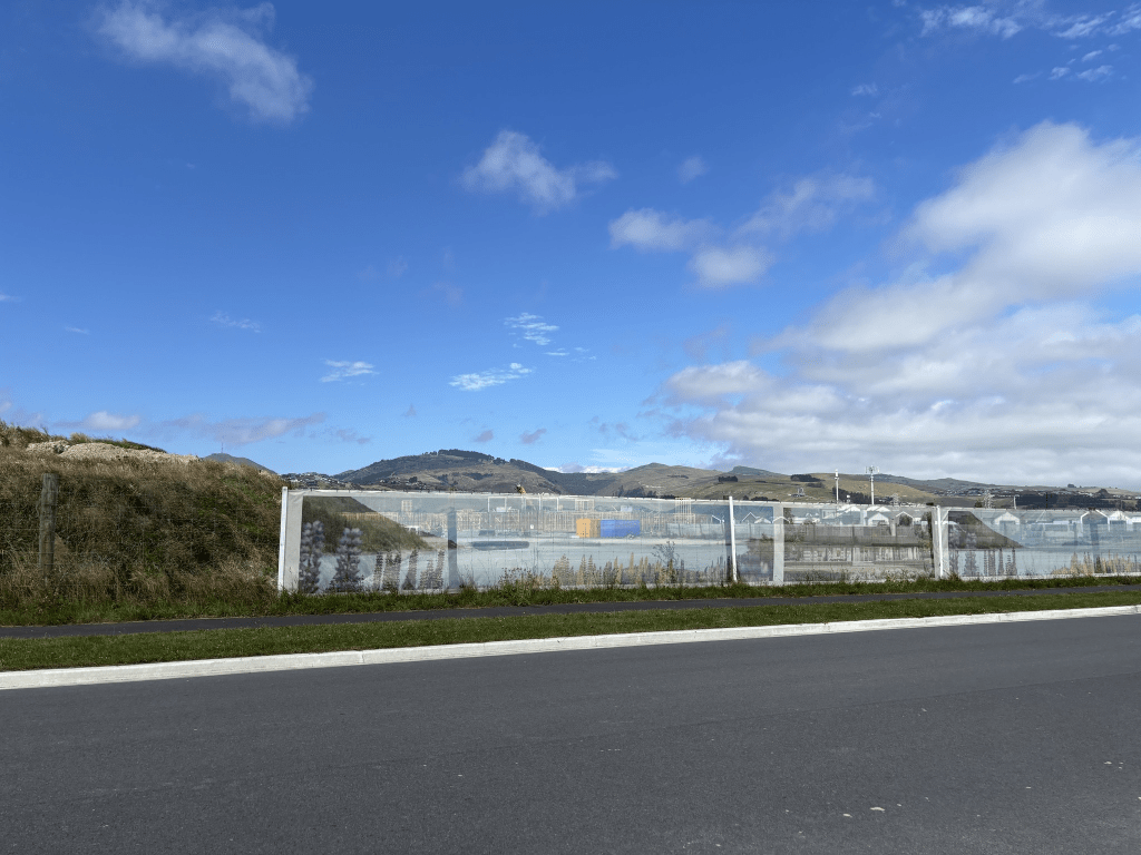
Tea Tree Lane in Wigram and it is too new for the library website. It will have been named after the tree. It runs off Owaka Rd and this street wasn’t there when I walked Owaka Rd in 2020.
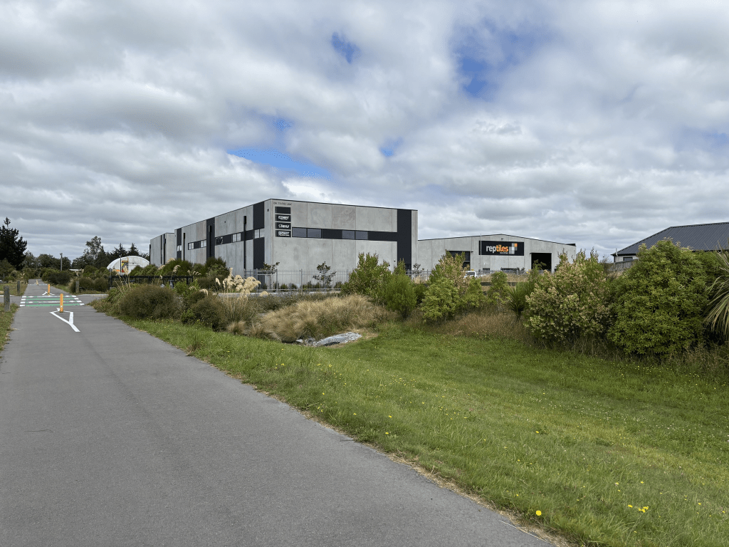
I didn’t actually walk this street as there wasn’t a footpath and there was only a couple of businesses here plus I didn’t feel like getting run over by a big truck.
Pistacia Place in Hornby – Named after pistacia plants which are a variety of shrubs and small trees. Pistacia trees were approved by the Christchurch City Council as a landscaping tree to complement the Little Gem magnolias which were planted on the berms of the larger of the two roads in the Magnolia Estate subdivision. Named in 2015
A small amount of information from the library website and the street is tree lined. Houses built between 2016 and 2021 plus there are still empty sections. There is a walkway that runs behind this street which I walked to get back to my car. The houses were varied enough for the street to look OK and a few gardens but I didn’t particularly like the street. There was a weird smell here and I was wondering if it was the reserve behind the street as the reserve was a bit swampy in parts. When I walked through the reserve there wasn’t a smell so it must be something in the street. The footpath was also on only one side of the street and we all know how much I dislike this.
Little Gem Road in Wigram / Hornby – Named after Little Gem, a variety of magnolia. Little Gems were approved by the Christchurch City Council as a landscaping tree along the berms of the larger of the two roads in the Magnolia Estate subdivision. Named in 2015
A small amount of information from the library website but they had the street as Little Gems Rd but it is Little Gem Rd. The library has it in Hornby but the valuation website puts it into Wigram. Edited to say that half of the street is in Wigram and the other half is in Hornby. The older houses are at the Hornby end of the street.
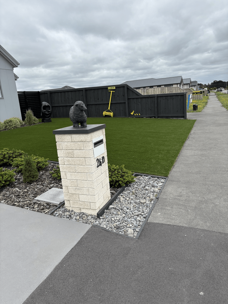
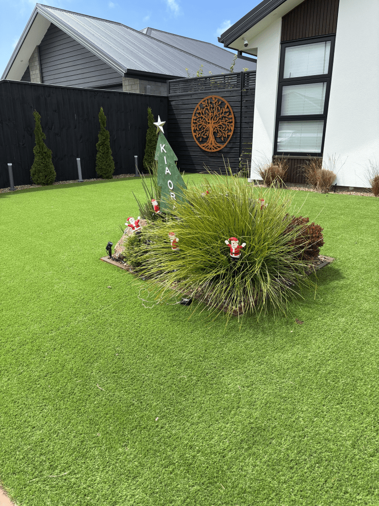
The older houses from 2016 are at one end of the street and this part of the street is tree lined. The houses at the Owaka Rd end of the street were built in 2023 and 2024 plus there are still a few empty sections. There is a reserve on one side of the street at the Owaka Rd end. There is a variety of styles of houses here and some have flowers and shrubs. There is a Montessori school on this street. Many houses had interesting garden decorations but one particularly caught my eye and I did take a photo. It had a handmower painted yellow with the word redundant above it. The reason that the lawn mower at this house is redundant is that they have artificial grass. I have occasionally been tempted to get artificial grass but it isn’t good for the environment. I will stick to my wildness area at my house.
Te Repo Drive in Halswell and too new for the library website. A tiny amount from the Council website – the original name of the John Miln’s estate.
The meaning of Te Repo is wetlands or swamps which is suitable for this area. I wouldn’t buy a house here and it is potentially a future red zone.
The street runs from Milns Rd and I can remember when this area was still farmland. I looked at Papers Past and there were many entries for Te Repo Farm in 1920 when the family sold the property. John Miln had a huge family from three wives. Two of the wives died really young and one died in childbirth.
The houses were mostly on just one side of the street and built in 2023 and 2024. The houses were modern and boring with tiny lawns and no gardens. On the other side of the street it is still being developed. There is an entrance to a reserve and walkway on this street. I did have a great conversation with some young men here as they were building a bike for something called Gravity Racing.
Lochhead Avenue in Halswell and too new for library website. A tiny amount of information from the council website – Robert Lochhead is understood to have been an owner of the property in the 1930’s.
I searched Papers Past and ancestry website but couldn’t find a Robert Lochhead living here. There were a couple in Leeston and one who possibly owned Molesworth Station. If he owned land here he didn’t live on the property.
The houses here were mostly built in 2021 and none of them stood out but the gardens were more established than ones in the nearby streets. I couldn’t resist taking a photo of one garden as it still had Christmas decorations in the garden.
Allied Road in Halswell and too new for the library website. A small amount of information from the council website – This is a name of significance to the family, as it is the name of the first business started by the developer’s father.
The houses here were built in 2021 and 2022 but nothing on street view yet the google car drove down a neighbouring street. Nothing stood out for me on this street as it was modern houses with well kept lawns and not a garden in sight. I didn’t even bother to take photos.
Dunning Way in Halswell and too new for the library website. Tiny amount of information from the council website – This is understood to be an area of Perthshire where John Miln was born. Ancestry website have John Miln as being born in a place called Forgandenny but this is only a few miles from Dunning.
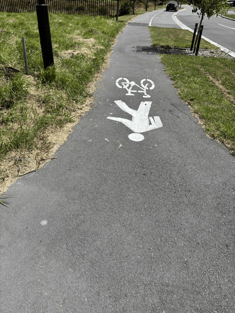
The houses here were built in 2020 and there are still some empty sections. Houses mostly on only one side of the road as there is a reserve on the other side. The houses were modern ones with lawns and no gardens. There is a footpath on both sides of the street but they are narrow and also a cycleway. I really don’t like it when pedestrians have to share a footpath with cyclists especially when the said footpath is very narrow. The cyclists tend to go very fast and I have lost count of how many times I have been nearly knocked over.
Grange Street in Hillsborough – Named after The Grange, the home of Dr James William Earle (1805-1878). Earle emigrated on the Randolph in 1850. He bought Rural Section 44, 50 acres, “Christchurch District, near Hills Road” (later Port Hills Road). He practised medicine in Lyttelton, later moving to Opawa where he built The Grange. Edward Steane Harley (1840?-1901), an accountant and a well-known cricketer, owned The Grange later. First appears in street directories in 1901. The northern section of Kennedy Crescent was incorporated into Grange Street in 1963; the southern section remained as Kennedy Crescent. [Jarden Place was originally suggested as a name for the northern section.]
A reasonable amount of information from the library website. I covered Dr Earle fully in my write up of Earl St. Edward Harley was accountant for many businesses in Christchurch and was involved with St Marks Church in Opawa.
When Dr Earle first owned The Grange it was known as Grange Farm as Dr Earle mostly farmed rather than practice as a doctor. There were so many different houses in Canterbury known as The Grange that I gave researching. I googled the meaning of grange and it means a country house with farm buildings. A reasonable amount of information on Papers Past including lots of death notices. In 1900 there was a new house in Grange St opposite Baunton’s Stables. Lots of ads between 1900 and 1905 for the sale of sections. Cooksley’s brickyard on Grange St is mentioned occasionally. Apart from ads and death notices there isn’t much on Papers Past until 1957 when the sewage works were upsetting the locals. In 1963 the Old Brewery at 10 Grange St went up in flames. It sounded more like a private home brewery rather than a big company. In 1988 Dingwall Food is mentioned and this business would have been at the far end of the street on the other side of Opawa Rd.
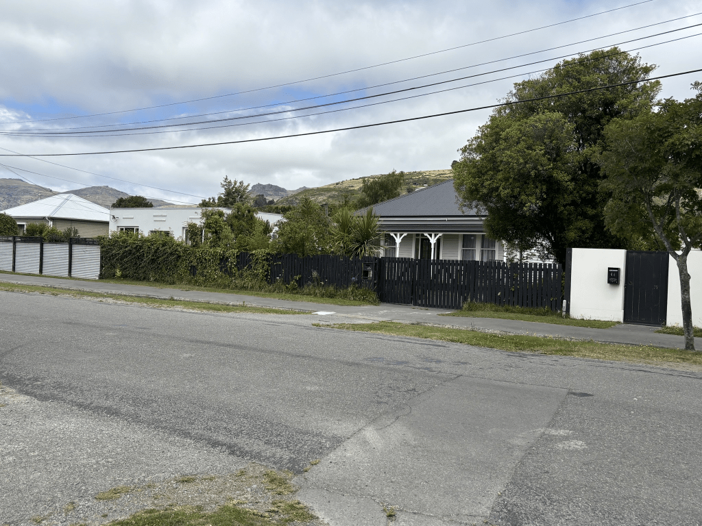
I actually walked this street a few weeks ago. Most houses seem to have been built between 1940 and 1970 but there are a few older houses. There are also a few modern houses. A real mixture of houses and I liked most of them. The older houses were in reasonable condition and I liked the Art Deco houses. I had friends who used to live on this street but I couldn’t figure out where their house used to be. I eventually figured that it had been altered so much that I didn’t recognise it. When you cross Opawa Rd the first thing you notice apart from a business is the Jurassic Mini Golf. It is a bit hard to miss giant dinosaurs.