Bernard Street in the suburb of Addington in Christchurch

Bernard Street – Formerly Feathers Lane. Named because the Star Hotel, formerly the Feathers Hotel, was on the corner of Lincoln Road and Feathers Lane. Also formerly named Railway Road and Station Street. Named because it led to the Addington Railway Station. Re-named Bernard Street. Named after General Bernard Cyril Freyberg (1891-1963). Re-named Bernard Street on 27 September 1948. Freyberg was a dentist, military leader and Governor-General of New Zealand 1946-1952.

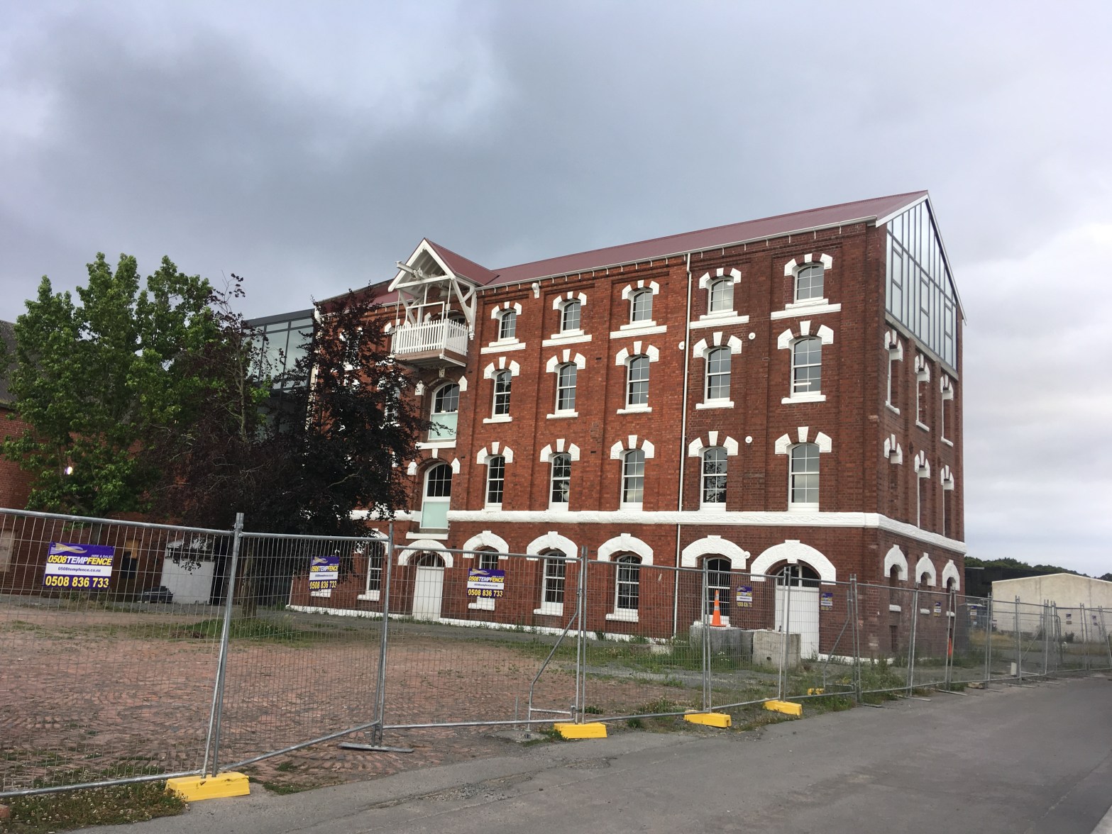
At the Lincoln Rd end there is a fairly new building built since the earthquakes which houses several businesses and also a 24 hour gym. At the other end is the Court theatre which have been here since the earthquakes as the original premises were damaged in the earthquakes. The street also runs past the back of the old mill and the road is really rough. I wouldn’t attempt to drive my car here. You can see the earthquake damage very clearly here. For a damaged and empty building I was surprised to see that there were lights on behind one of the doors.

Wise Street in the suburb of Addington in Christchurch

Wise Street – formerly Crofts Lane which was incorporated into Taylor Street. Formerly Taylor Street. Named after Edward Martin Taylor (1831-1907). Re-named Wise Street. Named after Herbert William Wise (1874?-1950). Re-named Wise Street on 27 September 1948. Wise was a Riccarton Borough councillor 1916-1938. Crofts Lane was named after Alfred John Croft (1870- 1954).

Several businesses on this street plus a heritage building that was damaged badly in the earthquakes. The Mill Theatre used to be in this building. The heritage building is being restored. Was unable to find a grave for this man.

Feast Place in the suburb of Addington in Christchurch

Feast Place – Named after Herbert Stanley Feast (1898?- 1961) – Feast was the town clerk of Christchurch 1940-1961.

I didn’t walk the full street here as I didn’t feel comfortable or safe to do this. This street is social housing and seems to be mostly men here. Unable to find this man’s grave.

Feilding Street in the suburb of Addington in Christchurch

Feilding Street -formerly Spohr Street. Formerly Spohr Street. Named after Louis Spohr (1784-1859). Re-named Feilding Street. Spohr was a German virtuoso violinist and composer. Re-named Feilding Street in 1917 because of a dislike of German names during World War I (1914-1918).

Mostly older houses along this street. It runs behind Addington Shopping Centre.

Stuart Mill Street in the suburb of Addington in Christchurch

Stuart Mill Street – Named after John Stuart Mill (1806- 1873). Mill was a philosopher and author. One of the “poets and writers” streets of Sydenham, Addington and Waltham.

This is a street that many people miss as it just looks like a driveway to the back of shops. There is a brand new building being built that is for a BMW car sales. I couldn’t walk the entire street as half of it has been fenced off and is used as a car park for local businesses. You need a swipe card to activate the gates.
I am going to have to google this man as I feel that I have read one of his books.

Kenilworth Street in the suburb of Addington in Christchurch

Kenilworth Street – Probably named after Kenilworth, in Warwickshire, England.

The library website didn’t have much to say about this street. It was mostly wooden villas ranging from very nice to seriously needing repairs. At the Clarence St end there were some modern ugly apartments. It was almost impossible to walk on the footpath because of the way cars were parked and I had to frequently go onto the road.

Leamington Street in the suburb of Addington in Christchurch

Leamington Street – Probably named after Leamington Spa in Warwickshire.

Another street where the library website has very little information. This street has mostly older wooden villas and one Art Deco place. There is a big section where new buildings are going up and I can’t remember what was originally there but was probably the more run-down old houses. On the other side of the street there is a playground where a geocache is hidden and closer to Whiteleigh Ave there are some businesses

Longley Place in the suburb of Addington in Christchurch

Longley Place – there was no information on library website.

A short street that curves around the playground with apartments on the other side. I wouldn’t like to live here as too close to the railway line. It goes from Leamington Street and curves around back to Leamington Street but it isn’t a crescent.

O’Shannessey Place in the suburb of Addington in Christchurch

O’Shannessey Place – Named after John “Jack” O’Shannessey (1900-1989). O’Shannessey was employed by NZ Rail. He was recalled from retirement to act as clerk of works when the Christchurch Railway Station was built in Moorhouse Avenue. The subdivision off 471 Whiteleigh Avenue is alongside the main south railway line so a name associated with railways was chosen. Named in 1999.

This street name is more interesting than I expected. The street had no footpaths and is a business area. Looked like a car storage that took up one side of the street and the other side had a couple of businesses but the rest were empty buildings up for lease. I wouldn’t have attempted walking this street during business hours as it wouldn’t have been safe because of the lack of footpaths. Was unable to find a grave for this man.