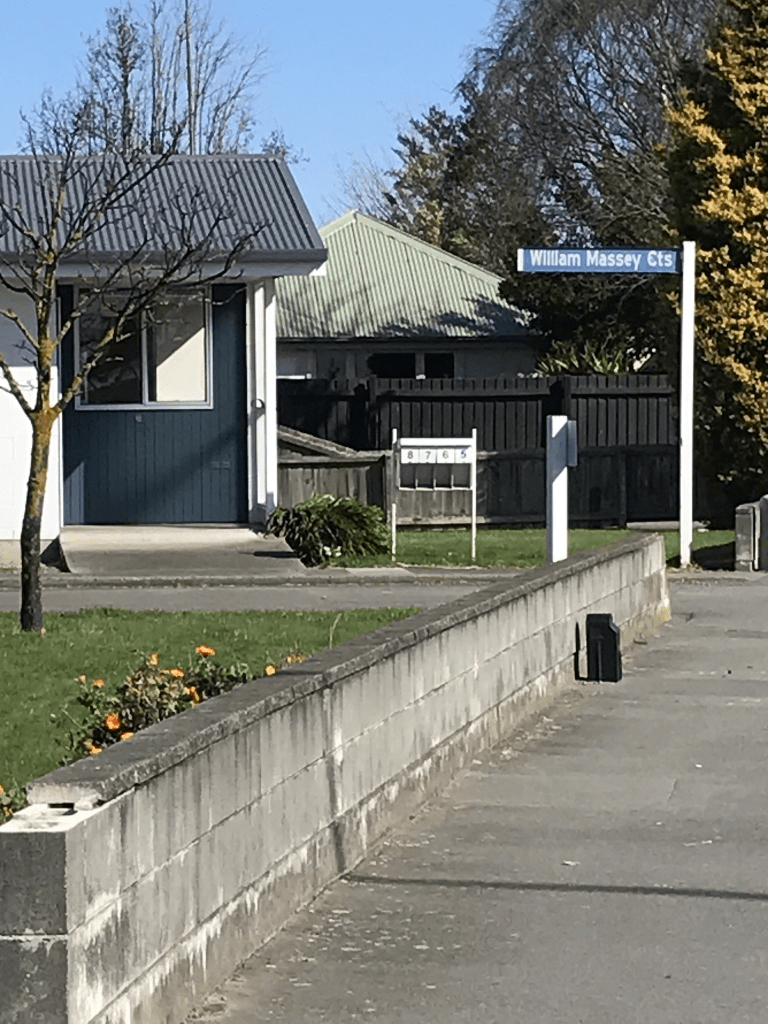
William Massey Courts in Waltham. Technically this lane is at 182 Ensors Road and it is social housing here. There are 14 units built in 1975. Papers Past only had a few death notices for this lane. There is a Wikipedia page for William Massey.
Lytteltonwitch's Walking the streets of Christchurch Project
I love walking and history and this project covers both interests
William Massey Courts in Waltham. Technically this lane is at 182 Ensors Road and it is social housing here. There are 14 units built in 1975. Papers Past only had a few death notices for this lane. There is a Wikipedia page for William Massey.
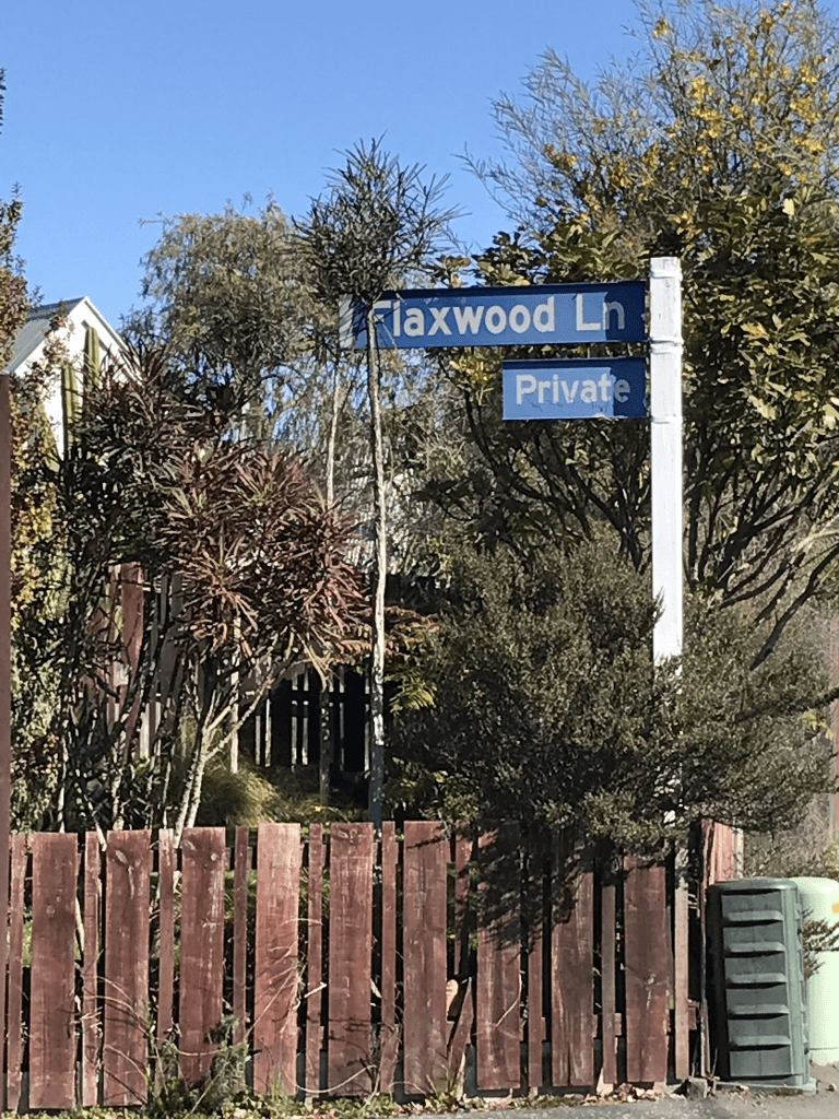
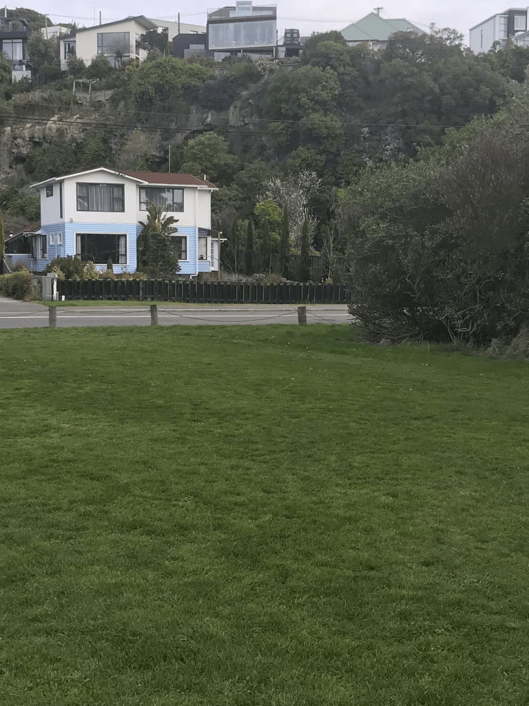
Flaxwood Lane in Waltham and nothing on the library website. I checked Ancestry website, cemetery records and Papers Past and it isn’t a surname. There are 17 houses here all built in the 1980s. The ads on Papers Past from 1986 describe them as luxury homes.
Kahukura Rd and nothing on the library website. This street couldn’t decide if it was in Hei Hei or Broomfield. The valuation website only showed one house built in 2020 yet there are at least 4 other houses probably built in the 1980s. Looking at street view it looks like the street has been extended recently and used to end at fields. These fields have now been subdivided. The older end of the street I liked and there is now a walkway entrance here. Lots of power pylons in this area and I was always told to never buy a house under power pylons.
Zenith Place in Hei Hei and nothing on the library website. This was surprising as most of the houses date from 1980 with one house from 1950. It was probably named after a racehorse. Papers Past had several ads for sections in 1980 plus there were a couple of death notices. Nothing outstanding about the street and when I looked at street view until recently the street looked out at open fields.
Piripiri Place in Broomfield and nothing on the library website. Street was probably named after the plant piripiri which is better known as biddy bid. The houses here were built between 2020 and 2023 and they all looked exactly the same. The footpath was on only one side of the street but at least there weren’t any cars parked on it. At the end of the street there was a path that took you to a combined walkway / cycleway.
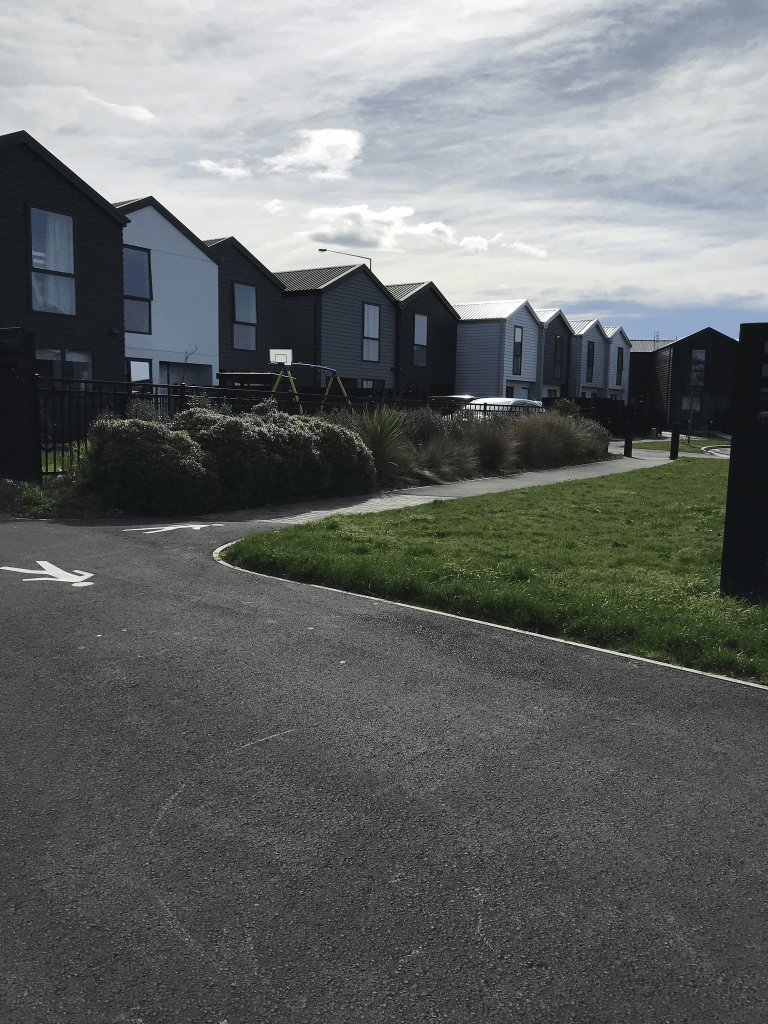
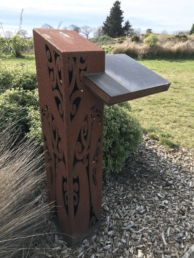
Miromiro Street in Broomfield and no information on the library website. I couldn’t find a racehorse with that name so the street must be named after the bird. There are 64 houses here built between 2020 and 2023. All that I will say about the houses is remember the words from a song which goes little boxes made of ticky tacky. The houses all looked exactly the same and I obviously didn’t like them. The best thing about the street was a piece of artwork. It looked like there should have been a plaque attached but it has probably been stolen
Musket Lane in Broomfield and no information on the library website. Most of the houses were built in 2020 and I suspect that the street was named after a racehorse. It did have a footpath but I was unable to walk it because of all the cars parked on the footpath. We all know how much I hate this.
Koral Lane in Broomfield and there isn’t any information on the library website for this street. I suspect that the street is named after a racehorse. Houses here were built between 2020 and 2022 and from what I could see the houses all looked exactly the same. The street did have a footpath but it was impossible to walk on it as there were so many cars parked on the footpath. I gave up walking it after only a few metres. Decided that I didn’t like this street because of ugly houses and the blocked footpath.
McCormacks Bay Road in Mt Pleasant – Named because it runs through McCormacks Bay which, in turn, is named after William McCormack (1822-1868). McCormack arrived on 17 December 1850 on the Sir George Seymour. First appears in street directories in 1950.
A small amount of information from the library website. The earliest entry on Papers Past was in 1935 when a man was charged with dangerous driving after an accident. In November 1938 it is a described as a new road. In 1950 the foundation stone for the Mt Pleasant War Memorial Community Centre was laid. The centre is being built on reclaimed land. Note I had a good look at the building today hoping to find a plaque but nothing. The original building has been demolished and there is a new building but I was still hoping for a plaque. In 1958 there was a letter to the editor asking when the long promised footpaths would be formed. In 1964 a 3 ton rock fell from the steep slope above a cave by the corner of the Christchurch – Sumner Rd and McCormacks Bay Rd narrowly missing a young girl. Local developers still went ahead and built houses on the hill here. None survived the earthquakes. In 1967 a contracting firm Ryan Brothers wanted to turn McCormacks Bay into an aquatic playground and picnic area. They didn’t think that it would cause a parking issue on McCormacks Bay Rd. This obviously didn’t happen. Can you imagine McCormacks Bay with man made sandy beaches. In 1973 there were a couple of letters to the editor suggesting that the council fill in the entire bay and build houses there. Another project that never happened.
William McCormack had a fatal accident in 1868 and he was only 46 years old. He was riding home from Christchurch when his horse bolted and threw William off. Apparently the horse had been spooked by a boat that was lying in the avenue near William’s home.
Nearly half the houses here are rebuilds after the earthquakes. There is one ugly house behind an old brick wall so I checked out street view and the original house was gorgeous. The original house was brick so it could have unrepairable after the earthquakes but the replacement house is so ugly. What I thought was a 1920s cottage was actually built in 1940. There is a house from 1920 but it is hard to see from the road. The houses are only on one side of the road as McCormacks Bay Reserve is on the other side of the road. There is a section at the Redcliffs end of the road where the houses haven’t been rebuilt after the earthquakes. The Community Centre and a kindergarten are on the reserve side of the road plus there is a community garden here. I walked along the street and returned to my car by walking on a path through the reserve. It was a pleasant through the reserve and I saw a kingfisher. The kingfisher flew away before I could get a photo.
Ocean View Terrace in Sumner – Named in 1927 at the request of the former landowner and subdivider, George Humphreys (1848- 1934). First appears in street directories in 1957.
A small amount of information from the library website. George Humphreys pops up occasionally regarding street names. He actually lived on Fendalton Road at a house that was originally called Daresbury Rookery and is now Daresbury. It is a gorgeous house and it is still standing.
On Papers Past I found the article dated 1927 that mentions George’s request for the street name and then there nothing until 1949. In 1949 there was just a couple of ads. In 1959 and 1960 there were ads for sections. A few death notices from about 1958 onwards. An article from June 1954 explains the lack of information. The article mentions that the road was formed 22 years ago by the late George Humphreys but building of houses was held up by the want of high pressure water. There is now water for the 25 sections but no sewer. The road is very overgrown.
In 1975 a developer proposed a subdivision off Ocean View Terrace but it didn’t sound as if this was approved by the council. If the subdivision did go ahead it didn’t survive the earthquakes. The instability of the land was mentioned in 1975 and at least one of the existing houses had been damaged by a large boulder hitting it.
Most of the houses here were built in the 1960s with a couple built in 2018 and 2019. At the start of the street there is a house from 1910 but you can’t tell that it is that old as it has been modernised.
There isn’t a footpath on this street but luckily it isn’t a busy street. There is also a little free library here but I managed to resist taking any books. Most of the houses are on only one side of the road but looking at street view from before the earthquakes were several houses on the high side of the street. In a couple of places you can see where there used to be driveways. Parking would be a nightmare here but the views over Sumner are fantastic. The houses were a variety of styles and some I liked and others I didn’t like. The street starts on the flat by Heberden Ave and ends at Evans Pass Rd. Walking back down the street I went down a walkway that leads back to Heberden Ave. The walkway starts by the sharp curve of the road and the only reason that you know that it is a walkway is the large sign saying walkway. You feel as if you are going through private property.

