Millpark Place – Named because it is in a subdivision which has its own water features and is also near the ponds and water features of the Styx Mill Reserve. The developer, Carlin Enterprises, wished to recognise these features in the street names in the subdivision. Named in 2003.
Interesting information from the library website and the information is more interesting than the street. A short street with very ordinary looking houses. Yet another street with a footpath on only one side of the street. No photos.
Rindle Lane in the suburb of Northwood, Christchurch
Rindle Lane – Named after a rindle, a small water course. Named because the countryside and waterways are the common theme used for naming streets in the first stages of the subdivision, and the applicants proposed to continue the theme for two new stages. In the Styx Mill Country Club subdivision. Named in 2004.
Now this is interesting information from the library website. I had never heard of a rindle.There was only three houses on this lane and there was no footpath.
Caroline Way in the suburb of Northwood, Christchurch
Caroline Way – Developed by Belfast Developments Ltd and Styx Developments Ltd. The developers “chose names suitable for the length of the road rather than trying to establish a common theme throughout the subdivision”. Named in 2000.
No real information from the library website. My feeling about the name is that it is connected to someone known to the developers.There was an unbelievable huge house on this street. I ended up chatting to a woman who was gardening. She said that there are smaller houses but the larger ones tend to stand out.
Jasper Place in the suburb of Northwood, Christchurch
Jasper Place – Developed by Belfast Developments Ltd and Styx Developments Ltd. The developers “chose names suitable for the length of the road rather than trying to establish a common theme throughout the subdivision”. Named in 2000.
Nothing much on the library website. The only place name that this place could be named after is Jasper in Canada or one of the developers know someone called Jasper. I didn’t take photos as there were too many people in their gardens. The houses were huge in this street and for some reason most them had columns at their entrances. I have noticed that many of the houses in this area have similar columns.Again immaculate but boring gardens.
Panache Place in the suburb of Northwood, Christchurch
Panache Place – Named after Panache, a variety of apple. Bayliss Nurseries had existed on the site for many years and its land was subdivided to form the street. Developed by the Freeman Partnership. The streets in the subdivision are named after varieties of fruit and personalities associated with the orchard. Named on 6 September 2000
Information from the library website a bit more interesting for this street. A small street with modern houses and why do modern subdivisions have a footpath on only one side of the street. I find this really weird. No photos for this street.
Annaby Drive in the suburb of Northwood,Christchurch
Annaby Drive – Developed by Belfast Developments Ltd and Styx Developments Ltd. The developers “chose names suitable for the length of the road rather than trying to establish a common theme throughout the subdivision”. Named in 2000.
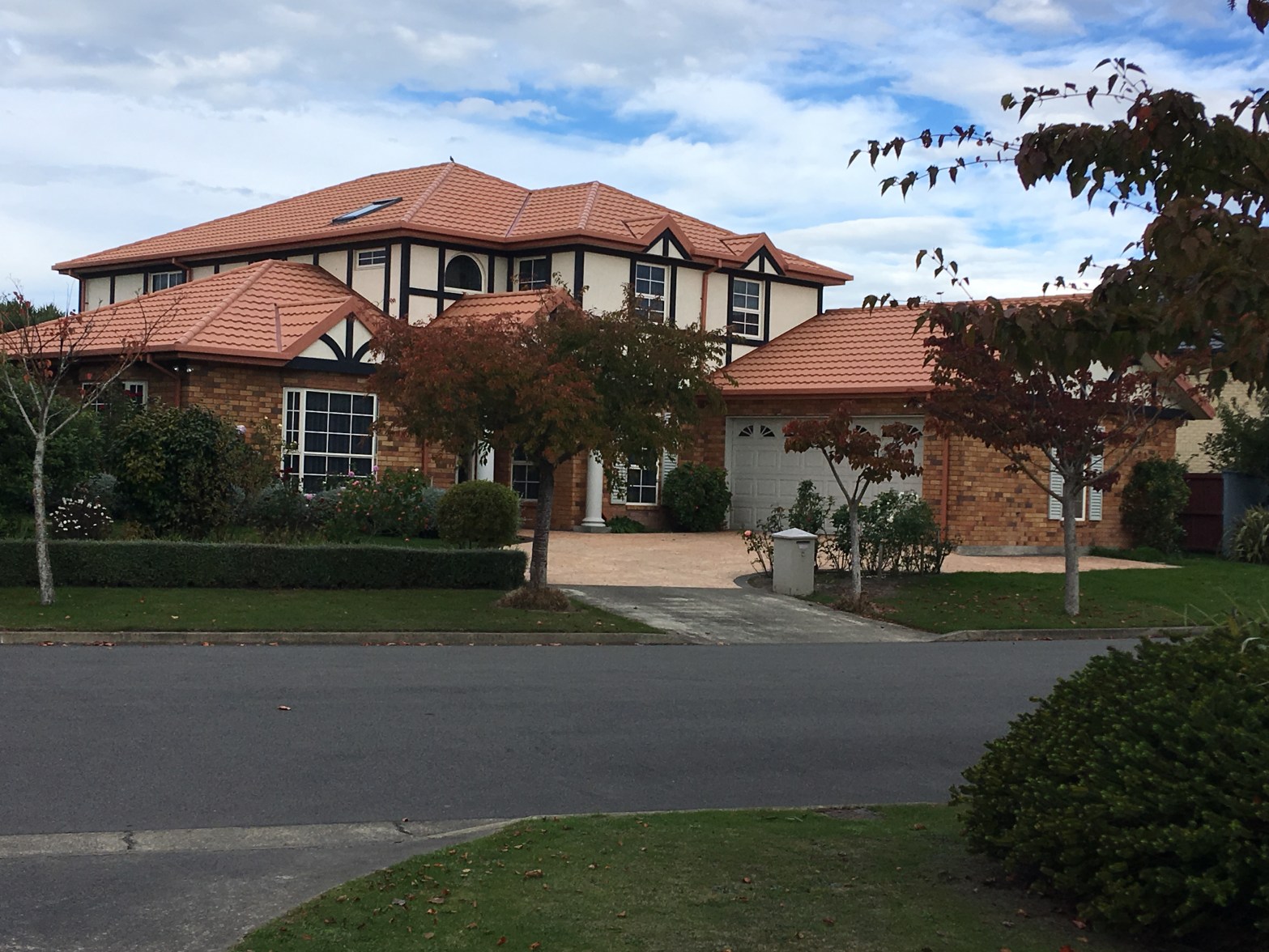
Again the library website didn’t have much information. I did find the council information which repeats the library information. Couldn’t find a reason for this name. Another street with large boring houses and boring gardens but at least one of the trees beside the footpath was a bit more colourful.
Wakefield Avenue in the suburb of Sumner, Christchurch
Wakefield Ave – Named after Felix Wakefield (1807- 1875). Wakefield was a surveyor and engineer. He selected Rural Section 2, 100 acres in Sumner.
Not much information on the library website for a very long street. Most of the houses were built from brick and looked like 1960s and 1970s houses. There were a few older houses and I managed to get photos of the best two houses. Van Asch College for the Deaf is near the Evans Pass end of the Ave. Wakefield Ave goes from Evans Pass Rd to Marriner St. One one side of the Ave there is a big gap where there are no buildings and I took a photo of the gate to where there used to be a church. I also took a photo of where the RSA used to be and sadly someone died here in the earthquakes. Near the Marriner St end is the shops and cafes plus a big new community centre and library. Most businesses were closed today but Coffee Culture which is on the bend of Marriner St and Wakefield Ave was open so I stopped for a welcome cup of coffee as I managed to walk over 10 km. Also found a book swap plus you can swap other stuff. Trouble is that it is open to the weather.
Looks like Felix Wakefield is buried at Barbadoes St Cemetery.
Heberden Avenue in the suburb of Sumner, Christchurch
Heberden Street formerly Heberden Road. On the original plan of the Town of Wakefield 1874. Heberden Road is first mentioned in the Star in 1883.
No reason for the street name on the library website. Note this street is actually called Heberden Ave. This street used to run from Evan Pass Rd to Esplanade but it is blocked at Wiggins St because of rock fall from the earthquakes. One side of the street had older houses and again difficult to get photos because of high fences. On the hill side the houses were modern rebuilt houses but I wouldn’t like to live in them. Several empty sections where houses had been demolished and the land is no longer safe to build on. This is a very long street. The other side of the blocked road has Scarborough Park where the playground that I mentioned in Esplanade is. The park has boundaries on Esplanade and Heberden St.
After checking Papers Past and an Ancestry website I couldn’t find anyone with that surname in NZ. There was an historic house on Heberden Ave that was built in the 1850s by a Dr Burrell Parkerson. It is possibly that Dr Parkerson was an admirer of one of the two Dr William Heberden. Sadly this historic house has been demolished thanks to the earthquakes.
Dryden Street in the suburb of Sumner, Christchurch
Dryden Street. Named after George Pickering Dryden (1837- 1890). Dryden was elected to the Heathcote Road Board in January 1880, becoming chairman in February 1884.
Small amount of information on the library website for a small street. The Sumner School playground is at the end of this street.
Burgess Street in the suburb of Sumner, Christchurch
Burgess Street – Formerly Morton Street. Re-named Burgess Street. Named after Charles Gordon Burgess (1896- 1980) Re-named Burgess Street on 1 September 1948 when 120 streets were renamed. Burgess was the last mayor of the Sumner Borough Council in 1944 before it was amalgamated with Christchurch City in 1945.
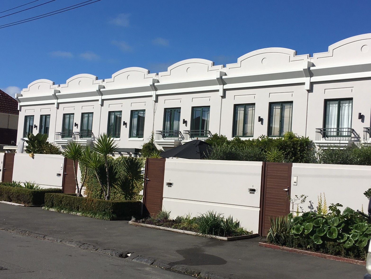
Interesting information from the library website. This was a short street between Marriner St and Esplanade, Cafes at the Marriner St end and modern houses on the rest of the street including Art Deco style of townhouses.
