Truscotts Rd in Heathcote- Formerly Albert Street. May have been named after Albert Charles Truscott (1838?- 1910). Re-named Truscotts Road. Named after Frederick Truscott (1874- 1945) and his wife, Selina Truscott, née Keast, (1875?- 1961). Frederick Truscott, a saddler, was a resident of Pawaho Hamlet in Heathcote in 1905. He farmed Truscott’s Farm, Moncks Spur, from about 1913. His brother, William John Truscott (1870-1941), a farmer, was a resident of the street in 1933 when it was re-named Albert Street. The farm was sold in 1963. It was advertised as “a farm in the city- the best of both worlds” and offered on behalf of the estate of F. Truscott.
A reasonable amount of information from the library website and most of it is rubbish.
I spent ages looking at Papers Past, Ancestry website plus old maps. Nothing on Papers Past about this Albert Street but there were so many Albert Streets in New Zealand including several in Christchurch. Unlikely to have been named after Albert Charles Truscott as he lived and farmed in West Melton. He only moved to Christchurch in 1894 when he was made bankrupt. In Christchurch he lived at 35 Queen Street which later became Union Street. The street was named after Prince Albert who had died in 1861.
The sentence where it says it was renamed Albert Street in 1933 is totally wrong as it was renamed Truscott’s Road. Some of the family were living at Pawaho Hamlet so it is likely to have been named after the family rather than an individual. In 1930s the electoral rolls say that William John Truscott was living in Heathcote Valley and then 24 Maunsell Street. Moncks Spur would be totally irrelevant to Heathcote Valley.
My next problem was to sort out exactly where Truscotts Road ended and Ferrymead Park Drive started. This is where I spent ages looking at maps and looking at Papers Past. I am still confused but have decided to count the street as going from Martindales Road to the intersection by the Ferrymead Heritage Park entrance. Apple Maps have the entire stretch of this road as Truscotts Road. Google maps can’t make up it’s mind and have it as both roads. A map from 1930 has it as Albert Street. From 1940s onwards it is Truscotts Road. More modern maps have the road that goes past Ferrymead Heritage Park as Ferrymead Park Drive but the map from 1983 has it as Truscotts Road. There are no sign posts on the roads to say which streets they are. Confused yet.
History of the street from information on Papers Past. In the 1940s there was only ads. In the 1950s there was one death notice and notices from the Drainage Board. In the 1960s and 1970s most entries were about the rubbish dump but in 1966 there was the first entry about planning a museum on Truscotts Road. In 1971 there was discussion about a new road to connect Bridle Path Road to Truscotts Road and in 1972 permission was given for the road to be built. In 1985 the rubbish dump was to be closed permanently and Ferrymead Heritage Park eventually extended to take over the land where the rubbish dump was sited. In 1988 an injured man who had his feet and hands tied up was found on Truscotts Road near the Ferrymead Heritage Park. At least three people were charged with kidnapping him and beating him up.
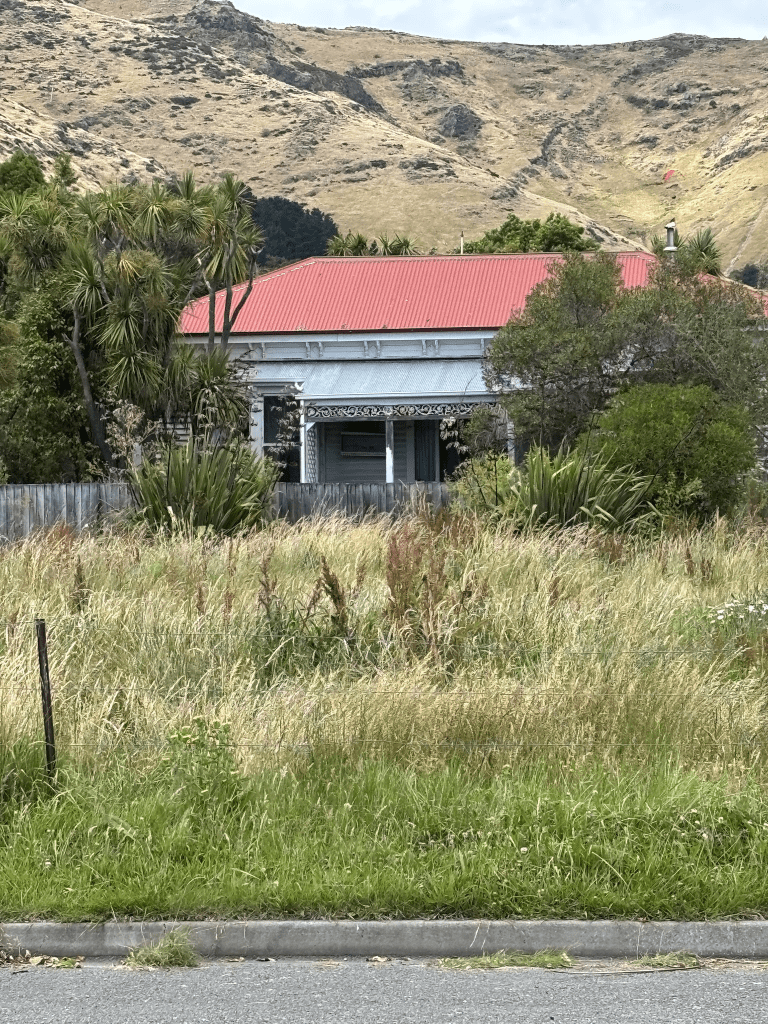
At the corner of Martindales Road and Truscotts Road there is a lovely looking wooden church. Then there are a few houses mostly built in the 1980s and 1990s with several more recently built. There is one house from 1915 but you can’t see it from Truscotts Road but I got a good view of it from Deavoll Place.
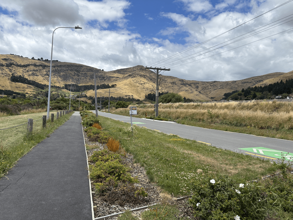
When you go around the slight bend this is where the maps disagree if it is Truscotts Road or Ferrymead Park Drive. Obviously Ferrymead Heritage Park takes up one side of the road here. On the other side there is a reserve plus car parks. Some maps say this area is called Ferrymead Park. There is a walkway in the reserve plus a wee lake where people sail model boats. I did a loop walk here as I started at Martindales Road end and then cut through Deavoll Place entrance to the Reserve. I had a nice walk through the reserve before returning via the road.
Edited to say that there was only one entry on Papers Past for Truscott’s Farm and that was in the 1880s and was Truscott’s Farm in West Melton. The entries in 1963 for the estate of F Truscott describe that property as Moncks Spur Farm and no mention of it being called Truscott’s Farm.
Edit No Two with information eventually found on council website – Truscotts Road will remain as that part following the railway line from Martindales Road, while that part of Truscotts Road near Ferrymead Park will have a change of name to that of the new road being constructed.