Hopkins Street in Woolston – Formerly Halfway Lane and Coronation Street. Named to commemorate the coronation of Edward VII (1841-1910) in 1902. Re-named Hopkins Street. Named after Joseph Harrap or Harrop Hopkins (1837-1910). Halfway Place first appears in street directories in 1894 as a blind street running off Ashbourne Street (later part of Ferry Road). Coronation Street first appears in The Press in 1903 when the road surveyor advised the Woolston Borough Council that at present there were no funds available for the “assistance or construction” of Coronation Street. Re-named Hopkins Street in 1922. Hopkins arrived in Canterbury on the Roman Emperor in 1863. He kept a store on Ferry Road called Hopkins Emporium and also built the first hotel in New Brighton. [Some records spell his middle name as Harrop; others as Harrap.]
A reasonable amount of information from the library website. Not sure why they named the street after Joseph Hopkins as it sounds like his shop was miles away from where this street is. Should have been named after a William Correll as he seemed to have owned most of the land in this area and sold it off to be subdivided. The information about Joseph Hopkins on the Ancestry website doesn’t match up the wikipedia page about the naming of the suburb. Joseph Hopkins was a very common name.
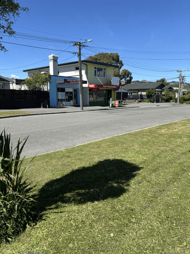
Nothing on Papers Past about Halfway Lane. The first entry for Coronation Street was in 1903 where the council said that work had commenced on forming the new street. In 1908 William Correll was selling 4 acres of land adjoining Woolston School and that the land was suitable for subdividing. In 1913 William Correll had shops and a dwelling available for rent. These shops would have been near McKenzie Ave corner and there are still shops there. William Correll was selling more land in 1919 and I suspect that this land was purchased by the government. In 1919 worker dwellings were to be built on the street and each dwelling would be on a quarter acre section and all the cottages would be made from concrete and designed by the Labour Dept architect Mr Temple. In 1923 there were complaints about the drainage issues with these cottages. A fairly dramatic headline about houses in Woolston Swamp. The health dept visited the houses and said that the Public Works dept were responsible for the drainage problem. The Public Works dept said that they were still waiting for a reply from Wellington. More sections for sale in 1937 and 1943 from the Public Trust Office. There was a poultry farm for sale in 1955. Mr A Smith’s garage is mentioned in 1959 and I think that this was on the corner by Ferry Road. In 1990 shops including the fish and chip shop along with a flat was for sale. In 1994 the Woolston Rugby Football League Club had a liquor license approved.
Lots of ads plus death notices over the years but not a lot of information considering the age of the street. Woolston Primary School is on the corner of Ferry Road and Hopkins Street but it was hardly mentioned. Woolston school has been around since 1870 but possibly had a Ferry Road address. I went to Woolston Primary School in 1967 as my sister was teaching at the school. It made after school care easier as my younger brother and I were too young to be left alone after school. The school looks very different these days to how it looked when I went there.
I walked this street last month and over half the houses are older houses and date from 1910. There are a few from 1990s onwards. The Woolston Rugby Club rooms are still there and look like they are still in use. The shops near McKenzie Ave corner are still there but the fish and chip shop was demolished after the earthquakes. It has since been rebuilt. I looked at street view from 2012 and the fish and chip shop just looked like a lean to against the shop but now it is a separate building. Still very tiny. When I think about it the street probably hasn’t changed much from when I used to walk down it from the school to a friend’s house on McKenzie Ave.