Jeffreys Rd – Named after Charles Alured Jeffreys (1821- 1904). Jeffreys owned the 200 acre Bryndwr estate. First appears in street directories in 1894.
A small amount of information from the library website. The library website puts the street in the suburbs of Fendalton and Strowan. Real Estate agents also use the suburb of Bryndwr for this street.
There were lots of entries on Papers Past and in 1884 the unformed part of the road to be formed. In 1898 a large house was destroyed by fire. Between 1901 and 1920 the Bryndwr Nurseries was mentioned. In 1927 the foundation stone for a new church was laid. Same year the St Johns Methodist Sunday School was mentioned. In 1950 a wooden temporary church is to be replace by a stone building. Not sure which church this was as in 1957 it was mentioned that St Matthews Catholic Church was needed and then in 1964 it said that new Catholic church being built to replace temporary one.
In 1931 a business called Sherwood Sawmills Ltd was mentioned. In 1956 the council yards and pumping station was mentioned. From 1957 onwards the entries are about the new council offices which will include a library.
In 1880 the property called Bryndwr was sold and in 1881 there were 140 sections available. Charles Alured Jeffreys was returning to the UK which is why he was selling up. There was an article in 1924 which mentioned that the suburb of Bryndwr was named after the property that belonged to a Welshman. The meaning of Bryndwr was on the brink of the water.
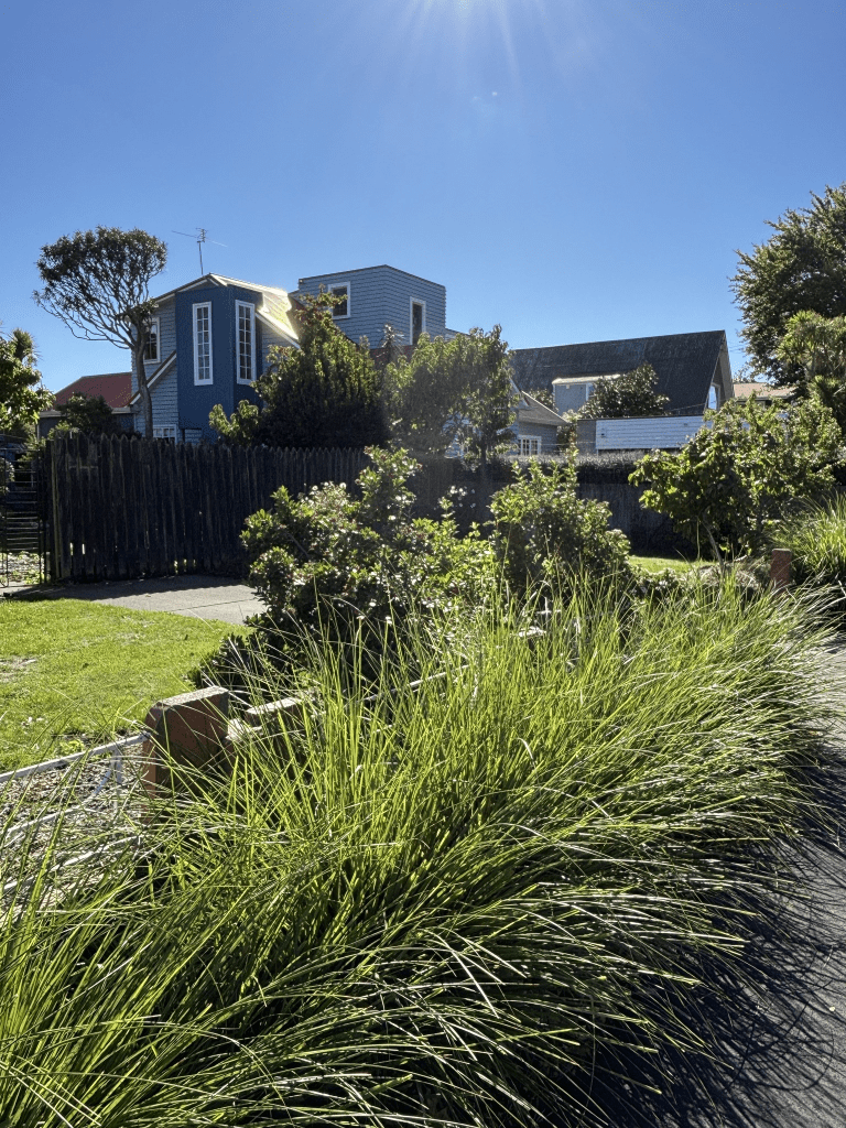
I walked this street a few weeks ago after visiting the library on this street. I started at the Clyde Road end of the street where the library is. Next to the library is the Jeffreys Reserve and then there are houses. The St Johns Church is on the corner of Jeffreys Road and Bryndwr Road. On the corner of Jeffreys Road and Idris Road there is St Patrick’s Catholic Primary School and St Matthews Church. There is also Jeffreys Giraffe Early Learning Centre. The street ends at Wairakei Road. There is a variety of house styles and they look as if they are from every decades. For some reason I couldn’t get the information that I wanted from the valuation website that I normally use unless I did each property individually. I only had this problem with this street as I tested the website with other streets. Weird. There is a big empty section at the St Patrick’s Catholic Primary School where buildings have been demolished. There was an interesting house that I liked and I ended up talking to the owner. The house was built in 1940 and was a bungalow but it is now a two story quirky looking house. Some of the houses look like they are from the 1920s and I wouldn’t be surprised if there are houses from 1905 and 1910. Frustrating that I can’t access this information like I can usually access it.
When I walked the street I assumed that it would have been named after someone with the surname Jeffrey as the letter s on the end of a street name usually means this. I was hoping that the street would be named after one of my Jeffrey / Jeffery ancestors.